


Why visit Dugcal
Townapedia lists 1 museum or landmark, 1 park or trail, 7 places to eat and 1 place to stay in and around town.
Highlights include Jose Maria Panganiban Monument and Camaligan River Park.
Weather in Dugcal
Forecast from MET Norway (CC BY 4.0). Full forecast
Museums and landmarks1

Jose Maria Panganiban Monument
Monument and historic site · 3.2 km
Monument in Naga, Philippines
Parks, trails and playgrounds1

Camaligan River Park
Park · 1.0 km
Linear park in Camaligan, Philippines
Restaurants and cafes7
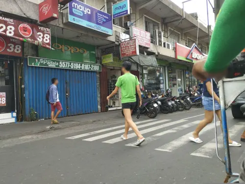

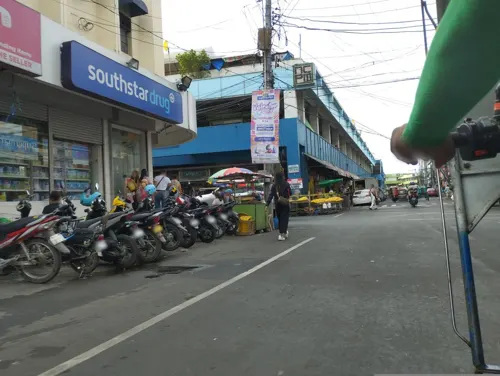

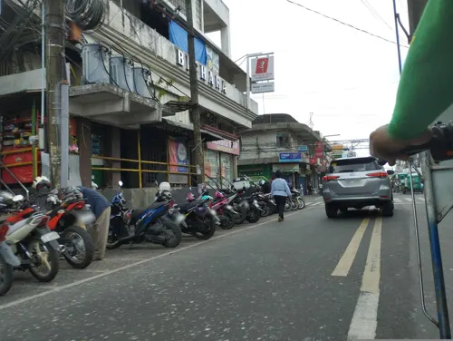

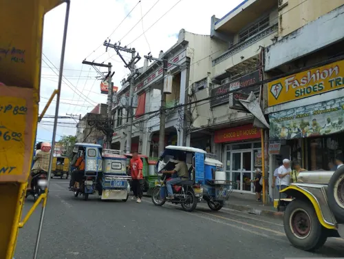


Where to stay1

Churches and places of worship9
Metropolitan Cathedral and Parish of Saint John the Evangelist
Church · 2.9 km
St. Anthony of Padua Parish
Church · Roman Catholic · 0.9 km
Sto. Domingo, Camaligan
Pentecostal Missionary Church of Christ (4th Watch)
Church · 2.1 km
Abella Street, Naga City
Shopping7
Gas and EV charging3
Schools, colleges and libraries29
University of Nueva Caceres
School · 2.4 km
J. Hernandez Avenue, Naga
Healthcare4
Map of Dugcal
62 places. The map loads OpenStreetMap tiles when you open it.
Getting there and nearby towns
Naga Airport (WNP) is the nearest airport with scheduled flights listed in OpenStreetMap, 13 km away.
- Camaligan 1 km east, about 1 min by car
- Naga 2 km east, about 2 min by car
- Gainza 2 km west, about 2 min by car
- Canaman 3 km north, about 3 min by car
- Milaor 4 km southeast, about 4 min by car
- Magarao 5 km northeast, about 5 min by car
- San Fernando 7 km south, about 7 min by car
- Minalabac 7 km south, about 7 min by car
- Bombon 9 km northeast, about 9 min by car
- Calabanga 11 km northeast, about 11 min by car
Drive times are estimates from straight-line distance, not routes.
Local news
Headlines from INDB.
Reviews, tips and questions
Loading what members have shared...
Sources and licences
- GeoNames (CC BY 4.0): population, coordinates, regions and time zone
- Mapillary (see each image): photos
- OpenStreetMap contributors (ODbL 1.0): places, airports, map data
- Wikidata (CC0 1.0): elevation, founding date, time zone, website, landmarks and historic places
- Wikimedia Commons (see each image): photos
Photo credits
- University of Nueva Caceres Arch, Jonathan Blaza, CC BY-SA 4.0
- Seminaryo, atubangan, Ringer, CC BY-SA 4.0
- Universidad de Sta. Isabel Naga, Jonathan Blaza, CC BY-SA 4.0
- Jose maria panganiban monument, Jun Pasa, CC BY-SA 3.0
- CATHEDRAL, Dilindin, CC BY-SA 4.0
- Home made ginataang suso (snail), Chammy17, CC BY-SA 4.0
- Camaligan River Park, MharAnthony16, CC BY-SA 4.0
- Fuchsia Butterfly, Srikandi73, CC0
- Philodendron Pink Princess, Srikandi73, CC BY-SA 4.0
- San Antonio de Padua Church Camaligan, MharAnthony16, CC BY-SA 4.0
- Edit-a-thon during WikiDunong Campaign 2023, Albinolongoria, CC BY-SA 4.0
- WikiDunong Edit-A-Thon, Albinolongoria, CC BY-SA 4.0
- School of Camaligan National High School, Albinolongoria, CC BY-SA 4.0
- Camaligan National High School, Albinolongoria, CC BY-SA 4.0
- CAMALIGAN RIVER SIDE, Lawrence756, CC BY-SA 4.0
- Seafood shrimp and bibe shell with mais, Chammy17, CC BY-SA 4.0
- WAP WPSKP 2023 13, Ballardmaize, CC BY-SA 4.0
- WAP WPSKP 2023 14, Ballardmaize, CC BY-SA 4.0
- Camaligan Hanging Bridge, Albinolongoria, CC BY-SA 4.0
- Old Rubas, Simcha4, CC BY-SA 4.0
- Rubas Wood, Simcha4, CC BY-SA 4.0
- Camaligan River Cruise, MharAnthony16, CC BY-SA 4.0
- Rubas from a House, Simcha4, CC BY-SA 4.0
- Rubas Used as Posts, Simcha4, CC BY-SA 4.0
- Rubas Used as Pillars, Simcha4, CC BY-SA 4.0
- A Chunk of Rubas, Simcha4, CC BY-SA 4.0
- Recipe for chicken salad, Chammy17, CC BY-SA 4.0
- Vegetable kare-kare, Chammy17, CC BY-SA 4.0
- Diet meal after gym, Chammy17, CC BY-SA 4.0
- Vegetables recipes needed for sinigang na baboy, Chammy17, CC BY-SA 4.0
- Home made chicken salad, Chammy17, CC BY-SA 4.0
- Tokwa diet, Chammy17, CC BY-SA 4.0
- Scrambled egg on plate, Chammy17, CC BY-SA 4.0
- Tilapia with salted black beans, Chammy17, CC BY-SA 4.0
- Sinigang sa hipon, Chammy17, CC BY-SA 4.0
- Lutong Bahay; Ginataang tulingan, Chammy17, CC BY-SA 4.0
- Sinabawan karning baboy, Chammy17, CC BY-SA 4.0
- Wild grass, Grace_Clarianes, CC BY-SA 3.0
- Millenium bug, Grace_Clarianes, CC BY-SA 3.0
- Different colors of ants, Grace_Clarianes, CC BY-SA 3.0
- Ateneo de Naga University, Dec 2025, Ralff Nestor Nacor, CC BY-SA 4.0
- Street-level photo, utteringmute, CC BY-SA 4.0
- Street-level photo, utteringmute, CC BY-SA 4.0
- Street-level photo, utteringmute, CC BY-SA 4.0
- Street-level photo, utteringmute, CC BY-SA 4.0
- Street-level photo, utteringmute, CC BY-SA 4.0


Page built November 7, 2026. Spotted a mistake? Tell us or suggest a place.