
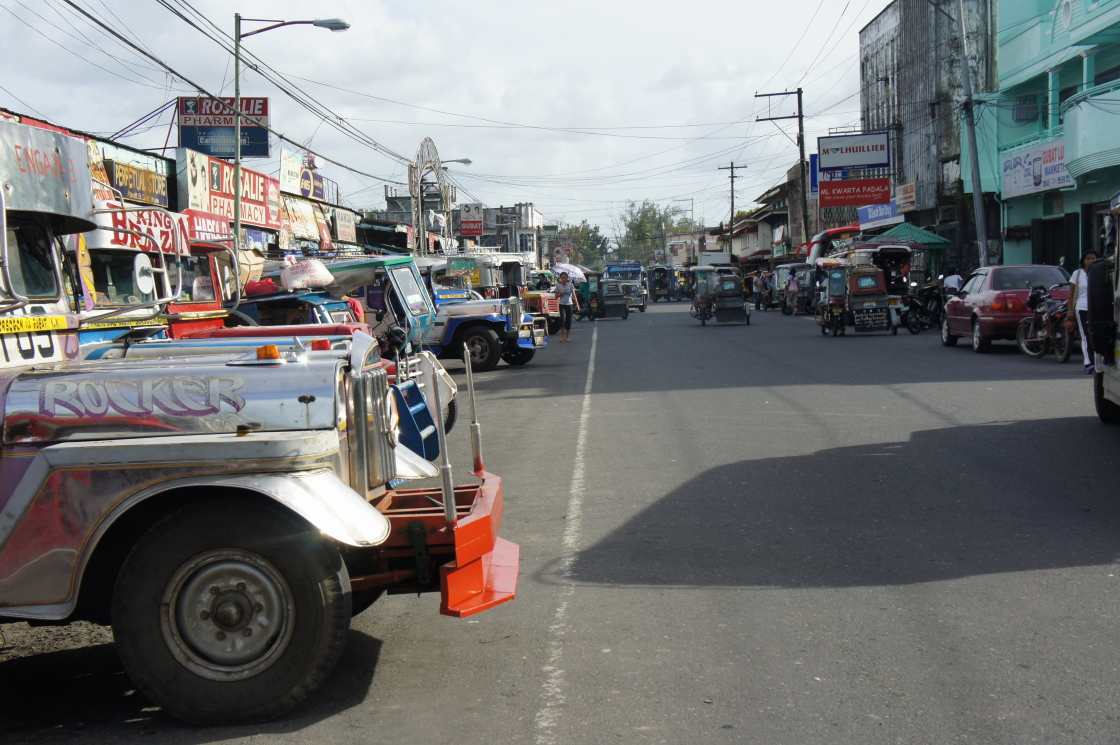


Gubat, Philippines
Gubat is a town of 61,095 people in Bicol Region, Philippines, founded in June 13, 1764.
Why visit Gubat
Townapedia lists 1 museum or landmark, 15 places to eat, 1 place to stay and 2 attractions in and around town.
Weather in Gubat
Forecast from MET Norway (CC BY 4.0). Full forecast
About Gubat
Gubat, officially the Municipality of Gubat (Gubatnon: Bungto san Gubat; Waray: Bungto han Gubat, Tagalog: Bayan ng Gubat), is a municipality in the province of Sorsogon, Philippines. According to the 2024 census, it has a population of 61,095 people.
From the Wikipedia article Gubat (this version), under CC BY-SA 4.0.
Things to do2

Museums and landmarks1

Restaurants and cafes15




3 more on the map.
Where to stay1

History
Gubat was originally a big barrio of Bulusan, inhabited by a few Tagalogs, Visayans and Albayanons who travelled on foot to hunt wild animals. These people built their homes close to the shore and called their location Buri, which today is the barrio of Buenavista. In 1764, Gubat finally became a town with Don Pedro Manook, the first Teniente del Barrio, also becoming the first gobernadorcillo. The town proper is named after Don Pedro Manook.
The word "gúbat" means forest in Tagalog. However, the name applied to the town is derived from the verb "guinobat", a term used by the natives which means "raided". In the early days when Christians and Muslims were constantly at odds, Muslim pirates, the Moros, would come in from the southern seas to raid the town. Due to the frequent raids, the town was referred to as "guinobat" which eventually became "Gubat". Legend has it that during one of those raids, the pastor along with the townspeople held up a statue of St. Anthony to ward off the attack, praying for a miracle. In one account, it was said that the child Jesus in St. Anthony's arms drove back the pirates. Hence, St. Anthony of Padua became the town's patron saint, and his feast day is lavishly celebrated as an official parish and town holiday every 13 June.
From the History section of Gubat on Wikipedia, under CC BY-SA 4.0.
Churches and places of worship11
Shopping5
Gas and EV charging3
Schools, colleges and libraries70
Saint Louise de Marillac College of Sorsogon - Gubat
School · Roman Catholic · 1.0 km
Healthcare9
Map of Gubat
117 places. The map loads OpenStreetMap tiles when you open it.
Getting there and nearby towns
Legazpi Airport (LGP) is the nearest airport with scheduled flights listed in OpenStreetMap, 50 km away.
- Sorsogon 15 km northwest, about 15 min by car
- Legaspi 48 km northwest, about 48 min by car
- Malilipot 61 km northwest, about 1 h by car
- Tabaco 64 km northwest, about 1 h by car
- Ligao 73 km northwest, about 1 h 15 min by car
- Virac 75 km north, about 1 h 15 min by car
- Oas 78 km northwest, about 1 h 15 min by car
- Tiwi 77 km northwest, about 1 h 15 min by car
- Polangui 80 km northwest, about 1 h 15 min by car
- Libon 85 km northwest, about 1 h 30 min by car
Drive times are estimates from straight-line distance, not routes.
Local news
Headlines from INDB.
Reviews, tips and questions
Loading what members have shared...
Sources and licences
- GeoNames (CC BY 4.0): population, coordinates, regions and time zone
- OpenStreetMap contributors (ODbL 1.0): places, airports, map data
- Wikidata (CC0 1.0): elevation, founding date, time zone, website
- Wikimedia Commons (see each image): photos
- Wikipedia (CC BY-SA 4.0): overview and history text
Photo credits
- Jeepney stop Gubat, Alma Gamil, CC BY 2.0
- Gubat Sorsogon, Gubat North Central School - panoramio, alfonsoereve, CC BY 3.0
- Bus Terminal Gubat, Alma Gamil, CC BY 2.0
- Pan mat made of bacbac, Alma Gamil, CC BY 2.0
- Bacbac bag, Alma Gamil, CC BY 2.0
- Bacbac in three natural shades, Alma Gamil, CC BY 2.0
- Abaca rooom slippers (8385296081), Alma Gamil from Philippines, CC BY 2.0
- ISS047-E-87430 - View of Earth, Earth Science and Remote Sensing Unit , Lyndon B. Johnson Space Center, Public domain
- Barcelona Church facade, National Historical Commission of the Philippines (NHCP), Public domain
- Church of Barcelona historical marker, National Historical Commission of the Philippines, Public domain
- ISS047-E-87429 - View of Earth, Earth Science and Remote Sensing Unit , Lyndon B. Johnson Space Center, Public domain
- ISS064-E-50377 - View of Earth, Earth Science and Remote Sensing Unit , Lyndon B. Johnson Space Center, Public domain


Page built November 7, 2026. Spotted a mistake? Tell us or suggest a place.