
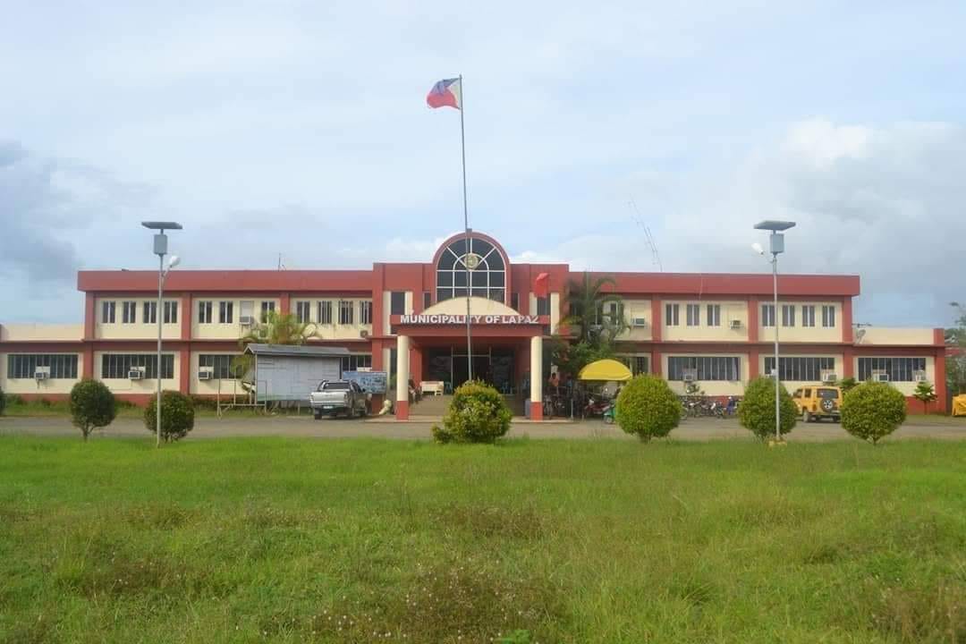

Why visit La Paz
Townapedia lists 1 park or trail, 13 places to eat and 2 places to stay in and around town.
Highlights include Agusan Marsh Wildlife Sanctuary.
Weather in La Paz
Forecast from MET Norway (CC BY 4.0). Full forecast
About La Paz
La Paz, officially the Municipality of La Paz (Cebuano: Lungsod sa La Paz; Tagalog: Bayan ng La Paz), is a municipality in the province of Agusan del Sur in the Caraga of the Philippines. The population was 29,096 at the 2024 census. La Paz is the largest town in terms of land area in Agusan del Sur and the entire Mindanao.
From the Wikipedia article La Paz, Agusan del Sur (this version), under CC BY-SA 4.0.
Parks, trails and playgrounds1


Agusan Marsh Wildlife Sanctuary
Hiking and trails · 7.7 km
Category: NIPAS Wildlife Sanctuary
Restaurants and cafes13




1 more on the map.
Where to stay2

Churches and places of worship2

Shopping3
Gas and EV charging1
Schools, colleges and libraries48
Healthcare3
Map of La Paz
73 places. The map loads OpenStreetMap tiles when you open it.
Getting there and nearby towns
Bislig Airport (BPH) is the nearest airport with scheduled flights listed in OpenStreetMap, 58 km away.
- Veruela 28 km southeast, about 28 min by car
- San Francisco 34 km northeast, about 34 min by car
- Prosperidad 36 km north, about 36 min by car
- Bayugan 54 km north, about 54 min by car
- Cabanglasan 55 km west, about 55 min by car
- Bislig 57 km east, about 57 min by car
- Sibagat 62 km north, about 1 h by car
- Montevista 68 km south, about 1 h 15 min by car
- Malaybalay 75 km west, about 1 h 15 min by car
- Butuan 81 km north, about 1 h 15 min by car
Drive times are estimates from straight-line distance, not routes.
Local news
Headlines from INDB.
Reviews, tips and questions
Loading what members have shared...
Sources and licences
- GeoNames (CC BY 4.0): population, coordinates, regions and time zone
- OpenStreetMap contributors (ODbL 1.0): places, airports, map data
- Wikidata (CC0 1.0): elevation, founding date, time zone, website
- Wikimedia Commons (see each image): photos
- Wikipedia (CC BY-SA 4.0): overview and history text
Photo credits
- La Paz Municipal Hall, Agusan del Sur, LGU La Paz, Agusan del Sur, Public domain
- Water Monitor (about 1.5m long), Rob and Stephanie Levy from Townsville, Australia, CC BY 2.0
Page built November 8, 2026. Spotted a mistake? Tell us or suggest a place.