


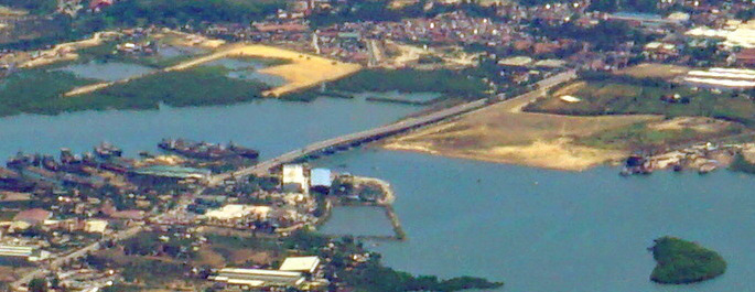

Lapu-Lapu City, Philippines
Lapu-Lapu
Lapu-Lapu City is a city of 497,813 people in Central Visayas, Philippines, founded in 1730.
Why visit Lapu-Lapu City
Townapedia lists 9 museums and landmarks, 12 parks and trails, 221 places to eat, 57 places to stay and 13 attractions in and around town.
Highlights include Mactan-Mandaue Bridge, Cansaga Bay Bridge, Cathedral Museum of Cebu and Lapulapu Monument.
Weather in Lapu-Lapu City
Forecast from MET Norway (CC BY 4.0). Full forecast
About Lapu-Lapu City
Lapu-Lapu, officially the City of Lapu-Lapu (Cebuano: Dakbayan sa Lapu-Lapu; Filipino: Lungsod ng Lapu-Lapu), is a highly urbanized city in the Central Visayas region of the Philippines. According to the 2024 census, it has a population of 497,813 people.
From the Wikipedia article Lapu-Lapu City (this version), under CC BY-SA 4.0.
Travel tips from other travellers: Lapu-Lapu City on Wikivoyage (CC BY-SA 4.0).
Things to do13
Cansaga Bay Bridge
Bridge · 4.8 km
Bridge in Mandaue and Consolacion, Cebu

Cebu–Cordova Link Expressway
Bridge · 5.9 km
Longest bridge in the Philippines

Mactan Island Aquarium
Monument and historic site · 5.9 km
Aquarium in the Philippines


Muelle Osmeña Lighthouse
Lighthouse
Lighthouse in Poblacion, Lapu Lapu, Philippines



1 more on the map.
Museums and landmarks9

Cathedral Museum of Cebu
Museum · 5.3 km
Catholic museum in Cebu City, Philippines
Lapulapu Monument
Monument and historic site · 7.2 km
Monumental statue of Lapulapu in Mactan, Philippines

Magellan Monument
Monument and historic site · 7.2 km
Monument dedicated to Ferdinand Magellan in Mactan, Philippines


University of San Carlos Museum
Museum · 5.7 km
History museum in Cebu City, Philippines
Parks, trails and playgrounds12

Cebu Business Park
Park · 4.2 km
Central business district in Central Visayas, Philippines

Liberty Shrine
Park · 7.2 km
Public park and memorial in Mactan, Philippines


Plaza Independencia
Park · 5.2 km
Public park in Cebu City, Philippines


Restaurants and cafes221


Dakasi
Restaurant · Bubble Tea, Milktea · 2.4 km
C. D. Seno Street, Mandaue City
Mo-Su 11:00-20:00
LS Burger
Restaurant · Burger, Pasta
Bartolome Mangubat Dimataga Street
Mo-Su 11:00-21:00

Pitlane Restobar
Bar and pub · Filipino · 2.9 km
A. S. Fortuna Street
24/7

Psalms Coffee & Pastries Cebu
Cafe · Coffee Shop, Pasta, Sandwich, Cake, Filipino, Korean, American · 2.6 km
11 A.C. Cortes Avenue, Mandaue
Mo-Su 08:00-23:00
Rabbit Hole
Restaurant · Filipino, American · 2.3 km
Manuel L. Quezon National Highway, Lapu-Lapu
6:30 - 23:00
Red Ribbon
Bakery · 1.7 km
Maximo V. Patalinjug, Jr. Avenue, Lapu-lapu City
Mo-Su 08:00-22:00
Wallstreet Coffee + Bar
Cafe · Coffee Shop · 2.1 km
Ouano Avenue
Mo-Su 06:00-22:00
209 more on the map.
History
The island of Mactan was already a thriving settlement before it was colonized by Spain in the 16th century. It was a strong ally of the Lakanate of Lawan, a prosperous kingdom in Samar. Datu Hadi Iberein ruled the Lakanate of Lawan. He was described by historian William Henry Scott as a "Samar datu by the name of Iberein was rowed out to a Spanish vessel anchored in his harbor in 1543 by oarsmen collared in gold; while wearing on his own person earrings and chains."
Magellan led a landing party of 49 men to force Lapulapu to submit to the authority of Spain. He and his men were confronted by some 1,500 Mactan warriors, who killed Ferdinand Magellan, along with several other members of his expedition.
The municipality of Opon was founded by the Augustinian missionaries in 1730. It was ceded to the Jesuits in 1737, and later restored to the Augustinians. When the Philippine Revolution spread to the Visayas in 1898, the people organized themselves into local revolutionary units.
From the History section of Lapu-Lapu City on Wikipedia, under CC BY-SA 4.0.
Where to stay57
Fairfield by Marriott, Mandaue City
Motel and hotel · 2.7 km
6014 A.C. Cortes Avenue
Goldberry Suites & Hotel
Motel and hotel · 2.4 km
Manuel L. Quezon National Highway, Lapu-Lapu
Churches and places of worship23
National Shrine of Saint Joseph
Church · Roman Catholic · 2.1 km
S.B. Cabahug Street, Mandaue City
The Church of Jesus Christ of Latter-day Saints
Church · Mormon · 2.5 km
A. S. Fortuna Extension
Christ The King Parish Church
Church · Roman Catholic · 2.6 km
Don G. LL. Ouano Street
Lokal ng Lapulapu City, Iglesia ni Cristo
Church · Iglesia Ni Cristo · 2.1 km
Mustang Road
Nuestra Señora dela Regla Parish National Shrine
Church · Roman Catholic
Bartolome Mangubat Dimataga Street, Lapu-Lapu City
Shopping64
Gaisano Island Mall Mactan
Shopping center · 1.7 km
Manuel L. Quezon National Highway
Gas and EV charging48
Schools, colleges and libraries72
Healthcare61
Map of Lapu-Lapu City
250 places. The map loads OpenStreetMap tiles when you open it.
Getting there and nearby towns
Mactan–Cebu International Airport (CEB) is the nearest airport with scheduled flights listed in OpenStreetMap, 3 km away.
- Mandaue City 3 km northwest, about 3 min by car
- Cebu City 6 km west, about 6 min by car
- Consolacion 7 km north, about 7 min by car
- Liloan 11 km northeast, about 11 min by car
- Talisay 13 km southwest, about 13 min by car
- Minglanilla 18 km southwest, about 18 min by car
- Compostela 17 km northeast, about 17 min by car
- Naga 24 km southwest, about 24 min by car
- Danao 25 km north, about 25 min by car
- Toledo 35 km west, about 35 min by car
Drive times are estimates from straight-line distance, not routes.
Local news
Headlines from INDB.
Reviews, tips and questions
Loading what members have shared...
Sources and licences
- GeoNames (CC BY 4.0): population, coordinates, regions and time zone
- OpenStreetMap contributors (ODbL 1.0): places, airports, map data
- Wikidata (CC0 1.0): elevation, founding date, time zone, website, landmarks and historic places
- Wikimedia Commons (see each image): photos
- Wikipedia (CC BY-SA 4.0): overview and history text
Photo credits
- Mactan-from-above, Lsj, CC BY-SA 3.0
- Sunset at Tulay, Lapu-Lapu City, Cebu, JanelleDS, CC BY 4.0
- CITY LIGHTS VIEW AT LAPU-LAPU CITY, CEBU, JanelleDS, CC BY 4.0
- Mactan-Mandaue Bridge, Mike Gonzalez ( TheCoffee ), Public domain
- Cebu coastline from the air - Cansaga Bay Bridge (cropped), Matt Kieffer from London, United Kingdom, CC BY-SA 2.0
- Cebu Downtown CCLEX top view (Cebu City; 09-07-2022), Patrickroque01, CC BY-SA 4.0
- Marcelo Fernan Bridge, Unknown author, Public domain
- Muelle Osmeña, Tribu akru, Public domain
- Bahay Na Bato Cebu, Markytour777, CC BY-SA 4.0
- A Monument fo Ferdinand Magellan, Alpapito, CC BY-SA 3.0
- Museo Sugbu, Aries Eroles, CC BY-SA 3.0
- Cebu Business Park skyscrapers view from Luz (Cebu City; 01-16-2024), Patrickroque01, CC BY-SA 4.0
- MactanShrineEntrance1, Carl Frances Morano Diaman, CC BY-SA 3.0
- Cebu Metropolitan Cathedral (P. Burgos, Cebu City; 01-10-2024), Patrickroque01, CC BY-SA 4.0
- National Shrine of St Joseph 2022 01 004, Martin Michlmayr, CC BY-SA 4.0
- Matilda Bradford Memorial Church, Jonathan Blaza, CC BY-SA 4.0
- Book of Mormon English Missionary Edition Soft Cover, photo by user:Ricardo630 , cover by The Church of Jesus Christ of Latter-day Saints which is {{PD-ineligible}}, Public domain
- Cebu City after dark, Ubo Pakes from Cebu City, Philippines, CC BY 2.0
- Mandaue Saint Joseph National Shrine 2026-07-11, LMP 2001, CC BY-SA 4.0
- Fort San Pedro, Plaza Independencia, Cebu Port Pier 1 drone (MJ Cuenco Avenue, Cebu City; 01-16-2026), Patrickroque01, CC BY-SA 4.0
- Angel Wings - panoramio, DAVID, CC BY-SA 3.0
- VDR on january 16, 2026, Matemi01, CC BY 4.0
- Dagkutanan sa Simbahan sa Birhen sa Regla, LJ Batiancila, CC BY-SA 4.0
- View of Mandaue from Lapu Lapu 2025-07-13 001, Martin Michlmayr, CC BY-SA 4.0
- View of Mandaue from Lapu Lapu 2025-07-13 002, Martin Michlmayr, CC BY-SA 4.0
- Sunset at Pajo National High School, JanelleDS, CC BY 4.0
- WIKIPAGKAT-ON SA SUGBO WORKSHOP, JanelleDS, CC BY 4.0
- Puso ug Lechon Festival Grand Showdown in Gun-ob, Lapu Lapu City, Mary Joanne Solamo, CC BY 4.0
- Lapu Lapu 2026-03-26 005, Martin Michlmayr, CC BY-SA 4.0
- Lapu Lapu 2025-12-09 001, Martin Michlmayr, CC BY-SA 4.0
- Lapu Lapu 2025-12-18 002, Martin Michlmayr, CC BY-SA 4.0
- Lapu Lapu 2025-12-18 001, Martin Michlmayr, CC BY-SA 4.0
- Lapu Lapu 2026-02-13 019, Martin Michlmayr, CC BY-SA 4.0
- Lapu Lapu 2026-02-13 018, Martin Michlmayr, CC BY-SA 4.0
- Lapu Lapu 2026-03-26 006, Martin Michlmayr, CC BY-SA 4.0
- Lapu-Lapu 2026-04-27 004, Martin Michlmayr, CC BY-SA 4.0
- Lapu-Lapu 2026-04-27 003, Martin Michlmayr, CC BY-SA 4.0
- Lapu-Lapu 2026-04-27 001, Martin Michlmayr, CC BY-SA 4.0
- Lapu-Lapu 2026-04-27 002, Martin Michlmayr, CC BY-SA 4.0
- Lapu-Lapu 2026-04-27 006, Martin Michlmayr, CC BY-SA 4.0


Page built November 8, 2026. Spotted a mistake? Tell us or suggest a place.