




Mandaue City, Philippines
Mandaue
Mandaue City is a city of 331,320 people in Central Visayas, Philippines, founded in August 30, 1969.
Why visit Mandaue City
Townapedia lists 6 museums and landmarks, 6 parks and trails, 349 places to eat, 53 places to stay and 6 attractions in and around town.
Highlights include Mactan-Mandaue Bridge, Cansaga Bay Bridge, Cathedral Museum of Cebu and Museo Sugbo.
Weather in Mandaue City
Forecast from MET Norway (CC BY 4.0). Full forecast
About Mandaue City
Mandaue (locally [mɐnˈdaʊ.ɛ]), officially the City of Mandaue (Cebuano: Dakbayan sa Mandaue; Filipino: Lungsod ng Mandaue), is a highly urbanized city in the Central Visayas region of the Philippines. According to the 2024 census, it has a population of 364,482 people.
From the Wikipedia article Mandaue (this version), under CC BY-SA 4.0.
Travel tips from other travellers: Mandaue City on Wikivoyage (CC BY-SA 4.0).
Things to do6
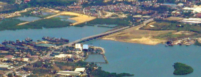
Cansaga Bay Bridge
Bridge · 5.8 km
Bridge in Mandaue and Consolacion, Cebu

Cebu–Cordova Link Expressway
Bridge · 5.1 km
Longest bridge in the Philippines
Muelle Osmeña Lighthouse
Lighthouse · 3.0 km
Lighthouse in Poblacion, Lapu Lapu, Philippines

Ayala Malls Central Bloc Cinema
Cinema and theater · 1.8 km
I. Villa Street, Cebu City
Mo-Su 10:00-21:00
Museums and landmarks6

Cathedral Museum of Cebu
Museum · 3.7 km
Catholic museum in Cebu City, Philippines


Temple of Leah
Monument and historic site · 7.3 km
Memorial building in Cebu, Philippines

University of San Carlos Museum
Museum · 3.7 km
History museum in Cebu City, Philippines

Parks, trails and playgrounds6

Cebu Business Park
Park · 1.5 km
Central business district in Central Visayas, Philippines


Plaza Independencia
Park · 3.9 km
Public park in Cebu City, Philippines


Restaurants and cafes349

Handuraw Pizza
Restaurant · Pizza
Cebu's best-tasting thin crust pizzas, Beer Below Zero, rice bowls, and more in a venue supportive of local music and the arts!
Lopez Jaena Street, Mandaue
Mo-Su 11:00-00:00
Goa Nights
Restaurant · Indian · 1.8 km
8WJ5+QC2 India Street
Su, Tu-Th 12:00-23:00; Fr-Sa 12:00-00:00
La Bella
Restaurant · Italian, Pasta, Pizza · 1.4 km
Pizzas are brick-oven baked. Daily operations are run by an all-female crew (matches their name, noh?).
11:30-21:00


Verified Rooftop Bar & Lounge
Bar and pub · 1.7 km
22nd floor Archbishop Reyes Avenue
Su, Tu-Th 17:00-01:00; Fr-Sa 17:00-02:00
Alberto's Pizza
Restaurant · Pizza, Breakfast, Shakes, Halohalo, Sodas And Juices · 1.3 km
Pope John Paul Ⅱ Avenue, Cebu
24/7
Big Brain Kasambagan
Restaurant · Filipino · 0.9 km
President Laurel Street
Mo-Fr 15:00-22:00; Sa-Su 15:00-22:30
Dakasi
Restaurant · Bubble Tea, Milktea · 1.4 km
C. D. Seno Street, Mandaue City
Mo-Su 11:00-20:00
Joed's Lutong Hapon
Restaurant · Japanese · 0.8 km
F. Cabahug Street, Cebu City
11:00-23:00
337 more on the map.
History
A community was established in Mandaue by a flourishing group of Austronesian people. The Venetian chronicler Antonio Pigafetta wrote of a settlement called "Mandaui" which existed in the area with a chieftain named Apanoaan some called him Lambuzzan in other accounts.
Mandaue natives were forced into a town as decreed by the Spanish authorities. This may have started off as a mission village (which included present day Consolacion, Liloan and Poro) serving as a bulwark for the church in the northern Cebu and was managed by the Jesuit in 1638 then a century later by the Recollects. During the year 1818, Mandaue had tributes representing 2,729 native families and 20 Spanish-Filipino families.
The Philippine Revolution of 1898 gave the town a new form of administration in accordance with the organic decree of the Central Revolutionary Government. The short-lived revolution was overthrown by the American troops and a battle nearly destroyed the town in 1901, killing Presidente Benito Ceniza.
From the History section of Mandaue on Wikipedia, under CC BY-SA 4.0.
Where to stay53
Seda Ayala Center Cebu
Motel and hotel · 1.8 km
Cardinal Rosales Avenue, Cebu City
Churches and places of worship20
Cebu Christian Gospel Center
Church · Evangelical · 1.9 km
Archbishop Reyes Avenue
The Church of Jesus Christ of Latter-day Saints
Church · Mormon · 1.8 km
A. S. Fortuna Extension
St. John XXIII Chapel
Church · Roman Catholic · 1.3 km
Cardinal Rosales Avenue, Cebu
Shopping57
Landers Superstore Cebu Membership Shopping
Grocery · 1.4 km
Cardinal Rosales Avenue, Cebu City
The Northwing at SM City Cebu
Shopping center · 1.3 km
Kaohsiung Street, Cebu City
Gas and EV charging31
Schools, colleges and libraries40
Healthcare26
Maxicare Healthcare Corporation - Primary Care Center
Clinic and pharmacy · 1.7 km
Mindanao Avenue, Cebu
Map of Mandaue City
250 places. The map loads OpenStreetMap tiles when you open it.
Getting there and nearby towns
Mactan–Cebu International Airport (CEB) is the nearest airport with scheduled flights listed in OpenStreetMap, 6 km away.
- Lapu-Lapu City 3 km southeast, about 3 min by car
- Cebu City 4 km west, about 4 min by car
- Consolacion 7 km northeast, about 7 min by car
- Talisay 12 km southwest, about 12 min by car
- Liloan 12 km northeast, about 12 min by car
- Minglanilla 16 km southwest, about 16 min by car
- Compostela 18 km northeast, about 18 min by car
- Naga 22 km southwest, about 22 min by car
- Danao 25 km northeast, about 25 min by car
- Toledo 32 km west, about 32 min by car
Drive times are estimates from straight-line distance, not routes.
Local news
Headlines from INDB.
Reviews, tips and questions
Loading what members have shared...
Sources and licences
- GeoNames (CC BY 4.0): population, coordinates, regions and time zone
- OpenStreetMap contributors (ODbL 1.0): places, airports, map data
- Wikidata (CC0 1.0): elevation, founding date, time zone, website, landmarks and historic places
- Wikimedia Commons (see each image): photos
- Wikipedia (CC BY-SA 4.0): overview and history text
Photo credits
- Mandaue, Mactan view from Tops Lookout (Cebu City; 09-06-2022), Patrickroque01, CC BY-SA 4.0
- Mactan-Mandaue Bridge, Mike Gonzalez ( TheCoffee ), Public domain
- Cebu coastline from the air - Cansaga Bay Bridge (cropped), Matt Kieffer from London, United Kingdom, CC BY-SA 2.0
- Cebu Downtown CCLEX top view (Cebu City; 09-07-2022), Patrickroque01, CC BY-SA 4.0
- Marcelo Fernan Bridge, Unknown author, Public domain
- Muelle Osmeña, Tribu akru, Public domain
- Bahay Na Bato Cebu, Markytour777, CC BY-SA 4.0
- Museo Sugbu, Aries Eroles, CC BY-SA 3.0
- Cebu Business Park skyscrapers view from Luz (Cebu City; 01-16-2024), Patrickroque01, CC BY-SA 4.0
- Cebu Metropolitan Cathedral (P. Burgos, Cebu City; 01-10-2024), Patrickroque01, CC BY-SA 4.0
- National Shrine of St Joseph 2022 01 004, Martin Michlmayr, CC BY-SA 4.0
- Matilda Bradford Memorial Church, Jonathan Blaza, CC BY-SA 4.0
- Book of Mormon English Missionary Edition Soft Cover, photo by user:Ricardo630 , cover by The Church of Jesus Christ of Latter-day Saints which is {{PD-ineligible}}, Public domain
- Cebu City after dark, Ubo Pakes from Cebu City, Philippines, CC BY 2.0
- Fort San Pedro, Plaza Independencia, Cebu Port Pier 1 drone (MJ Cuenco Avenue, Cebu City; 01-16-2026), Patrickroque01, CC BY-SA 4.0
- Temple of Leah 2025-08-24 014, Martin Michlmayr, CC BY-SA 4.0


Page built November 8, 2026. Spotted a mistake? Tell us or suggest a place.