


Malitbog, Philippines
Malitbog is a town of 2,800 people in Eastern Visayas, Philippines.
Why visit Malitbog
Townapedia lists 2 museums and landmarks, 1 park or trail, 11 places to eat, 2 places to stay and 3 attractions in and around town.
Weather in Malitbog
Forecast from MET Norway (CC BY 4.0). Full forecast
About Malitbog
Malitbog, officially the Municipality of Malitbog (Cebuano: Lungsod sa Malitbog; Tagalog: Bayan ng Malitbog), is a municipality in the province of Southern Leyte, Philippines. According to the 2024 census, it has a population of 21,691 people.
From the Wikipedia article Malitbog, Southern Leyte (this version), under CC BY-SA 4.0.
Things to do3


Museums and landmarks2



Parks, trails and playgrounds1

Restaurants and cafes11

Weng's Videoke Reataurant
Restaurant · Regional · 5.2 km
Malitbog-Padre Burgos Road



History
The town of Malitbog, Southern Leyte, came into existence in the early 18th century as proven by the inscriptions on the stone walls of the ruins of the watchtowers "Baluarte" located equidistant from the Roman Catholic Church. One is found south of the Poblacion in Barangay Caaga and the other in Barangay Abgao north of the Poblacion. Said watchtowers were constructed in the year 1820. The two barangays abovementioned were ruled by their chieftains, called capitanes. No traces could be found as to the names of the capitanes. As absolute rulers of their respective barangays, they tried to established their own kingdoms. Both of the chieftains wanted to rule the other, hence, there was strong and keen rivalry between the two and the pueblo was to be organized by the Spaniards sometimes in the middle part of the 18th century. The inhabitants were very much confused as to where the pueblo be located. Confusion in the local dialect means "makalibog". Since that time the Spaniards organized the pueblo, they called it Malitbog, a derivative or distorted word from the dialect "makalibog". They built the Town Center midway and equidistant between the two Barrios.
From the History section of Malitbog, Southern Leyte on Wikipedia, under CC BY-SA 4.0.
Where to stay2
Churches and places of worship3
Shopping2
Gas and EV charging1
Schools, colleges and libraries24
Healthcare2
Map of Malitbog
51 places. The map loads OpenStreetMap tiles when you open it.
Getting there and nearby towns
Surigao Airport (SUG) is the nearest airport with scheduled flights listed in OpenStreetMap, 69 km away.
- Tomas Oppus 10 km north, about 10 min by car
- Sogod 25 km north, about 25 min by car
- Matalom 27 km northwest, about 27 min by car
- Inopacan 47 km northwest, about 47 min by car
- Ubay 59 km west, about 59 min by car
- Baybay 62 km north, about 1 h by car
- Trinidad 73 km west, about 1 h 15 min by car
- Sierra Bullones 87 km southwest, about 1 h 30 min by car
- Jagna 89 km southwest, about 1 h 30 min by car
- Dulag 88 km north, about 1 h 30 min by car
Drive times are estimates from straight-line distance, not routes.
Local news
Headlines from INDB.
Reviews, tips and questions
Loading what members have shared...
Sources and licences
- GeoNames (CC BY 4.0): population, coordinates, regions and time zone
- Mapillary (see each image): photos
- OpenStreetMap contributors (ODbL 1.0): places, airports, map data
- Wikidata (CC0 1.0): elevation, founding date, time zone, website
- Wikimedia Commons (see each image): photos
- Wikipedia (CC BY-SA 4.0): overview and history text
Photo credits
- Santo Niño Catholic Church in Malitbog, Southern Leyte, Ninjakeg, CC BY-SA 3.0
- Neopetrolisthes maculatus 489811622, Chris Spain, CC0
- Solenostomus paradoxus 489811557, Chris Spain, CC0
- Amphiprion ocellaris 489811638, Chris Spain, CC0
- Amphiprion ocellaris 493662966, Chris Spain, CC0
- Nembrotha chamberlaini snackin 493662381, Chris Spain, CC0
- Hypselodoris krakatoa 493662331, Chris Spain, CC0
- Hypselodoris reidi 493663041, Chris Spain, CC0
- Canthigaster valentini 493663195, Chris Spain, CC0
- Solenostomus paradoxus 496627182, Chris Spain, CC0
- Solenostomus paradoxus 496627190, Chris Spain, CC0
- Solenostomus paradoxus 496627211, Chris Spain, CC0
- Solenostomus paradoxus 496627187, Chris Spain, CC0
- Solenostomus paradoxus 496627189, Chris Spain, CC0
- Solenostomus paradoxus 496517060, Chris Spain, CC0
- Solenostomus paradoxus 496516932, Chris Spain, CC0
- Solenostomus paradoxus 496627212, Chris Spain, CC0
- Bryaninops yongei - Chris Spain - 608568743, Chris Spain, CC0
- Neopetrolisthes maculatus 489386877, Chris Spain, CC0
- Amphiprion ocellaris 489386897, Chris Spain, CC0
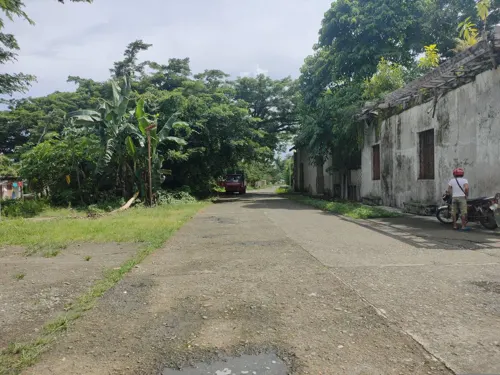
- Street-level photo, Joms, CC BY-SA 4.0


Page built November 7, 2026. Spotted a mistake? Tell us or suggest a place.