


Nasipit, Philippines
Nasipit is a town of 9,407 people in Caraga, Philippines, founded in August 1, 1929.
Why visit Nasipit
Townapedia lists 2 museums and landmarks, 1 park or trail, 2 places to eat, 4 places to stay and 2 attractions in and around town.
Weather in Nasipit
Forecast from MET Norway (CC BY 4.0). Full forecast
About Nasipit
Nasipit, officially the Municipality of Nasipit (Cebuano: Lungsod sa Nasipit; Tagalog: Bayan ng Nasipit), is a municipality in the province of Agusan del Norte, Philippines. According to the 2024 census, it has a population of 46,382 people.
From the Wikipedia article Nasipit (this version), under CC BY-SA 4.0.
Things to do2

Museums and landmarks2
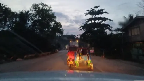

Parks, trails and playgrounds1

Restaurants and cafes2




History
Nasipit is an industrial municipality situated on a promontory overlooking Nasipit Bay. Its industrial activity has historically been centered around the operations of the Nasipit Lumber Company and the Philippine Wallboard Corporation.
The shoreline of Nasipit assumes a claw-like from which “Nasip-it” was derived. Until 1929, Nasipit was a barrio of Butuan. The then Governor Guingona proposed to change the name Nasipit to “Aurora”. Due to the strong opposition of the early inhabitants, however, the word Na-si-pit was retained.
Little is documented about the early history of the town. According to local tradition, three women were once abducted by Moro raiders who periodically attacked the area to loot and plunder. These incursions caused widespread fear among the inhabitants, who would retreat to the forested hills for safety. Over time, these elevated areas were settled and eventually developed into what is now the poblacion. In response to the threat of raids, early settlers constructed a watchtower on the site now occupied by the Catholic church, serving as a lookout point to warn residents of approaching attackers.
The earliest settlers of this town were immigrants from Cebu, Leyte and the different parts of the archipelago threaded their way into this town to settle permanently.
From the History section of Nasipit on Wikipedia, under CC BY-SA 4.0.
Where to stay4
Churches and places of worship3
The Church of Jesus Christ of Latter-day Saints
Church · Mormon · 6.0 km
Butuan-Cagayan de Oro-Iligan Road
Shopping1
Gas and EV charging4
Schools, colleges and libraries40
Cabantian Elementary School
School · 9.1 km
Butuan-Cagayan de Oro-Iligan Road, Magsaysay
Healthcare4
Map of Nasipit
63 places. The map loads OpenStreetMap tiles when you open it.
Getting there and nearby towns
Bancasi Airport (BXU) is the nearest airport with scheduled flights listed in OpenStreetMap, 20 km away.
- Buenavista 13 km east, about 13 min by car
- Butuan 27 km east, about 27 min by car
- Gingoog 27 km southwest, about 27 min by car
- Cabadbaran 31 km northeast, about 31 min by car
- Tubay 33 km northeast, about 33 min by car
- Sibagat 47 km east, about 47 min by car
- Bayugan 57 km southeast, about 57 min by car
- Claveria 59 km southwest, about 59 min by car
- Balingasag 62 km southwest, about 1 h by car
- Prosperidad 79 km southeast, about 1 h 15 min by car
Drive times are estimates from straight-line distance, not routes.
Local news
Headlines from INDB.
Reviews, tips and questions
Loading what members have shared...
Sources and licences
- GeoNames (CC BY 4.0): population, coordinates, regions and time zone
- Mapillary (see each image): photos
- OpenStreetMap contributors (ODbL 1.0): places, airports, map data
- Wikidata (CC0 1.0): elevation, founding date, time zone, website, landmarks and historic places
- Wikimedia Commons (see each image): photos
- Wikipedia (CC BY-SA 4.0): overview and history text
Photo credits
- Nasipit poblacion, Historianurian, Public domain
- MV St. Francis Xavier - CREW Q. RM. EXH. FAN - Oct 2024, Dominic Nelson, CC BY-SA 4.0
- MV St. Francis Xavier - exhausts and generator room - Oct 2024, Dominic Nelson, CC BY-SA 4.0
- MV St. Francis Xavier - evacuation chute No. 1 - Oct 2024, Dominic Nelson, CC BY-SA 4.0
- MV St. Francis Xavier - assembly station No.1 - Oct 2024, Dominic Nelson, CC BY-SA 4.0
- NORTHERN MINDANAO SUNRISE, Dhansoi Casupanan, CC BY-SA 4.0
- The rock in Bulihon - panoramio, kbraner, CC BY-SA 3.0
- Street-level photo, dp24ph, CC BY-SA 4.0
- Street-level photo, dp24ph, CC BY-SA 4.0
- Street-level photo, dp24ph, CC BY-SA 4.0
- Street-level photo, dp24ph, CC BY-SA 4.0
- Street-level photo, dp24ph, CC BY-SA 4.0
- Street-level photo, dp24ph, CC BY-SA 4.0

Page built November 7, 2026. Spotted a mistake? Tell us or suggest a place.