


Opol, Philippines
Opol is a town of 3,468 people in Northern Mindanao, Philippines, founded in June 15, 1950.
Why visit Opol
Townapedia lists 11 museums and landmarks, 20 parks and trails, 172 places to eat, 40 places to stay and 4 attractions in and around town.
Highlights include MacArthur Memorial Marker, Labanan sa Cagayan de Misamis and Gaston Park.
Weather in Opol
Forecast from MET Norway (CC BY 4.0). Full forecast
About Opol
Opol, officially the Municipality of Opol (Cebuano: Lungsod sa Opol; Tagalog: Bayan ng Opol), is a municipality in the province of Misamis Oriental, Philippines. According to the 2024 census, it has a population of 66,836 people.
From the Wikipedia article Opol (this version), under CC BY-SA 4.0.
Things to do4



Museums and landmarks11

MacArthur Memorial Marker
Monument and historic site · 10.5 km
Monument commemorating Gen. Douglas MacArthur in Cagayan de Oro, Philippines

Labanan sa Cagayan de Misamis
Monument and historic site · 9.3 km
Gaston Circle, Cagayan de Oro

Pagtataas ng Watawat ng Pilipinas sa Cagayan de Misamis
Monument and historic site · 9.2 km
J. V. Serina Street, Cagayan de Oro

Sendong Memorial Wall
Monument and historic site · 9.3 km
Gaston Circle, Cagayan de Oro City

Parks, trails and playgrounds20


Seven Seas Waterpark & Resort
Sports field and stadium · 4.1 km
Mo-Su 09:00-17:00



8 more on the map.
Restaurants and cafes172
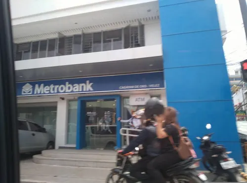
Cafè Pilar
Cafe · Cake, Coffee Shop, Sandwich, Breakfast, Pasta, Tea · 9.3 km
Yacapin Street
Mo-Sa 08:00-20:00
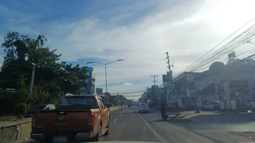
Catee's Pizza
Restaurant · Pizza · 4.8 km
C. M. Recto Avenue, Cagayan de Oro City
24/7

Cucina Higala
Restaurant · Regional · 9.1 km
222 General Capistrano Street
Mo-Su 11:00-21:00

Royal Cafe
Cafe · Milktea, Coffee, Sandwich, Refresher, Street Foods, Noodles · 4.1 km
Zone 3 Barra Road, Opol
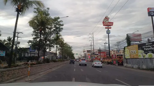
24/7 Cafe
Cafe · Coffee Shop, Sandwich · 7.1 km
C. M. Recto Avenue, Cagayan de Oro City
24/7

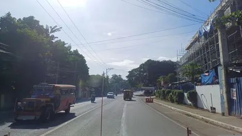
Auds
Restaurant · Korean, Filipino · 5.9 km
Mayor P. N. Roa Street
Mo-Su 10:00-24:00
Durian ni Duran
Cafe · Durian, Dessert, Filipino · 9.1 km
Tirso Neri Street, Cagayan de Oro City
Mo-Sa 09:00-18:00
Elbs Cafe
Cafe · Coffee Shop, Cake, Dessert · 8.1 km
Saint Ignatius Street, Cagayan de Oro City
Mo-Sa 08:00-18:00
Handumanan Cafe
Cafe · Coffee Shop, Pasta · 8.7 km
B13 L3 SM Bypass Road, Cagayan de Oro City
Mo-Sa 11:00-20:00
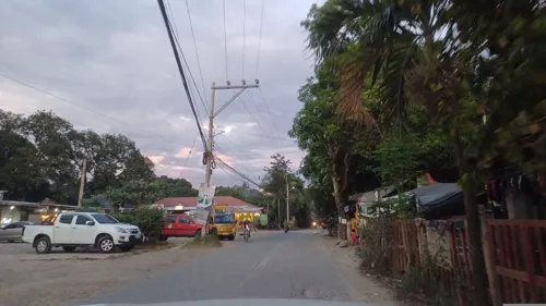


Captain's Pub by Pour and Mix
Bar and pub · 5.2 km
Captain Jabulin Street
Mo-Fr 14:00-22:00; Sa, Su 14:00-00:00
160 more on the map.
History
Although the first inhabitants of Opol were Higaonon people, the area was either once largely uninhabited or slightly populated before Spanish colonial period, until one group of Visayans from Bohol led by a datu, migrated to the place and settled in the area now known as Barangay Bonbon, where they planted different types of crops for their livelihood. This made Higaonons move to the mountains from coastal areas where they initially dwell prior, to avoid contact with Visayans and later from Spaniards. Those who remained then assimilated and intermarried with both Visayans and Spaniards, resulting to the presence of Spanish mestizas and mestizos in the area.
Since the end of Spanish colonial period, Opol started to grow as migrants from Luzon and Visayas as well as the Chinese and Indians flocked to the area seeking new life and various economic opportunities awaited them. Most of the migrants were experienced farmers and other agricultural workers as well as wealthy individuals consisted of Bicolanos, Hiligaynons, Ilocanos, Kapampangans, and Tagalogs in addition to Cebuanos and Boholanos, resulting to the process of Opol's urbanization from being a once largely agricultural area due to its proximity to Cagayan de Oro, where Opol was formerly part of.
From the History section of Opol on Wikipedia, under CC BY-SA 4.0.
Where to stay40
Homewood pensionne house
Motel and hotel · 4.0 km
Butuan-Cagayan de Oro-Iligan Road
Churches and places of worship63
Saint Augustine Metropolitan Cathedral
Church · Roman Catholic · 9.3 km
Gaston Circle, Cagayan de Oro City
United Church of Christ in the Philippines
Church · Protestant · 5.6 km
078, Cagayan de Oro City
Bayabas Chapel
Church · Roman Catholic · 6.5 km
West Coastal Road, Cagayan de Oro City
Iglesia ni Cristo
Church · Iglesia Ni Cristo · 8.9 km
Butuan-Cagayan de Oro-Iligan Road
Iglesia ni Cristo
Church · Iglesia Ni Cristo · 8.9 km
Burgos Street, Cagayan de Oro City
Immaculate Conception Parish Church
Church · Roman Catholic · 5.4 km
C. M. Recto Avenue, Cagayan de Oro City
Our Lady of Fatima Chapel
Church · Roman Catholic · 8.0 km
Rodolfo N. Pelaez Boulevard, Cagayan de Oro City
Our Lady of the Blessed Sacrament
Church · Catholic · 8.3 km
R. N. Pelaez Boulevard, Cagayan de Oro City
Philippine Army 4th I.D. Masjid
Place of worship · Sunni · 6.8 km
Mayor P. N. Roa Street
Shopping56
Bunso Paint Center & General Merchandise
Hardware store · 5.6 km
C. M. Recto Avenue
Carmen Lumber Trading & Construction Supply
Hardware store · 8.7 km
Vamenta Boulevard
CLT Coco Lumber & Construction Supply
Hardware store · 6.5 km
Mayor P. N. Roa Street
Gas and EV charging63
Schools, colleges and libraries97
Liceo de Cagayan University
School · 8.5 km
R. N. Pelaez Boulevard, Cagayan de Oro City
University of Science and Technology of Southern Philippines
School · 10.2 km
Healthcare37
Montaño Medical Clinic
Clinic and pharmacy · 8.2 km
#1114 R. N. Pelaez Boulevard, Cagayan de Oro City
ARC Kidney Care & Dialysis Center
Clinic and pharmacy · 8.2 km
C. M. Recto Avenue
Cagayan de Oro Maternity-Children’s Hospital and Puericulture Center
Hospital · 9.3 km
Justo Gaerlan Street, Cagayan de Oro City
El Salvador City Health Center
Clinic and pharmacy · 6.4 km
Feliciano O. Ayudtud Street
Fin Pharmacy
Clinic and pharmacy · 7.1 km
F. Pacaña Sr. Street, Cagayan de Oro City
J. R. Borja Memorial City Hospital
Hospital · 7.7 km
J. V. Seriña Street, Cagayan de Oro City
Map of Opol
250 places. The map loads OpenStreetMap tiles when you open it.
Getting there and nearby towns
Laguindingan Airport (CGY) is the nearest airport with scheduled flights listed in OpenStreetMap, 16 km away.
- Cagayan de Oro 9 km southeast, about 9 min by car
- Tagoloan 20 km east, about 20 min by car
- Villanueva 24 km east, about 24 min by car
- Iligan City 36 km southwest, about 36 min by car
- Manolo Fortich 36 km southeast, about 36 min by car
- Iligan 49 km southwest, about 49 min by car
- Marawi City 66 km southwest, about 1 h by car
- Gingoog 67 km northeast, about 1 h by car
- Malaybalay 73 km southeast, about 1 h 15 min by car
- Casisang 74 km southeast, about 1 h 15 min by car
Drive times are estimates from straight-line distance, not routes.
Local news
Headlines from INDB.
Reviews, tips and questions
Loading what members have shared...
Sources and licences
- GeoNames (CC BY 4.0): population, coordinates, regions and time zone
- Mapillary (see each image): photos
- OpenStreetMap contributors (ODbL 1.0): places, airports, map data
- Wikidata (CC0 1.0): elevation, founding date, time zone, website, landmarks and historic places
- Wikimedia Commons (see each image): photos
- Wikipedia (CC BY-SA 4.0): overview and history text
Photo credits
- Opol, Misamis Oriental waterfront, Kleomarlo, CC BY-SA 4.0
- CDO Metropolitan Cathedral 2026-06-14, LMP 2001, CC BY-SA 4.0
- Phils Cagayan de Oro City MacArthur Memorial Marker, Ryme26, CC BY-SA 3.0
- Saint Agustine Cathedral (Cagayan de Oro; 11-27-2021), patrickroque01, CC BY-SA 4.0
- Labanan sa Cagayan de Misamis NHI Marker - 2000, Bap Flores, CC0
- Pagtataas ng Watawat ng Pilipinas sa Cagayan de Misamis Marker, Bap Flores, CC0
- Gaston Park fountain sunset (Capistrano, Cagayan De Oro City; 12-06-2023), Patrickroque01, CC BY-SA 4.0
- ISS043-E-256936 - View of Earth, Earth Science and Remote Sensing Unit , Lyndon B. Johnson Space Center, Public domain
- ISS043-E-256937 - View of Earth, Earth Science and Remote Sensing Unit , Lyndon B. Johnson Space Center, Public domain
- ISS043-E-254522 - View of Earth, Earth Science and Remote Sensing Unit , Lyndon B. Johnson Space Center, Public domain
- ISS043-E-256938 - View of Earth, Earth Science and Remote Sensing Unit , Lyndon B. Johnson Space Center, Public domain
- ISS043-E-254521 - View of Earth, Earth Science and Remote Sensing Unit , Lyndon B. Johnson Space Center, Public domain
- Small Market Outside Of A Church, 影丸, CC0
- Divine Mercy Shrine, Sepherine13100, CC0
- Rural Tours at Westbound Terminal - panoramio, Kenneth Rangas, CC BY 3.0
- Westbound Terminal Bus bays - panoramio, Kenneth Rangas, CC BY 3.0
- Bulua Integrated Bus Terminal, Ahri Boy, CC BY 4.0
- Too Dangerous To Shoot, 影丸, CC0
- Cagayan De Oro CM Recto Bridge - panoramio, Kenneth Rangas, CC BY 3.0
- Amphitheater - panoramio, Rocky3068, CC BY-SA 3.0
- Lourdes College Chapel and Auditorium - panoramio, Rocky3068, CC BY-SA 3.0
- Fruit Stand - panoramio, Rocky3068, CC BY-SA 3.0
- Dataworld - panoramio, Rocky3068, CC BY-SA 3.0
- Lourdes College Intrance Gate - panoramio, Rocky3068, CC BY-SA 3.0
- Chowking - panoramio, Rocky3068, CC BY-SA 3.0
- Dr. Jose P. Rizal Monument - panoramio, Rocky3068, CC BY-SA 3.0
- Gaston Park 2, Shywise, CC BY-SA 4.0
- Sidewalk Vendor, Shywise, CC BY-SA 4.0
- Postal Bank - panoramio, Rocky3068, CC BY-SA 3.0
- ISS043-E-254517 - View of Earth, Earth Science and Remote Sensing Unit , Lyndon B. Johnson Space Center, Public domain
- ISS043-E-254519 - View of Earth, Earth Science and Remote Sensing Unit , Lyndon B. Johnson Space Center, Public domain
- ISS043-E-254520 - View of Earth, Earth Science and Remote Sensing Unit , Lyndon B. Johnson Space Center, Public domain
- ISS043-E-254518 - View of Earth, Earth Science and Remote Sensing Unit , Lyndon B. Johnson Space Center, Public domain
- St. Agustine Cathedral, Shywise, CC BY-SA 4.0
- Sendong Memorial Tombstone at Gaston Park, Cagayan de Oro City, Shywise, CC BY-SA 4.0
- Gaston Park, Shywise, CC BY-SA 4.0
- DOTC - Telecom Office 10 - panoramio, Rocky3068, CC BY-SA 3.0
- Veterance Bank - panoramio, Rocky3068, CC BY-SA 3.0
- City Post Office - panoramio, Rocky3068, CC BY-SA 3.0
- Seda Hotel from Chowking - panoramio, Kenneth Rangas, CC BY 3.0
- Street-level photo, dp24ph, CC BY-SA 4.0
- Street-level photo, joyceeemaeee, CC BY-SA 4.0
- Street-level photo, dp24ph, CC BY-SA 4.0
- Street-level photo, dp24ph, CC BY-SA 4.0
- Street-level photo, dp24ph, CC BY-SA 4.0
- Street-level photo, dp24ph, CC BY-SA 4.0
- Street-level photo, dp24ph, CC BY-SA 4.0
- Street-level photo, dp24ph, CC BY-SA 4.0
- Street-level photo, dp24ph, CC BY-SA 4.0
- Street-level photo, dp24ph, CC BY-SA 4.0
- Street-level photo, dp24ph, CC BY-SA 4.0
- Street-level photo, dp24ph, CC BY-SA 4.0
- Street-level photo, dp24ph, CC BY-SA 4.0
- Street-level photo, dp24ph, CC BY-SA 4.0
- Street-level photo, joyceeemaeee, CC BY-SA 4.0
- Street-level photo, dp24ph, CC BY-SA 4.0


Page built November 7, 2026. Spotted a mistake? Tell us or suggest a place.