


Why visit Pandan
Townapedia lists 1 park or trail and 2 attractions in and around town.
Weather in Pandan
Forecast from MET Norway (CC BY 4.0). Full forecast
About Pandan
Pandan, officially the Municipality of Pandan, is a municipality in the province of Catanduanes, Philippines. According to the 2024 census, it has a population of 20,796 people.
From the Wikipedia article Pandan, Catanduanes (this version), under CC BY-SA 4.0.
Things to do2

Parks, trails and playgrounds1
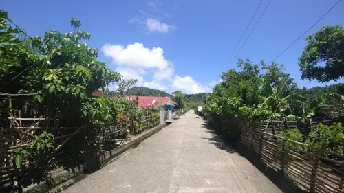


Churches and places of worship3

Gas and EV charging1

History
Formerly the town site was located some two kilometers away south of the present site. Then the people were disturbed by constant depredation of bandits coming from other places.
The present site has been chosen because it was near the sea and the fishermen found it very convenient for their trade, however, being near the sea, it was vulnerable to Moros who always come to get their belongings or even capture some people.
As a defense against such moro raids, the people planted pandan shrubs close to each other to form a formidable defense against invaders. When the Spaniards came, they found the plants around the poblacion in great abundance. When asked what the name of the shrubs was, the people told them that they were pandan shrubs. Thus, the Spaniards called the place Pandan.
From the History section of Pandan, Catanduanes on Wikipedia, under CC BY-SA 4.0.
Schools, colleges and libraries28
Pandan School of Arts and Trades
School · 1.6 km
Catanduanes Circumferential Road, Pandan
Healthcare2
Map of Pandan
37 places. The map loads OpenStreetMap tiles when you open it.
Getting there and nearby towns
Virac Airport (VRC) is the nearest airport with scheduled flights listed in OpenStreetMap, 52 km away.
- Caramoran 8 km southwest, about 8 min by car
- Tubli 13 km south, about 13 min by car
- Panganiban 21 km southeast, about 21 min by car
- Viga 24 km southeast, about 24 min by car
- Virac 52 km south, about 52 min by car
- Goa 83 km southwest, about 1 h 30 min by car
- Tiwi 84 km southwest, about 1 h 30 min by car
- Tigaon 86 km southwest, about 1 h 30 min by car
- Sagnay 85 km southwest, about 1 h 30 min by car
- Tabaco 90 km southwest, about 1 h 30 min by car
Drive times are estimates from straight-line distance, not routes.
Local news
Headlines from INDB.
Reviews, tips and questions
Loading what members have shared...
Sources and licences
- GeoNames (CC BY 4.0): population, coordinates, regions and time zone
- Mapillary (see each image): photos
- OpenStreetMap contributors (ODbL 1.0): places, airports, map data
- Wikidata (CC0 1.0): elevation, founding date, time zone, website
- Wikimedia Commons (see each image): photos
- Wikipedia (CC BY-SA 4.0): overview and history text
Photo credits
- Pandan Church, Catanduanes, Joelaldor, CC BY-SA 4.0
- ISS056-E-13661 - View of Earth, Earth Science and Remote Sensing Unit, NASA Johnson Space Center, Public domain
- ISS044-E-58383 - View of Earth, Earth Science and Remote Sensing Unit , Lyndon B. Johnson Space Center, Public domain
- ISS044-E-58382 - View of Earth, Earth Science and Remote Sensing Unit , Lyndon B. Johnson Space Center, Public domain
- ISS044-E-59309 - View of Earth, Earth Science and Remote Sensing Unit , Lyndon B. Johnson Space Center, Public domain
- ISS030-E-32068 - View of Earth, Earth Science and Remote Sensing Unit , Lyndon B. Johnson Space Center, Public domain
- Street-level photo, danbjoseph, CC BY-SA 4.0
Page built November 7, 2026. Spotted a mistake? Tell us or suggest a place.