


Why visit Saguday
Townapedia lists 1 museum or landmark and 3 places to stay in and around town.
Weather in Saguday
Forecast from MET Norway (CC BY 4.0). Full forecast
About Saguday
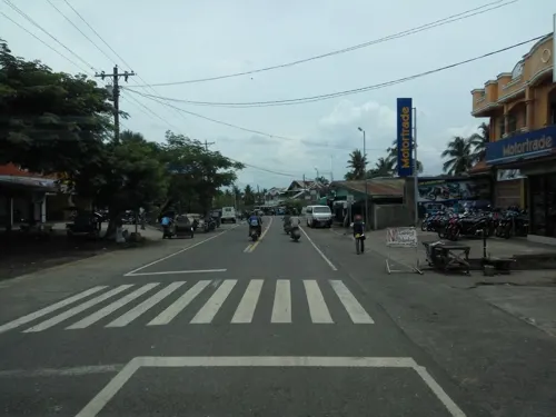
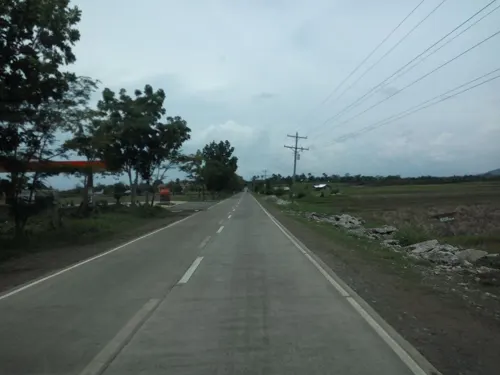
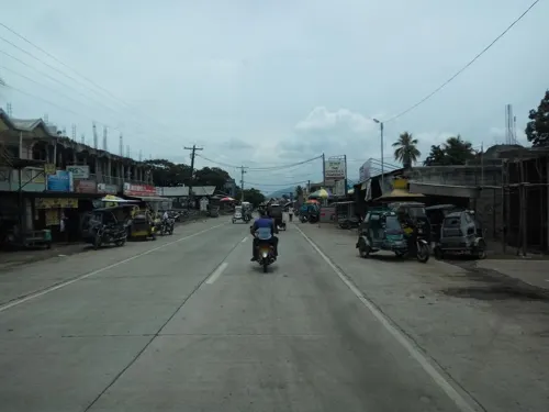
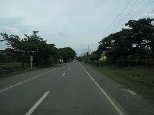
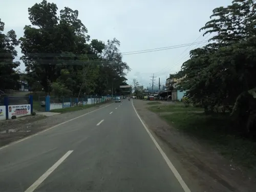
Saguday, officially the Municipality of Saguday (Ilocano: Ili ti Saguday; Tagalog: Bayan ng Saguday), is a municipality in the province of Quirino, Philippines. According to the 2024 census, it has a population of 17,863 people.
From the Wikipedia article Saguday (this version), under CC BY-SA 4.0.
Travel tips from other travellers: Saguday on Wikivoyage (CC BY-SA 4.0).
Museums and landmarks1

Where to stay3

Quirino Capitol Plaza Hotel
Motel and hotel · 5.2 km
Capitol Hills Road, Cabarroguis
Churches and places of worship3

Saint Mark Parish Church
Church · Roman Catholic · 4.9 km
Cordon-Aurora Boundary Road, Cabarroguis

Iglecia ni Cristo
Place of worship · 3.1 km
Cordon-Aurora Boundary Road, Cabarroguis
Gas and EV charging8



History
Saguday was formally founded on June 21, 1959 as a regular municipality of Nueva Vizcaya by virtue of House Bill No. 2541, authored by Leonardo B. Perez, then Congressman of the Lone District of Nueva Vizcaya which pursuant to the provisions of Article VI, Section 20 (1) of the Philippine Constitution, became a law without the signature of President Carlos P. Garcia, entitled Republic Act No. 2519. Pursuant to Section 1 of this law, the seven barrios composing the Municipality of Saguday were as follows: La Paz, Saguday (now Rizal and Magsaysay), Salvacion, Santo Tomas which were separated from the Municipality of Diffun; while Dibul, Mangandingay and Tres Reyes were separated from the Municipality of Aglipay.
Originally, Saguday was a barrio of the Municipality of Santiago, Isabela, however, upon the final settlement of the boundary dispute between Isabela and Nueva Vizcaya, Saguday became a regular barrio of Diffun by virtue of an Executive Order No. 386, issued by then President Elpidio Quirino.
The first settlers of Saguday were spearheaded by Ilocanos, composed of the families of Corpuz, Cortez, Cabiles, Guzman and Bacani who hailed from the Province of Pangasinan, the Pagbilao, Guillermo and Olonan families from Ilocos Region, and the families of Cardenas, and Tomas from the Province of Nueva Ecija, who all came to benefit from the lands and forest of this valley.
From the History section of Saguday on Wikipedia, under CC BY-SA 4.0.
Schools, colleges and libraries33
Cabarroguis National School of Arts and Trades
School · 4.5 km
George Capinpin Street
Healthcare1
Map of Saguday
49 places. The map loads OpenStreetMap tiles when you open it.
Getting there and nearby towns
Cauayan Airport (CYZ) is the nearest airport with scheduled flights listed in OpenStreetMap, 48 km away.
- Santiago 16 km north, about 16 min by car
- Cordon 18 km northwest, about 18 min by car
- Echague 22 km northeast, about 22 min by car
- Ramon 27 km north, about 27 min by car
- Alicia 30 km northeast, about 30 min by car
- Angadanan 31 km northeast, about 31 min by car
- Quezon 32 km west, about 32 min by car
- Solano 41 km west, about 41 min by car
- Bayombong 45 km west, about 45 min by car
- Bambang 52 km west, about 52 min by car
Drive times are estimates from straight-line distance, not routes.
Local news
Headlines from INDB.
Reviews, tips and questions
Loading what members have shared...
Sources and licences
- GeoNames (CC BY 4.0): population, coordinates, regions and time zone
- Mapillary (see each image): photos
- OpenStreetMap contributors (ODbL 1.0): places, airports, map data
- Wikidata (CC0 1.0): elevation, founding date, time zone, website, landmarks and historic places
- Wikimedia Commons (see each image): photos
- Wikipedia (CC BY-SA 4.0): overview and history text
Photo credits
- Saguday Marker in Quirino Provincial Capitol, Jun 2026, Ralff Nestor Nacor, CC BY-SA 4.0
- Cabarroguis Church Parish Office, Quirino, Jun 2026, Ralff Nestor Nacor, CC BY-SA 4.0
- Cabarroguis Church, Quirino, Jun 2026 (1), Ralff Nestor Nacor, CC BY-SA 4.0
- Our Lady of Fatima, Cabarroguis Church, Quirino, Jun 2026, Ralff Nestor Nacor, CC BY-SA 4.0
- Cabarroguis Church Interior, Quirino, Jun 2026, Ralff Nestor Nacor, CC BY-SA 4.0
- Saint Mark School, Cabarroguis, Quirino, Jun 2026, Ralff Nestor Nacor, CC BY-SA 4.0
- Cabarroguis Church, Quirino, Jun 2026 (2), Ralff Nestor Nacor, CC BY-SA 4.0
- Cabarroguis Church, Quirino, Jun 2026 (3), Ralff Nestor Nacor, CC BY-SA 4.0
- Cordon-Aurora Road, Cabarroguis, Quirino, Jun 2026 (1), Ralff Nestor Nacor, CC BY-SA 4.0
- Cabarroguis Town Proper, Quirino, Jun 2026, Ralff Nestor Nacor, CC BY-SA 4.0
- Quirino Province Plenary Hall, Jun 2026, Ralff Nestor Nacor, CC BY-SA 4.0
- Cordon-Aurora Road, Cabarroguis, Quirino, Jun 2026 (2), Ralff Nestor Nacor, CC BY-SA 4.0
- Divila Bridge, Cabarroguis, Quirino, Jun 2026, Ralff Nestor Nacor, CC BY-SA 4.0
- Cabarroguis Public Market, Quirino, Jun 2026, Ralff Nestor Nacor, CC BY-SA 4.0
- Quirino Sports Tourism Complex Arch, Jun 2026, Ralff Nestor Nacor, CC BY-SA 4.0
- Quirino Arch at Provincial Capitol, Jun 2026, Ralff Nestor Nacor, CC BY-SA 4.0
- Capitol Road, Cabarroguis, Quirino, Jun 2026 (1), Ralff Nestor Nacor, CC BY-SA 4.0
- Capitol Road, Cabarroguis, Quirino, Jun 2026 (2), Ralff Nestor Nacor, CC BY-SA 4.0
- Capitol Road, Cabarroguis, Quirino, Jun 2026 (3), Ralff Nestor Nacor, CC BY-SA 4.0
- Quirino Province Museum & Library, Jun 2026 (2), Ralff Nestor Nacor, CC BY-SA 4.0
- Brief History of the Province of Quirino Marker, Cabarroguis, Quirino, Ralff Nestor Nacor, CC BY-SA 4.0
- OTOP Quirino Hub, Jun 2026, Ralff Nestor Nacor, CC BY-SA 4.0
- Marker with Quirino Province Historical Marker, Jun 2026, Ralff Nestor Nacor, CC BY-SA 4.0
- DTI OTOP Store in Quirino Provincial Capitol, Jun 2026, Ralff Nestor Nacor, CC BY-SA 4.0
- Quirino Province Museum & Library, Jun 2026 (1), Ralff Nestor Nacor, CC BY-SA 4.0
- Quirino Provincial Hall Welcome Arch, Jun 2026, Ralff Nestor Nacor, CC BY-SA 4.0
- Quirino Provincial Tourism Office, Jun 2026, Ralff Nestor Nacor, CC BY-SA 4.0
- Quirino Capitol Peoples Mart, Jun 2026, Ralff Nestor Nacor, CC BY-SA 4.0
- Quirino Marker at Provincial Museum & Library, Jun 2026, Ralff Nestor Nacor, CC BY-SA 4.0
- OTOP Quirino Hub Interior, Jun 2026, Ralff Nestor Nacor, CC BY-SA 4.0
- Pink Rice in OTOP Quirino, Jun 2026, Ralff Nestor Nacor, CC BY-SA 4.0
- Fruit Baskets in OTOP Quirino Hub, Jun 2026, Ralff Nestor Nacor, CC BY-SA 4.0
- Quirino Province Gymnasium, Jun 2026, Ralff Nestor Nacor, CC BY-SA 4.0
- Quirino Sports Tourism Complex, Jun 2026 (1), Ralff Nestor Nacor, CC BY-SA 4.0
- Quirino Sports Tourism Complex, Jun 2026 (2), Ralff Nestor Nacor, CC BY-SA 4.0
- Quirino Provincial Capitol, Jun 2026 (2), Ralff Nestor Nacor, CC BY-SA 4.0
- I Love Diffun in Quirino Provincial Capitol, Jun 2026, Ralff Nestor Nacor, CC BY-SA 4.0
- Quirino Provincial Capitol, Jun 2026 (1), Ralff Nestor Nacor, CC BY-SA 4.0
- Quirino Provincial Capitol Interior, Jun 2026 (1), Ralff Nestor Nacor, CC BY-SA 4.0
- Quirino Sports Tourism Complex from Capitol, Jun 2026, Ralff Nestor Nacor, CC BY-SA 4.0
- Street-level photo, asdfasdf0986, CC BY-SA 4.0
- Street-level photo, asdfasdf0986, CC BY-SA 4.0
- Street-level photo, asdfasdf0986, CC BY-SA 4.0
- Street-level photo, asdfasdf0986, CC BY-SA 4.0
- Street-level photo, asdfasdf0986, CC BY-SA 4.0
- Street-level photo, asdfasdf0986, CC BY-SA 4.0
- Street-level photo, asdfasdf0986, CC BY-SA 4.0
- Street-level photo, asdfasdf0986, CC BY-SA 4.0
- Street-level photo, asdfasdf0986, CC BY-SA 4.0


Page built November 7, 2026. Spotted a mistake? Tell us or suggest a place.