


Pompton Plains, New Jersey
Pompton Plains is a community of 10,971 people in Morris County, New Jersey.
Why visit Pompton Plains
Townapedia lists 26 museums and landmarks, 30 parks and trails, 55 places to eat, 2 places to stay and 3 attractions in and around town.
Highlights include Packanack Mountain, Butler, Demarest-Hopper House and Pompton Aquatic Park.
July is the warmest month, with average highs of 84°F; January lows average 20°F.
Weather in Pompton Plains
Forecast from the National Weather Service. Full forecast
About Pompton Plains
Pompton Plains is a census-designated place (CDP) and unincorporated community constituting the majority of Pequannock Township, Morris County, in the U.S. state of New Jersey. As of the 2020 United States census, the CDP's population was 11,144. The community was first listed as a CDP in advance of the 2020 census.
From the Wikipedia article Pompton Plains, New Jersey (this version), under CC BY-SA 4.0.
Things to do3


Museums and landmarks26

Butler
Monument and historic site · National Register of Historic Places · 3.2 mi
NYS&W station

Demarest-Hopper House
Monument and historic site · National Register of Historic Places · 3.9 mi
Historic house in Bergen County, New Jersey

James Van Duyne Farmhouse
Monument and historic site · National Register of Historic Places · 3.6 mi
Historic house in Montville, New Jersey

John Dods House and Tavern
Monument and historic site · National Register of Historic Places · 3.4 mi
Historic buildings in Morris County, New Jersey

Martin Berry House
Monument and historic site · National Register of Historic Places · 0.9 mi
Historic house in Morris County, New Jersey
Mead-Van Duyne House
Monument and historic site · National Register of Historic Places · 3.3 mi
Historic house in Passaic County, New Jersey

Nicholas Vreeland Outkitchen
Monument and historic site · National Register of Historic Places · 3.0 mi
Farm building in Montville, New Jersey

Pompton Plains
Monument and historic site · National Register of Historic Places · 0.6 mi
Railway station in Pequannock Township, the United States of America
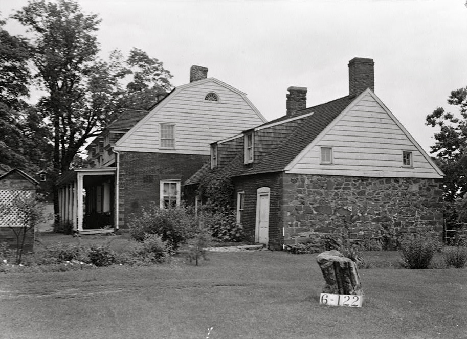
Schuyler-Colfax House
Monument and historic site · National Register of Historic Places · 1.9 mi
Historic house in New Jersey, United States

Van Houten-Ackerman House
Monument and historic site · National Register of Historic Places · 3.9 mi
United States historic house in New Jersey


Van Riper-Hopper House
Monument and historic site · National Register of Historic Places · 3.3 mi
Historic house in New Jersey, United States

Schuyler-Colfax House Historic House Museum
Museum · 1.9 mi
2343 Paterson-Hamburg Turnpike, Wayne
14 more on the map.
Parks, trails and playgrounds30

Pompton Aquatic Park
Park · 1.4 mi
Park in New Jersey, United States of America
Friendship Park
Park · 3.3 mi
Park in New Jersey, United States of America

Pompton Valley Rail Trail - River Drive Trailhead
Hiking and trails · 1.1 mi
River Drive, Pequannock Township
18 more on the map.
Restaurants and cafes55




Black Bull Steakhouse & Seafood
Restaurant · Steak House · 1.5 mi
88 Newark-Pompton Turnpike, Riverdale

43 more on the map.
Where to stay2
Churches and places of worship17
Chabad Center of Passaic County
Place of worship · Orthodox · 2.3 mi
194 Ratzer Road, Wayne
Kingdom Hall of Jehovah's Witnesses
Church · Jehovahs Witness · 1.3 mi
146 Willow Avenue, Pompton Lakes
Our Lady of Consolation Church
Church · Catholic · 2.1 mi
1799 Paterson-Hamburg Turnpike, Wayne
Our Lady of Good Counsel Church
Church · Roman Catholic · 0.4 mi
155 West Parkway, Pompton Plains
Pequannock Reformed Church in Wayne
Church · Reformed · 2.3 mi
530 Newark-Pompton Turnpike, Wayne
St. Michael's Russian Orthodox Church
Church · Russian Orthodox · 2.1 mi
171 Colfax Road, Wayne
The First Reformed Church of Pompton Plains
Church · 0.5 mi
529 Newark Pompton Turnpike, Pompton Plains
Shopping20
Jersey Pride Deli & Catering
Shop · 2.2 mi
715 Paterson-Hamburg Turnpike, Pompton Lakes
Gas and EV charging17
Schools, colleges and libraries52
Healthcare23
Associates in Women's Healthcare
Clinic and pharmacy · 2.2 mi
1777 Paterson-Hamburg Turnpike, Wayne
Gastrointestinal Group of North Jersey, P.A.
Clinic and pharmacy · 2.2 mi
1777 Paterson-Hamburg Turnpike, Wayne
Lifeline Medical Associates
Clinic and pharmacy · 2.2 mi
1777 Paterson-Hamburg Turnpike, Wayne
Neighbor Care Pharmacy
Clinic and pharmacy · 1.9 mi
493 Black Oak Ridge Road, Wayne
New Jersey Urology
Clinic and pharmacy · 2.2 mi
1777 Paterson-Hamburg Turnpike, Wayne
Map of Pompton Plains
245 places. The map loads OpenStreetMap tiles when you open it.
Climate by month
Monthly table
| Month | High | Low | Rain |
|---|---|---|---|
| Jan | 38°F | 20°F | 3.4 in |
| Feb | 40°F | 20°F | 2.7 in |
| Mar | 48°F | 29°F | 3.9 in |
| Apr | 60°F | 39°F | 4.2 in |
| May | 71°F | 50°F | 3.6 in |
| Jun | 79°F | 58°F | 5.1 in |
| Jul | 84°F | 64°F | 4.7 in |
| Aug | 83°F | 63°F | 4.6 in |
| Sep | 76°F | 56°F | 4.0 in |
| Oct | 64°F | 43°F | 4.4 in |
| Nov | 53°F | 35°F | 3.8 in |
| Dec | 43°F | 27°F | 4.0 in |
U.S. Climate Normals 1991-2020 for Wanaque Raymond Dam (5 mi away), NOAA NCEI.
People and cost of living
American Community Survey 5-year estimates, 2020-2024, U.S. Census Bureau. Estimates have margins of error, larger for small towns.
Disaster history
Morris County has had 22 federal disaster declarations since 2000, most often for hurricanes.
- 2021-09-05: Remnants Of Hurricane Ida (Hurricane)
- 2021-09-02: Remnants Of Hurricane Ida (Hurricane)
- 2021-04-28: Severe Winter Storm And Snowstorm (Snowstorm)
- 2020-12-11: Tropical Storm Isaias (Hurricane)
- 2020-03-25: Covid-19 Pandemic (Biological)
- 2020-03-13: Covid-19 (Biological)
OpenFEMA disaster declarations summaries.
Getting there and nearby towns
Essex County Airport (CDW) is the nearest airport with scheduled flights listed in OpenStreetMap, 7 miles away.
- Pompton Lakes 3 mi north, about 4 min by car
- Lincoln Park 3 mi south, about 5 min by car
- Kinnelon 4 mi west, about 7 min by car
- Oakland 6 mi northeast, about 9 min by car
- Franklin Lakes 6 mi northeast, about 9 min by car
- Lake Hiawatha 7 mi southwest, about 12 min by car
- Paterson 8 mi southeast, about 13 min by car
- Glen Rock 9 mi east, about 15 min by car
- Oak Ridge 11 mi west, about 18 min by car
- Maywood 13 mi east, about 21 min by car
Drive times are estimates from straight-line distance, not routes.
Local news
Headlines from INDB, the NEMICO news database.
Reviews, tips and questions
Loading what members have shared...
Sources and licences
- NCES EDGE (Public domain): public schools
- NOAA NCEI U.S. Climate Normals 1991-2020 (Public domain): climate by month
- OpenFEMA (Public domain): disaster declarations
- OpenStreetMap contributors (ODbL 1.0): places, airports, map data
- U.S. Census Bureau (Public domain): population, income, housing, education, commute
- Wikidata (CC0 1.0): elevation, founding date, time zone, website, landmarks and historic places
- Wikimedia Commons (see each image): photos
- Wikipedia (CC BY-SA 4.0): overview and history text
Photo credits
- Pompton Plains post office, Pequannock Township, NJ, Nov. 2025, Mr. Matté (if there is an issue with this image, contact me using this image's Commons talk page , my Commons user talk page , or my English Wikipedia user talk page ; I'll know about it a lot faster), CC BY-SA 4.0
- The Pompton Plains Railroad Station - Looking Across The Street - Street Side - View 06, John Andrew Aquilio, CC BY-SA 4.0
- The Pompton Plains Railroad Station - An Angled Frontal View Of The Station - Street Side - View 04, John Andrew Aquilio, CC BY-SA 4.0
- The Pompton Plains Railroad Station - A Diagonal View Of The Station - Front & Side - View 05, John Andrew Aquilio, CC BY-SA 4.0
- The Pompton Plains Railroad Station - The Old Station And Wagon - End Side - View 03, John Andrew Aquilio, CC BY-SA 4.0
- Pompton Plains Station - November 2023, Kether83, CC BY-SA 4.0
- The Pompton Plains Railroad Station - The End Of The Line - Track Side - View 02, John Andrew Aquilio, CC BY-SA 4.0
- The Pompton Plains Railroad Station - Looking Down The Old Tracks - Track Side - View 01, John Andrew Aquilio, CC BY-SA 4.0
- MARTIN BERRY HOUSE, POMPTON PLAINS, MORRIS COUNTY, Jerrye & Roy Klotz, MD, CC BY-SA 3.0
- NICHOLAS VREELAND OUTKITCHEN, MORRIS COUNTY, Jerrye & Roy Klotz, MD, CC BY-SA 3.0
- VanRiper-Hopper House, Lithium6ion, Public domain
- Schuyler-Colfax House, Nathaniel R. Ewan, Public domain
- Pompton Plains Station - September 2014, Adam Moss, CC BY-SA 2.0
- DEMAREST-HOPPER HOUSE, OAKLAND, BERGEN COUNTY, NJ, JERRYE & ROY KLOTZ M.D., CC BY-SA 4.0
- JAMES VAN DUYNE FARM HOUSE, JERRYE & ROY KLOTZ MD, CC BY-SA 3.0
- Butler station - August 2011, Adam Moss, CC BY-SA 2.0
- VAN HOUTON-ACKERMAN HOUSE, FRANKLIN LAKES, BERGEN COUNTY, NJ, JERRYE & ROY KLOTZ MD, CC BY-SA 4.0
- 20210816-USDA-OC-PSD-0237 Tomatoes in the United States, USDAgov, Public domain
- CR 511 Alt. sb approaching CR 504, Feb. 2023, Mr. Matté (if there is an issue with this image, contact me using this image's Commons talk page , my Commons user talk page , or my English Wikipedia user talk page ; I'll know about it a lot faster), CC BY-SA 4.0
- 2018-07-24 17 26 47 View north along New Jersey State Route 23 just north of Morris County Route 660 (Newark-Pompton Turnpike) in Pequannock Township, Morris County, New Jersey, Famartin, CC BY-SA 4.0
- 2018-07-28 10 13 09 View north along Interstate 287 just south of Exit 52 in Pequannock Township, Morris County, New Jersey, Famartin, CC BY-SA 4.0
- 2018-07-28 15 26 24 View south along Morris County Route 511 Alternate (Boulevard) at Dunn Place in Pequannock Township, Morris County, New Jersey, Famartin, CC BY-SA 4.0
- CR 504 eb approaching CR 511 Alt., Feb. 2023, Mr. Matté (if there is an issue with this image, contact me using this image's Commons talk page , my Commons user talk page , or my English Wikipedia user talk page ; I'll know about it a lot faster), CC BY-SA 4.0
- 2018-07-28 14 57 07 View east along Morris County Route 504 (Jacksonville Road) at Morris County Route 511 Alternate (Boulevard) in Pequannock Township, Morris County, New Jersey, Famartin, CC BY-SA 4.0
- 2020-10-11 15 37 13 View north along Morris County Route 511 Alternate (Boulevard) at New Jersey State Route 23 in Pequannock Township, Morris County, New Jersey, Famartin, CC BY-SA 4.0
- 2018-07-24 19 33 59 View south along New Jersey State Route 23 just south of Morris County Route 511 Alternate (Boulevard) in Pequannock Township, Morris County, New Jersey, Famartin, CC BY-SA 4.0
- 2018-07-28 08 29 18 View south along Interstate 287 just south of Exit 52 in Pequannock Township, Morris County, New Jersey, Famartin, CC BY-SA 4.0
- 2020-09-09 14 35 46 View south along New Jersey State Route 23 at the exit for Morris County Route 511 Alternate SOUTH (Boulevard, West Parkway, Newark-Pompton Turnpike) in Pequannock Township..., Famartin, CC BY-SA 4.0
- 2018-07-28 14 30 30 View west along Morris County Route 504 (Jacksonville Road) at Morris County Route 660 (Newark-Pompton Turnpike) in Pequannock Township, Morris County, New Jersey, Famartin, CC BY-SA 4.0
- 2018-07-28 14 59 48 View east along Morris County Route 504 (Newark-Pompton Turnpike) at Jacksonville Road in Pequannock Township, Morris County, New Jersey, Famartin, CC BY-SA 4.0
- 2014-05-07 16 17 37 View of Interstate 287 and Wanaque Reservoir from an airplane heading for Newark Liberty International Airport, Famartin, CC BY-SA 3.0
- CR 504 eb approaching CR 635, Pequannock Twp., Feb. 2023, Mr. Matté (if there is an issue with this image, contact me using this image's Commons talk page , my Commons user talk page , or my English Wikipedia user talk page ; I'll know about it a lot faster), CC BY-SA 4.0
- 2024-10-22 09 36 15 Autumn view north along Interstate 287 between Exit 47 and Exit 52 in Pequannock Township, Morris County, New Jersey, Famartin, CC BY-SA 4.0
- 2020-07-08 13 54 40 View north along Interstate 287 at Exit 52A (New Jersey State Route 23 SOUTH, Riverdale, Wayne) in Riverdale, Morris County, New Jersey, Famartin, CC BY-SA 4.0
- 2018-07-28 10 29 13 View north along Interstate 287 at Exit 52A (New Jersey State Route 23 SOUTH, Riverdale, Wayne) in Riverdale, Morris County, New Jersey, Famartin, CC BY-SA 4.0
- 2018-07-24 17 40 50 View north along New Jersey State Route 23 just north of Morris County Route 511 Alternate (Newark-Pompton Turnpike) in Riverdale, Morris County, New Jersey, Famartin, CC BY-SA 4.0
- 2018-07-28 15 10 55 View north along Morris County Route 511 Alternate (Newark-Pompton Turnpike) just north of New Jersey State Route 23 in Riverdale, Morris County, New Jersey, Famartin, CC BY-SA 4.0
- 2020-09-09 11 17 16 View north along New Jersey State Route 23 at the exit for Interstate 287 NORTH (Mahwah, TO Morris County Route 694, Bloomingdale, Pompton Lakes) in Riverdale, Morris County, New..., Famartin, CC BY-SA 4.0
- 2020-07-08 13 56 26 View north along Interstate 287 at Exit 52B (New Jersey State Route 23 NORTH, Butler) in Riverdale, Morris County, New Jersey, Famartin, CC BY-SA 4.0
- 2020-09-09 14 29 44 View south along New Jersey State Route 23 at the exit for Interstate 287 NORTH (Mahwah, TO Morris County Route 694, Bloomingdale, Pompton Lakes) in Riverdale, Morris County, New..., Famartin, CC BY-SA 4.0


Page built October 30, 2026. Spotted a mistake? Tell us or suggest a place.