

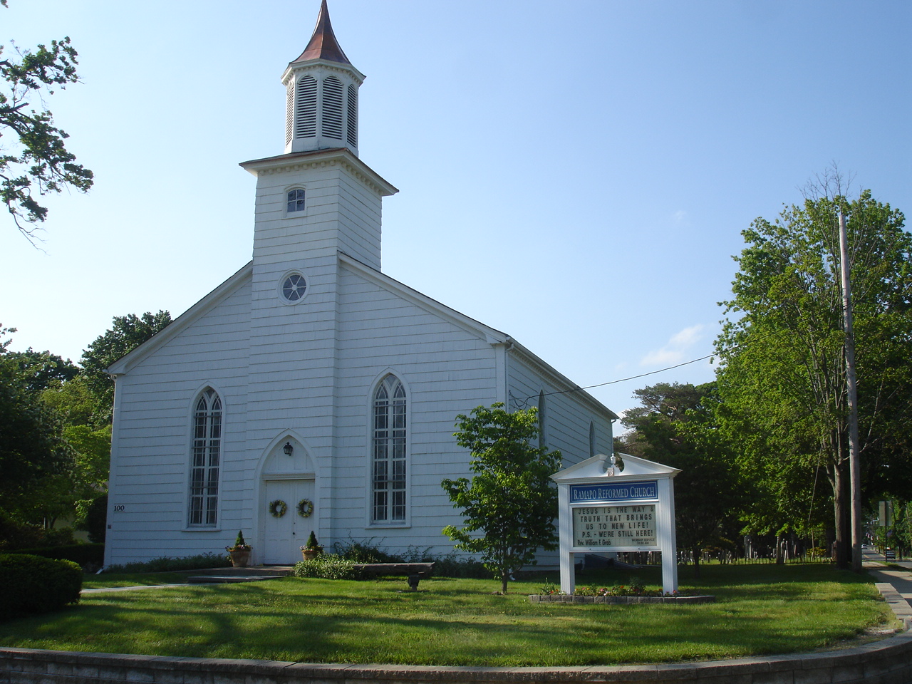


Ramapo College of New Jersey, New Jersey
Ramapo College of New Jersey is a community of 2,018 people in Bergen County, New Jersey.
Why visit Ramapo College of New Jersey
Townapedia lists 17 museums and landmarks, 7 parks and trails, 18 places to eat, 7 places to stay and 7 attractions in and around town.
Highlights include Campgaw Mountain Reservation, Green Hill, Abraham Van Gelder House and Crocker-McMillin Mansion-Immaculate Conception Seminary.
July is the warmest month, with average highs of 84°F; January lows average 20°F.
Weather in Ramapo College of New Jersey
Forecast from the National Weather Service. Full forecast
About Ramapo College of New Jersey
Ramapo College of New Jersey (RCNJ) is a public liberal arts college in Mahwah, New Jersey, United States. It is part of New Jersey's public system of higher education. As of the fall 2021 semester, there were a total of 5,732 students enrolled at the college, including 576 graduate students and 11 doctorate students.
From the Wikipedia article Ramapo College (this version), under CC BY-SA 4.0.
Things to do7

Campgaw Mountain Reservation
Ski area · 2.3 mi
County park in Bergen County


Museums and landmarks17

Abraham Van Gelder House
Monument and historic site · National Register of Historic Places · 2.5 mi
House in Ramsey, New Jersey

Crocker-McMillin Mansion-Immaculate Conception Seminary
Monument and historic site · National Register of Historic Places · 1.0 mi
Historic house in New Jersey, United States
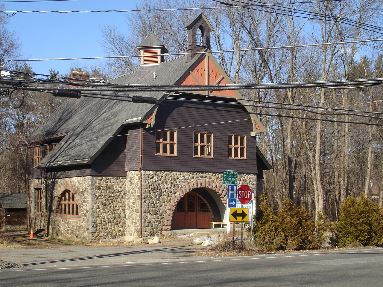
Darlington Schoolhouse
Monument and historic site · National Register of Historic Places · 0.5 mi
School building in New Jersey, United States of America

David Van Gelder House
Monument and historic site · National Register of Historic Places · 2.6 mi
Historic house in New Jersey, United States

Hopper-Van Horn House
Monument and historic site · National Register of Historic Places · 0.5 mi
Historic house in Mahwah, New Jersey

Isaac Bogert House
Monument and historic site · National Register of Historic Places · 2.9 mi
Historic house in Mahwah, New Jersey, United States

John Bartholf House
Monument and historic site · National Register of Historic Places · 2.7 mi
Dutch colonial house in Mahwah, New Jersey, United States

Main School
Monument and historic site · National Register of Historic Places · 3.1 mi
Historic building in Hillburn, New York, United States

Texwipe Corporation Headquarters
Monument and historic site · National Register of Historic Places · 2.9 mi
Historic district in Bergen County, New Jersey

United States Post Office
Monument and historic site · National Register of Historic Places · 2.7 mi
Post office in Suffern, New York

Vanderbeck House
Monument and historic site · National Register of Historic Places · 3.4 mi
Historic house located in Mahwah, New Jersey, United States


Washington Avenue Soldier's Monument and Triangle
Monument and historic site · National Register of Historic Places · 2.7 mi
Monument in Suffern, New York, United States
5 more on the map.
Parks, trails and playgrounds7




Restaurants and cafes18



6 more on the map.
History
In the late 19th century, the Ramapo Valley was developed for large estates by many wealthy families. Ramapo Valley is named after the Ramapough, a band of the Lenape Indians. Theodore Havemeyer and his family arrived in the area in the 1870s. Havemeyer, a founder of the American Sugar Company, purchased and renovated a home on the road that would become Route 202 and developed more than 1,000 acres (400 ha) surrounding the mansion into a farm. In 1889, he had a second mansion built on the property for one of his daughters. That mansion and about 700 acres (280 ha) of the original 1,000 were later purchased by Stephen Birch, president of the Kennecott Copper Company.
In 1968, the New Jersey Department of Higher Education authorized establishing a new state college in Bergen County, due to its increasing population and suburbanization. The criteria for the new college's location were sufficient land for the construction of current needs and future expansion, and proximity to at least one major highway. The locations of existing public and private institutions in the state were also taken into consideration. The college was planned to serve economically deprived students from urban and rural areas, in addition to a full range of middle-class families.
From the History section of Ramapo College on Wikipedia, under CC BY-SA 4.0.
Where to stay7
Churches and places of worship9
Dutch Reformed Church at Romopock
Church · National Register of Historic Places · 1.5 mi
Shopping1
Gas and EV charging10
Schools, colleges and libraries48
Edith A. Bogert Elementary School
School · 4.1 mi
391 W Saddle River Rd, Upper Saddle River
Emil A. Cavallini Middle School
School · 4.2 mi
392 W Saddle River Rd, Upper Saddle River
Franklin Avenue Middle School
School · 4.4 mi
755 Franklin Avenue, Franklin Lakes
Healthcare1
Map of Ramapo College of New Jersey
125 places. The map loads OpenStreetMap tiles when you open it.
Climate by month
Monthly table
| Month | High | Low | Rain |
|---|---|---|---|
| Jan | 38°F | 20°F | 3.4 in |
| Feb | 40°F | 20°F | 2.7 in |
| Mar | 48°F | 29°F | 3.9 in |
| Apr | 60°F | 39°F | 4.2 in |
| May | 71°F | 50°F | 3.6 in |
| Jun | 79°F | 58°F | 5.1 in |
| Jul | 84°F | 64°F | 4.7 in |
| Aug | 83°F | 63°F | 4.6 in |
| Sep | 76°F | 56°F | 4.0 in |
| Oct | 64°F | 43°F | 4.4 in |
| Nov | 53°F | 35°F | 3.8 in |
| Dec | 43°F | 27°F | 4.0 in |
U.S. Climate Normals 1991-2020 for Wanaque Raymond Dam (7 mi away), NOAA NCEI.
People and cost of living
American Community Survey 5-year estimates, 2020-2024, U.S. Census Bureau. Estimates have margins of error, larger for small towns.
Disaster history
Bergen County has had 21 federal disaster declarations since 2000, most often for hurricanes.
- 2021-09-05: Remnants Of Hurricane Ida (Hurricane)
- 2021-09-02: Remnants Of Hurricane Ida (Hurricane)
- 2020-12-11: Tropical Storm Isaias (Hurricane)
- 2020-03-25: Covid-19 Pandemic (Biological)
- 2020-03-13: Covid-19 (Biological)
- 2018-06-08: Severe Winter Storm And Snowstorm (Severe Storm)
OpenFEMA disaster declarations summaries.
Getting there and nearby towns
Essex County Airport (CDW) is the nearest airport with scheduled flights listed in OpenStreetMap, 16 miles away.
- Ramsey 2 mi southeast, about 3 min by car
- Suffern 3 mi northeast, about 4 min by car
- Allendale 4 mi southeast, about 6 min by car
- Airmont 4 mi east, about 7 min by car
- Oakland 5 mi southwest, about 8 min by car
- Monsey 5 mi east, about 9 min by car
- Ringwood 5 mi west, about 9 min by car
- Franklin Lakes 5 mi south, about 9 min by car
- Waldwick 5 mi southeast, about 9 min by car
- Midland Park 6 mi south, about 10 min by car
Drive times are estimates from straight-line distance, not routes.
Local news
Headlines from INDB, the NEMICO news database.
Reviews, tips and questions
Loading what members have shared...
Sources and licences
- NCES EDGE (Public domain): public schools
- NOAA NCEI U.S. Climate Normals 1991-2020 (Public domain): climate by month
- OpenFEMA (Public domain): disaster declarations
- OpenStreetMap contributors (ODbL 1.0): places, airports, map data
- U.S. Census Bureau (Public domain): population, income, housing, education, commute
- Wikidata (CC0 1.0): elevation, founding date, time zone, website, landmarks and historic places
- Wikimedia Commons (see each image): photos
- Wikipedia (CC BY-SA 4.0): overview and history text
Photo credits
- Suffern, NY, post office, Daniel Case, CC BY-SA 3.0
- DutchReformedChurchMahwah, KForce at en.wikipedia, CC BY-SA 3.0
- BrookChapel, JFino, CC BY-SA 3.0
- JOHN BARTHOLF HOUSE, MAHWAH, BERGEN COUNTY, JERRYE & ROY KLOTZ M.D., CC BY-SA 4.0
- Washington Avenue Soldiers' Monument, Daniel Case, CC BY-SA 3.0
- CROCKER-McMILLIN MANSION - IMMACULATE CONCEPTION SEMINARY, MAHWAH, BERGEN COUNTY, JERRYE & ROY KLOTZ M.D., CC BY-SA 4.0
- Tea House, Texwipe Corporation Headquarters, Upper Saddle River, NJ, Zeete, CC BY-SA 4.0
- DarlingtonSchoolhouse, KForce at English Wikipedia, CC BY-SA 3.0
- HOPPER-VAN HORN HOUSE, MAHWAH, BERGEN COUNTY, NJ, JERRYE & ROY KLOTZ M.D., CC BY-SA 4.0
- David Van Gelder House, Elle829, CC BY-SA 3.0
- Former Main School building - Hillburn, NY (2010), Doug Kerr from Albany, NY, United States, CC BY-SA 2.0
- Abraham Gelder House, Elle829, CC BY-SA 3.0
- Westervelt - Ackerson House 9494, Richard Arthur Norton (1958- ), CC BY-SA 4.0
- Vanderbeck House, Elle829, CC BY-SA 3.0
- ISAAC BOGERT HOUSE, MAHWAH, BERGEN COUNTY, NJ, JERRYE & ROY KLOTZ M.D., CC BY-SA 4.0
- CampgawMountainReservation FykePond, Lithium6ion, Public domain

Page built October 30, 2026. Spotted a mistake? Tell us or suggest a place.