




Rolling Hills Estates, California
Rolling Hills Estates is a city of 8,131 people in Los Angeles County, California, founded in 1957.
Why visit Rolling Hills Estates
Townapedia lists 11 museums and landmarks, 29 parks and trails, 141 places to eat, 4 places to stay and 4 attractions in and around town.
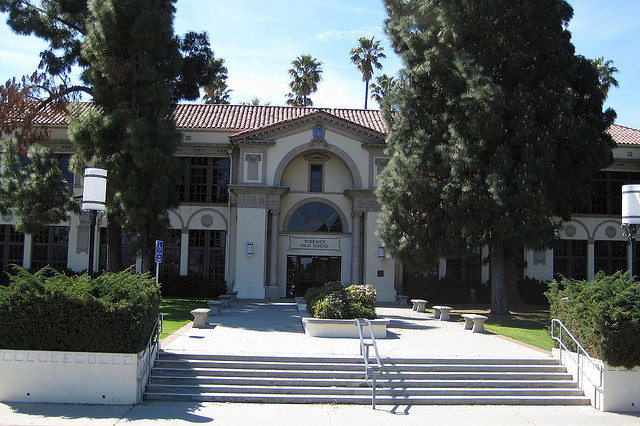
Highlights include AMC Rolling Hills 20, Terrace Cinemas, Auditorium (Torrance High School) and Home Economics Building.
August is the warmest month, with average highs of 78°F; December lows average 46°F.
Weather in Rolling Hills Estates
Forecast from the National Weather Service. Full forecast
About Rolling Hills Estates
Rolling Hills Estates is a city in Los Angeles County, California, United States. On the northern side of the Palos Verdes Peninsula, facing Torrance, Rolling Hills Estates is mostly residential. Incorporated in 1957, Rolling Hills Estates has many horse paths. The population was 8,280 at the 2020 census, up from 8,067 at the 2010 census.
From the Wikipedia article Rolling Hills Estates, California (this version), under CC BY-SA 4.0.
Things to do4


Museums and landmarks11

Auditorium (Torrance High School)
Monument and historic site · National Register of Historic Places · 3.7 mi
Event venue in Torrance, United States of America

Home Economics Building
Monument and historic site · National Register of Historic Places · 3.7 mi
Torrance, California, listed on the NRHP in Los Angeles County, California
Main Building
Monument and historic site · National Register of Historic Places · 3.7 mi
Building in California, United States

Malaga Cove Library
Monument and historic site · National Register of Historic Places · 3.5 mi
Public library in Palos Verdes Estates, California, USA
Torrance School
Monument and historic site · National Register of Historic Places · 3.6 mi
School building in California, United States of America

Warner Grand Theater
Monument and historic site · National Register of Historic Places · 3.6 mi
Movie theater in San Pedro, Los Angeles, California, United States


Lomita Railroad Museum
Museum · 1.6 mi
Railroad museum in Lomita, California
2137 250th Street
Fr-Su 10:00-17:00; Mo-Th off; PH off


George F. Canyon Nature Center
Museum · 0.5 mi
Fr 13:00-16:00; Sa,Su 10:00-15:30; Mo-Th off
Parks, trails and playgrounds29

Averill Park
Park · 3.4 mi
Urban park in San Pedro, Los Angeles, California
Del Cerro Park
Park · 2.5 mi
Park in California, United States of America, United States of America

Ken Malloy Harbor Regional Park
Park · 2.2 mi
Park in Los Angeles County, California, United States of America

Rolling Hills Country Club
Golf course · 0.4 mi
18 hole Par 70
27000 Palos Verdes Drive East, Rolling Hills Estates
17 more on the map.
Restaurants and cafes141


Bites & Bashes Cafe
Restaurant · American, Asian, Breakfast, Korean, Sandwich · 1.2 mi
25600 Narbonne Avenue
Tu-Sa 08:00-15:00; Su 08:00-14:00

Cara Mia
Cafe · Bakery, Coffee Shop · 1.9 mi
2213 Lomita Boulevard
Mo-Fr 07:00-15:00; Sa 08:00-13:00; Su off
Hot N Tot
Restaurant · American, Breakfast, Diner · 1.0 mi
2347 Pacific Coast Highway
Mo-Su 07:00-15:00
Peet's Coffee
Cafe · Coffee Shop · 1.0 mi
2649 Pacific Coast Highway, Torrance
Mo-Fr 05:30-18:00; Sa,Su 06:00-18:00
Starbucks
Cafe · Coffee Shop · 1.8 mi
24427 Crenshaw Boulevard, Torrance
Mo-Fr 04:30-20:00; Sa,Su 04:30-19:00
Suki Time Thai Kitchen
Restaurant · Thai · 1.9 mi
2271 Lomita Boulevard
Tu-Fr 11:00-14:00, 16:00-20:00; Sa-Su 12:00-14:30, 16:00-20:30
Corridor Flow
Cafe · Coffee Shop · 1.8 mi
24614 Narbonne Avenue
Mo-Th 07:00-17:00; Fr 07:00-18:00; Sa 08:00-18:00; Su off
129 more on the map.
History
Rolling Hills Estates was historically part of Rancho San Pedro. The area eventually became known as Rancho El Elastico prior to incorporating as Rolling Hills Estates. It was Los Angeles County's 60th municipality, incorporated on September 18, 1957.
From the History section of Rolling Hills Estates, California on Wikipedia, under CC BY-SA 4.0.
Where to stay4
Rodeway Inn & Suites Pacific Coast Highway
Motel and hotel · 1.7 mi
1665 Pacific Coast Highway, Harbor City
Quality Inn Lomita - Torrance
Motel and hotel · 1.3 mi
2037 Pacific Coast Highway, Lomita
Churches and places of worship16
Wayfarers Chapel
Church · National Register of Historic Places · 3.5 mi
Mary Star of the Sea Catholic Church, San Pedro, California
Church · 3.5 mi
Walteria United Methodist Church
Church · Methodist · 1.7 mi
3646 Newton Street, Torrance
Shopping19
Gas and EV charging7
Schools, colleges and libraries57
Miraleste Library - Palos Verdes Library District
Library · 1.6 mi
29089 Palos Verdes Drive East, Rancho Palos Verdes
Healthcare11
South Bay Pain and Wellness
Clinic and pharmacy · 0.9 mi
2583 Pacific Coast Highway
Passport Health Torrance Travel Clinic
Clinic and pharmacy · 1.9 mi
24445 Hawthorne Boulevard, Torrance
Map of Rolling Hills Estates
250 places. The map loads OpenStreetMap tiles when you open it.
Climate by month
Monthly table
| Month | High | Low | Rain | Snow |
|---|---|---|---|---|
| Jan | 67°F | 47°F | 3.4 in | 0.0 in |
| Feb | 66°F | 48°F | 3.7 in | 0.0 in |
| Mar | 68°F | 50°F | 2.0 in | 0.0 in |
| Apr | 70°F | 52°F | 0.6 in | 0.0 in |
| May | 72°F | 55°F | 0.3 in | 0.0 in |
| Jun | 74°F | 58°F | 0.1 in | 0.0 in |
| Jul | 77°F | 62°F | 0.1 in | 0.0 in |
| Aug | 78°F | 62°F | 0.0 in | 0.0 in |
| Sep | 78°F | 61°F | 0.1 in | 0.0 in |
| Oct | 76°F | 57°F | 0.5 in | 0.0 in |
| Nov | 71°F | 51°F | 0.8 in | 0.0 in |
| Dec | 66°F | 46°F | 2.2 in | 0.0 in |
U.S. Climate Normals 1991-2020 for Torrance Ap (2 mi away), NOAA NCEI.
People and cost of living
American Community Survey 5-year estimates, 2020-2024, U.S. Census Bureau. Estimates have margins of error, larger for small towns.
Disaster history
Los Angeles County has had 67 federal disaster declarations since 2000, most often for fires.
- 2025-08-08: Canyon Fire (Fire)
- 2025-01-08: Wildfires And Straight-Line Winds (Fire)
- 2025-01-08: Eaton Fire (Fire)
- 2025-01-08: Hurst Fire (Fire)
- 2025-01-07: Palisades Fire (Fire)
- 2024-12-10: Franklin Fire (Fire)
OpenFEMA disaster declarations summaries.
Getting there and nearby towns
Zamperini Field (TOA) is the nearest airport with scheduled flights listed in OpenStreetMap, 2 miles away.
- Lomita 1 mi northeast, about 2 min by car
- Rolling Hills 1 mi southwest, about 2 min by car
- Rancho Palos Verdes 3 mi southwest, about 6 min by car
- Torrance 4 mi north, about 6 min by car
- West Carson 4 mi northeast, about 6 min by car
- Palos Verdes Estates 5 mi west, about 9 min by car
- Redondo Beach 6 mi northwest, about 10 min by car
- Carson 6 mi northeast, about 10 min by car
- Lawndale 8 mi north, about 12 min by car
- Hermosa Beach 8 mi northwest, about 12 min by car
Drive times are estimates from straight-line distance, not routes.
Local news
Headlines from INDB, the NEMICO news database.
Reviews, tips and questions
Loading what members have shared...
Sources and licences
- NCES EDGE (Public domain): public schools
- NOAA NCEI U.S. Climate Normals 1991-2020 (Public domain): climate by month
- OpenFEMA (Public domain): disaster declarations
- OpenStreetMap contributors (ODbL 1.0): places, airports, map data
- U.S. Census Bureau (Public domain): population, income, housing, education, commute
- Wikidata (CC0 1.0): elevation, founding date, time zone, website, landmarks and historic places
- Wikimedia Commons (see each image): photos
- Wikipedia (CC BY-SA 4.0): overview and history text
Photo credits
- Palos Verdes Street Fair & Music Festival 2011, Clotee Allochuku, CC BY 2.0
- THS HomeEc, Original uploader was Alton at en.wikipedia, CC BY-SA 3.0
- Malaga Cove Library, Palos Verdes Library District, CC BY 2.0
- Torrance High School entrance, LCfam, CC BY-SA 3.0
- THS facade, the 216, CC BY 2.0
- Torrance High School Assembly Hall, Los Angeles, CC BY-SA 3.0
- Warner Grand Theater, San Pedro, Los Angeles, CC BY-SA 3.0
- Lomita Railroad Museum, Lomita, CC BY-SA 3.0
- 1962 Ferrari 250 GT Spyder - blue met - rvl-1 (4665804379), Rex Gray, CC BY 2.0
- 1962 Ferrari 250 GT Spyder - blue met - rvr-1 (4665804553), Rex Gray, CC BY 2.0
- 1951 Packard Patrician 400 sdn - maroon - rvr (4665798803), Rex Gray, CC BY 2.0
- 1954 Chrysler Ghia Special G1 - blue - fvl, Rex Gray, CC BY 2.0
- 1962 Ferrari 250 GT Spyder - blue met - fvl-1 (4665803625), Rex Gray, CC BY 2.0
- 1941 Packard 180 Darrin convertible victoria - black - rvl (4665808581), Rex Gray, CC BY 2.0
- 1951 Packard Patrician 400 sdn - maroon - fvr (4665798645), Rex Gray, CC BY 2.0
- 1951 Riley dhc - red black - int (4666431296), Rex Gray, CC BY 2.0
- 1954 Chrysler Ghia Special G1 - blue - rvl, Rex Gray, CC BY 2.0
- 1941 Packard 180 Darrin convertible victoria - black - fvl (4665808941), Rex Gray, CC BY 2.0
- 1949 Riley Roadster - tan - rvr (4666431864), Rex Gray, CC BY 2.0
- 1941 Packard 180 Darrin convertible victoria - black - rvr2 (4666433180), Rex Gray, CC BY 2.0
- Spring A Ding Ding, Terry Lucas, CC BY 3.0
- Bright and Happy - Flickr - tdlucas5000, tdlucas5000 from Lakewood Ca., United States, CC BY 2.0
- Purple Madeira, Terry Lucas, CC BY 3.0
- Tasty Purple Goodies, Terry Lucas, CC BY 3.0
- Seed Hunter, Terry Lucas, CC BY 3.0
- Winter Foxgloves, Terry Lucas, CC BY 3.0
- Backlit Bee Breakfast, Terry Lucas, CC BY 3.0
- Ladybug Hide Out, Terry Lucas, CC BY 3.0
- Winter Yellow, Terry Lucas, CC BY 3.0
- Workin Hard For His Breakfast, Terry Lucas, CC BY 3.0
- Cactus Flowers In Progress, Terry Lucas, CC BY 3.0
- Buttress roots, Patti Neumann, CC BY-SA 3.0
- Porcellio dilatatus 113133483, redrovertracy, CC BY 4.0
- Busy Spring Bee, Terry Lucas, CC BY 3.0
- Cactus Flowers In Progress, Terry Lucas, CC BY 3.0
- Mercedes-Benz C-Klasse (W206) C 300 (2023) (53491181737), Charles from Port Chester, New York, CC BY 2.0
- Tea Kungfu, Xing Su, CC BY-SA 4.0
- Hyundai Excel (US) (8038131673), InSapphoWeTrust from Los Angeles, California, USA, CC BY-SA 2.0
- South Bay Botanic Garden, Palos Verdes Peninsula (8038135096), InSapphoWeTrust from Los Angeles, California, USA, CC BY-SA 2.0
- South Bay Botanic Garden, Palos Verdes Peninsula (8038136346), InSapphoWeTrust from Los Angeles, California, USA, CC BY-SA 2.0


Page built October 30, 2026. Spotted a mistake? Tell us or suggest a place.