




San Felipe, Texas
San Felipe is a town of 1,334 people in Austin County, Texas, founded in 1823.
Why visit San Felipe
Townapedia lists 12 museums and landmarks, 2 parks and trails, 1 place to eat and 1 place to stay in and around town.
Highlights include San Felipe de Austin State Historic Site, Stephen F. Austin, City Park and Stephen F. Austin State Park.
July is the warmest month, with average highs of 95°F; January lows average 42°F.
Weather in San Felipe
Forecast from the National Weather Service. Full forecast
About San Felipe
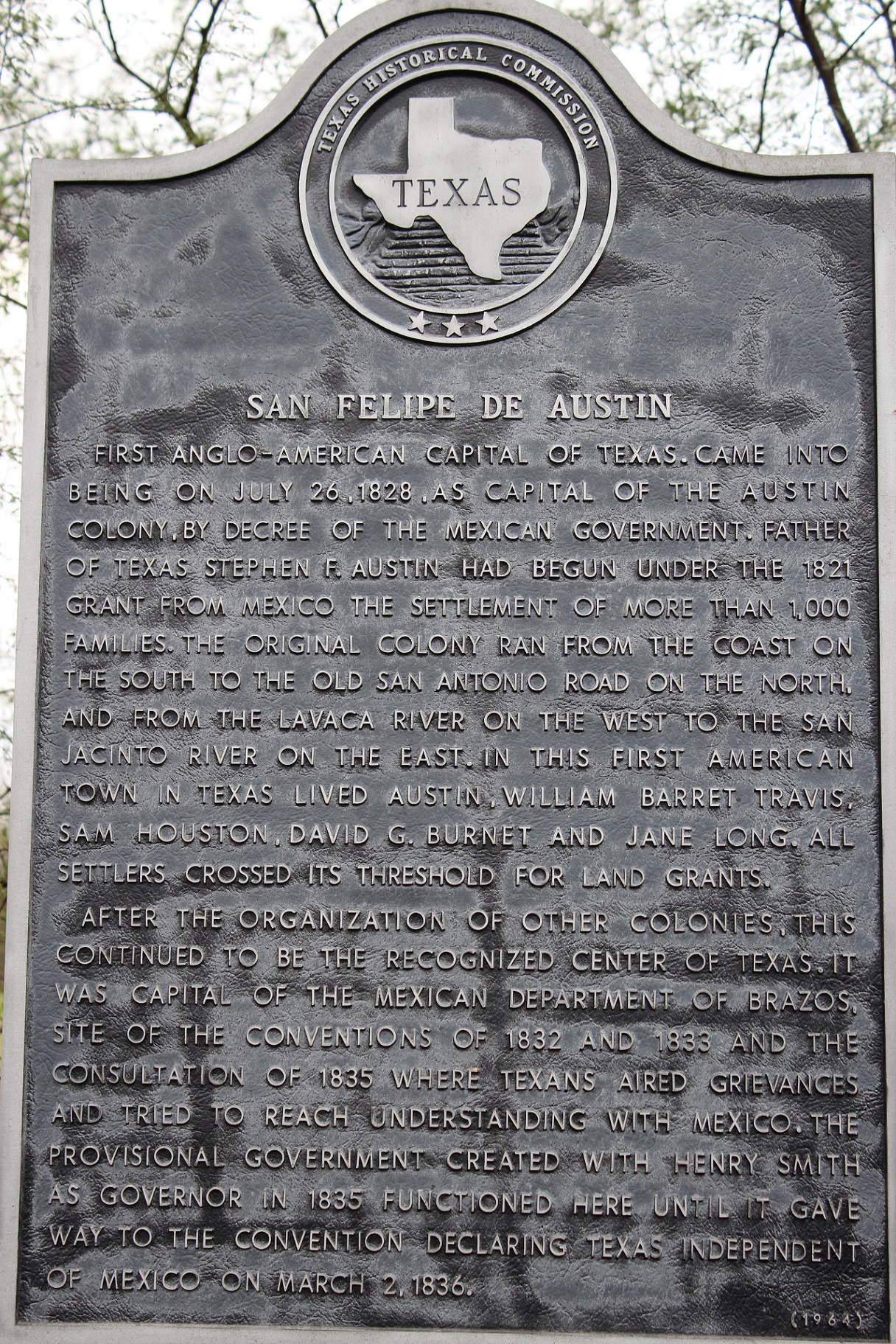
San Felipe, also known as San Felipe de Austin, is a town in Austin County, Texas, United States. The town was the social, economic, and political center of the early Stephen F. Austin colony. Its population was 691 at the 2020 census.
From the Wikipedia article San Felipe, Texas (this version), under CC BY-SA 4.0.
Museums and landmarks12

San Felipe de Austin State Historic Site
Monument and historic site · National Register of Historic Places · 1.0 mi
Historic district in San Felipe, Austin County, Texas
09:00-17:00




Parks, trails and playgrounds2

Restaurants and cafes1

Subway
Fast food · Sandwich · 1.2 mi
5168 Northeast I-10 Frontage Road, Sealy
Mo-Fr 07:00-22:00; Sa 08:00-22:00; Su 09:00-21:00
Where to stay1

History
In 1823, John McFarland operated a ferry on the Brazos River near this location. In the fall of the same year, the site was chosen by Stephen F. Austin, with the help of Felipe Enrique Neri, Baron de Bastrop, to be the main site in Texas for American colonization. Founded in 1824 as San Felipe de Austin, the town served as the capital of Stephen F. Austin's first colony and the founding site of the Texas Rangers.
By 1828, San Felipe had been surveyed, with Calle Commercio laid out as the main commercial street. Austin and his secretary, Samuel May Williams, both resided in log cabins on the square. Of about 30 buildings, at least one was a wood-framed structure. Also on the square was the tavern of Jonathan Peyton. Starting in 1830, James (Jack) Cummins operated a nearby lumber mill and grist mill, and about the same time, settlers raised livestock in the area.
It was home to the first post office and one of the earliest newspapers and land offices in Texas. San Felipe was second only to San Antonio as a commercial center of Texas.
From the History section of San Felipe, Texas on Wikipedia, under CC BY-SA 4.0.
Churches and places of worship3
Schools, colleges and libraries4
Map of San Felipe
23 places. The map loads OpenStreetMap tiles when you open it.
Climate by month
Monthly table
| Month | High | Low | Rain |
|---|---|---|---|
| Jan | 64°F | 42°F | 4.2 in |
| Feb | 68°F | 45°F | 2.9 in |
| Mar | 74°F | 52°F | 3.6 in |
| Apr | 79°F | 58°F | 4.2 in |
| May | 86°F | 66°F | 4.7 in |
| Jun | 92°F | 72°F | 5.5 in |
| Jul | 95°F | 74°F | 6.2 in |
| Aug | 95°F | 73°F | 3.7 in |
| Sep | 90°F | 69°F | 4.6 in |
| Oct | 82°F | 59°F | 3.2 in |
| Nov | 73°F | 50°F | 4.1 in |
| Dec | 66°F | 44°F | 3.9 in |
U.S. Climate Normals 1991-2020 for Sealy (3 mi away), rain and snow from San Felipe 1.0 Wnw, NOAA NCEI.
People and cost of living
American Community Survey 5-year estimates, 2020-2024, U.S. Census Bureau. Estimates have margins of error, larger for small towns.
Disaster history
Austin County has had 18 federal disaster declarations since 2000, most often for hurricanes.
- 2024-07-09: Hurricane Beryl (Hurricane)
- 2024-05-17: Severe Storms, Straight-Line Winds, Tornadoes, And Flooding (Flood)
- 2021-02-19: Severe Winter Storms (Severe Ice Storm)
- 2021-02-14: Severe Winter Storm (Severe Ice Storm)
- 2020-03-25: Covid-19 Pandemic (Biological)
- 2020-03-13: Covid-19 (Biological)
OpenFEMA disaster declarations summaries.
Getting there and nearby towns
Eagle Lake Airport (ELA) is the nearest airport with scheduled flights listed in OpenStreetMap, 19 miles away.
- Bellville 14 mi northwest, about 22 min by car
- Fulshear 15 mi southeast, about 24 min by car
- Katy 16 mi east, about 26 min by car
- East Bernard 19 mi south, about 30 min by car
- Pine Island 19 mi north, about 30 min by car
- Eagle Lake 20 mi southwest, about 32 min by car
- Cinco Ranch 21 mi east, about 34 min by car
- Rosenberg 24 mi southeast, about 39 min by car
- Pecan Grove 25 mi southeast, about 41 min by car
- Mission Bend 27 mi east, about 44 min by car
Drive times are estimates from straight-line distance, not routes.
Local news
Headlines from INDB, the NEMICO news database.
Reviews, tips and questions
Loading what members have shared...
Sources and licences
- NCES EDGE (Public domain): public schools
- NOAA NCEI U.S. Climate Normals 1991-2020 (Public domain): climate by month
- OpenFEMA (Public domain): disaster declarations
- OpenStreetMap contributors (ODbL 1.0): places, airports, map data
- U.S. Census Bureau (Public domain): population, income, housing, education, commute
- Wikidata (CC0 1.0): elevation, founding date, time zone, website, landmarks and historic places
- Wikimedia Commons (see each image): photos
- Wikipedia (CC BY-SA 4.0): overview and history text
Photo credits
- San Felipe TX Post Office, Djmaschek, CC BY-SA 4.0
- Printshop Exterior Villa de Austin Texas 2023, Larry D. Moore, CC BY 4.0
- San-felipe-tx2016-6, Darrylpearson, CC BY-SA 4.0
- Cemetery(san-felipe-tx)2016-1, Darrylpearson, CC BY-SA 4.0
- San Felipe TX Hill House Marker, Djmaschek, CC BY-SA 4.0
- San-felipe-tx2016-62(old-san-felipe)(josey-general-store), Darrylpearson, CC BY-SA 4.0
- San Felipe TX Roads Marker, Djmaschek, CC BY-SA 4.0
Page built October 30, 2026. Spotted a mistake? Tell us or suggest a place.