


Chiang Mai, Thailand
เทศบาลนครเชียงใหม่
Chiang Mai is a regional capital of 127,240 people in Chiang Mai, Thailand, founded in 1201.
Why visit Chiang Mai
Townapedia lists 146 museums and landmarks, 104 parks and trails, 422 places to eat, 105 places to stay and 31 attractions in and around town.
Highlights include Huay Kaew Waterfall, Chiang Mai Zoo, Chiang Mai City Art & Cultural Center and Chiang Mai National Museum.
Weather in Chiang Mai
Forecast from MET Norway (CC BY 4.0). Full forecast
About Chiang Mai
Chiang Mai is the largest city in northern Thailand, the capital of Chiang Mai province and the second-largest city in Thailand by urban population. It is 700 km (435 mi) north of Bangkok in a mountainous region called the Thai highlands, and has a population of approximately 127,000 within the city municipality and an urban population of about 1.2 million as of 2023.
From the Wikipedia article Chiang Mai (this version), under CC BY-SA 4.0.
Travel tips from other travellers: Chiang Mai on Wikivoyage (CC BY-SA 4.0).
Photos of Chiang Mai


Things to do31



Thai Cooking Class & Organic Garden Farm
Farm and orchard · Thai, Regional · 13.4 km
58 Moo. 1 T. Phaipai A. Sansai, Chiang Mai, Thailand
Mo-Sa 08:30-16:00

Doi Pui
Scenic view · 11.1 km
The highest summit of Doi Suthep-Pui mountain national park.
Chaloem Phra Kiat Pavilion Viewpoint
Scenic view · 5.4 km
ถนนห้วยแก้ว, Chiang Mai
24/7


19 more on the map.
Museums and landmarks146


Chiang Mai Philatelic Museum
Museum · 1.8 km
Postal museum in Chiang Mai, Thailand
Tu-Su 09:00-16:00; PH off

Lanna Folklife Museum
Museum
Ethnographic museum in Chiang Mai, Thailand
Mi-Su 08:30-16:30


Khuang Singh Monument
Monument and historic site · 2.6 km
Historic site in Chiang Mai Province, Thailand

Chiang Mai Cabaret Show
Monument and historic site · 2.0 km
Ladyboy Cabbaret show. Showtimes 21:30
ถนนเจริญประเทศ ซอย 8
Mo-Su 20:00-00:00
Wiang Kum Kam
Monument and historic site · 4.2 km
Archaeological site in Chiang Mai province, Thailand
ชมรมการขับขี่มอเตอรไซค์เพื่อการท่องเที่ยวและมิตรภาพ
Monument and historic site · 8.6 km
32/4 Moo 1, 195 Moo 1 121
24/7

134 more on the map.
Parks, trails and playgrounds104



STeP - Science and Technology Park
Park · 5.8 km
เป็นสถานที่ที่มีนวัตกรรมต่าง ๆ
155, Chiang Mai University Mae-Hea, Mueang, Chiang Mai, Thailand
Mo-Fr 08:00-17:00

Grand Canyon Water Park
Sports field and stadium · 14.2 km
Floating water park in man made lake
202 ถนนเลียบคลองชลประทาน
Mo-Su 09:00-18:30
Tube Trek Water Park Chiang Mai
Sports field and stadium · 12.1 km
Entrance fees start at 850thb for Thai people and expats living in Chiang Mai (with a work permit or driving license), 1350thb for...
Mo-Su 10:30-19:00
92 more on the map.
Restaurants and cafes422
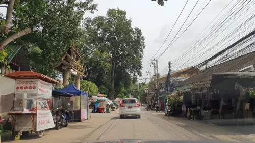
Biscotti House
Bakery · Cake, Chocolate, Dessert · 4.7 km
Possibility to prepare cakes for birthdays, Vegan option.
23/28 moo 6 (Pong Noi T. Suthep, Mueang Chiang Mai District, Chiang Mai
Mon-Sat 08:30-18:00
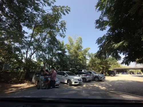
Meena Rice Based Cuisine
Restaurant · Thai · 6.5 km
Beautiful outdoor restaurant with beautifully prepared dishes of northern Thai food. Five star dishes at a very reasonable price. Vegan...
135/5
Mo-Su 10:00-17:00
Open in Google Maps · +66 87 177 0523;+66 95 693 9586;+66 86 390 4277
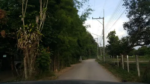
Siam Garden Cooking School
Restaurant · Thai · 14.3 km
Learn to cook Thai food like a Thai, completely hands on!, from the Thai garden to the wok.
225
Mo-Su 08:00-21:00
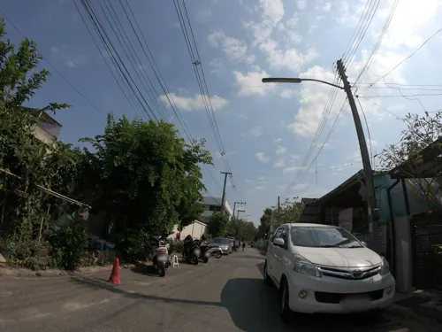
100 Flavors: Chiang Mai Craft Ice Cream
Ice cream · Ice Cream · 2.1 km
A lot of icea creams, almost 100. Ice cream with a (V) mark are without milk.
Mon-Sun 13:00-20:30
AMM (Aung Myint Mo Kyay Oh)
Restaurant · Burmese Food, Noodle · 1.4 km
8/8 Ratchaphruek Road, Chiang Mai
Su-Fr 10:30-20:00
Baan Mae Café & Restaurant Chiang Mai
Cafe · Thai · 2.0 km
Stylish cafe and restaurant
Mo-Su 10:00-22:00




Auf der Au Garden Restaurant & Bistro
Restaurant · German, Coffee Shop, Cake · 2.9 km
1, 3 Rat Uthit Road
Mo-Su 10:30-14:00, 16:30-21:00
Bier Stube
Restaurant · Thai, Breakfast, Burger, Coffee Shop, Diner, French, Italian, Sandwich · 1.0 km
319 Mun Mueang Rd, Tambon Si Phum, Amphoe Mueang Chiang Mai, Chang Wat Chiang Mai 50100
Mo-Su 07:00-23:30
410 more on the map.
History
Mangrai founded Chiang Mai in 1294 or 1296 on a site that the Lawa people called Wiang Nopburi.
The city succeeded Chiang Rai as the capital of Lan Na. Phayu enlarged and fortified it against the small Fakkham-Intha-Artse confederation, and built Wat Phra Singh in honor of his father, Khamfu. With the decline of Lan Na, Chiang Mai lost importance and was occupied by the Toungoo Empire in 1556. It formally became part of the Thonburi Kingdom in 1774, by an agreement with Kawila, after the Thonburi king Taksin helped drive out the Burmese. Subsequent Burmese counterattacks led to Chiang Mai's abandonment between 1776 and 1791;
The modern municipality dates to a sanitary district (sukhaphiban) that was created in 1915; it was upgraded to a city municipality (thesaban nakhon) on 29 March 1935. First covering just 17.5 square kilometres (6.8 sq mi), the city was enlarged to 40.2 square kilometres (15.5 sq mi) on 5 April 1983.
In May 2006, Chiang Mai was the site of the Chiang Mai Initiative, concluded between ASEAN and the "ASEAN+3" countries, (China, Japan, and South Korea). Chiang Mai was one of three Thai cities contending for Thailand's bid to host the World Expo 2020. Ayutthaya was ultimately chosen by the Thai parliament to register for the international competition.
Read more of the history
Chiang Mai was one of two tourist destinations in Thailand on TripAdvisor's 2014 list of "25 Best Destinations in the World", where it stood at number 24. Chiang Mai is also the place where the new idol group CGM48 was founded.
The city emblem shows the stupa at Wat Phra That Doi Suthep in its center. Below it are clouds representing the moderate climate in the mountains of northern Thailand. There is a nāga, the mythical snake said to be the source of the Ping River, and rice stalks, which refer to the fertility of the land.
From the History section of Chiang Mai on Wikipedia, under CC BY-SA 4.0.
More about Chiang Mai
Geography
Chiang Mai Municipality covers an area of 40.2 square kilometres (15.52 sq mi), while the urban city covers an area of 405 square kilometres (156.371 sq mi). The city's sprawl reaches into six neighboring districts: Mae Rim, Doi Saket, San Kamphaeng, Hang Dong, Saraphi and Suthep. Chiang Mai is the only city outside Bangkok to reach into other districts.
The city is situated in a broad basin in the Thai highlands and lies at an average elevation of 300 m (1,000 ft) elevation above sea level. Chiang Mai's city centre sits west of the Ping River, a tributary to the Chao Phraya River. The city's sprawl extends outward in all directions, especially north, south, and east. East of the city is the Khun Tan mountain range. Abutting the west side of Chiang Mai lies the Thanon Thong Chai mountain range, with the twin peaks of Doi Pui and Doi Suthep prominently rising above the city with elevations of over 1700 and 1600 metres, respectively.
Economy
In February 2017, the Digital Economy Promotion Agency (DEPA) (under Thailand's Digital Economy and Society Ministry) announced that 36.5 million baht would be invested into developing Chiang Mai into an innovation-driven "smart city". Chiang Mai was the second city in Thailand, after Phuket and along with Khon Kaen, to be developed using the "smart city" model. The model aims to capture and populate multiple levels of information (including building, social, environmental, governmental, and economic data) from sources like sensors, real-time traffic information, and social forums for access by managers, governments, and citizens using mobile apps, tablets, and dashboards. The "Smart City" outlook (integrating Information and Communications Technology (ICT) with the Internet of Things (IOT)), is viewed to be critical both for secondary cities with burgeoning urban population like Chiang Mai, as well as part of Thailand's move to be digital hub of ASEAN. The role of private sector investment, together with public sector partnership, is key to promote digital entrepreneurship.
Arts and culture
Loi Krathong (along with Yi Peng), held on the full moon of the 12th month of the traditional Thai lunar calendar, being the full moon of the second month of the old Lanna calendar. In the Western calendar this usually falls in November. Every year thousands of people assemble floating banana-leaf containers (krathong) decorated with flowers and candles and deposit them on the waterways of the city in worship of the Goddess of Water. Lanna-style sky lanterns (khom fai or kom loi), which are hot-air balloons made of paper, are launched into the air. These sky lanterns are believed to help rid the locals of troubles and are also used to decorate houses and streets.
Songkran is held in mid-April to celebrate the traditional Thai New Year. Chiang Mai has become one of the most popular locations to visit during this festival. A variety of religious and fun-related activities (notably the indiscriminate citywide water fight) take place each year, along with parades and Miss Songkran beauty competition.
Chiang Mai Flower Festival is a three-day festival held during the first weekend in February each year; this event occurs when Chiang Mai's temperate and tropical flowers are in full bloom.
Tam Bun Khan Dok, the Inthakhin (City Pillar) Festival, starts on the day of the waning moon of the sixth lunar month and lasts 6–8 days.
From the Wikipedia article Chiang Mai, under CC BY-SA 4.0.
Notable people from Chiang Mai
 Parinya CharoenpholThai actress, model, and kickboxerPhoto: Fairtex from Thailand, CC BY 2.5
 Noppawan LertcheewakarnThai tennis playerPhoto: robbiesaurus from Smithtown, NY, USA, CC BY-SA 2.0
 Prin SuparatThai actor and modelPhoto: THHeadline, CC BY 3.0
 Thanawat RattanakitpaisanThai actorPhoto: Winrywifeu, CC0
 Surapong TovichakchaikulThai politician (1953-2020)Photo: U.S. Department of State, Public domain
 Nat SakdatornThai singerPhoto: Bdaeng, CC BY-SA 4.0
- Witwisit HiranyawongkulThai actor and singer-songwriter
- Chaowat VeerachatThai association football player
- Natthaphong SamanaThai footballer
- Worachit KanitsribampenThai association football player
- Suradet Piniwatmusical artist
- Praveenar SinghThai beauty pageant titleholder


Born in Chiang Mai, according to Wikidata (CC0). Each name links to its Wikipedia article.
Where to stay105
Churches and places of worship106
Shopping210
Gas and EV charging97
Schools, colleges and libraries106
Healthcare104
Map of Chiang Mai
250 places. The map loads OpenStreetMap tiles when you open it.
Getting there and nearby towns
Chiang Mai International Airport (CNX) is the nearest airport with scheduled flights listed in OpenStreetMap, 3 km away.
- Hang Dong 13 km southwest, about 13 min by car
- San Kamphaeng 15 km east, about 15 min by car
- San Pa Tong 20 km southwest, about 20 min by car
- Lamphun 23 km south, about 23 min by car
- Pa Sang 30 km south, about 30 min by car
- Ban Pa Khaem 36 km north, about 36 min by car
- Mae Tha 40 km southeast, about 40 min by car
- Chom Thong 53 km southwest, about 53 min by car
- Ban Mae Waen 62 km north, about 1 h by car
- Lampang 77 km southeast, about 1 h 15 min by car
Drive times are estimates from straight-line distance, not routes.
Keep exploring
Local news
Headlines from INDB.
Reviews, tips and questions
Loading what members have shared...
Sources and licences
- GeoNames (CC BY 4.0): population, coordinates, regions and time zone
- Mapillary (see each image): photos
- OpenStreetMap contributors (ODbL 1.0): places, airports, map data
- Wikidata (CC0 1.0): elevation, founding date, time zone, website, landmarks and historic places
- Wikimedia Commons (see each image): photos
- Wikipedia (CC BY-SA 4.0): overview and history text
Photo credits
- Panoramic view of Chiang Mai City, Supanut Arunoprayote, CC BY 4.0
- Chiang Mai Sunday Night Market 6, Christophe95, CC BY-SA 4.0
- Chiang Mai - Wat Tung Yu - 0006, Stefan Fussan, CC BY-SA 3.0
- Pai Chiang Mai In B W 2009, Unnawut Leepaisalsuwanna, CC BY 3.0
- Chiang Mai Train Station, Unnawut Leepaisalsuwanna, CC BY 3.0
- Chiang Mai - Wat Tung Yu - 0005, Stefan Fussan, CC BY-SA 3.0
- Chiang Mai - Wat Tung Yu - 0004, Stefan Fussan, CC BY-SA 3.0
- Chiang Mai - Wat Tung Yu - 0001, Stefan Fussan, CC BY-SA 3.0
- Chiang Mai Sunday Night Market 3, Christophe95, CC BY-SA 4.0
- Inner courtyard of the Chiang Mai City Art and Cultural Center, Christophe95, CC BY-SA 4.0
- Chiang Mai photo-7504, Immanuelle, CC BY 4.0
- Chiang Mai - Wat Pha Bong (Mangkhalaram) - วัดผาบ่อง (มังคลาราม) (2026) - IMG 07, Chainwit., CC BY 4.0
- Chiang Mai photo-7505, Immanuelle, CC BY 4.0
- Chiang Mai photo-7506, Immanuelle, CC BY 4.0
- Chiang Mai photo-7503, Immanuelle, CC BY 4.0
- Chiang Mai photo-7502, Immanuelle, CC BY 4.0
- Chiang Mai police station Indra Shrine, Immanuelle, CC BY 4.0
- Chiang Mai - Wat Si Koet - 0001, Stefan Fussan, CC BY-SA 3.0
- Huay Kaew Waterfall (49721143653), Nina R from Africa, CC BY 2.0
- Chiang Mai National Museum, Zhou Guanhuai, CC0
- Doi Pui mountains, Chiang Mai, Thailand, Vyacheslav Argenberg, CC BY 4.0
- Aobkan National Park Chiangmai Thailand, Sutham Jirapanakorn, CC BY 3.0
- Chiang Mai Sacred Heart, Takeaway, CC BY-SA 3.0
- LICMUx800, Chiang Mai University, Public domain
- Chiang Mai Rajabhat University, Zhou Guanhuai, CC0
- Buak Hard Park, Kawin Jungsakulrujirek, CC BY-SA 3.0
- Rhino CMZ, This user loves Krittaya., Public domain
- Panorama of Doi Suthep 2010, FredTC, CC BY-SA 3.0
- Wat Chiang Man (I), This Photo was taken by Supanut Arunoprayote . Feel free to use any of my images, but please mention me as the author and may send me a message. (สามารถใช้ภาพได้อิสระ..., CC BY 4.0
- Phra That Doi Suthep 01, ผู้สร้างสรรค์ผลงาน/ส่งข้อมูลเก็บในคลังข้อมูลเสรีวิกิมีเดียคอมมอนส์ - เทวประภาส มากคล้าย, CC BY 3.0
- Chiang Mai - Wat Phra Singh - 0004, Stefan Fussan, CC BY-SA 3.0
- Wat Suan Dok 2026 (325013), Setawut, CC BY-SA 4.0
- CHIANG MAI NIGHT BAZAAR THAILAND FEB 2012 (6869571256), calflier001, CC BY-SA 2.0
- Maharaj Nakorn Chiang Mai Hospital 3, Vano111ru, CC BY-SA 4.0
- Yupparaj Wittayalai School, Vano111ru, CC BY-SA 4.0
- By Diamond 2429 (cropped), Diamond2429, CC BY-SA 4.0
- Chiang Mai - Chiang Mai City Art and Cultural Center - 0001, Stefan Fussan, CC BY-SA 3.0
- Chiang Mai - Wat Pha Bong - 0001, Stefan Fussan, CC BY-SA 3.0
- Chiang Mai - Wat Pha Lat - 0001, Stefan Fussan, CC BY-SA 3.0
- Don Kaeo - Huai Tueng Thao - 0001-Pano, Stefan Fussan, CC BY-SA 3.0
- St. Vladimir Russian Orthodox Church in Chiang Mai, Ralph Apeldoorn, CC BY 2.0
- Lanna Folklife Museum, Christophe95, CC BY-SA 4.0
- Khuang Singh Monument Overzicht oostzijde IMG20240124113533, FredTC, CC BY-SA 4.0
- Chiang Mai Philatelic Museum IMG20251217102502a, FredTC, CC BY-SA 4.0
- Street-level photo, jrcarlsen, CC BY-SA 4.0
- Street-level photo, mishari, CC BY-SA 4.0
- Street-level photo, jrcarlsen, CC BY-SA 4.0
- Street-level photo, chanuwath_grab, CC BY-SA 4.0
- Street-level photo, jrcarlsen, CC BY-SA 4.0
- Street-level photo, chanuwath_grab, CC BY-SA 4.0
- Street-level photo, chanuwath_grab, CC BY-SA 4.0
- Street-level photo, kaart_3, CC BY-SA 4.0
- Street-level photo, superbate, CC BY-SA 4.0
- Street-level photo, jrcarlsen, CC BY-SA 4.0
- Street-level photo, jrcarlsen, CC BY-SA 4.0
- Street-level photo, chanuwath_grab, CC BY-SA 4.0
- Street-level photo, jrcarlsen, CC BY-SA 4.0
- Street-level photo, chanuwath_grab, CC BY-SA 4.0
- Street-level photo, jrcarlsen, CC BY-SA 4.0
- Street-level photo, jrcarlsen, CC BY-SA 4.0
- Street-level photo, ThailandCambodia, CC BY-SA 4.0
- Street-level photo, chanuwath_grab, CC BY-SA 4.0
- Street-level photo, chanuwath_grab, CC BY-SA 4.0
- Street-level photo, jirayoot, CC BY-SA 4.0
- Street-level photo, chanuwath_grab, CC BY-SA 4.0


Page built November 10, 2026. Spotted a mistake? Tell us or suggest a place.