


Chiang Saen, Thailand
เวียงเชียงแสน
Chiang Saen is a town of 10,807 people in Chiang Rai, Thailand.
Why visit Chiang Saen
Townapedia lists 19 museums and landmarks, 1 park or trail, 15 places to eat and 18 places to stay in and around town.
Highlights include Chiang Saen National Museum and Wat Pa Sak.
Weather in Chiang Saen
Forecast from MET Norway (CC BY 4.0). Full forecast
About Chiang Saen
Chiang Saen (Thai: เชียงแสน) is an old city in Northern Thailand. Chiang Saen is the capital of the Chiang Saen district, which lies in the north of the Chiang Rai province.
From the Wikipedia article Chiang Saen (this version), under CC BY-SA 4.0.
Photos of Chiang Saen


Museums and landmarks19
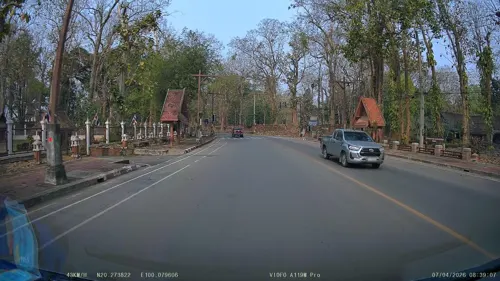

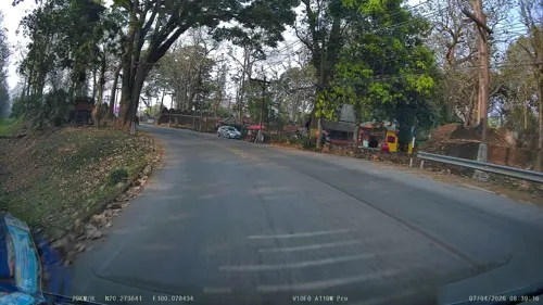



7 more on the map.
Parks, trails and playgrounds1

Chiang Saen golf driving range
Golf course · 1.0 km
Chiang Saen golf driving range
Rop Wiang
Restaurants and cafes15


FA Mai Restaurants
Restaurant · Fish, Thai
Thanon Rimkhong Soi 3
Mo-Su 08:00-20:00

3 more on the map.
Where to stay18

Athita The Hidden Court Chiang Sarn Boutique Hotel
Motel and hotel · 0.6 km
6 more on the map.
History
The area around Chiang Saen has been inhabited since prehistoric times, as evidenced by finds on display at the Chiang Saen National Museum. Chronicles describe an ancient royal city, Ngoenyang, which was probably the first major city in the area. It was on one of the trade routes that led from northern Thailand all the way to Yunnan. The chronicles go on to say that the ruler of this city made an alliance by marriage with Chiang Hung, which is now called Jinghong and at that time was located in "Sipsong Pan Na" (today: Xishuangbanna). Mangrai, later king of Lan Na, was born into this family in 1239. The town of Ngoenyang no longer exists, although its name is still used interchangeably with Chiang Saen.
Read more of the history
The city of Chiang Saen was founded in 1329 by Saenphu, a grandson of Mangrai. The newly founded city was initially called "Mueang Roi", shaped like an irregular rectangle at 1500 by 700 Wa (about 3000 meters by 1400 meters) in size. Its outlines are still clearly visible in today's city. Saenphu had it built directly on the Mekong, so he only had to dig a moat on three sides, the fourth side was the Mekong. Behind the ditch was an earth wall, and a total of five gates led into the city. Eight watchtowers were erected in the city and at strategically important locations in the surrounding area. Shortly after the city was completed, Saenphu made his son Khamfu governor of Chiang Mai and retired to Chiang Saen, which has borne his name ever since. Here he died in 1334.
During the Burmese rule of Lan Na from 1558 to 1774, the Burmese established a fort at Chiang Saen which served as the military and political center of Lan Na under their control in the 18th century. A Burmese governor (myowun) resided here. Chiang Saen was more firmly integrated into the Burmese Empire than other parts of Lan Na. The 19th-century "Chiang Saen Chronicles" even gives a negative account of Chiang Mai's rebellion against Burmese rule. It was not until 1804 that Chiang Saen, as the last part of today's northern Thailand inhabited by Tai Yuan, came under the control of Siamese king Rama I, after it was conquered by Siamese troops with the help of the armies of King Kawila of Chiang Mai and prince Atthawarapanyo of Nan, who had been captured by the Siamese. The Siamese king ordered that the city should be destroyed except for the religious sites. He also had the population deported as forced laborers to his immediate dominion, the central Thai basin. To this day, descendants of the Tai Yuan from Chiang Saen who were abducted at the time can be found in the provinces of Ratchaburi and Saraburi.
For the next few years the city remained deserted, as noted by British surveyor Holt Samuel Hallett, who visited the city in 1876. It was not until 1881 that King Rama V (Chulalongkorn) Chiang Saen was refounded and repopulated with families from Lamphun, Lampang and Chiang Mai. To date, only a small part of the old town is inhabited. Of the original five city gates, only the Chiang Saen Gate has been restored, through which Route 1016 runs from Mae Chan district down to the banks of the Mekong.
From the History section of Chiang Saen on Wikipedia, under CC BY-SA 4.0.
More about Chiang Saen
Geography
Chiang Saen is located in the northernmost tip of Thailand. The provincial capital, Chiang Rai, lies about 60 kilometers to the south-west. In the vast plain of the lower Maenam Kok (Kok River), Chiang Saen lies on the west bank of the Mekong River, the opposite bank is in Laos. About five kilometers further south of today's city, the Maenam Kok flows into the Mekong.
From the Wikipedia article Chiang Saen, under CC BY-SA 4.0.
Churches and places of worship4
Shopping1
Gas and EV charging3
Schools, colleges and libraries2
Healthcare2
Map of Chiang Saen
65 places. The map loads OpenStreetMap tiles when you open it.
Getting there and nearby towns
Chiangrai International Airport (CEI) is the nearest airport with scheduled flights listed in OpenStreetMap, 42 km away.
- Mae Sai 28 km northwest, about 28 min by car
- Mae Chan 28 km southwest, about 28 min by car
- Chiang Khong 33 km east, about 33 min by car
- Chiang Rai 49 km southwest, about 49 min by car
- Ban Ho Mae Salong 49 km west, about 49 min by car
- Pa Daet 86 km south, about 1 h 30 min by car
- Chiang Kham 87 km south, about 1 h 30 min by car
Drive times are estimates from straight-line distance, not routes.
Keep exploring
Local news
Headlines from INDB.
Reviews, tips and questions
Loading what members have shared...
Sources and licences
- GeoNames (CC BY 4.0): population, coordinates, regions and time zone
- Mapillary (see each image): photos
- OpenStreetMap contributors (ODbL 1.0): places, airports, map data
- Wikidata (CC0 1.0): elevation, founding date, time zone, website
- Wikimedia Commons (see each image): photos
- Wikipedia (CC BY-SA 4.0): overview and history text
Photo credits
- Watpasak1, Kesaputta at English Wikipedia, CC BY-SA 3.0
- Chiang Saen - panoramio, CHAMRAT CHAROENKHET, CC BY 3.0
- อำเภอเชียงแสน Chiang Saen - panoramio - CHAMRAT CHAROENKHET, CHAMRAT CHAROENKHET, CC BY 3.0
- อำเภอเชียงแสน Chiang Saen - panoramio, CHAMRAT CHAROENKHET, CC BY 3.0
- View Chiang Saen - panoramio - CHAMRAT CHAROENKHET (5), CHAMRAT CHAROENKHET, CC BY 3.0
- View Chiang Saen - panoramio - CHAMRAT CHAROENKHET (7), CHAMRAT CHAROENKHET, CC BY 3.0
- View Chiang Saen - panoramio - CHAMRAT CHAROENKHET (11), CHAMRAT CHAROENKHET, CC BY 3.0
- View Chiang Saen - panoramio - CHAMRAT CHAROENKHET (4), CHAMRAT CHAROENKHET, CC BY 3.0
- View Chiang Saen - panoramio - CHAMRAT CHAROENKHET (12), CHAMRAT CHAROENKHET, CC BY 3.0
- View Chiang Saen - panoramio - CHAMRAT CHAROENKHET (6), CHAMRAT CHAROENKHET, CC BY 3.0
- View Chiang Saen - panoramio - CHAMRAT CHAROENKHET (9), CHAMRAT CHAROENKHET, CC BY 3.0
- View Chiang Saen - panoramio - CHAMRAT CHAROENKHET (8), CHAMRAT CHAROENKHET, CC BY 3.0
- Chiang Saen town Mekhong, Takeaway, CC BY-SA 3.0
- Wiang, Chiang Saen District, Chiang Rai, Thailand - panoramio (8), Mozhar, CC BY-SA 3.0
- Wiang, Chiang Saen District, Chiang Rai, Thailand - panoramio (7), Mozhar, CC BY-SA 3.0
- Wiang, Chiang Saen District, Chiang Rai, Thailand - panoramio (9), Mozhar, CC BY-SA 3.0
- View Chiang Saen - panoramio - CHAMRAT CHAROENKHET (10), CHAMRAT CHAROENKHET, CC BY 3.0
- Wiang, Chiang Saen District, Chiang Rai, Thailand - panoramio (6), Mozhar, CC BY-SA 3.0
- Wiang, Chiang Saen District, Chiang Rai, Thailand - panoramio (10), Mozhar, CC BY-SA 3.0
- View Chiang Saen - panoramio - CHAMRAT CHAROENKHET (13), CHAMRAT CHAROENKHET, CC BY 3.0
- View Chiang Saen - panoramio - CHAMRAT CHAROENKHET (14), CHAMRAT CHAROENKHET, CC BY 3.0
- View Chiang Saen - panoramio - CHAMRAT CHAROENKHET, CHAMRAT CHAROENKHET, CC BY 3.0
- View Chiang Saen - panoramio - CHAMRAT CHAROENKHET (1), CHAMRAT CHAROENKHET, CC BY 3.0
- View Boat Chiang Saen - panoramio, CHAMRAT CHAROENKHET, CC BY 3.0
- View Chiang Saen - panoramio, CHAMRAT CHAROENKHET, CC BY 3.0
- View Chiang Saen - panoramio - CHAMRAT CHAROENKHET (16), CHAMRAT CHAROENKHET, CC BY 3.0
- 2014 Chiang Saen Chinese restaurant, Takeaway, CC BY-SA 3.0
- View Boat Chiang Saen - panoramio - CHAMRAT CHAROENKHET, CHAMRAT CHAROENKHET, CC BY 3.0
- View Chiang Saen - panoramio - CHAMRAT CHAROENKHET (3), CHAMRAT CHAROENKHET, CC BY 3.0
- อำเภอเชียงแสน Chiang Saen - panoramio - CHAMRAT CHAROENKHET (1), CHAMRAT CHAROENKHET, CC BY 3.0
- View Chiang Saen - panoramio - CHAMRAT CHAROENKHET (15), CHAMRAT CHAROENKHET, CC BY 3.0
- วัดพระธาตุจอมกิตติ เชียงแสน Wat Phra That Chom Kitti 06, Chainwit., CC BY-SA 4.0
- Chiang Saen - Wat Pa Sak วัดป่าสัก เชียงแสน (2021) - img 18, Chainwit., CC BY 4.0
- วัดเจดีย์หลวง(1), Sarawut VRW, CC BY-SA 3.0
- Rim Khong - panoramio - CHAMRAT CHAROENKHET (10), CHAMRAT CHAROENKHET, CC BY 3.0
- Rim Khong - panoramio - CHAMRAT CHAROENKHET (5), CHAMRAT CHAROENKHET, CC BY 3.0
- Rim Khong - panoramio - CHAMRAT CHAROENKHET (6), CHAMRAT CHAROENKHET, CC BY 3.0
- Rim Khong - panoramio - CHAMRAT CHAROENKHET (1), CHAMRAT CHAROENKHET, CC BY 3.0
- Rim Khong - panoramio - CHAMRAT CHAROENKHET (7), CHAMRAT CHAROENKHET, CC BY 3.0
- Rim Khong - panoramio - CHAMRAT CHAROENKHET (8), CHAMRAT CHAROENKHET, CC BY 3.0
- Street-level photo, ThailandCambodia, CC BY-SA 4.0
- Street-level photo, ThailandCambodia, CC BY-SA 4.0
- Street-level photo, ThailandCambodia, CC BY-SA 4.0


Page built November 10, 2026. Spotted a mistake? Tell us or suggest a place.