


Nakhon Sawan, Thailand
เทศบาลนครนครสวรรค์
Nakhon Sawan is a regional capital of 82,305 people in Nakhon Sawan, Thailand.
Why visit Nakhon Sawan
Townapedia lists 3 museums and landmarks, 5 parks and trails, 36 places to eat, 18 places to stay and 8 attractions in and around town.
Highlights include Nong Pling Bridge and Bueng Boraphet Aquarium.
Weather in Nakhon Sawan
Forecast from MET Norway (CC BY 4.0). Full forecast
About Nakhon Sawan
Nakhon Sawan (Thai: นครสวรรค์, pronounced [ná(ʔ).kʰɔ̄ːn sā.wǎn]) is a city (thesaban nakhon) in Thailand. The name literally means "Heavenly City". The city is the capital of Nakhon Sawan province, and covers the complete subdistrict (tambon) of Pak Nam Pho and parts of Khwae Yai, Nakhon Sawan Tok, Nakhon Sawan Ok and Wat Sai, as well as all of Mueang Nakhon Sawan district. As of 31 December 2020, it has a population of 82,305.
From the Wikipedia article Nakhon Sawan (this version), under CC BY-SA 4.0.
Travel tips from other travellers: Nakhon Sawan on Wikivoyage (CC BY-SA 4.0).
Photos of Nakhon Sawan


Things to do8



Museums and landmarks3


Parks, trails and playgrounds5



Restaurants and cafes36


Khun Ben Kitchen
Restaurant · Thai · 4.3 km
19/2 หมู่ 1 ทางหลวงแผ่นดินหมายเลข 117 บางม่วง, นครสวรรค์
Mo-Su 09:00-21:00
Nai Chua Restaurant
Restaurant · Thai, Asian
27,29 ถนนหลังวัดวรนาถบรรพต
Mo-Su 04:30-04:00
เตี๋ยวเห๊อะ
Restaurant · Noodle · 3.6 km
83/67 จักรวาล, วัดไทร
Mo-Su 10:00-16:00
Artow Restaurant ร้านอาท้าว
Restaurant · Chinese
168/3 ถนนอรรถกวี, Nakhon Sawan นครสวรรค์
06:00-17:00
Tissue Papers Cafe
Cafe · Coffee Shop · 1.7 km
Mo-Fr 07:00-18:30; Sa-Su 07:30-19:00

24 more on the map.
More about Nakhon Sawan
Geography
Nakhon Sawan is about 250 kilometres (160 mi) north of Bangkok, and marks the point of confluence of two of Thailand's major rivers, the Ping and the Nan. These converge in Nakhon Sawan to form the Chao Phraya which flows south to Bangkok and out into the Gulf of Thailand. The city's surroundings are mostly flat, but in the city itself a hill rises about 110 metres (360 ft) above the plain.
Bueng Boraphet, east of Nakhon Sawan, is Thailand's biggest freshwater swamp.
From the Wikipedia article Nakhon Sawan, under CC BY-SA 4.0.
Notable people from Nakhon Sawan
 Prapawadee JaroenrattanatarakoonOlympic weightlifterPhoto: Copyright owned by the Thai Amateur..., CC BY-SA 3.0
- Anawin JujeenThai footballer
- Kraikiat BeadtakuThai footballer
- Chotipat Poomkeawassociation football player
- Weerayut JitkuntodThai footballer
- Sanor LongsawangThai footballer
- Vithoon KijmongkolsakThai footballer
- Sasom PobprasertThai footballer
- Tanongsak PromdardThai footballer
- Sirimongkol RattanapoomThai footballer (born 2002)
- Rangsan WiroonsriThai footballer
- Chalermsakdi InswangThai sports shooter
Born in Nakhon Sawan, according to Wikidata (CC0). Each name links to its Wikipedia article.
Where to stay18
42C The Chic Hotel
Motel and hotel · 2.7 km
23/18 Nakhonsawan - Phitsanuloke Rd, Nakhon Sawan
Churches and places of worship16
Shopping8
Gas and EV charging7
Schools, colleges and libraries23
Healthcare6
Map of Nakhon Sawan
130 places. The map loads OpenStreetMap tiles when you open it.
Getting there and nearby towns
Takhli Royal Thai Air Force Base (TKH) is the nearest airport with scheduled flights listed in OpenStreetMap, 51 km away.
- Kao Liao 17 km north, about 17 min by car
- Phayuha Khiri 28 km south, about 28 min by car
- Lat Yao 38 km west, about 38 min by car
- Thap Than 38 km southwest, about 38 min by car
- Uthai Thani 38 km south, about 38 min by car
- Bang Mun Nak 44 km northeast, about 44 min by car
- Khanu Woralaksaburi 50 km northwest, about 50 min by car
- Nong Bua 51 km east, about 51 min by car
- Bueng Na Rang 52 km north, about 52 min by car
- Phai Sali 56 km east, about 56 min by car
Drive times are estimates from straight-line distance, not routes.
Towns near Nakhon Sawan


Keep exploring
Local news
Headlines from INDB.
Reviews, tips and questions
Loading what members have shared...
Sources and licences
- GeoNames (CC BY 4.0): population, coordinates, regions and time zone
- Mapillary (see each image): photos
- OpenStreetMap contributors (ODbL 1.0): places, airports, map data
- Wikidata (CC0 1.0): elevation, founding date, time zone, website, landmarks and historic places
- Wikimedia Commons (see each image): photos
- Wikipedia (CC BY-SA 4.0): overview and history text
Photo credits
- Nakhonsawan03, Fotograf / Photographer: Heinrich Damm ( User:Hdamm , Hdamm at de.wikipedia.org ), CC BY 2.0
- Sawanpracharak Hospital, Nakhon Sawan, Reversemos.sapanaht, CC BY-SA 4.0
- Wat Nakhon sawan, User:Tanawat buatsunthia, CC BY-SA 4.0
- Light shows at Ko Yuan, Nakhon Sawan, Philsacor, CC0
- Wat nakhon sawan 3, Tnwq, CC BY-SA 4.0
- พระจุฬามณีเจดีย์ nakhon sawan, นาย ธนว, CC BY-SA 4.0
- Wat nakhon sawan2, Tnwq, CC BY-SA 4.0
- Central Nakhon Sawan, Jiafei Slay Queen, CC0
- Dairy Queen restaurant at Central Nakhon Sawan, Reversemos.sapanaht, CC0
- Rainbow fountain show in Central Nakhon Sawan 2, Jiafei Slay Queen, CC0
- Rainbow fountain show in Central Nakhon Sawan, Jiafei Slay Queen, CC0
- วัดนครสวรรค์, Tanawat buatsunthia, CC BY-SA 4.0
- Nakhon Sawan Rajabhat University (NSRU) - Outside, Jiafei Slay Queen, CC0
- Thai Junior Encyclopedia Project, Jiafei Slay Queen, CC0
- วัดนครสวรรค์พระอารามหลวง, Tanawat.b, CC BY-SA 4.0
- พระพุทธศรีสวรรค์1, Tanawat.b, CC BY-SA 4.0
- Chedi Wat Khao Kob 1, Pk pongpaka, CC BY-SA 4.0
- Chedi Wat Khao Kob 2, Pk pongpaka, CC BY-SA 4.0
- Chedi Wat Khao Kob 3, Pk pongpaka, CC BY-SA 4.0
- Madagascar periwinkles, Jiafei Slay Queen, CC0
- Waterfall with trees surrounding the area, Jiafei Slay Queen, CC0
- Celosias, Jiafei Slay Queen, CC0
- Fancy lights on the bridge, Jiafei Slay Queen, CC0
- Fountain show, Jiafei Slay Queen, CC0
- Light pink bougainvilleas, Jiafei Slay Queen, CC0
- Plumerias, Jiafei Slay Queen, CC0
- Dragon statue with four other small dragons in Uthayan Sawan, Jiafei Slay Queen, CC0
- Fountain and boats, Jiafei Slay Queen, CC0
- 00 wat Nakhonsawan, Tanawat buatsunthia, CC BY-SA 4.0
- 0 watjuramani, Tanawat buatsunthia, CC BY-SA 4.0
- พระจุฬามณีเจดีย์, Tanawat buatsunthia, CC BY-SA 4.0
- Fort Chiraprawat hospital building, Philsacor, CC0
- Escalator going up, Jiafei Slay Queen, CC0
- Victoria Crowned Pigeon in captivity, Jiafei Slay Queen, CC0
- Pink oleander inflorescences, Jiafei Slay Queen, CC0
- Solenopsis geminata 256490764, portioid, CC BY-SA 4.0
- Ischiodon scutellaris 256484687, portioid, CC BY-SA 4.0
- Random milk products, Jiafei Slay Queen, CC0
- Navamindarajudis Matchim School - Building view from the fields, Jiafei Slay Queen, CC0
- Zollingeria dongnaiensis 256619883, portioid, CC BY-SA 4.0
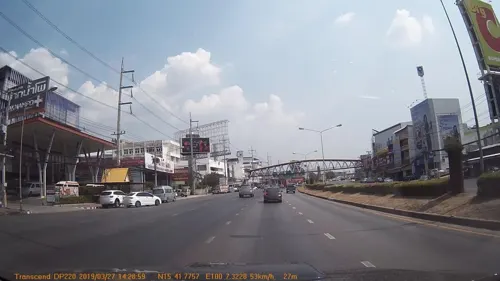
- Street-level photo, mapcreator, CC BY-SA 4.0
- Street-level photo, mapcreator, CC BY-SA 4.0


Page built November 10, 2026. Spotted a mistake? Tell us or suggest a place.