


Pathum Wan, Thailand
เขตปทุมวัน
Pathum Wan is a town of 53,263 people in Bangkok, Thailand.
Why visit Pathum Wan
Townapedia lists 143 museums and landmarks, 74 parks and trails, 130 places to eat, 30 places to stay and 51 attractions in and around town.
Highlights include Chalerm Krung Royal Theatre, Snake Farm of Queen Saovabha Memorial Institute, Bangkok Art and Culture Centre and Jim Thompson House.
Weather in Pathum Wan
Forecast from MET Norway (CC BY 4.0). Full forecast
About Pathum Wan
Pathum Wan (Thai: ปทุมวัน, pronounced [pā.tʰūm.wān]) is one of the fifty districts (khet) of Bangkok, Thailand. It lies just beyond the old city boundary of Khlong Phadung Krung Kasem and was a rural area on the eastern outskirts of the city when royal villas were built there in the late nineteenth century. The district was officially established in 1915, and covers an area of 8.37 square kilometres (3.23 sq mi). A large part of the district area is taken up by the campus of Chulalongkorn University and the green expanses of Lumphini Park and the Royal Bangkok Sports Club.
From the Wikipedia article Pathum Wan district (this version), under CC BY-SA 4.0.
Travel tips from other travellers: Pathum Wan on Wikivoyage (CC BY-SA 4.0).
Things to do51

Chalerm Krung Royal Theatre
Cinema and theater · 2.7 km
66 ถนนเจริญกรุง
Mo-Su 09:00-18:00; PH open
Open in Google Maps · Wikipedia · +66 2 224 4499;+66 2 225 8757;+66 2 225 8758;+66 2 623 8148;+66 2 623 8149

Snake Farm of Queen Saovabha Memorial Institute
Zoo and aquarium · 1.1 km
Mo-Fr 09:30-15:30; Sa-Su 09:30-13:00


Green Bridge
Bridge · 3.0 km
Elevated cycle and footpath in Bangkok, Thailand



39 more on the map.
Museums and landmarks143

Bangkok Art and Culture Centre
Museum · 1.3 km
Art museum and cultural center in Bangkok
939 ถนนพระราม 1
Tu-Su 10:00-20:00
Open in Google Maps · Wikipedia · +66 2 214 6630;+66 2 214 6631;+66 2 214 6632;+66 2 214 6633;+66 2 214 6634;+66 2 214 6635;+66 2 214 6636;+66 2 214 6637;+66 2 214 6638


Golden Mount
Monument and historic site · 2.6 km
344 ถนนบริพัตร
Mo-Su 07:00-19:00

Sea Life Bangkok Ocean World
Monument and historic site · 1.7 km
Aquarium in Bangkok, Thailand
991 Rama 1 Rd
Mo-Su 10:00-21:00


The Venerable Phra Achan Man Bhuridatto Museum at Wat Pathum Wanaram
Museum · 1.8 km
We-Su 08:00-17:00

Thailand Creative and Design Center
Museum · 1.4 km
Tu-Su,PH 10:30-21:00; Mo closed
Open in Google Maps · Wikipedia · +66 2 105 7400 p 213; +66 2 105 7400 p 214; +66 2 105 7441
131 more on the map.
Parks, trails and playgrounds74


Lumphini Park
Park · 2.1 km
Public park in Bangkok
192 ถนนวิทยุ, แขวงลุมพินี
04:30-22:00

Chao Phraya Sky Park
Park · 2.7 km
Elevated park in Bangkok, Thailand

King Rama IX Memorial Park
Park · 2.9 km
Public Park in Bangkok
ถนนศรีอยุธยา, แขวงสวนจิตรลดา

Pathumwananurak Park
Park · 2.2 km
Public park in Bangkok, Thailand
5/1-5/40 ถนนราชดำริ, แขวงปทุมวัน

Princess Mother Memorial Park
Park · 2.6 km
Park in Bangkok, Thailand

Benjakitti Park
Park · 3.9 km
Park in the Khlong Toei District of central Bangkok



62 more on the map.
Restaurants and cafes130

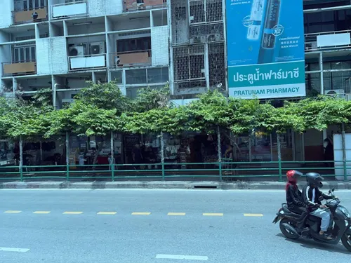
Everything Halal Restaurant
Restaurant · Indian, Pakistani, Burmese · 2.6 km
Everything Halal is a delightful restaurant serving an exquisite blend of Pakistani and Chettinad cuisine, tantalizing your taste buds...
120 89 Ratchaprarop 1 Alley
Mo-Su 10:00-22:00
Front Room
Restaurant · Thai · 2.0 km
Thai restaurant in Waldorf Astoria Bangkok.
151 ถนนราชดำริ, Pathum Wan
Mo-Su 11:30-15:00, 17:30-22:00
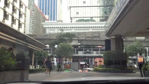
Balcony Lounge and Humidor Cigar Bar
Bar and pub · Cake, Coffee Shop, Tea · 2.1 km
973 ถนนเพลินจิต
Mo-Su 08:00-00:00
Bull & Bear
Restaurant · Steak House, Restaurant · 2.0 km
151 ถนนราชดำริ, Pathum Wan
Mo-Su 11:30-14:30,17:30-22:00

The Brasserie
Restaurant · French · 2.0 km
French restaurant in bangkok
151 ถนนราชดำริ, Pathum Wan
Mo-Su 06:30-10:30 11:30-15:00
AMRA Thai Cuisine
Restaurant · Asian, Thai, Seafood, Chicken, Noodle, Juice, Diner, Soup, Fries, Beer, Alcohol · 1.8 km
53 สมเด็จเจ้าพระยา 17
Mo-Su 10:00-22:00

CRAFT
Cafe · Cake, Coffee Shop, Donut, Ice Cream, International, Pancake · 2.2 km
78 ซอยต้นสน
Mo-Su 07:00-23:00
Cannabis Kingdom Dispensary & Cafe
Cafe · Coffee Shop · 1.7 km
18/1 Convent
Mo-Th 08:30-23:00; Su 09:00-23:00; Fr 08:30-23:30; Sa 09:00-23:30
118 more on the map.
History
When King Rama I established Bangkok as his capital in 1782, he had canals dug including Khlong Maha Nak, which extended eastward from the fortified city proper of Rattanakosin Island. Communities formed along its bank, including Ban Khrua, a Muslim community mainly of Cham settlers, which stood at the end of the canal. As the canal was extended further eastward and became known as Khlong Bang Kapi (later Khlong Saen Saep), the outlying areas were cleared for paddy fields, though apart from the canal's banks the areas remained sparsely populated.
By the reign of King Mongkut (Rama IV, 1851–1868), the city had spread beyond its original walls, and Khlong Phadung Krung Kasem was dug to extend the city's periphery in 1852. The eastern fringe of the city was then dominated by expansive rice fields, with Thung Bang Kapi occupying the areas along Bang Kapi Canal. The area that is now Pathum Wan was occupied by royal paddy fields by the canal, between Khlong Phadung Krung Kasem and Ban Khrua to the west and the Bang Kapi fields to the east. Some Lao war captives had also been settled in the area following the razing of Vientiane in 1827.
Read more of the history
Sometime before 1855, Mongkut had part of the royal fields south of the canal landscaped with ponds and waterways, which were planted with decorative lotuses, for leisurely visits. A royal villa was built there, which was named Pathum Wan, meaning "lotus forest" (from Pali paduma + vana). A temple, named Wat Pathumwanaram, was also built next to the palace. The King made annual visits to the palace and the temple, at first travelling by boat. A road was later built, continuing eastward from Bamrung Mueang Road, linking the palace to the city. It was originally known as Sa Pathum or Pathum Wan Road before being renamed Rama I Road in 1920.
With the royal development, the area began to attract more residents, and more palaces were built during the following reign of King Chulalongkorn (Rama V, 1868–1910). The King had a palace built for Prince Svasti Sobhana west of Pathum Wan Palace in 1880, and commissioned Windsor Palace in 1881 for his own son Prince Vajirunhis, buying up large amounts of land for what was to be its extensive grounds. He also later gifted a plot of land to another son, Prince Mahidol Adulyadej, though it was Mahidol's mother Queen Savang Vadhana who oversaw the construction Sa Pathum Palace there after Chulalongkorn died in 1910.
Windsor Palace had become vacant following Vajirunhis's death in 1895, and its grounds became the site of several successive educational institutions which became established as Chulalongkorn University in 1917 by King Vajiravudh (Rama VI, r. 1910–1925). By then, several canals, roads and railways had been built through the area. West of the university grounds the Bangkok Railway Station, the country's main terminus, had been built in 1916. To the east, the Phloen Chit area was developed by the enterprising businessman Nai Lert around the same time. When the administration of Bangkok's districts was reorganized in 1915, the district was established as Amphoe Pathum Wan, bounded by Khlong Saen Saep to the north, the Chong Nonsi Railway to the east, Khlong Hua Lamphong to the south, and Khlong Phadung Krung Kasem to the west. Its status, along with Bangkok's other districts', was later changed from amphoe to khet in 1972.
Pathum Wan District saw increasing development throughout the 20th century, especially since the 1970s when the area along Rama I and Phloenchit roads became developed as a major shopping and commercial district. The Erawan Hotel opened on Ratchaprasong Intersection in 1956, and the Thai Daimaru department store, famous for introducing air conditioning and the escalator, opened on the opposite corner in 1964. Siam Square was developed as a low-rise retail area by Chulalongkorn University the same year, and the Siam Inter-Continental Hotel opened opposite it in 1966. Rajadamri Arcade—a modern, enclosed shopping mall—opened at Ratchaprasong in 1972, and Siam Center (next to the Inter-Continental) followed the next year. Gradually, Siam and Ratchaprasong supplanted the Wang Burapha area as Bangkok's centre of urban retail and youth culture. With the opening of the BTS Skytrain in 1999, the location of its central interchange at Siam station helped cement the neighbourhood's prominence as Bangkok's modern-day city centre. The area's prominence led to its occupation by anti-government protesters in 2010, which ended in a violent military crackdown.
The legal case about demolishing a high-rise on Soi Ruamrudee, was finally decided in 2025 by the Supreme Administrative Court; "The ruling means that no more legal barriers to demolition remain", according to media. The high-rise was built in 2005, without proper authority.
From the History section of Pathum Wan district on Wikipedia, under CC BY-SA 4.0.
More about Pathum Wan
Geography
Pathum Wan District occupies 8.369 square kilometres (3.231 sq mi) in Bangkok's Phra Nakhon side (east of the Chao Phraya River). It is bordered by Dusit and Ratchathewi districts to the north across Khlong Saen Saep, Watthana and Khlong Toei to the east across the Maenam railway, Sathon and Bang Rak to the south across Rama IV Road, and Pom Prap Sattru Phai and Samphanthawong to the west across Khlong Phadung Krung Kasem.
The district is served by two major thoroughfares running roughly west–east: Rama I–Phloen Chit near Saen Saep Canal and Rama IV Road along the district's southern edge. They are crossed by several roads running north–south: Rama VI–Charu Mueang, Banthat Thong, Phaya Thai, Henri Dunant, Ratchadamri, Chit Lom–Lang Suan, and Witthayu. The Si Rat and Chaloem Maha Nakhon expressways run above Phra Ram VI–Charu Mueang and alongside the Maenam railway, respectively.
Banthat Thong, Phaya Thai and Ratchadamri roads divide the district into four subdistricts (khwaeng). They are, from east to west: Rong Mueang, Wang Mai, Pathum Wan and Lumphini. Together, they have a registered population of 47,685 as of October 2019.
From the Wikipedia article Pathum Wan district, under CC BY-SA 4.0.
Notable people from Pathum Wan
 SirikitQueen Consort of Thailand from 1950 to 2016, since then Queen Mother (1932–2025)Photo: Joop van Bilsen / Anefo, CC0
- Chartchai ChionoiThai boxer (1942–2018)
Born in Pathum Wan, according to Wikidata (CC0). Each name links to its Wikipedia article.
Where to stay30
Grande Centre Point Ratchadamri
Motel and hotel · 2.0 km
153/2 Soi Mahatlek - Luang 1, Ratchadamri Road, Lumpini, Pathumwan
Churches and places of worship38
Wat Ratchanatdaram Worawihan
Place of worship · Thai Mahanikaya · 2.9 km
2 ถนนมหาไชย
Wat Suthat Thep Wararam Ratchaworamahawihan
Place of worship · Thai Mahanikaya · 2.8 km
Wat Thep Sirinthrawat Ratchaworawihan
Place of worship · Thai Thammayut · 1.5 km
Shopping64
Gas and EV charging24
Schools, colleges and libraries36
Poh-Chang Academy of Arts, Rajamangala University of Technology Rattanakosin
School · 2.8 km
86 ถนนตรีเพชร
Saipanya School Under the Royal Patronage of her Majesty the Queen
School · 1.1 km
1598 ถนนกรุงเกษม, ป้อมปราบศัตรูพ่าย
Healthcare32
Map of Pathum Wan
250 places. The map loads OpenStreetMap tiles when you open it.
Getting there and nearby towns
Don Mueang International Airport (DMK) is the nearest airport with scheduled flights listed in OpenStreetMap, 21 km away.
- Bang Rak 1 km south, about 1 min by car
- Samphanthawong 1 km west, about 1 min by car
- Bangkok 3 km northwest, about 3 min by car
- Pom Prap Sattru Phai 3 km northwest, about 3 min by car
- Thon Buri 4 km west, about 4 min by car
- Dusit 4 km north, about 4 min by car
- Yan Nawa 5 km southeast, about 5 min by car
- Bangkok Yai 5 km west, about 5 min by car
- Bang Kho Laem 5 km southwest, about 5 min by car
- Bangkok Noi 6 km northwest, about 6 min by car
Drive times are estimates from straight-line distance, not routes.
Towns near Pathum Wan


Keep exploring
Local news
Headlines from INDB.
Reviews, tips and questions
Loading what members have shared...
Sources and licences
- GeoNames (CC BY 4.0): population, coordinates, regions and time zone
- Mapillary (see each image): photos
- OpenStreetMap contributors (ODbL 1.0): places, airports, map data
- Wikidata (CC0 1.0): elevation, founding date, time zone, website, landmarks and historic places
- Wikimedia Commons (see each image): photos
- Wikipedia (CC BY-SA 4.0): overview and history text
Photo credits
- Bangkok Siam Pathumwan, Paolobon140, CC0
- Krua Suan Luang, Wang mai, Pathum Wan, bangkok - panoramio, trungydang, CC BY 3.0
- Chulalong Lom 5, Wang mai, Pathum Wan, Bangkok - panoramio, trungydang, CC BY 3.0
- สะพานเฉลิมหล้า 56 เขตปทุมวัน กรุงเทพมหานคร (4), กสิณธร ราชโอรส, CC BY-SA 4.0
- สะพานเฉลิมพันธุ์ ๕๓ มกราคม 2563 01, Chainwit., CC BY-SA 4.0
- BKK Saphan Chamai Maruchet, Hdamm, CC BY-SA 3.0
- สะพานช้างโรงสี Saphan Chang Rong Si Bridge (October 2021) - img 01, Chainwit., CC BY-SA 4.0
- Charoenpadana bridge, Sry85, CC BY-SA 4.0
- สะพานเจริญรัช 31, BerryJ, CC BY-SA 3.0
- Krung Thong Bridge 05499, dsin_travel, CC BY 2.0
- Bangkok Art and Culture Centre building, Cush2k, CC BY-SA 3.0
- Siam Ocean World, Terence Ong, CC BY 2.5
- Bangkok Suan Romaninart Park IMG 6834, Bjoertvedt, CC BY-SA 4.0
- Lumphini Park as seen from Dusit Arun (2025) - img 01, Chainwit., CC BY 4.0
- A gate of King Rama IX Memorial Park 20221016 165652, Xiengyod~commonswiki, CC BY-SA 4.0
- Парк Патхумвананурак (20250319120345), MikSed, CC BY-SA 4.0
- NarongchaiV 1018-02-0008, Narongchaiv, CC BY-SA 3.0
- Bangkok Benjakiti Park 2, Mr.Peerapong Prasutr, CC BY-SA 4.0
- Benjasiri park, Lerdsuwa, CC BY-SA 3.0
- 2021 สวนชูวิทย์ Chuvit Garden, Chainwit., CC BY-SA 4.0
- Dusit Zoo bear statue, Ahoerstemeier, CC BY-SA 3.0
- Wat Karawah (cropped), Supanut Arunoprayote, CC BY 4.0
- Assumption Cathedral Bangkok 2023-10 อาสนวิหารอัสสัมชัญ, Chainwit., CC BY-SA 4.0
- Bangkok Thailand Temple (2026) 01, Medelam, CC BY-SA 4.0
- วัดพระมหาไถ่ April2021 Holy Redeemer Church Bangkok 05, Chainwit., CC BY-SA 4.0
- Pathumwan Institute of Technology - Bangkok IMG 7303, Bjoertvedt, CC BY-SA 4.0
- Bkkwangsuanpakkardlp03, Heinrich Damm ( User:Hdamm , Hdamm at de.wikipedia.org ), CC BY 2.0
- คริสตจักรไครสต์เชิร์ช เขตบางรัก กรุงเทพมหานคร (6), กสิณธร ราชโอรส, CC BY-SA 4.0
- Bkksuangularbschoola, Hdamm, CC BY-SA 3.0
- Queen Saovabha Memorial Institute main building, Paul_012, CC BY-SA 3.0
- Main auditorium of Chulalongkorn University IMG 0338, Carnopus, CC BY-SA 3.0
- Bird's-eye view of Triam Udom Suksa School, Paul_012, CC BY-SA 3.0
- Siam Center Night view 201801, Wpcpey, CC BY-SA 4.0
- 2016 Bangkok, Dystrykt Samphanthawong, Ulica Yaowarat (05), Marcin Konsek, CC BY-SA 4.0
- Loha Prasat, Ahoerstemeier, CC BY-SA 3.0
- Dusit Arun at Dusit Central Park (07-09-2025) - views - Chulalongkorn Hospital, Chainwit., CC BY 4.0
- MBK Bangkok 1, Christian Henrich, CC BY-SA 2.5
- Golden Mount3, Kriengsak Jirasirirojanakorn, CC BY-SA 4.0
- 2016 Bangkok, Dystrykt Phra Nakhon, Wat Suthat (34), Marcin Konsek, CC BY-SA 4.0
- Pantip Plaza taken from Baiyoke Tower 2, Jarcje, CC BY-SA 4.0
- The Baiyoke Tower II closeup in Bangkok, Thaliand, Paolobon140, CC0
- Jim Thompson House spirit house, BrokenSphere, CC BY 3.0
- CentralWorld-2015, Imtaiki, CC BY-SA 4.0
- โรงพยาบาลบีเอ็นเอช, Dharmadana, CC BY-SA 4.0
- The Bangkok Christian Hospital, Sry85, CC BY-SA 3.0
- Building of Church of Christ in Thailand, Tonbi ko, CC BY-SA 3.0
- ศาลาเฉลิมกรุง April2021 Sala Chaloem Krung Theatre Bangkok, Chainwit., CC BY-SA 4.0
- Central Chidlom, Syced, CC0
- 005-วัดสระเกศราชวรมหาวิหาร (ภูเขาทอง), Nawit science, CC BY-SA 4.0
- วัดเทพศิรินทราวาสราชวรวิหาร เขตป้อมปราบศัตรูพ่าย กรุงเทพมหานคร (41), กสิณธร ราชโอรส, CC BY-SA 4.0
- Bangkok - Si Phraya - surawong street IMG 7400 neilson hays library, Bjoertvedt, CC BY-SA 4.0
- Klang hospital, Sry85, CC BY-SA 3.0
- โรงเรียนวัดสุทธิวราราม 2, Dharmadana, CC BY-SA 4.0
- วิทยาลัยเพาะช่าง มหาวิทยาลัยเทคโนโลยีราชมงคลรัตนโกสินทร์, Dharmadana, CC BY-SA 4.0
- River City Aerial 02, River City Bangkok, CC BY-SA 4.0
- Iconsiam at Night, This Photo was taken by Supanut Arunoprayote . Feel free to use any of my images, but please mention me as the author and may send me a message. (สามารถใช้ภาพได้อิสระ..., CC BY 4.0
- โรงพยาบาลเลิดสิน Lerdsin Hospital Bangkok, Chainwit., CC BY-SA 4.0
- Chao Phraya and The Hilton Hotel (7997316754), Fabio Achilli from Milano, Italy, CC BY 2.0
- 2021 - โรงพยาบาลตากสิน - Taksin Hospital, Bangkok, Chainwit., CC BY-SA 4.0
- Samyan Mitrtown สามย่านมิตรทาวน์, Chainwit., CC BY-SA 4.0
- พิพิธภัณฑ์พระอาจารย์มั่น ภูริทตฺโต วัดปทุมวนาราม (๒๕๖๘) - ภาพ 02, Chainwit., CC BY 4.0
- Bangkok-Sathon - White Jade Tai Hong Gong Shrine - ศาลเจ้าไต้ฮงกงหยกขาว - (2026 Jul) - IMG 17, Chainwit., CC BY 4.0
- Rachaiwithi อาคารราชัยวิถี วิทยาลัยเซนต์หลุยส์, Chainwit., CC BY-SA 4.0
- Lebua at State Tower IMG 1402 01, Na derdingseben, CC BY-SA 3.0
- สะพานหัน 2564 Saphan Han (October 2021) - img 01, Chainwit., CC BY-SA 4.0
- All Seasons Place awash with light in 2009 2, Mark Fischer, CC BY-SA 2.0
- Chao Phraya Sky Park เจ้าพระยาสกายปาร์ค สวนลอยฟ้าเจ้าพระยา (October 2021) - img 19, Chainwit., CC BY-SA 4.0
- Green Bridge Lumpini-Banjakiti (11), กสิณธร ราชโอรส, CC BY-SA 4.0
- CU100YearsPark2018, BunBn, CC BY-SA 4.0
- Street-level photo, mapcreator, CC BY-SA 4.0
- Street-level photo, DriveWithHoang, CC BY-SA 4.0
- Street-level photo, dukeduke, CC BY-SA 4.0
- Street-level photo, balletty, CC BY-SA 4.0
- Street-level photo, mishari, CC BY-SA 4.0
- Street-level photo, mishari, CC BY-SA 4.0
- Street-level photo, DriveWithHoang, CC BY-SA 4.0
- Street-level photo, tana129, CC BY-SA 4.0
- Street-level photo, Poolert, CC BY-SA 4.0
- Street-level photo, mishari, CC BY-SA 4.0
- Street-level photo, Poolert, CC BY-SA 4.0
- Street-level photo, Poolert, CC BY-SA 4.0
- Street-level photo, dukeduke, CC BY-SA 4.0
- Street-level photo, ratirat, CC BY-SA 4.0
- Street-level photo, mishari, CC BY-SA 4.0
- Street-level photo, mapcreator, CC BY-SA 4.0
- Street-level photo, lvl5, CC BY-SA 4.0
- Street-level photo, mishari, CC BY-SA 4.0
- Street-level photo, promthak, CC BY-SA 4.0
- Street-level photo, mishari, CC BY-SA 4.0


Page built November 10, 2026. Spotted a mistake? Tell us or suggest a place.