


Bangkok Yai, Thailand
เขตบางกอกใหญ่
Bangkok Yai is a town of 72,321 people in Bangkok, Thailand.
Why visit Bangkok Yai
Townapedia lists 47 museums and landmarks, 19 parks and trails, 114 places to eat, 16 places to stay and 29 attractions in and around town.
Highlights include Chaloem Phan 53 Bridge, Chang Rong Si bridge, Baan Kudichin Museum and 14 October 1973 Memorial.
Weather in Bangkok Yai
Forecast from MET Norway (CC BY 4.0). Full forecast
About Bangkok Yai
Bangkok Yai (Thai: บางกอกใหญ่, pronounced [bāːŋ.kɔ̀ːk jàj]) is one of the 50 districts (khet) of Bangkok, Thailand. Neighbouring districts are (from north clockwise) Bangkok Noi, Phra Nakhon (across Chao Phraya River), Thon Buri, Phasi Charoen, and Taling Chan.
From the Wikipedia article Bangkok Yai district (this version), under CC BY-SA 4.0.
Things to do29


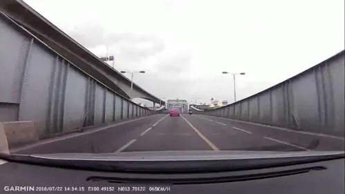


Memorial Bridge
Bridge · 3.0 km
Bridge crossing Chao Phraya River, Thailand

National Theatre
Cinema and theater · 4.4 km
Theatre in Bangkok, Thailand

Chaloem Wan Chat bridge
Bridge · 4.9 km
Bridge and road intersection in Bangkok, Thailand
Chaturaphak Rangsarit Bridge
Bridge · 5.7 km
Bridge in Bangkok, Thailand
17 more on the map.
Museums and landmarks47


14 October 1973 Memorial
Monument and historic site · 4.5 km
Memorial in Thailand
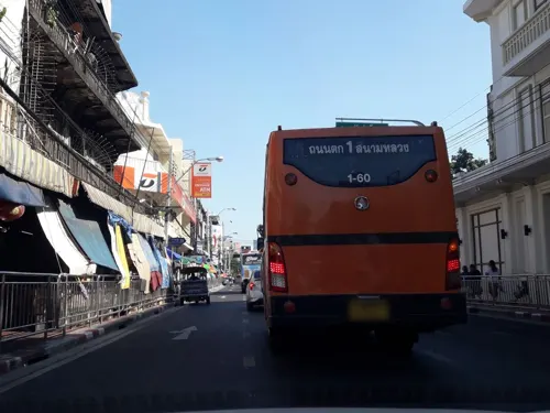
Baan Kao Lao Rueng Museum
Museum · 4.3 km
History museum in Bangkok, Thailand

Bangkok Corrections Museum
Museum · 4.1 km
Prison museum in Bangkok, Thailand


Berlin Pharmaceutical Museum
Museum · 4.2 km
Medical museum in Bangkok, Thailand

Democracy Monument
Monument and historic site · 4.6 km
Monument in Bangkok, Thailand
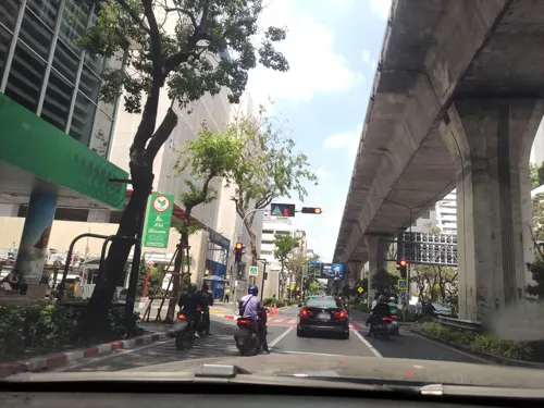

Grand Palace
Monument and historic site · 3.5 km
Official residence of the King of Thailand since 1782

35 more on the map.
Parks, trails and playgrounds19

Chao Phraya Sky Park
Park · 3.0 km
Elevated park in Bangkok, Thailand

Chulalongkorn University Centenary Park
Park · 5.5 km
Public park in Bangkok

Khlong Chong Nonsi Public Park
Park · 5.7 km
Park in Bangkok, Thailand


Princess Mother Memorial Park
Park · 3.0 km
Park in Bangkok, Thailand



Uncle Sorn's Park
Park · 1.9 km
พื้นที่สีเขียวประเภทสวน ลุงศรณ์ เป็นชาวสวนคนเดียวในบางกอกใหญ่ที่ลงทะเบียนเป็นเกษตรกรในเขตบางกอกใหญ่...
7 more on the map.
Restaurants and cafes114
T-REX'S Gastrobar
Cafe · Coffee Shop, Fish And Chips, Dessert, Cake, Salad, Breakfast, Bagel, Tapas, Brunch · 2.7 km
ซอยเจริญนคร 64
everyday 08:00-16:00

DoughMily
Cafe · Coffee, Bakery · 2.7 km
277 ถนนวังเดิม
Mo-Su 09:00-17:00

SUSHi PLUS The Mall Lifestore Thapra
Restaurant · Sushi, ซููชิสายพาน · 1.2 km
129 ถนนรัชดาภิเษก
Mo-Su 10:30-21:00
นวลหมูปิ้ง
Restaurant · Thai · 2.6 km
126 ถนนอรุณอมรินทร์
Mo 07:00-12:00; We-Th 07:00-12:00; Sa-Su 07:00-12:00;
Archie
Restaurant · 2.3 km
256 Prajadhipok Rd
Mo-Fr 11:00-14:00,17:00-22:00; Sa,Su 11:00-22:00
Baan Plern Jitt at Khlong Bang Luang
Restaurant · Thai · 1.6 km
Soi Phet Kasem 20
Mo-Su 11:00-17:00
102 more on the map.
History
The district is named after Khlong Bangkok Yai (คลองบางกอกใหญ่, also called Khlong Bang Luang, คลองบางหลวง) which was actually part of Chao Phraya River until a canal dug in 1522 during the Ayutthaya period altered the flow of the river such that the canal became the main river and the section of original river became present-day Khlong Bangkok Yai. Bangkok Yai, or more precisely, the Wat Arun Sub-district, was also the site of Thon Buri when the capital was set up here from 1767-1782.
Originally called Amphoe Hongsaram (อำเภอหงสาราม) when the district was set up in 1915, it was renamed "Amphoe Bangkok Yai" in 1916, demoted to a king amphoe of amphoe Bang Yi Khan (อำเภอบางยี่ขัน) in 1938, promoted back to amphoe in 1958, and finally changed to a khet in an administrative reform in 1972.
From the History section of Bangkok Yai district on Wikipedia, under CC BY-SA 4.0.
Notable people from Bangkok Yai
 Tat Na TakuatungThai singer and actorPhoto: Reversemos.sapanaht, CC BY-SA 4.0
- Lor TokThai actor
Born in Bangkok Yai, according to Wikidata (CC0). Each name links to its Wikipedia article.
Where to stay16
Churches and places of worship83
Wat Anongkharam Worawihan
Place of worship · Thai Mahanikaya · 2.7 km
ถนนสมเด็จเจ้าพระยา
Wat Nak Klang Worawihan
Place of worship · Thai Mahanikaya · 2.6 km
อิสรภาพ 42, บางกอกใหญ่
Wat Nang Ratchaworawihan
Place of worship · Thai Mahanikaya · 2.3 km
ซอยวุฒากาศ 42
Wat Ratcha-orasaram Ratchaworawihan
Place of worship · Thai Mahanikaya · 2.6 km
เอกชัย, จอมทอง
Wat Apson Sawan Worawihan
Place of worship · Thai Mahanikaya · 0.7 km
Shopping37
Big C
Grocery · 2.8 km
1050 แขวงบุคคโล เขตธนบุรี สมเด็จพระเจ้าตากสิน, กรุงเทพมหานคร
Gas and EV charging13
Schools, colleges and libraries54
Healthcare9
Map of Bangkok Yai
250 places. The map loads OpenStreetMap tiles when you open it.
Getting there and nearby towns
Don Mueang International Airport (DMK) is the nearest airport with scheduled flights listed in OpenStreetMap, 25 km away.
- Thon Buri 1 km east, about 1 min by car
- Bangkok 4 km northeast, about 4 min by car
- Phasi Charoen 4 km west, about 4 min by car
- Bangkok Noi 4 km north, about 4 min by car
- Samphanthawong 4 km east, about 4 min by car
- Chom Thong 5 km south, about 5 min by car
- Bang Rak 5 km east, about 5 min by car
- Pom Prap Sattru Phai 6 km northeast, about 6 min by car
- Rat Burana 6 km southeast, about 6 min by car
- Taling Chan 6 km north, about 6 min by car
Drive times are estimates from straight-line distance, not routes.
Towns near Bangkok Yai


Keep exploring
Local news
Headlines from INDB.
Reviews, tips and questions
Loading what members have shared...
Sources and licences
- GeoNames (CC BY 4.0): population, coordinates, regions and time zone
- Mapillary (see each image): photos
- OpenStreetMap contributors (ODbL 1.0): places, airports, map data
- Wikidata (CC0 1.0): elevation, founding date, time zone, website, landmarks and historic places
- Wikimedia Commons (see each image): photos
- Wikipedia (CC BY-SA 4.0): overview and history text
Photo credits
- Bangkok Yai, Bangkok 10600, Thailand - panoramio, Anil Kaushik, CC BY-SA 3.0
- Bangkok Yai, Bangkok 10600, Thailand - panoramio - Anil Kaushik, Anil Kaushik, CC BY-SA 3.0
- สะพานเฉลิมพันธุ์ ๕๓ มกราคม 2563 01, Chainwit., CC BY-SA 4.0
- สะพานช้างโรงสี Saphan Chang Rong Si Bridge (October 2021) - img 01, Chainwit., CC BY-SA 4.0
- สะพานเจริญราษฎร์ 32, Dharmadana, CC BY-SA 4.0
- Charoenpadana bridge, Sry85, CC BY-SA 4.0
- สะพานเจริญรัช 31, BerryJ, CC BY-SA 3.0
- สะพานดำรงสถิต969, CKasa, CC BY-SA 3.0
- Bkksaphanphut0609, Heinrich Damm ( User:Hdamm , Hdamm at de.wikipedia.org ), CC BY 2.0
- โรงละครแห่งชาติ April2021 Thailand National Theatre Bangkok 01, Chainwit., CC BY-SA 4.0
- Baan Kudichin Museum (2026) 01, Medelam, CC BY-SA 4.0
- อนุสรณ์สถาน 14 ตุลา ถ่ายเมื่อกันยายน 2563 14 October 1973 Memorial 02, Chainwit., CC BY-SA 4.0
- Mahachai,Correction Museum, Samran Rat,bangkok - panoramio, trungydang, CC BY 3.0
- Bangkok Kunsthalle - exterior (2026) - img 02, Chainwit., CC BY 4.0
- Bangkok National Museum, This Photo was taken by Supanut Arunoprayote . Feel free to use any of my images, but please mention me as the author and may send me a message. (สามารถใช้ภาพได้อิสระ..., CC BY 4.0
- พิพิธภัณท์เหรียญ, Bntofficial, CC BY-SA 4.0
- 010-Democracy Monument, Nawit science, CC BY-SA 4.0
- 0005574-พระบรมมหาราชวังและวัดพระศรีรัตนราศดาราม, Preecha.MJ, CC BY-SA 4.0
- CU100YearsPark2018, BunBn, CC BY-SA 4.0
- สวนสาธารณะคลองช่องนนทรี 01, Dharmadana, CC BY-SA 4.0
- Pata Zoo - panoramio, mohigan, CC BY-SA 3.0
- NarongchaiV 1018-02-0008, Narongchaiv, CC BY-SA 3.0
- สวนหลวงพระราม 8 ๘, Phoebus 28, CC BY-SA 4.0
- Bangkok Suan Romaninart Park IMG 6834, Bjoertvedt, CC BY-SA 4.0
- Bangkokphrasumenfort03, Fotograf / Photographer: Heinrich Damm ( User:Hdamm , Hdamm at de.wikipedia.org ), CC BY 2.0
- น้ำพุพานโลหะ สวนสราญรมย์ Bronze Fountain of Saransom Park, Chainwit., CC BY-SA 4.0
- Samray Church, Bangkok 1 2, dahlfred, CC BY-SA 3.0
- Tampak Depan Gereja Santa Cruz Kudi Chin (2026) 02, Medelam, CC BY-SA 4.0
- Assumption Cathedral Bangkok 2023-10 อาสนวิหารอัสสัมชัญ, Chainwit., CC BY-SA 4.0
- Wat Karawah (cropped), Supanut Arunoprayote, CC BY 4.0
- Bkkwangthaphra0603e, Hdamm, CC BY-SA 3.0
- Wat Arun from Chao Phraya River, Diliff, CC BY 2.5
- NV 1035-02-0011, Narongchaiv, CC BY-SA 3.0
- Taweethapisek School view from building 1, Earthpanot, CC BY-SA 3.0
- Entrance of Dhonburi Rajabhat University, Sry85, CC BY-SA 4.0
- Tonson Masjid มัสยิดต้นสน กรุงเทพฯ 09, Chainwit., CC BY-SA 4.0
- Bkkwatanongkharam090527, Hdamm, CC BY-SA 3.0
- พระอุโบสถ วัดหนังราชวรวิหาร (1), กสิณธร ราชโอรส, CC BY-SA 3.0
- อาคาร1 และ อาคาร11, Ronnatad, CC BY-SA 4.0
- วัดนาคกลาง 01, Anusorn sanaphanthu, CC BY-SA 3.0
- Chinorot Witthayalai School entrance, Ahoerstemeier, CC BY-SA 4.0
- Stupa of Wat Apson Sawan, Supanut Arunoprayote, CC BY 4.0
- วัดบางน้ำชน 2 (1), Dharmadana, CC BY-SA 4.0
- โรงพยาบาลสมเด็จพระปิ่นเกล้า, Dharmadana, CC BY-SA 4.0
- สะพานหัน 2564 Saphan Han (October 2021) - img 01, Chainwit., CC BY-SA 4.0
- Bangkok 2014 PD 087, Bin im Garten, CC BY 3.0
- Chao Phraya Sky Park เจ้าพระยาสกายปาร์ค สวนลอยฟ้าเจ้าพระยา (October 2021) - img 19, Chainwit., CC BY-SA 4.0
- Berlin Pharmaceutical Museum, Bangkok, Thailand, C411978, CC0
- Suksanari School โรงเรียนศึกษานารี (2021 October) - 01, Chainwit., CC BY-SA 4.0
- WatNuannoraditSchoolEmblem, Wat Nuannoradit School, Public domain
- วิทยาลัยพณิชยการธนบุรี, Dharmadana, CC BY-SA 4.0
- Street-level photo, jgauvasu, CC BY-SA 4.0
- Street-level photo, dukeduke, CC BY-SA 4.0
- Street-level photo, kasetitkml_pipitchai, CC BY-SA 4.0
- Street-level photo, noonishere, CC BY-SA 4.0
- Street-level photo, jetman11, CC BY-SA 4.0
- Street-level photo, naaao5228, CC BY-SA 4.0
- Street-level photo, koki2529, CC BY-SA 4.0
- Street-level photo, ThailandCambodia, CC BY-SA 4.0
- Street-level photo, noonishere, CC BY-SA 4.0
- Street-level photo, mishari, CC BY-SA 4.0
- Street-level photo, mapcreator, CC BY-SA 4.0
- Street-level photo, naaao5228, CC BY-SA 4.0
- Street-level photo, mapcreator, CC BY-SA 4.0
- Street-level photo, km2bp, CC BY-SA 4.0
- Street-level photo, ratirat, CC BY-SA 4.0
- Street-level photo, km2bp, CC BY-SA 4.0
- Street-level photo, km2bp, CC BY-SA 4.0
- Street-level photo, kasetitkml_pipitchai, CC BY-SA 4.0
- Street-level photo, mishari, CC BY-SA 4.0


Page built November 10, 2026. Spotted a mistake? Tell us or suggest a place.