
Rong Kwang, Thailand
เทศบาลตำบลร้องกวาง
Rong Kwang is a town of 12,087 people in Phrae, Thailand, founded in August 3, 1956.
Loading the weather...
Population12,087
GeoNames
Local nameเทศบาลตำบลร้องกวาง
RegionPhrae
Elevation212 m
696 ft
FoundedAugust 3, 1956
Time zoneAsia/Bangkok
Nearest airportPhrae Airport (PRH)
28 km
Why visit Rong Kwang
Townapedia lists 1 place to eat and 1 place to stay in and around town.
Weather in Rong Kwang
Forecast from MET Norway (CC BY 4.0). Full forecast
Restaurants and cafes1
Where to stay1
Map of Rong Kwang
2 places. The map loads OpenStreetMap tiles when you open it.
Getting there and nearby towns
Phrae Airport (PRH) is the nearest airport with scheduled flights listed in OpenStreetMap, 28 km away.
- Phrae 28 km southwest, about 28 min by car
- Den Chai 48 km southwest, about 48 min by car
- Long 59 km southwest, about 59 min by car
- Nan 69 km northeast, about 1 h 15 min by car
- Uttaradit 83 km south, about 1 h 30 min by car
- Lampang 87 km west, about 1 h 30 min by car
Drive times are estimates from straight-line distance, not routes.
Towns near Rong Kwang


Keep exploring
Local news
Headlines from INDB.
Reviews, tips and questions
Loading what members have shared...
Sources and licences
- GeoNames (CC BY 4.0): population, coordinates, regions and time zone
- Mapillary (see each image): photos
- OpenStreetMap contributors (ODbL 1.0): places, airports, map data
- Wikidata (CC0 1.0): elevation, founding date, time zone, website
Photo credits
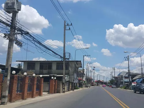
- Street-level photo, jrcarlsen, CC BY-SA 4.0
Page built November 10, 2026. Spotted a mistake? Tell us or suggest a place.