


Why visit Thoen
Townapedia lists 6 places to eat, 1 place to stay and 1 attraction in and around town.
Weather in Thoen
Forecast from MET Norway (CC BY 4.0). Full forecast
About Thoen
Thoen (Thai: เถิน, pronounced [tʰɤ̌n]) is a district (amphoe) in the southern part of Lampang province, northern Thailand.
From the Wikipedia article Thoen district (this version), under CC BY-SA 4.0.
Things to do1
Restaurants and cafes6
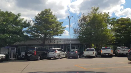
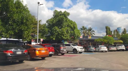

Where to stay1

Churches and places of worship9
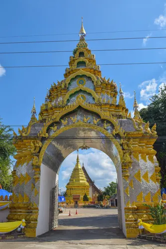
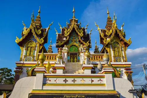




History
The high ground along the district's boundary with Ban Dan Lan Hoi in Sukhothai province carries tin, lead and iron ore, and is continuous with the ranges of Tak province to the south-west. One of the metal-working sites recorded in that ground, Den Pang Hang, lies in the district. Iron tools were found in graves there, buried with the dead, and match those made at the smelting sites of the Mae Lamphan basin.
In 1938 the district was renamed from Mueang Thoen (เมืองเถิน) to Thoen, as only the capital districts were supposed to have the term Mueang in their name.
From the History section of Thoen district on Wikipedia, under CC BY-SA 4.0.
More about Thoen
Geography
Neighboring districts are (from the north clockwise): Soem Ngam, Sop Prap of Lampang Province, Wang Chin of Phrae province, Si Satchanalai, Thung Saliam, Ban Dan Lan Hoi of Sukhothai province, Ban Tak, Sam Ngao of Tak province, Mae Phrik of Lampang Province again, Li and Thung Hua Chang of Lamphun province.
Mae Wa National Park is in the western part of the district at the southern end of the Khun Tan Range. The Phi Pan Nam Mountains dominate the landscape of the eastern side of the district.
From the Wikipedia article Thoen district, under CC BY-SA 4.0.
Shopping1
Gas and EV charging7
Schools, colleges and libraries6
Healthcare1
Map of Thoen
32 places. The map loads OpenStreetMap tiles when you open it.
Getting there and nearby towns
Sukhothai Airport (THS) is the nearest airport with scheduled flights listed in OpenStreetMap, 77 km away.
- Ban Wang Man 47 km south, about 47 min by car
- Si Satchanalai 59 km east, about 59 min by car
- Ban Tak 65 km south, about 1 h by car
- Sawankhalok 73 km southeast, about 1 h 15 min by car
- Ban Dan Lan Hoi 77 km southeast, about 1 h 15 min by car
- Ban Aen Mai 78 km northwest, about 1 h 15 min by car
- Lampang 81 km north, about 1 h 15 min by car
- Long 83 km northeast, about 1 h 30 min by car
- Tak 83 km south, about 1 h 30 min by car
- Ban Na 86 km southeast, about 1 h 30 min by car
Drive times are estimates from straight-line distance, not routes.
Keep exploring
Local news
Headlines from INDB.
Reviews, tips and questions
Loading what members have shared...
Sources and licences
- GeoNames (CC BY 4.0): population, coordinates, regions and time zone
- Mapillary (see each image): photos
- OpenStreetMap contributors (ODbL 1.0): places, airports, map data
- Openverse (see each image): photos
- Wikidata (CC0 1.0): elevation, founding date, time zone, website
- Wikimedia Commons (see each image): photos
- Wikipedia (CC BY-SA 4.0): overview and history text
Photo credits
- Women's only parking in Thailand, PumpkinSky, CC BY-SA 4.0
- ISS028-E-28982 - View of Earth, Earth Science and Remote Sensing Unit , Lyndon B. Johnson Space Center, Public domain
- ISS067-E-301573 - View of Earth, Earth Science and Remote Sensing Unit , Lyndon B. Johnson Space Center, Public domain
- ISS007-E-15407 - View of Asia, Earth Science and Remote Sensing Unit , Lyndon B. Johnson Space Center, Public domain
- Gate of Wat Don Chai, aken_arin, CC BY 2.0
- Wat Wieng, aken_arin, CC BY 2.0
- Street-level photo, jrcarlsen, CC BY-SA 4.0
- Street-level photo, jrcarlsen, CC BY-SA 4.0
- Street-level photo, jrcarlsen, CC BY-SA 4.0
- Street-level photo, jrcarlsen, CC BY-SA 4.0
- Street-level photo, jrcarlsen, CC BY-SA 4.0
- Street-level photo, jrcarlsen, CC BY-SA 4.0
- Street-level photo, jrcarlsen, CC BY-SA 4.0
- Street-level photo, jrcarlsen, CC BY-SA 4.0
- Street-level photo, jrcarlsen, CC BY-SA 4.0
- Street-level photo, ThailandCambodia, CC BY-SA 4.0
- Street-level photo, jrcarlsen, CC BY-SA 4.0
- Street-level photo, lin_wang, CC BY-SA 4.0
- Street-level photo, jrcarlsen, CC BY-SA 4.0
- Street-level photo, jrcarlsen, CC BY-SA 4.0
Page built November 10, 2026. Spotted a mistake? Tell us or suggest a place.