


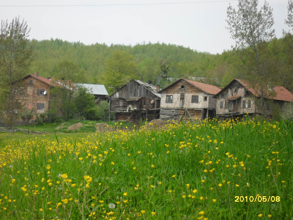

Why visit Azdavay
Townapedia lists 1 place to eat in and around town.
Weather in Azdavay
Forecast from MET Norway (CC BY 4.0). Full forecast
About Azdavay
Azdavay (formerly: Çarşamba) is a town in the Kastamonu Province in the Black Sea region of Turkey. It is located about 74 km away to the northwest of the province center Kastamonu. It is the seat of Azdavay District. Its population is 3,227 (2021).
From the Wikipedia article Azdavay (this version), under CC BY-SA 4.0.
Restaurants and cafes1

Churches and places of worship1

Gas and EV charging1
Healthcare3


History
Archaeological findings hint that history of Azdavay reaches back to the Paphlagonians in 8th century BC. The region was dominated by the Hittites, Lydians, Persians, Hellenes, Pontus, Bithynians, Romans and the Byzantines in conjunction with the general historical timeline of the Kastamonu province. During the reign of the Jandarids, it was one of the 36 districts subject to the Kastamonu Sanjak. With the conquest of the region by the Ottoman sultan Mehmed II in 1460, Azdavay was annexed to the Ottoman Empire. In 1868, when the neighboring Daday was made a district of Kastamonu, Azdavay was attached to Daday as a town. After the proclamation of the Turkish republic, Azdavay was made a district in 1946, although by the secession of the towns Ağlı and Pınarbaşı in 1988, its population and land area largely decreased.
From the History section of Azdavay on Wikipedia, under CC BY-SA 4.0.
Map of Azdavay
6 places. The map loads OpenStreetMap tiles when you open it.
Getting there and nearby towns
Kastamonu Airport (KFS) is the nearest airport with scheduled flights listed in OpenStreetMap, 55 km away.
- Pınarbaşı 16 km west, about 16 min by car
- Daday 23 km southeast, about 23 min by car
- Örencik 29 km east, about 29 min by car
- Cide 37 km northwest, about 37 min by car
- Kastamonu 49 km southeast, about 49 min by car
- İnebolu 53 km northeast, about 53 min by car
- Safranbolu 67 km southwest, about 1 h by car
- Bozkurt 69 km northeast, about 1 h 15 min by car
- Karabük 74 km southwest, about 1 h 15 min by car
- Bartın 80 km west, about 1 h 15 min by car
Drive times are estimates from straight-line distance, not routes.
Local news
Headlines from INDB.
Reviews, tips and questions
Loading what members have shared...
Sources and licences
- GeoNames (CC BY 4.0): population, coordinates, regions and time zone
- OpenStreetMap contributors (ODbL 1.0): places, airports, map data
- Wikidata (CC0 1.0): elevation, founding date, time zone, website
- Wikimedia Commons (see each image): photos
- Wikipedia (CC BY-SA 4.0): overview and history text
Photo credits
- Kizkayasi azdavay, Noonmassive, CC BY-SA 3.0
- MANZARA KASTAMONU - panoramio, Zeki, CC BY-SA 3.0
Page built November 8, 2026. Spotted a mistake? Tell us or suggest a place.