


Why visit Beylikdüzü
Townapedia lists 3 museums and landmarks, 26 parks and trails, 61 places to eat and 1 place to stay in and around town.
Highlights include Cyprus Monument.
Weather in Beylikdüzü
Forecast from MET Norway (CC BY 4.0). Full forecast
About Beylikdüzü
Beylikdüzü (Turkish: [bejˈlicdyzy]) is a municipality and district of Istanbul Province, Turkey. Its area is 39 km2, and its population is 415,290 (2024). It is on the European side of Istanbul, located north of the Sea of Marmara, south of Esenyurt, east of Büyükçekmece, and west of Avcılar.
From the Wikipedia article Beylikdüzü (this version), under CC BY-SA 4.0.
Museums and landmarks3

Cyprus Monument
Monument and historic site · 2.9 km
Monument in İstanbul, Turkey

Parks, trails and playgrounds26
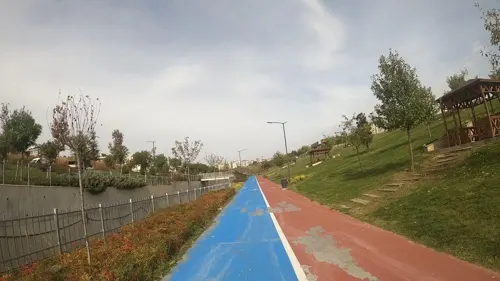

14 more on the map.
Restaurants and cafes61

Susam Kids Cafe
Cafe · Coffee Shop, Breakfast, Burger, Pizza, Pasta, Turkish, Donut · 1.7 km
1 Ender Sokağı, İstanbul
Mo-Su 09:00-21:00


Usturmaca Fish Restaurant
Restaurant · Mediterranean, Breakfast · 2.4 km
Mo-Su 09:30-01:00
Osmanlı Börek Pide
Cafe · Tea, Bagel, Breakfast · 2.3 km
Osmanlı Caddesi


49 more on the map.
Where to stay1

History
It is assumed that Beylikdüzü was first settled by Greeks from Byzantion in the second century AD as a farming village. It later became a popular resort for residents of Constantinople in the Byzantine Empire, a status that continued after the Fall of Constantinople to the Ottoman Empire. The region was referred to as "Garden" in the later Ottoman period, and following the foundation of the Turkish Republic was called "Kavaklı," after the large number of poplar trees, a name which was used until 2003. The modern name means "Plains of the Beylik." In 2008 the district Beylikdüzü was created from part of the district Büyükçekmece.
From the History section of Beylikdüzü on Wikipedia, under CC BY-SA 4.0.
Churches and places of worship26
Shopping42
Gas and EV charging9
Schools, colleges and libraries37
Vali Muammer Güler Sosyal Bilimler Lisesi
School · 2.4 km
16 19 Mayıs Caddesi, İstanbul
Healthcare43
Aleyna Çakırgöz Eczanesi
Clinic and pharmacy · 1.9 km
319/4D/12 Kocatepe Caddesi, İstanbul
Bilge Eczanesi
Clinic and pharmacy · 1.9 km
51/5C Yavuz Sultan Selim Bulvarı, İstanbul
Map of Beylikdüzü
248 places. The map loads OpenStreetMap tiles when you open it.
Getting there and nearby towns
Istanbul Atatürk Airport (ISL) is the nearest airport with scheduled flights listed in OpenStreetMap, 15 km away.
- Küçükçekmece 11 km east, about 11 min by car
- Bağcılar 19 km east, about 19 min by car
- Esenler 21 km east, about 21 min by car
- Arnavutköy 24 km north, about 24 min by car
- Istanbul 26 km east, about 26 min by car
- Fatih 26 km east, about 26 min by car
- Üsküdar 32 km east, about 32 min by car
- Ümraniye 41 km east, about 41 min by car
- Gebze 69 km east, about 1 h 15 min by car
- Nilüfer 89 km south, about 1 h 30 min by car
Drive times are estimates from straight-line distance, not routes.
Local news
Headlines from INDB.
Reviews, tips and questions
Loading what members have shared...
Sources and licences
- GeoNames (CC BY 4.0): population, coordinates, regions and time zone
- Mapillary (see each image): photos
- OpenStreetMap contributors (ODbL 1.0): places, airports, map data
- Wikidata (CC0 1.0): elevation, founding date, time zone, website, landmarks and historic places
- Wikimedia Commons (see each image): photos
- Wikipedia (CC BY-SA 4.0): overview and history text
Photo credits
- Beylikdüzü Sahili Panoraması, Mayıs 2014, buzkozan, CC BY-SA 3.0
- Istanbul beylikdüzü çekirge, Doldur83, CC BY-SA 4.0
- Enveradakan cad Adakent mah büyükşehir mah beylikdüzü İSTANBUL - panoramio, by rock, CC BY 3.0
- Beykent Bölgesi Beylikdüzü Gece Manzarası, Nisan 2014 - panoramio, buzkozan, CC BY 3.0
- Beylikdüzü karlar altında - panoramio, buzkozan, CC BY 3.0
- Yavuz Sultan Selim Bulvarı, Beylikdüzü Beykent Bölgesi Adnan Kahveci Mahallesi - panoramio, buzkozan, CC BY 3.0
- Paşabahce Caddesi Beylikdüzü, Adnan Kahveci Mahallesi - panoramio (1), buzkozan, CC BY 3.0
- Beylikdüzü adnan kahveci mahallesi - panoramio, buzkozan, CC BY 3.0
- Beylikdüzü Yavuz Sultan Selim Bulvarı, Nisan 2014 - panoramio (1), buzkozan, CC BY 3.0
- Innovia 2 Nazim Hikmet Bulvari Beylikdüzü Esenyurt Bölgesi, buzkozan, CC BY-SA 3.0
- Paşabahce Caddesi Beylikdüzü, Adnan Kahveci Mahallesi - panoramio, buzkozan, CC BY 3.0
- Beylikdüzü Adnan Kahvevi Mahallesi Düzenli Planlı Kentleşme Şehirleşme Yapılaşma, buzkozan, CC BY-SA 3.0
- Beylikdüzü Yavuz Sultan Selim Bulvarı, Nisan 2014 - panoramio, buzkozan, CC BY 3.0
- Yavuz Sultan Selim Bulvarı Bisiklet Yolları Beylikdüzü Adnan Kahveci Mahallesi Beykent, buzkozan, CC BY-SA 3.0
- Yavuz Sultan Selim Bulvarı Beylikdüzü Adnan Kahveci Mahallesi Beykent, buzkozan, CC BY-SA 3.0
- Beylikdüzü Yeşil Vadi-Yaşam Vadisi Botanik Parkı İnşaatı, Nisan 2014 - panoramio, buzkozan, CC BY 3.0
- Beylikdüzü Yaşam Vadisi Giriş Yolu, Nisan 2014 - panoramio, buzkozan, CC BY 3.0
- Beylikdüzü Anadolu Caddesi, Yeni Tip Kısa Katlı Binalar, buzkozan, CC BY-SA 3.0
- Cyprus Monument, Maurice Flesier, CC BY-SA 4.0
- Enlight5914, İzznfs, CC BY-SA 4.0
- Ambarli - panoramio, ---=XEON=---, CC BY 3.0
- Vasilis imamoglou, Trabzon24i, CC BY-SA 4.0
- Istanbul, aerial view photo2, Sami Mlouhi, CC BY-SA 4.0
- Inşaat işçileri ve olmayan "can güvenlikleri" - panoramio, buzkozan, CC BY 3.0
- Pasabahce Caddesi Adnan Kahveci Mahallesi Beylikduzu, buzkozan, CC BY-SA 3.0
- Innovia 1 sitesi, buzkozan, CC BY-SA 3.0
- Innovia 1 blokları, buzkozan, CC BY-SA 3.0
- Newista residence inşaatı nisan 2014, buzkozan, CC BY-SA 3.0
- Yavuz Sultan Selim Bulvarı kaldırımları - panoramio, buzkozan, CC BY 3.0
- Yavuz Sultan Selim Bulvarı - panoramio, buzkozan, CC BY 3.0
- Yeşilkent 2 - panoramio (1), buzkozan, CC BY 3.0
- MİKAİL, MİKAİL UÇAR, CC0
- Yeşilkent 2 - panoramio, buzkozan, CC BY 3.0
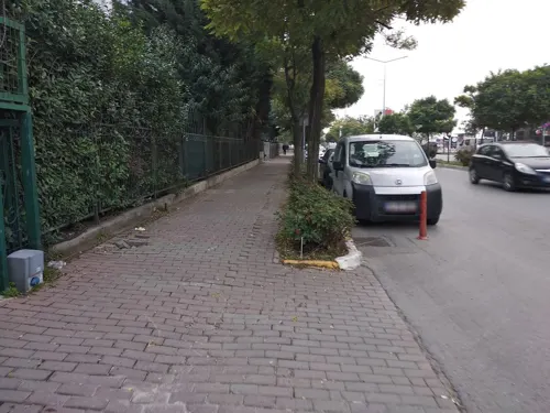
- Street-level photo, ozkanilyasaksu, CC BY-SA 4.0
- Street-level photo, boracasli, CC BY-SA 4.0
- Street-level photo, Eray_ozturk, CC BY-SA 4.0


Page built November 8, 2026. Spotted a mistake? Tell us or suggest a place.