


Weather in Boynuyoğun
Forecast from MET Norway (CC BY 4.0). Full forecast
About Boynuyoğun
Boynuyoğun is a neighbourhood in the municipality and district of Sarıçam, Adana Province, Turkey. Its population is 1,671 (2022). Before 2008, it was part of the district of Yüreğir.
From the Wikipedia article Boynuyoğun, Sarıçam (this version), under CC BY-SA 4.0.
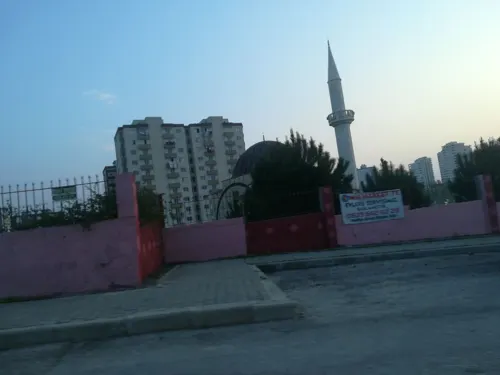
Churches and places of worship9

Shopping3

Schools, colleges and libraries7

Adana Alparslan Türkeş Science and Technology University
School · 4.0 km
State university in Adana, Turkey


Çukurova University
School · 5.0 km
State university in Adana, Turkey
Healthcare5

Map of Boynuyoğun
24 places. The map loads OpenStreetMap tiles when you open it.
Getting there and nearby towns
Incirlik Air Base (UAB) is the nearest airport with scheduled flights listed in OpenStreetMap, 7 km away.
- Adana 12 km southwest, about 12 min by car
- Kurttepe 12 km west, about 12 min by car
- Kireçocağı 16 km west, about 16 min by car
- Ceyhan 36 km east, about 36 min by car
- Yumurtalık 47 km southeast, about 47 min by car
- Bolatlı 47 km west, about 47 min by car
- Tarsus 49 km west, about 49 min by car
- Kozan 56 km northeast, about 56 min by car
- Kadirli 70 km northeast, about 1 h 15 min by car
- Mersin 74 km west, about 1 h 15 min by car
Drive times are estimates from straight-line distance, not routes.
Local news
Headlines from INDB.
Reviews, tips and questions
Loading what members have shared...
Sources and licences
- GeoNames (CC BY 4.0): population, coordinates, regions and time zone
- Mapillary (see each image): photos
- OpenStreetMap contributors (ODbL 1.0): places, airports, map data
- Wikidata (CC0 1.0): elevation, founding date, time zone, website, landmarks and historic places
- Wikimedia Commons (see each image): photos
- Wikipedia (CC BY-SA 4.0): overview and history text
Photo credits
- ÇU Beyazevler Campus, Seyhan668, CC BY-SA 3.0
- Toki Sarıçam, Adana, Zeynel Cebeci, CC BY-SA 4.0
- Purpuricenus budensis 01, Zeynel Cebeci, CC BY-SA 4.0
- Purpuricenus budensis 07, Zeynel Cebeci, CC BY-SA 4.0
- Purpuricenus budensis 04, Zeynel Cebeci, CC BY-SA 4.0
- Purpuricenus budensis 08, Zeynel Cebeci, CC BY-SA 4.0
- Purpuricenus budensis 03, Zeynel Cebeci, CC BY-SA 4.0
- Purpuricenus budensis 05, Zeynel Cebeci, CC BY-SA 4.0
- Purpuricenus budensis 02, Zeynel Cebeci, CC BY-SA 4.0
- Purpuricenus budensis 10, Zeynel Cebeci, CC BY-SA 4.0
- Purpuricenus budensis 06, Zeynel Cebeci, CC BY-SA 4.0
- Purpuricenus budensis 09, Zeynel Cebeci, CC BY-SA 4.0
- Polyommatus icarus - Common blue 19, Zeynel Cebeci, CC BY-SA 4.0
- Polyommatus icarus - Common blue 20, Zeynel Cebeci, CC BY-SA 4.0
- Prinia gracilis - Graceful prinia, Adana 2016 10 28 - 3, Zeynel Cebeci, CC BY-SA 4.0
- Prinia gracilis - Graceful prinia, Adana 2016 10 28 - 4, Zeynel Cebeci, CC BY-SA 4.0
- Prinia gracilis - Graceful prinia, Adana 2016 10 28 - 8, Zeynel Cebeci, CC BY-SA 4.0
- Prinia gracilis - Graceful prinia, Adana 2016 10 28 - 5, Zeynel Cebeci, CC BY-SA 4.0
- Prinia gracilis - Graceful prinia, Adana 2016 10 28 - 7, Zeynel Cebeci, CC BY-SA 4.0
- Prinia gracilis - Graceful prinia, Adana 2016 10 28 - 6, Zeynel Cebeci, CC BY-SA 4.0
- Prinia gracilis - Graceful prinia, Adana 2016 10 28 - 9, Zeynel Cebeci, CC BY-SA 4.0
- Prinia gracilis - Graceful prinia, Adana 2016 10 28 - 2, Zeynel Cebeci, CC BY-SA 4.0
- Prinia gracilis - Graceful prinia, Adana 2016 10 28 - 1, Zeynel Cebeci, CC BY-SA 4.0
- Melitaea trivia - Güzel iparhan 04-2, Zeynel Cebeci, CC BY-SA 4.0
- Melitaea trivia - Güzel iparhan 04-1, Zeynel Cebeci, CC BY-SA 4.0
- Melitaea trivia - Güzel iparhan 04, Zeynel Cebeci, CC BY-SA 4.0
- Melitaea trivia - Güzel iparhan 03-5, Zeynel Cebeci, CC BY-SA 4.0
- Melitaea trivia - Güzel iparhan 03-4, Zeynel Cebeci, CC BY-SA 4.0
- Melitaea trivia - Güzel iparhan 03-1, Zeynel Cebeci, CC BY-SA 4.0
- Melitaea trivia - Güzel iparhan 03-2, Zeynel Cebeci, CC BY-SA 4.0
- Melitaea trivia - Güzel iparhan 03-3, Zeynel Cebeci, CC BY-SA 4.0
- Melitaea trivia - Güzel iparhan 02-1, Zeynel Cebeci, CC BY-SA 4.0
- Melitaea trivia - Güzel iparhan 02-2, Zeynel Cebeci, CC BY-SA 4.0
- Melitaea trivia - Güzel iparhan 01, Zeynel Cebeci, CC BY-SA 4.0
- Emberiza melanocephala - Black-headed Bunting 03, Zeynel Cebeci, CC BY-SA 4.0
- Street-level photo, samil, CC BY-SA 4.0


Page built November 8, 2026. Spotted a mistake? Tell us or suggest a place.