


Why visit Geyve
Townapedia lists 2 museums and landmarks, 7 places to eat, 1 place to stay and 2 attractions in and around town.
Highlights include Doğançay Waterfall, Kabia and Kizoura.
Weather in Geyve
Forecast from MET Norway (CC BY 4.0). Full forecast
About Geyve
Geyve is a municipality and district of Sakarya Province, Turkey. Its area is 662 km2, and its population is 50,799 as of 2022. The closest international airport is Istanbul Sabiha Gökçen International Airport, 139 km (86 mi) from Geyve. It is the largest district of Sakarya Province in terms of area.
From the Wikipedia article Geyve (this version), under CC BY-SA 4.0.
Things to do2

Doğançay Waterfall
Waterfall · 12.3 km
Waterfall in Sakarya Province, northwestern Turkey

Museums and landmarks2

Kabia
Monument and historic site · 1.0 km
Ancient city of Bithynia in modern-day Turkey
Kizoura
Monument and historic site · 5.3 km
Ancient city of Bithynia in modern-day Turkey
Restaurants and cafes7


Künefeci Ahmet Kahvaltı
Cafe · Pizza, Coffee Shop, Regional, Sandwich, Ice Cream, Seafood, Turkish, Pasta · 10.3 km
2, Pamukova
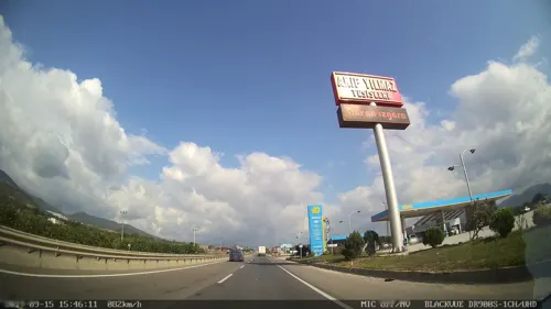


Where to stay1

History
There is not enough scientific evidence available regarding the first settlers of Geyve. The ruins around the region do not survive, but it is almost certain that Geyve is an historical settlement dating back thousands of years. There are different claims that its origin goes to 4000 BC, and even some sources to 10000 BC. Geyve region has been inhabited by Phrygians, Hittites, Lydians, Romans, Armenians, Byzantines, Turks and many other civilizations since prehistoric times. Many historical evidence from Byzantine and Roman Empire era have been discovered in Geyve. Geyve was known to be one of the early Ottoman conquests. It was conquered by Osman Gazi (reigned c. 1299–1323/4), first Ottoman Sultan, in the 14th century from the Byzantine Empire.
The demography of the town has been significantly impacted by the population exchange between Greece and Turkey in 1923. According to the Ottoman General Census of 1881/82-1893, the kaza of Geyve had a total population of 32,607, consisting of 22,133 Muslims, 5,873 Armenians, 4,520 Greeks, 79 Protestants, 1 Jew and 1 foreign citizen. Several old photographs and evidence have been collected by a local researcher-collector in the following link.
The origin of Geyve's name is controversial. Evliya Çelebi, famous Ottoman traveller, in his Seyahatnâme states that Geyve's name comes from the Byzantine princess named Geyve.
From the History section of Geyve on Wikipedia, under CC BY-SA 4.0.
Churches and places of worship8
İkramiye Mahallesi Halim Aydın Cami
Place of worship · Sunni · 12.4 km
12 İkramiye Sokak, Sakarya
İkramiye Mahallesi Necati Kaya Cami
Place of worship · Sunni · 13.7 km
13 İkramiye Sokak, Sakarya
Shopping11
Gas and EV charging22
Schools, colleges and libraries6
Sakarya Uygulamalı Bilimler Üniversitesi Geyve Meslek Yüksekokulu
School · 3.0 km
Healthcare21
Map of Geyve
80 places. The map loads OpenStreetMap tiles when you open it.
Getting there and nearby towns
Cengiz Topel Havaalanı (KCO) is the nearest airport with scheduled flights listed in OpenStreetMap, 31 km away.
- Pamukova 11 km west, about 11 min by car
- Sapanca 21 km north, about 21 min by car
- Adapazarı 32 km north, about 32 min by car
- İzmit 42 km northwest, about 42 min by car
- Gölcük 46 km northwest, about 46 min by car
- Derince 49 km northwest, about 49 min by car
- Bilecik 49 km southwest, about 49 min by car
- İznik 49 km west, about 49 min by car
- Körfez 52 km northwest, about 52 min by car
- Karamürsel 61 km west, about 1 h by car
Drive times are estimates from straight-line distance, not routes.
Local news
Headlines from INDB.
Reviews, tips and questions
Loading what members have shared...
Sources and licences
- GeoNames (CC BY 4.0): population, coordinates, regions and time zone
- Mapillary (see each image): photos
- OpenStreetMap contributors (ODbL 1.0): places, airports, map data
- Wikidata (CC0 1.0): elevation, founding date, time zone, website, landmarks and historic places
- Wikimedia Commons (see each image): photos
- Wikipedia (CC BY-SA 4.0): overview and history text
Photo credits
- SakaryaNehriGEYVE, Erdalldogan, CC BY-SA 4.0
- Geyve Boğazı, Acar54, CC BY-SA 4.0
- Doğançay Şelalesi, Acar54, CC BY-SA 3.0
- ISS064-E-7699 - View of Earth, Earth Science and Remote Sensing Unit, NASA Johnson Space Center, Public domain
- ISS061-E-66530 - View of Earth, Earth Science and Remote Sensing Unit, NASA Johnson Space Center, Public domain
- Just Beautiful - panoramio, M. PINARCI, CC BY-SA 3.0
- Cool And Fresh Air - panoramio, M. PINARCI, CC BY-SA 3.0
- Lots Of Fresh Air - Bol Temiz Hava - panoramio, M. PINARCI, CC BY-SA 3.0
- Ilhan tan tesisleri - panoramio, izcoban, CC BY 3.0
- Enerhetykiv Avenue 1, Minami Himemiya, CC BY-SA 2.5
- ALİ FUAT PAŞA, Acar54, CC BY-SA 4.0
- İkinci Beyazıt Köprüsü, Acar54, CC BY-SA 4.0
- Ali Fuat Cebesoy Müzesi, Acar54, CC BY-SA 4.0
- ISS067-E-78703 - View of Earth, Earth Science and Remote Sensing Unit , Lyndon B. Johnson Space Center, Public domain
- ISS064-E-7700 - View of Earth, Earth Science and Remote Sensing Unit, NASA Johnson Space Center, Public domain
- ISS064-E-7701 - View of Earth, Earth Science and Remote Sensing Unit, NASA Johnson Space Center, Public domain
- Street-level photo, azadezey, CC BY-SA 4.0
- Street-level photo, yercizenler, CC BY-SA 4.0
- Street-level photo, azadezey, CC BY-SA 4.0
- Street-level photo, yercizenler, CC BY-SA 4.0
- Street-level photo, ademturkmen, CC BY-SA 4.0
- Street-level photo, yercizenler, CC BY-SA 4.0
- Street-level photo, yercizenler, CC BY-SA 4.0
- Street-level photo, yercizenler, CC BY-SA 4.0
- Street-level photo, nazif, CC BY-SA 4.0
- Street-level photo, asturksever, CC BY-SA 4.0
- Street-level photo, nazif, CC BY-SA 4.0
- Street-level photo, unen, CC BY-SA 4.0
- Street-level photo, erdoganksgn, CC BY-SA 4.0
- Street-level photo, asturksever, CC BY-SA 4.0
- Street-level photo, yercizenler, CC BY-SA 4.0
- Street-level photo, nazif, CC BY-SA 4.0


Page built November 8, 2026. Spotted a mistake? Tell us or suggest a place.