


Why visit Körfez
Townapedia lists 31 museums and landmarks, 83 parks and trails, 108 places to eat, 3 places to stay and 25 attractions in and around town.
Highlights include Arbeila, Astacus in Bithynia, Mimar Sinan Çocuk Parkı and BOSNA YILDIZ PARKI.
Weather in Körfez
Forecast from MET Norway (CC BY 4.0). Full forecast
About Körfez
Körfez, formerly known as Elaia, or Elaea, is a municipality and district of Kocaeli Province, Turkey. Its area is 301 km2, and its population is 178,048 (2022).
From the Wikipedia article Körfez (this version), under CC BY-SA 4.0.
Things to do25



13 more on the map.
Museums and landmarks31

Arbeila
Monument and historic site · 8.7 km
Ancient city of Bithynia in modern-day Turkey
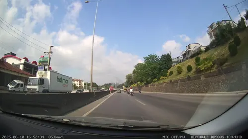
Astacus in Bithynia
Monument and historic site · 13.6 km
Ancient city of Bithynia in modern-day Turkey
Brunca
Monument and historic site · 7.0 km
Ancient city of Bithynia, in modern-day Turkey
Charax
Monument and historic site · 14.4 km
Roman and Byzantine town in Bithynia
Diolkides
Monument and historic site · 8.2 km
Ancient city of Bithynia in modern-day Turkey
Elaea
Monument and historic site · 2.0 km
Ancient city of Bithynia in modern-day Turkey
Eribolum
Monument and historic site · 12.4 km
Port town of ancient Bithynia
Geragathe
Monument and historic site · 14.5 km
Settlement of ancient Bithynia inhabited during Byzantine times
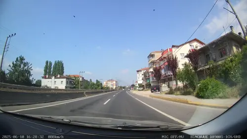
Heracleium
Monument and historic site · 12.5 km
Ancient city of Bithynia in modern-day Turkey

Koubaita
Monument and historic site · 14.2 km
Ancient city of Bithynia in modern-day Turkey
Nerola
Monument and historic site · 16.5 km
Ancient city of Bithynia in modern-day Turkey
19 more on the map.
Parks, trails and playgrounds83



Kocaeli Olimpik Buz Sporları Salonu
Sports field and stadium · 6.3 km
Cahide Sokak
Mo-Fr 08:00-17:00
71 more on the map.
Restaurants and cafes108

Dönerci Adil Usta
Restaurant · Turkish, Kebab, Ice Cream · 0.7 km
88/B Ağa Dere Caddesi, Kocaeli
Mo-Su 10:00-22:00
Glutensiz Bizim Mutfak
Restaurant · Burger, Sandwich, Soba, Cake, Bagel, Pasta, Balkan, Pancake, Pizza, Turkish, Breakfast, Tea, Local, Friture, Kebab · 2.4 km
112 Piri Reis caddesi
Mo-Sa 09:00-19:00
KISMETİM
Restaurant · Turkish, Regional · 4.9 km
Denizciler Caddesi, KOCAELİ
24/7
Derince Belediyesi Kent Lokantası
Restaurant · Turkish · 3.7 km
Denizciler Caddesi, Kocaeli
12:00-17:00

Senin Kafen
Cafe · Coffee Shop, Sandwich, Regional, Burger · 2.8 km
İsmet Paşa Caddesi, Kocaeli
Mo-Su 09:00-21:00


Yelken Restoran & Cafe
Restaurant · Turkish, Italian, Burger, Regional · 2.6 km
Rıhtım Caddesi, KOCAELİ
Mo-Su 06:00-23:00

Somoncu Baba Ekmek Fırını
Bakery · 5.4 km
Çenesuyu Caddesi, Kocaeli
Mo-Su 07:00-22:00

96 more on the map.
History
Kaiser II. Wilhelm Mansion is located in the district. It was built in 1898 for the German Emperor Wilhelm's visit to the Ottoman Empire.
The district Körfez was established in 1987 from parts of the central district of Kocaeli (now İzmit) and of the district of Gebze. At the same time, the municipality Yarımca was renamed to Körfez. It has borders with Şile to north, Derince from east, Dilovası from southwest and Gebze from west. Hereke and Kirazlıyalı were independent towns within the district until they were absorbed into the municipality Körfez in 2008.
From the History section of Körfez on Wikipedia, under CC BY-SA 4.0.
Where to stay3
Churches and places of worship68
Petrol Ofisi Cami
Place of worship · Sunni · 6.1 km
Petrol Ofisi Caddesi, KOCAELİ
Toki Barbaros-Kabakoz Evleri Sitesi Cami
Place of worship · Sunni · 2.3 km
Toki Barbaros-Kabakoz Evleri Sitesi, Kocaeli
Shopping71
Gas and EV charging25
Schools, colleges and libraries93
Healthcare65
Çenedağ Mahallesi Aile Sağlığı Merkezi
Clinic and pharmacy · 4.4 km
Sağlık Sokak, KOCAELİ
Map of Körfez
250 places. The map loads OpenStreetMap tiles when you open it.
Getting there and nearby towns
Cengiz Topel Havaalanı (KCO) is the nearest airport with scheduled flights listed in OpenStreetMap, 25 km away.
- Derince 3 km southeast, about 3 min by car
- İzmit 12 km east, about 12 min by car
- Gebze 30 km west, about 30 min by car
- İznik 38 km south, about 38 min by car
- Adapazarı 52 km east, about 52 min by car
- Sancaktepe 53 km northwest, about 53 min by car
- Ümraniye 62 km northwest, about 1 h by car
- Gemlik 65 km southwest, about 1 h by car
- Üsküdar 71 km northwest, about 1 h 15 min by car
- Istanbul 75 km west, about 1 h 15 min by car
Drive times are estimates from straight-line distance, not routes.
Local news
Headlines from INDB.
Reviews, tips and questions
Loading what members have shared...
Sources and licences
- GeoNames (CC BY 4.0): population, coordinates, regions and time zone
- Mapillary (see each image): photos
- OpenStreetMap contributors (ODbL 1.0): places, airports, map data
- Wikidata (CC0 1.0): elevation, founding date, time zone, website, landmarks and historic places
- Wikimedia Commons (see each image): photos
- Wikipedia (CC BY-SA 4.0): overview and history text
Photo credits
- Nostaljik gemimiz ©Abdullah Kiyga - panoramio (1), Abdullah kıyga, CC BY 3.0
- KÖRFEZKENT SUNSET 2009 - panoramio, nurettingülay(from T…, CC BY-SA 3.0
- Yavuz Sultan Selim, 41780 Körfez-Kocaeli, Turkey - panoramio, Dalibor Z. Chvatal, CC BY 3.0
- KÖRFEZKENT 2009 - panoramio, nurettingülay(from T…, CC BY-SA 3.0
- Körfezray inşaatı 2025, Kayra, CC BY 4.0
- Körfez - panoramio, fatihset, CC BY 3.0
- Kocaeli Arkeoloji ve Etnografya Müzesi ana bina soldan, Cobija, CC BY-SA 4.0
- Derince harikalar sahili (4) 02, Kocaeligönüllüsü, CC BY-SA 4.0
- Dernek, Kocaeli Yozgatlılar Derneği, CC BY-SA 4.0
- Dernek2, Kocaeli Yozgatlılar Derneği, CC BY-SA 4.0
- Dernek3, Kocaeli Yozgatlılar Derneği, CC BY-SA 4.0
- Tilkiler İş Merkezi - panoramio, Yılmaz TİLKİ, CC BY 3.0
- Tilkiler İş Merkezi - panoramio (7), Yılmaz TİLKİ, CC BY 3.0
- Tilkiler İş Merkezi - panoramio (6), Yılmaz TİLKİ, CC BY 3.0
- Tilkiler İş Merkezi - panoramio (4), Yılmaz TİLKİ, CC BY 3.0
- Tilkiler İş Merkezi - panoramio (1), Yılmaz TİLKİ, CC BY 3.0
- Tilkiler İş Merkezi - panoramio (5), Yılmaz TİLKİ, CC BY 3.0
- Tilkiler İş Merkezi - panoramio (3), Yılmaz TİLKİ, CC BY 3.0
- Tilkiler İş Merkezi - panoramio (2), Yılmaz TİLKİ, CC BY 3.0
- TCDD 154 kV - panoramio, Allen Turner, CC BY-SA 3.0
- Yarımca topel sok. başlagıcı - panoramio, suataffeder, CC BY 3.0
- Zayn Sofuoğlu 20231012, Zafer, CC BY-SA 4.0
- Derince harikalar sahili (4) 01, Kocaeligönüllüsü, CC BY-SA 4.0
- Derince harikalar sahili (4) 04, Kocaeligönüllüsü, CC BY-SA 4.0
- Derince harikalar sahili (4) 03, Kocaeligönüllüsü, CC BY-SA 4.0
- Petrochemical plants and newly built bridges - panoramio, Abdullah kıyga, CC BY 3.0
- Eren Bilen 20220901, Fevzi Faruk Çetin, CC BY 2.0
- Derince İş Bankası - panoramio, Yılmaz TİLKİ, CC BY 3.0
- Derince Merkez Camii, Rasitkeskin, CC BY-SA 4.0
- Değirmendere Atıksu Terfi Merkezi, Satirdan kahraman, CC BY-SA 4.0
- Değirmendere 20231219 162229 03, Satirdan kahraman, CC BY-SA 4.0
- Değirmendere 02, Satirdan kahraman, CC BY-SA 4.0
- EUKOR RORO night with Römorks (Medium), Tanzer.genc, CC BY-SA 4.0
- Değirmendere 20231219 151758 14, Satirdan kahraman, CC BY-SA 4.0
- Değirmendere 20231219 151758 13, Satirdan kahraman, CC BY-SA 4.0
- Değirmendere 20231219 151758 10, Satirdan kahraman, CC BY-SA 4.0
- Değirmendere 20231219 151758 12, Satirdan kahraman, CC BY-SA 4.0
- Değirmendere 20231219 151758 09, Satirdan kahraman, CC BY-SA 4.0
- Değirmendere 20231219 151758 11, Satirdan kahraman, CC BY-SA 4.0
- Değirmendere 20231219 151758 16, Satirdan kahraman, CC BY-SA 4.0
- Street-level photo, Zafer, CC BY-SA 4.0
- Street-level photo, Zafer, CC BY-SA 4.0
- Street-level photo, asturksever, CC BY-SA 4.0
- Street-level photo, asturksever, CC BY-SA 4.0
- Street-level photo, asturksever, CC BY-SA 4.0
- Street-level photo, okansafak, CC BY-SA 4.0
- Street-level photo, hderinoz, CC BY-SA 4.0
- Street-level photo, hderinoz, CC BY-SA 4.0
- Street-level photo, Zafer, CC BY-SA 4.0


Page built November 8, 2026. Spotted a mistake? Tell us or suggest a place.