


Gömeç, Turkey
Emrutabat
Gömeç is a town of 4,380 people in Balıkesir, Turkey, founded in May 20, 1990.
Why visit Gömeç
Townapedia lists 3 museums and landmarks, 18 parks and trails, 26 places to eat, 2 places to stay and 1 attraction in and around town.
Highlights include Cisthene and Coryphas.
Weather in Gömeç
Forecast from MET Norway (CC BY 4.0). Full forecast
About Gömeç
Gömeç (known in antiquity as Passawanda and Kisthene, Κισθένη in Ancient Greek), is a municipality and district of Balıkesir Province, Turkey. Its area is 171 km2, and its population is 16,880 (2022). Its former name was Armutova before becoming a district. The ancient city Kisthene is located in Gömeç.
From the Wikipedia article Gömeç (this version), under CC BY-SA 4.0.
Things to do1

Museums and landmarks3

Cisthene
Monument and historic site · 2.4 km
Ancient city of Aeolis, Turkey
Coryphas
Monument and historic site · 6.3 km
Populated place in ancient Aeolis
Parks, trails and playgrounds18


6 more on the map.
Restaurants and cafes26




14 more on the map.
Where to stay2
Churches and places of worship9
Shopping12
Gas and EV charging8
Schools, colleges and libraries8
Healthcare4
Map of Gömeç
91 places. The map loads OpenStreetMap tiles when you open it.
Getting there and nearby towns
Balıkesir Koca Seyit Airport (EDO) is the nearest airport with scheduled flights listed in OpenStreetMap, 23 km away.
- Burhaniye 17 km northeast, about 17 min by car
- Altınoluk 23 km northwest, about 23 min by car
- Edremit 28 km northeast, about 28 min by car
- Dikili 36 km south, about 36 min by car
- Bergama 42 km southeast, about 42 min by car
- İvrindi 59 km east, about 59 min by car
- Ezine 61 km northwest, about 1 h by car
- Aliağa 67 km south, about 1 h by car
- Kırkağaç 78 km southeast, about 1 h 15 min by car
- Foça 80 km south, about 1 h 15 min by car
Drive times are estimates from straight-line distance, not routes.
Local news
Headlines from INDB.
Reviews, tips and questions
Loading what members have shared...
Sources and licences
- GeoNames (CC BY 4.0): population, coordinates, regions and time zone
- Mapillary (see each image): photos
- OpenStreetMap contributors (ODbL 1.0): places, airports, map data
- Wikidata (CC0 1.0): elevation, founding date, time zone, website, landmarks and historic places
- Wikimedia Commons (see each image): photos
- Wikipedia (CC BY-SA 4.0): overview and history text
Photo credits
- Town center of Gömeç, Maurice Flesier, CC BY-SA 4.0
- Gömeç town center, Maurice Flesier, CC BY-SA 4.0
- Gömeç Çarşı Mosque, Maurice Flesier, CC BY-SA 4.0
- Ege Cafe, Gömeç, Maurice Flesier, CC BY-SA 4.0
- A house in Gömeç district, Maurice Flesier, CC BY-SA 4.0
- Mithatpaşa, Gömeç, Maurice Flesier, CC BY-SA 4.0
- Gömeç Municipality Building 2, Maurice Flesier, CC BY-SA 4.0
- Gömeç Municipality Building, Maurice Flesier, CC BY-SA 4.0
- Ornithogalum umbellatum in Gömeç, Maurice Flesier, CC BY-SA 4.0
- Olive groves in Gömeç, Balıkesir, Maurice Flesier, CC BY-SA 4.0
- Gömeç, Balıkesir Province, Maurice Flesier, CC BY-SA 4.0
- Olive groves in Gömeç District, Maurice Flesier, CC BY-SA 4.0
- Olive groves in Gömeç, Maurice Flesier, CC BY-SA 4.0
- Ornithogalum umbellatum in Gömeç, Balıkesir, Maurice Flesier, CC BY-SA 4.0
- Ornithogalum umbellatum in Gömeç District, Maurice Flesier, CC BY-SA 4.0
- Ornithogalum umbellatum in Gömeç, Balıkesir Province, Maurice Flesier, CC BY-SA 4.0
- Kemalpaşa, Gömeç, Maurice Flesier, CC BY-SA 4.0
- Olive groves in Gömeç, Balıkesir Province, Maurice Flesier, CC BY-SA 4.0
- Kemalpaşa, Gömeç, Balıkesir Province, Maurice Flesier, CC BY-SA 4.0
- Kara kova Plajı, Karaağaç Beldesi, GÖMEÇ* - panoramio, HakkiAynur, CC BY-SA 3.0
- İzmir-Çanakkale road, Maurice Flesier, CC BY-SA 4.0
- An Anchusa azurea flower in Turkey, Maurice Flesier, CC BY-SA 4.0
- Anchusa azurea in Turkey, Maurice Flesier, CC BY-SA 4.0
- Ataturk rocks, Maurice Flesier, CC BY-SA 4.0
- Kocagedik Tepesi 10 km - panoramio, Allen Turner, CC BY-SA 3.0
- ISS022-E-86523 - View of Earth, Earth Science and Remote Sensing Unit , Lyndon B. Johnson Space Center, Public domain
- ISS048-E-17166 - View of Earth, Earth Science and Remote Sensing Unit , Lyndon B. Johnson Space Center, Public domain
- ISS042-E-308252 - View of Cyprus, Earth Science and Remote Sensing Unit , Lyndon B. Johnson Space Center, Public domain
- ISS030-E-292827 - View of Earth, Earth Science and Remote Sensing Unit , Lyndon B. Johnson Space Center, Public domain
- ISS022-E-86525 - View of Earth, Earth Science and Remote Sensing Unit , Lyndon B. Johnson Space Center, Public domain
- ISS037-E-21071 - View of Earth, Earth Science and Remote Sensing Unit , Lyndon B. Johnson Space Center, Public domain
- ISS022-E-86524 - View of Earth, Earth Science and Remote Sensing Unit , Lyndon B. Johnson Space Center, Public domain
- ISS009-E-15399 - View of Greece, Earth Science and Remote Sensing Unit , Lyndon B. Johnson Space Center, Public domain
- Altınoluk 18 km - panoramio, Allen Turner, CC BY-SA 3.0
- Trafo - panoramio, Allen Turner, CC BY-SA 3.0
- Yeryüzü tabakası, Allen Turner, CC BY-SA 3.0
- Guzelbelde Sitesi - panoramio, alafortanfuni, CC BY-SA 3.0
- Kuğukent Sahiline Bakış 01 - panoramio, goohooni, CC BY-SA 3.0
- Güzelbelde'den Günbatımı - panoramio, Mehmet Cankaya, CC BY-SA 3.0
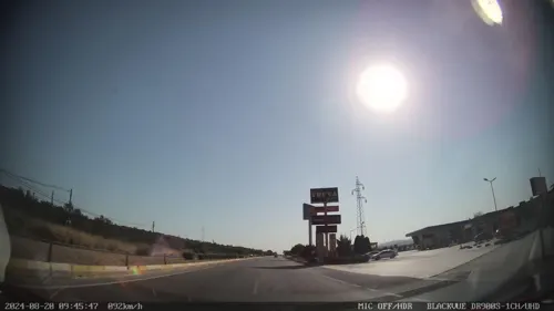
- Street-level photo, doriel, CC BY-SA 4.0
- Street-level photo, unen, CC BY-SA 4.0
- Street-level photo, unen, CC BY-SA 4.0
- Street-level photo, unen, CC BY-SA 4.0
- Street-level photo, unen, CC BY-SA 4.0
- Street-level photo, unen, CC BY-SA 4.0
- Street-level photo, doriel, CC BY-SA 4.0
- Street-level photo, unen, CC BY-SA 4.0
- Street-level photo, unen, CC BY-SA 4.0
- Street-level photo, unen, CC BY-SA 4.0


Page built November 8, 2026. Spotted a mistake? Tell us or suggest a place.