


Gümüşhane, Turkey
Gümüşhane is a regional capital of 39,214 people in Gümüşhane Province, Turkey.
Why visit Gümüşhane
Townapedia lists 1 museum or landmark, 1 park or trail, 2 places to eat, 2 places to stay and 7 attractions in and around town.
Weather in Gümüşhane
Forecast from MET Norway (CC BY 4.0). Full forecast
About Gümüşhane
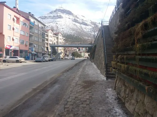
Gümüşhane (Turkish: [ɟyˈmyʃhaːne] ; lit. 'place of silver') is a city in the Black Sea Region of Turkey. It is the seat of Gümüşhane Province and Gümüşhane District. Its population is 39,214 (2022). The city lies along the Harşit River, about 40 miles (64 km) southwest of Trabzon.
From the Wikipedia article Gümüşhane (this version), under CC BY-SA 4.0.
Travel tips from other travellers: Gümüşhane on Wikivoyage (CC BY-SA 4.0).
Things to do7

Museums and landmarks1

Parks, trails and playgrounds1

Restaurants and cafes2



History
It is suggested that the ancient Thia (Θεία in Greek, a settlement of Roman, Late Roman and Byzantine periods) was located 4 mi (6.4 km) west of modern Gümüşhane, in modern Beşkilise. In the Byzantine period, there was a town named Tzanicha or Tzantzakon (Τζάνιχα, Τζάντζακον in Byzantine Greek) means land of Zan / Laz people, possibly located 2 miles (3.2 km) to the west of Gümüşhane. The area did not remain Laz after the 7th–9th centuries though.
Around 840 AD, the area was included in the new Roman (Byzantine) province of Chaldia (Χαλδία). It was later ruled by the Byzantine Empire of Trebizond.
During the Ottoman years, the sanjak of Gümüşhane fell under the administration successively of Rum Province, Erzurum Province and Trabzon Province, and was divided into four kazas: Gümüşhane, Torul (capital city Ardassa), Şiran (Cheriana), and Kelkit (Keltik).
The sanjak in which Gümüşhane was situated at some stage comprised 37 mines of argentiferous lead and six copper mines. There is no evidence that these mines were in use during Byzantine times.
From the History section of Gümüşhane on Wikipedia, under CC BY-SA 4.0.
Where to stay2
Churches and places of worship5
Shopping9
Gas and EV charging2
Opet Gümüşhane Merkez
Gas station · 2.3 km
4 Trabzon Erzurum Transit Yolu Kazım Karabekir Caddesi, Gümüşhane
Schools, colleges and libraries1
Healthcare14
Map of Gümüşhane
44 places. The map loads OpenStreetMap tiles when you open it.
Getting there and nearby towns
Trabzon International Airport (TZX) is the nearest airport with scheduled flights listed in OpenStreetMap, 65 km away.
- Yağlıdere 10 km northeast, about 10 min by car
- Torul 19 km northwest, about 19 min by car
- Köse 32 km southeast, about 32 min by car
- Trabzon 64 km north, about 1 h by car
- Yomra 64 km northeast, about 1 h by car
- Eynesil 73 km north, about 1 h 15 min by car
- Görele 75 km northwest, about 1 h 15 min by car
- Erzincan 80 km south, about 1 h 15 min by car
- Tirebolu 82 km northwest, about 1 h 15 min by car
- Of 85 km northeast, about 1 h 30 min by car
Drive times are estimates from straight-line distance, not routes.
Local news
Headlines from INDB.
Reviews, tips and questions
Loading what members have shared...
Sources and licences
- GeoNames (CC BY 4.0): population, coordinates, regions and time zone
- Mapillary (see each image): photos
- OpenStreetMap contributors (ODbL 1.0): places, airports, map data
- Wikidata (CC0 1.0): elevation, founding date, time zone, website, landmarks and historic places
- Wikimedia Commons (see each image): photos
- Wikipedia (CC BY-SA 4.0): overview and history text
Photo credits
- Gümüşhane Genel, Ghanevalilik, CC BY-SA 4.0
- DJI 20251026134840 0005 D (1), Unobay, CC BY 4.0
- Street-level photo, enestaha, CC BY-SA 4.0
- Street-level photo, hamitylmzz, CC BY-SA 4.0
- Street-level photo, barisozdemir, CC BY-SA 4.0
- Street-level photo, enestaha, CC BY-SA 4.0
- Street-level photo, barisozdemir, CC BY-SA 4.0
- Street-level photo, barisozdemir, CC BY-SA 4.0
- Street-level photo, enestaha, CC BY-SA 4.0
- Street-level photo, barisozdemir, CC BY-SA 4.0
Page built November 8, 2026. Spotted a mistake? Tell us or suggest a place.