


Why visit Kandıra
Townapedia lists 15 museums and landmarks, 21 parks and trails, 25 places to eat, 7 places to stay and 3 attractions in and around town.
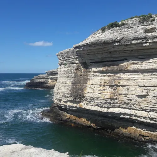
Highlights include Baradendromia, Desa, Bağırganlı Plajı and Kerpe Plajı.
Weather in Kandıra
Forecast from MET Norway (CC BY 4.0). Full forecast
About Kandıra
Kandıra is a municipality and district of Kocaeli Province, Turkey. Its area is 840 km2, and its population is 52,874 (2022). Its neighbours are Kaynarca to the east, Adapazarı to the southeast, İzmit to the south and Şile to the west.
From the Wikipedia article Kandıra (this version), under CC BY-SA 4.0.
Things to do3


Museums and landmarks15

Baradendromia
Monument and historic site · 14.5 km
Ancient city of Bithynia in modern-day Turkey
Desa
Monument and historic site · 1.1 km
Ancient city of Bithynia in modern-day Turkey
Morzapena
Monument and historic site · 2.1 km
Ancient city of Bithynia in modern-day Turkey
Pentephyle
Monument and historic site · 17.0 km
Ancient city of Bithynia in modern-day Turkey
Tenba
Monument and historic site · 13.1 km
Ancient city of Bithynia in modern-day Turkey
Trikomia
Monument and historic site · 15.8 km
Ancient city of Bithynia in modern-day Turkey


3 more on the map.
Parks, trails and playgrounds21






9 more on the map.
Restaurants and cafes25


13 more on the map.
History
Kandıra is first mentioned as Desa(nôn Kômê). The state hospital of Kandıra was founded in 1949.
From the History section of Kandıra on Wikipedia, under CC BY-SA 4.0.
Where to stay7
Churches and places of worship30
Shopping7
Gas and EV charging7
Schools, colleges and libraries5
Healthcare25
Ayşe Erman Eczanesi
Clinic and pharmacy · 13.0 km
46/B şehit ercan karadağ caddesi, Sakarya
Map of Kandıra
145 places. The map loads OpenStreetMap tiles when you open it.
Getting there and nearby towns
Cengiz Topel Havaalanı (KCO) is the nearest airport with scheduled flights listed in OpenStreetMap, 38 km away.
- Adapazarı 38 km southeast, about 38 min by car
- İzmit 39 km southwest, about 39 min by car
- Sapanca 43 km south, about 43 min by car
- Derince 45 km southwest, about 45 min by car
- Körfez 46 km southwest, about 46 min by car
- Karasu 46 km east, about 46 min by car
- Karamürsel 62 km southwest, about 1 h by car
- Pamukova 62 km south, about 1 h by car
- Gebze 68 km southwest, about 1 h 15 min by car
- Sancaktepe 78 km west, about 1 h 15 min by car
Drive times are estimates from straight-line distance, not routes.
Local news
Headlines from INDB.
Reviews, tips and questions
Loading what members have shared...
Sources and licences
- GeoNames (CC BY 4.0): population, coordinates, regions and time zone
- Mapillary (see each image): photos
- OpenStreetMap contributors (ODbL 1.0): places, airports, map data
- Wikidata (CC0 1.0): elevation, founding date, time zone, website, landmarks and historic places
- Wikimedia Commons (see each image): photos
- Wikipedia (CC BY-SA 4.0): overview and history text
Photo credits
- Kerpe Genel Görünüş, Ucandairebaskani, CC BY-SA 4.0
- Kandıra Çarşı Camii (11), Şadi Akdoğan, CC BY 2.0
- Kandıra Çarşı Camii (7), Şadi Akdoğan, CC BY 2.0
- Kocaeli Kandıra Tarihi Şefik Camii, Kocaeli Kameraman Şadi Akdoğan, CC BY-SA 4.0
- Kandıra Çarşı Camii (9), Şadi Akdoğan, CC BY 2.0
- Kandıra Çarşı Camii (10), Şadi Akdoğan, CC BY 2.0
- Kandıra Çarşı Camii (17), Şadi Akdoğan, CC BY 2.0
- Kandıra Zafer Camii (1), Şadi Akdoğan, CC BY 2.0
- Kandıra Çarşı Camii (4), Şadi Akdoğan, CC BY 2.0
- Kandıra Çarşı Camii (16), Şadi Akdoğan, CC BY 2.0
- Kandıra Stadyumu (5), Şadi Akdoğan, CC BY 2.0
- Kandıra Stadyumu (1), Şadi Akdoğan, CC BY 2.0
- Kandıra Çarşı Camii (14), Şadi Akdoğan, CC BY 2.0
- Kandıra Akçakoca Camii, Şadi Akdoğan, CC BY 2.0
- Kandıra tarihi namazgah çayırı güreşleri 2025 16 Temmuz, Şadi Akdoğan, CC BY 4.0
- Kandıra Sanayi Camii (2), Şadi Akdoğan, CC BY 2.0
- Kandıra Sanayi Camii (1), Şadi Akdoğan, CC BY 2.0
- Kandıra Zafer Camii (19), Şadi Akdoğan, CC BY 2.0
- Kandıra Zafer Camii (18), Şadi Akdoğan, CC BY 2.0
- Kandıra Zafer Camii (10), Şadi Akdoğan, CC BY 2.0
- Kandıra Zafer Camii (12), Şadi Akdoğan, CC BY 2.0
- Kandıra Zafer Camii (15), Şadi Akdoğan, CC BY 2.0
- Buffalos in Kandıra, Şadi Akdoğan, CC BY 2.0
- Yusufca village, Kandıra, Kocaeli Province, Şadi Akdoğan, CC BY 2.0
- Akça Koca Bey Anıt Mezarı, Kocaeli Kameraman Şadi Akdoğan, CC BY-SA 4.0
- SUBÜ Kaynarca Seyfettin Selim Meslek Yüksekokulu (2), Jelican9, CC BY-SA 4.0
- Kerpe Plajı 02, Kocaeligönüllüsü, CC BY-SA 4.0
- Bağırganlı Halk Plajı 01, Kocaeligönüllüsü, CC BY-SA 4.0
- Şefik Camii (9), Şadi Akdoğan, CC BY 2.0
- Şefik Camii (1), Şadi Akdoğan, CC BY 2.0
- Şefik Camii (14), Şadi Akdoğan, CC BY 2.0
- Şefik Camii (12), Şadi Akdoğan, CC BY 2.0
- Şefik Camii (2), Şadi Akdoğan, CC BY 2.0
- Şefik Camii (7), Şadi Akdoğan, CC BY 2.0
- Namazgah Kültür Merkezi (2), Şadi Akdoğan, CC BY 2.0
- YELKENCİOĞLU KONAĞI KANDIRA, Kocaeli Kameraman Şadi Akdoğan, CC BY-SA 4.0
- NAMAZGAH BARAJI (6), Şadi Akdoğan, CC BY 4.0
- NAMAZGAH BARAJI (3), Kocaeli Kameraman Şadi Akdoğan, CC BY-SA 4.0
- NAMAZGAH BARAJI (1), Şadi Akdoğan, CC BY 4.0
- NAMAZGAH BARAJI (9), Kocaeli Kameraman Şadi Akdoğan, CC BY-SA 4.0
- Street-level photo, quidam, CC BY-SA 4.0


Page built November 8, 2026. Spotted a mistake? Tell us or suggest a place.