


Sancaktepe, Turkey
Sancaktepe (şehir)
Sancaktepe is a city of 489,848 people in Istanbul, Turkey.
Why visit Sancaktepe
Townapedia lists 4 museums and landmarks, 58 parks and trails, 147 places to eat and 3 places to stay in and around town.
Highlights include Damatrys Sarayı and Sarıgazi Türbesi.
Weather in Sancaktepe
Forecast from MET Norway (CC BY 4.0). Full forecast
About Sancaktepe
Sancaktepe is a municipality and district of Istanbul Province, Turkey. Its area is 63 km2, and its population is 489,848 (2022).
From the Wikipedia article Sancaktepe (this version), under CC BY-SA 4.0.
Museums and landmarks4



Parks, trails and playgrounds58


46 more on the map.
Restaurants and cafes147

Pelikan Balık & Restaurant
Restaurant · Fish, Local, Turkish · 1.4 km
Ulus Caddesi
Mo-Su 10:00-22:00
Open in Google Maps · +90 216 350 37 56; +90 216 311 21 22; +90 530 833 31 63
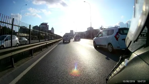

Iftar odun
Bakery · 2.9 km
Mimar sinan caddesi, İstanbul
Mo-Fr 07:00-13:30; Mo-Fr 17:00-20:00
Tarihi Hemşin Pasta Fırını
Bakery · 1.5 km
Atayolu Caddesi, İstanbul
05:30-00:45
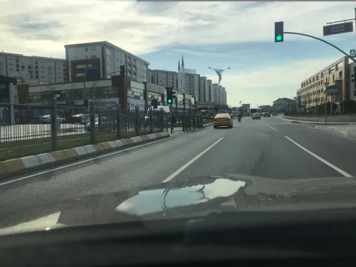
Altın köşk
Bakery · 2.8 km
Mimar sinan caddesi, İstanbul
Mo-Fr 07:00-13:30; Mo-Fr 17:00-20:00
Cemile Sultan Ev Yemekleri
Restaurant · Turkish · 2.9 km
70/A Yakuphan Caddesi, İstanbul

Somuncu baba unlu mamülleri
Bakery · 3.0 km
Mimar sinan caddesi, İstanbul
Mo-Fr 07:00-13:30; Mo-Fr 17:00-20:00
Oruç kardeşler lahmacun
Restaurant · 2.8 km
Mimar sinan caddesi, İstanbul
135 more on the map.
Where to stay3



History
Sancaktepe's oldest historic structure is Damatris Summer Palace that was built by I. Tiberius Konstantinos (578–582) and Maurice (582–602) in Byzantine Age. The Ottoman Empire conquered this area completely in 1328.
From the History section of Sancaktepe on Wikipedia, under CC BY-SA 4.0.
Churches and places of worship52
Shopping87
Gas and EV charging15
Schools, colleges and libraries70
Healthcare99
Begüm Atasoy Eczanesi
Clinic and pharmacy · 2.8 km
13/A-1 Yenice Sokağı, İstanbul
Asrın Deniz Eczanesi
Clinic and pharmacy · 2.7 km
9/A Mehmet Akif Ersoy Caddesi, İstanbul
Buse Melek Eczanesi
Clinic and pharmacy · 3.0 km
29/31A Mehmet Akif Caddesi, İstanbul
Map of Sancaktepe
250 places. The map loads OpenStreetMap tiles when you open it.
Getting there and nearby towns
Sabiha Gökçen International Airport (SAW) is the nearest airport with scheduled flights listed in OpenStreetMap, 14 km away.
- Ümraniye 9 km west, about 9 min by car
- Üsküdar 18 km west, about 18 min by car
- Istanbul 24 km west, about 24 min by car
- Fatih 25 km west, about 25 min by car
- Gebze 28 km southeast, about 28 min by car
- Esenler 30 km west, about 30 min by car
- Bahçelievler 31 km west, about 31 min by car
- Bağcılar 32 km west, about 32 min by car
- Küçükçekmece 39 km west, about 39 min by car
- Arnavutköy 46 km northwest, about 46 min by car
Drive times are estimates from straight-line distance, not routes.
Local news
Headlines from INDB.
Reviews, tips and questions
Loading what members have shared...
Sources and licences
- GeoNames (CC BY 4.0): population, coordinates, regions and time zone
- Mapillary (see each image): photos
- OpenStreetMap contributors (ODbL 1.0): places, airports, map data
- Wikidata (CC0 1.0): elevation, founding date, time zone, website, landmarks and historic places
- Wikimedia Commons (see each image): photos
- Wikipedia (CC BY-SA 4.0): overview and history text
Photo credits
- M5 Sancaktepe Şehir Hastanesi İnşaatı, Alikam1896, CC BY-SA 4.0
- Sancaktepe Şehir Hastanesi İstasyonu TBM Çıkışı, Alikam1896, CC BY-SA 4.0
- M5 Sancaktepe Metro İstasyonu İnşaatı, Alikam1896, CC BY-SA 4.0
- M5 Sancaktepe Metro İstasyonu Giriş İnşaatı, Alikam1896, CC BY-SA 4.0
- Paşaköy trafo merkezi - panoramio - Allen Turner (2), Allen Turner, CC BY-SA 3.0
- Arap Hekim Camii 1761585929, Mkurtel, CC BY-SA 4.0
- Sargazi Trbesi 1761587059, Mkurtel, CC BY-SA 4.0
- Paşaköy trafo merkezi - panoramio - Allen Turner (1), Allen Turner, CC BY-SA 3.0
- Paşaköy trafo merkezi - panoramio, Allen Turner, CC BY-SA 3.0
- Paşaköy trafo merkezi - panoramio - Allen Turner, Allen Turner, CC BY-SA 3.0
- Atik Valide Sultan emesi 1761586917, Mkurtel, CC BY-SA 4.0
- Sargazi Trbesi Su Kuyusu 1761587461, Mkurtel, CC BY-SA 4.0
- Sargazi Trbesi Abdest Teknesi 1761587165, Mkurtel, CC BY-SA 4.0
- Evknihal Usta emesi 1761587333, Mkurtel, CC BY-SA 4.0
- Sarıgazi Metro Nisan23, Alikam1896, CC BY-SA 4.0
- M5 Sarıgazi İstasyonu İnşaatı 08.2022, Alikam1896, CC BY-SA 4.0
- Ateş haris, Haris.wonder, CC BY-SA 4.0
- M5 Samandıra Metro İstasyonu İnşaatı, Alikam1896, CC BY-SA 4.0
- Paşaköy, jobeyub, CC BY-SA 4.0
- Turkish Encyclopedia, Rlmnmmnv, CC BY-SA 4.0
- IMG 0285 - panoramio, hüsamettin_alpaslan, CC BY 3.0
- IMG 0269 Başak - panoramio, hüsamettin_alpaslan, CC BY 3.0
- IMG 0305 - panoramio, hüsamettin_alpaslan, CC BY 3.0
- Turkey 2013, Juan Banda, CC BY 3.0
- ISS065-E-48808 - View of Earth, Earth Science and Remote Sensing Unit , Lyndon B. Johnson Space Center, Public domain
- ISS008-E-20781 - View of Turkey, Earth Science and Remote Sensing Unit , Lyndon B. Johnson Space Center, Public domain
- ISS030-E-222092 - View of Earth, Earth Science and Remote Sensing Unit , Lyndon B. Johnson Space Center, Public domain
- Büyükbakkalköy trafo merkezi - panoramio, Allen Turner, CC BY-SA 3.0
- Anadolu Otoyolu ıstanbul Decamber 2010 - panoramio, Mehrdad Sarhangi, CC BY 3.0
- Çilek Plaza, Yasinsavas, CC0
- Çamlık - panoramio, hüsamettin_alpaslan, CC BY 3.0
- Dikenin himayesindeki güzellik - panoramio, hüsamettin_alpaslan, CC BY 3.0
- Sultanbeyli, Sultanbeyli-İstanbul, Turkey - panoramio - akcakoca 57, akcakoca_57, CC BY-SA 3.0
- Gülün gölgesinde geçti ömrüm - panoramio, hüsamettin_alpaslan, CC BY 3.0
- Istanbul, İstanbul, Turkey - panoramio (8), hüsamettin_alpaslan, CC BY 3.0
- Kumru (Streptopelia senegalensis) - panoramio, hüsamettin_alpaslan, CC BY 3.0
- 23.12.2009 08=32 - panoramio, hüsamettin_alpaslan, CC BY 3.0
- 23.12.2009 08=20 - panoramio, hüsamettin_alpaslan, CC BY 3.0
- Çekmeköy metro m5 line, Alikam1896, CC BY-SA 4.0
- Sığırcık, Lalesar, Akridoter, Hodan (Sturnus vulgaris) - panoramio, hüsamettin_alpaslan, CC BY 3.0
- Street-level photo, unen, CC BY-SA 4.0
- Street-level photo, yolcu, CC BY-SA 4.0
- Street-level photo, yolcu, CC BY-SA 4.0
- Street-level photo, healixx, CC BY-SA 4.0


Page built November 8, 2026. Spotted a mistake? Tell us or suggest a place.