


Why visit Korkuteli
Townapedia lists 1 museum or landmark, 3 parks and trails, 2 places to eat and 3 places to stay in and around town.
Highlights include Isinda.
Weather in Korkuteli
Forecast from MET Norway (CC BY 4.0). Full forecast
About Korkuteli
Korkuteli is a municipality and district of Antalya Province, Turkey. Its area is 2,433 km2, and its population is 56,285 (2022). It is 56 km (35 mi) north-west of the city of Antalya. It was previously called İstanoz or Stenez.
From the Wikipedia article Korkuteli (this version), under CC BY-SA 4.0.
Museums and landmarks1

Isinda
Monument and historic site · 3.0 km
Ancient city of Pisidia in modern-day Turkey
Parks, trails and playgrounds3

Restaurants and cafes2

Seyir Park
Restaurant · Pizza, Burger, Coffee Shop, Chicken, Kebab, International, Turkish, Steak House · 1.3 km
42 100. Yıl Caddesi, Antalya
Mo-Su 09:00-24:00
Where to stay3



History
Buildings of the Roman and Byzantine periods in Korkuteli include the Keşiş Evi ("priest's house") and the building that later became the Hamidoglu Medrese, which has Latin inscriptions.
The area was taken from the Byzantines by the Seljuk Turks of Gıyaseddin Keyhüsrev I in 1207, and was used as a summer residence by the local Seljuk rulers. Seljuk architecture in Korkuteli includes the mosque of Sultan Alaadin and some hamams ("Turkish baths") and tombs.
Upon the decline of the Seljuks in the early 14th century the area became a stronghold of the Beylik of Teke and then of the Hamidid clan of nearby Isparta. Bayezid I brought the district into the Ottoman Empire in 1392.
From the History section of Korkuteli on Wikipedia, under CC BY-SA 4.0.
Churches and places of worship13
Schools, colleges and libraries1
Healthcare22
Map of Korkuteli
45 places. The map loads OpenStreetMap tiles when you open it.
Getting there and nearby towns
Antalya Airport (AYT) is the nearest airport with scheduled flights listed in OpenStreetMap, 56 km away.
- Kargalık 2 km southwest, about 2 min by car
- İmrahor 2 km southeast, about 2 min by car
- Tatköy 5 km southeast, about 5 min by car
- Akyar 11 km north, about 11 min by car
- Ulucak 11 km southwest, about 11 min by car
- Sülekler 13 km northwest, about 13 min by car
- Antalya 48 km east, about 48 min by car
- Muratpaşa 54 km east, about 54 min by car
- Serik 82 km east, about 1 h 15 min by car
- Isparta 84 km north, about 1 h 30 min by car
Drive times are estimates from straight-line distance, not routes.
Local news
Headlines from INDB.
Reviews, tips and questions
Loading what members have shared...
Sources and licences
- GeoNames (CC BY 4.0): population, coordinates, regions and time zone
- Mapillary (see each image): photos
- OpenStreetMap contributors (ODbL 1.0): places, airports, map data
- Wikidata (CC0 1.0): elevation, founding date, time zone, website, landmarks and historic places
- Wikimedia Commons (see each image): photos
- Wikipedia (CC BY-SA 4.0): overview and history text
Photo credits
- Korkuteli; Tarihi Hamam; 13. Jahrhundert, Christian1311, CC BY-SA 4.0
- Isinda Zeus, Hermann Junghans, CC BY-SA 3.0 de
- Diren SOMA, Cobija, CC BY-SA 4.0
- Antalyaspor bayrak, Cobija, CC BY-SA 4.0
- Road from Antalya to Denizli - panoramio (3), Andrej Kuźniečyk, CC BY-SA 3.0
- 20180112 DenizliHwy 5619 (26256067108), Ray Swi-hymn from Sijhih-Taipei, Taiwan, CC BY-SA 2.0
- Сельскохозяйственное - panoramio, karel291, CC BY 3.0
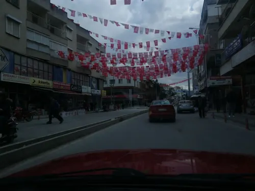
- Street-level photo, nazif, CC BY-SA 4.0
- Street-level photo, nazif, CC BY-SA 4.0
- Street-level photo, nazif, CC BY-SA 4.0

Page built November 8, 2026. Spotted a mistake? Tell us or suggest a place.