


Why visit Sivaslı
Townapedia lists 10 museums and landmarks and 3 attractions in and around town.
Highlights include Burgaz Dağı, Babdalai and Clannuda.
Weather in Sivaslı
Forecast from MET Norway (CC BY 4.0). Full forecast
About Sivaslı
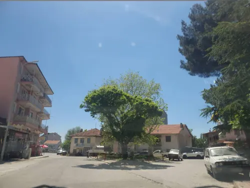
Sivaslı, formerly known as Sebaste (Greek: Σεβαστή) is a town in Uşak Province in the inner Aegean region of Turkey. It is the seat of Sivaslı District. Its population is 7,082 (2022). Sebaste ancient city area is 2 km (1.2 mi) away from Sivaslı town center today.
From the Wikipedia article Sivaslı (this version), under CC BY-SA 4.0.
Things to do3


Museums and landmarks10

Babdalai
Monument and historic site · 13.5 km
Ancient city of Phrygia, in modern-day Turkey
Clannuda
Monument and historic site · 2.3 km
Ancient city of Phrygia in modern-day Turkey
Sebaste
Monument and historic site · 2.3 km
Ancient city of Phrygia in modern-day Turkey
Vardar Malikhanesi
Monument and historic site · 14.3 km
Vardar Malikhanesi, Köy evi. Özel Güvenlik Bölgesi
Hacım Köyü İç Yolu (Vardar Sokak) Nu:2
Çilehane
Monument and historic site · 14.2 km
Hacım Sultan müridlerinden Derviş BURHAN ve Odman BABA kabirleri bulunmaktadır. Dev bir çıtlık ağacı ile efsanesi süren Dut ağacı...
Hacım Sultan Boğasının Ayak İzleri
Monument and historic site · 14.3 km
Hacım Sultan Boğasının Ayak İzleri
Sarı Seyit Kabri
Monument and historic site · 14.4 km
Hacım Sultan müridlerinden Sarı Seyit'in mezarı
Churches and places of worship1

Shopping1


Gas and EV charging2
Schools, colleges and libraries9
Healthcare9
Map of Sivaslı
35 places. The map loads OpenStreetMap tiles when you open it.
Getting there and nearby towns
Uşak Havalimanı (USQ) is the nearest airport with scheduled flights listed in OpenStreetMap, 28 km away.
- Banaz 27 km north, about 27 min by car
- Uşak 31 km northwest, about 31 min by car
- Sandıklı 51 km east, about 51 min by car
- Sinanpaşa 56 km northeast, about 56 min by car
- Dinar 64 km southeast, about 1 h by car
- Bozkurt 75 km south, about 1 h 15 min by car
- Afyonkarahisar 80 km east, about 1 h 15 min by car
- Pamukkale 82 km southwest, about 1 h 15 min by car
- Senirkent 87 km southeast, about 1 h 30 min by car
- Simav 90 km northwest, about 1 h 30 min by car
Drive times are estimates from straight-line distance, not routes.
Local news
Headlines from INDB.
Reviews, tips and questions
Loading what members have shared...
Sources and licences
- GeoNames (CC BY 4.0): population, coordinates, regions and time zone
- Mapillary (see each image): photos
- OpenStreetMap contributors (ODbL 1.0): places, airports, map data
- Wikidata (CC0 1.0): elevation, founding date, time zone, website, landmarks and historic places
- Wikimedia Commons (see each image): photos
- Wikipedia (CC BY-SA 4.0): overview and history text
Photo credits
- Sebaste Ruins Sivasli UsakProvince Turkey, Arif Solak at http://www.wowturkey.com, CC BY 2.5
- BULKAZ DAĞLARI, Acar54, CC BY-SA 4.0
- ISS053-E-9781 - View of Earth, Earth Science and Remote Sensing Unit , Lyndon B. Johnson Space Center, Public domain
- Tatar ev - panoramio, Gökceler, CC BY-SA 3.0
- ISS065-E-414235 - View of Earth, Earth Science and Remote Sensing Unit , Lyndon B. Johnson Space Center, Public domain
- ISS065-E-420089 - View of Earth, Earth Science and Remote Sensing Unit , Lyndon B. Johnson Space Center, Public domain
- ISS065-E-420090 - View of Earth, Earth Science and Remote Sensing Unit , Lyndon B. Johnson Space Center, Public domain
- ISS053-E-9780 - View of Earth, Earth Science and Remote Sensing Unit , Lyndon B. Johnson Space Center, Public domain
- Street-level photo, VoSToK, CC BY-SA 4.0
- Street-level photo, VoSToK, CC BY-SA 4.0
- Street-level photo, VoSToK, CC BY-SA 4.0


Page built November 8, 2026. Spotted a mistake? Tell us or suggest a place.