
Why visit Uluborlu
Townapedia lists 2 museums and landmarks and 1 place to stay in and around town.
Highlights include Sozopolis.
Weather in Uluborlu
Forecast from MET Norway (CC BY 4.0). Full forecast
About Uluborlu
Uluborlu is a town in Isparta Province in the Mediterranean Region of Turkey. It is the seat of [] and has a population of 5,635 (2022). Uluborlu has been identified as the ancient town of Sozopolis.
From the Wikipedia article Uluborlu (this version), under CC BY-SA 4.0.
Museums and landmarks2

Where to stay1

Churches and places of worship3

Healthcare3


History
Throughout history, Uluborlu has been on the military and commercial crossroads of Asia minor which has shaped its character. The settlement is known from prehistoric times and was called either Sozopolis or Apollonia. In early historic times it was part of Phrygia.
It fell to Alexander the Great in the 330s BC. Following Alexander's death it passed to the Asian arm of the Seleucid Empire and then the Attalid kingdom (188–133 BC) for 130 years. Subsequently, it was ceded to the Romans and formed part of the province of Asia until the division of the Roman Empire in 395 AD. Sozopolis remained then part of the Byzantine Empire until 1074 when it passed into the hands of the Seljuk Turks, though returning briefly to Byzantine control in the years 1119-1120. In 1403 Timur seized the city and its men were killed as retribution for their defence of the city, while the women and children were taken captive.
During the Ottoman period of the 15th and 16th centuries Uluborlu prospered and supported the new dynasty.
Hamid Sanjak held the first census of Uluborlu in 1831. In 1911 Uluborlu suffered a great fire. In 1963 the municipality of Uluborlu was established.
From the History section of Uluborlu on Wikipedia, under CC BY-SA 4.0.
Map of Uluborlu
9 places. The map loads OpenStreetMap tiles when you open it.
Getting there and nearby towns
Isparta Süleyman Demirel Airport (ISE) is the nearest airport with scheduled flights listed in OpenStreetMap, 26 km away.
- Senirkent 9 km east, about 9 min by car
- Gönen 15 km south, about 15 min by car
- Kadılar 14 km north, about 14 min by car
- Dinar 25 km west, about 25 min by car
- Isparta 36 km south, about 36 min by car
- Burdur 42 km south, about 42 min by car
- Sandıklı 46 km north, about 46 min by car
- Afyonkarahisar 76 km north, about 1 h 15 min by car
- Çay 76 km northeast, about 1 h 15 min by car
- Bolvadin 88 km northeast, about 1 h 30 min by car
Drive times are estimates from straight-line distance, not routes.
Local news
Headlines from INDB.
Reviews, tips and questions
Loading what members have shared...
Sources and licences
- GeoNames (CC BY 4.0): population, coordinates, regions and time zone
- Mapillary (see each image): photos
- OpenStreetMap contributors (ODbL 1.0): places, airports, map data
- Wikidata (CC0 1.0): elevation, founding date, time zone, website
- Wikipedia (CC BY-SA 4.0): overview and history text
Photo credits
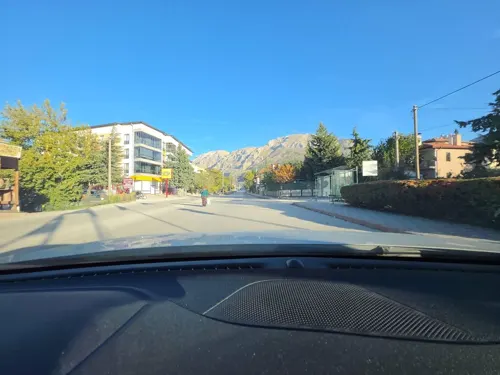
- Street-level photo, worms, CC BY-SA 4.0
Page built November 8, 2026. Spotted a mistake? Tell us or suggest a place.