


Bagamoyo, Tanzania
Bagamoyo (mji)
Bagamoyo is a town of 82,426 people in Pwani, Tanzania.
Why visit Bagamoyo
Townapedia lists 13 museums and landmarks, 1 park or trail, 18 places to eat, 27 places to stay and 1 attraction in and around town.
Highlights include Roman Catholic Museum.
Weather in Bagamoyo
Forecast from MET Norway (CC BY 4.0). Full forecast
About Bagamoyo
Bagamoyo (Mji wa Bagamoyo, in Swahili) is a historic coastal town and capital of Bagamoyo District in the Pwani Region of Tanzania. Much of the settlement was founded at the end of the 18th century, though it is an extension of a much older (8th century) Swahili settlement, Kaole. It was chosen as the capital of German East Africa by the German colonial administration and it became one of the most important trading ports for the Germans along the East African coast along the west of the Indian Ocean in the late 19th and early 20th century. Bagamoyo lies 75 kilometres (47 miles) north of Dar-es-Salaam on the coast of the Zanzibar Channel, across from the island of Zanzibar.
From the Wikipedia article Bagamoyo (this version), under CC BY-SA 4.0.
Travel tips from other travellers: Bagamoyo on Wikivoyage (CC BY-SA 4.0).
Photos of Bagamoyo


Things to do1

Museums and landmarks13
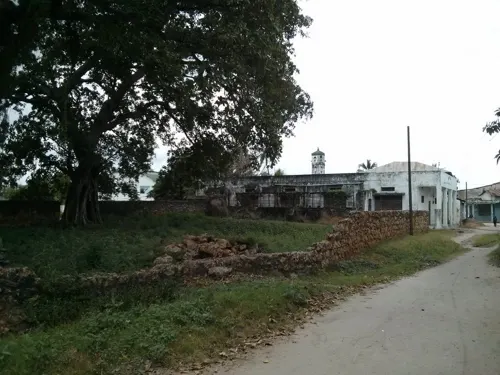
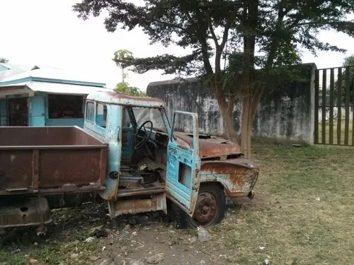
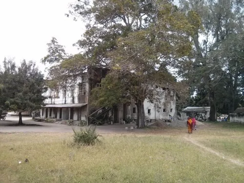


Mission Cross (msalabani)
Monument and historic site · 1.1 km
Commemorative cross
1 more on the map.
Parks, trails and playgrounds1

Restaurants and cafes18
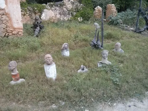
Nashe's Café
Restaurant · African, Grill, Crepe, Coffee Shop, Pasta, Noodles, Diner, Chicken, Fish, Breakfast, Seafood, Local, Italian, Barbecue


Fresh Pizza - best Italian pizza in town!
Restaurant · African, Italian Pizza, Italian
Tu-Su 10:00-21:00
The Funky Squid's Beach Bar & Grill
Restaurant · Regional, Seafood, Pasta, Pizza, Burger, Fish, Grill · 1.2 km

6 more on the map.
History
The original settlement, Kaole, was founded c. 800 CE, and grew into an important trading town by the 13th century. The Kaole Ruins contain the remnants of two mosques and 30 tombs, dated back to the 13th century. Until the 18th century, Bagamoyo, the settlement 5 kilometres (3 mi) north of Kaole, was a small trading center where most of the population were fishermen and farmers. Their main trading goods were fish, salt and gum, among others. Around the 17th century this area began growing in prosperity and by the 18th century it was an important stop in the caravan and slave trade, acquiring the name Bagamoyo. It became the most important trading entrepot of the east central coast of Africa in the late 19th century.
In the late 18th century, Muslim families settled in Bagamoyo, all of which were relatives of Shamvi la Magimba in Oman. They made their living by enforcing taxes on the native population and by trading in salt, gathered from the Nunge coast north of Bagamoyo.
Read more of the history
In the first half of the 19th century, Bagamoyo became a trading port for ivory and slave, with traders coming from the African interior – places as far as Morogoro, Lake Tanganyika and Usambara- on their way to Zanzibar. This explains the meaning of the word Bagamoyo ("Bwaga-Moyo") which means "Lay down your Heart" in Swahili. It is disputed whether this refers to the slave trade which passed through the town (i.e. "give up all hope") or to the porters who rested in Bagamoyo after carrying 16-kilogram (35 lb) cargoes on their shoulders from the Great Lakes region (i.e. "take the load off and rest"). There is considerable debate regarding the extent of the slave trade as a major export in Bagamoyo, with archival analysis suggesting that ivory was the primary export over slaves, and that many of the caravan porters on the ivory route were free wage laborers as opposed to slaves. However, the history of the slave trade features prominently in the shared culture of its residents and organizations such as UNESCO emphasize its importance as a cultural heritage site memorializing the slave trade in East Africa.
The slave trade in East Africa was officially prohibited in the year 1873, but continued surreptitiously to the end of the 19th century.
In 1868, Bagamoyo local rulers, known as majumbe, presented the Catholic "Fathers of the Holy Ghost" with land for a mission north of the town, the first mission in East Africa. This caused resistance by the native Zaramo people which was mediated by representatives of Sultan Majid and, after 1870, by Sultan Barghash. Originally the mission was intended to house children who were rescued from slavery, but it soon expanded to a church, a school, and some workshops and farming projects.
But Bagamoyo was not only a trade centre for ivory and copra; it was also a starting point for renowned European explorers. From Bagamoyo they moved out to find the source of the River Nile and explored the African inner lakes. Some of these were Richard Francis Burton, John Hanning Speke, Henry Morton Stanley and James Augustus Grant. Although often believed so, David Livingstone had never been to Bagamoyo in his lifetime. Only after his death he was laid out in the Old Church's tower (nowadays named Livingston Tower) to wait for the high tide to come in and ship his body to Zanzibar.
Bagamoyo was the first capital of the colony while serving as the German headquarters of German East Africa (first under the auspices of the German East African Company and then the German Imperial Government) between 1886–1891. Dar es Salaam became the new capital of the colony in 1891. The town was apparently where SS-Oberführer Julian Scherner was born in 1895. When the German Empire decided to build a narrow gauge railway from Dar es Salaam into the interior in 1905, Bagamoyo's importance began to decline.
In the East African campaign of World War I, British and Empire forces attacked Bagamoyo in August 1916. The Royal Navy bombarded the town with the protected cruiser HMS Talbot on 1 August and battleship HMS Vengeance on 4 August.
Before dawn on 15 August a flotilla anchored off Bagamoyo that included Vengeance, the protected cruiser Challenger, the monitors Severn and Mersey, the armed merchant cruiser Himalaya, and several auxiliary ships. The Royal Navy landed a force of 176 armed sailors, 65 Royal Marines and 55 Zanzibar Rifles to attack the town.
A kite balloon flown by HMS Manica directed a naval bombardment of German positions ashore. A seaplane from Himalaya bombed German trenches in the town, and then assisted in directing naval gunnery.
The Imperial German Army defended Bagamoyo with 60 German troops and 350 Askari Schutztruppe, commanded by German officers. However, many of the defenders were at Mtoni, about 6 kilometres (4 mi) west of Bagamoyo, defending a crossing over the Kingani River.
The German defences of Bagamoyo included trenches along the shore, around the Arab and German forts, and on a hill just south of the town. German artillery included at least two small field guns on the shore, plus one of the 105 mm naval guns that had been salvaged from the cruiser SMS Königsberg, and installed in an emplacement on the hill with 100 rounds of ammunition.
Königsberg's gun engaged the monitors Severn and Mersey, which were some distance out to sea, but it could not be lowered enough to engage vessels nearer the shore. Three smaller Royal Navy vessels, including the armed tugboat HMS Helmuth, got within 500 metres of the German gun and opened fire on it with their 3-pounder guns. A British machine gun section then attacked the hill, eventually forcing the German artillerymen to abandon their gun and retreat. This was the first of Königsberg's guns to be captured by British forces.
From the History section of Bagamoyo on Wikipedia, under CC BY-SA 4.0.
Notable people from Bagamoyo
 Sewa Haji ParooTanzanian philanthropist (1851-1897)Photo: Unknown author, CC BY 4.0
- Julian SchernerGerman politician (1895-1945)
Born in Bagamoyo, according to Wikidata (CC0). Each name links to its Wikipedia article.
Where to stay27
Churches and places of worship5
Shopping5
Gas and EV charging3
Schools, colleges and libraries17
Healthcare4
Map of Bagamoyo
94 places. The map loads OpenStreetMap tiles when you open it.
Getting there and nearby towns
Abeid Amani Karume International Airport (ZNZ) is the nearest airport with scheduled flights listed in OpenStreetMap, 43 km away.
- Mapinga 25 km southeast, about 25 min by car
- Mvomero 34 km northwest, about 34 min by car
- Mlandizi 34 km southwest, about 34 min by car
- Kibaha 36 km south, about 36 min by car
- Zanzibar 45 km northeast, about 45 min by car
- Bububu 51 km northeast, about 51 min by car
- Kisarawe 54 km south, about 54 min by car
- Koani Ndogo 54 km northeast, about 54 min by car
- Koani 54 km northeast, about 54 min by car
- Dar es Salaam 59 km southeast, about 59 min by car
Drive times are estimates from straight-line distance, not routes.
Towns near Bagamoyo


Keep exploring
Local news
Headlines from INDB.
Reviews, tips and questions
Loading what members have shared...
Sources and licences
- GeoNames (CC BY 4.0): population, coordinates, regions and time zone
- Mapillary (see each image): photos
- OpenStreetMap contributors (ODbL 1.0): places, airports, map data
- Wikidata (CC0 1.0): elevation, founding date, time zone, website
- Wikimedia Commons (see each image): photos
- Wikipedia (CC BY-SA 4.0): overview and history text
Photo credits
- Bagamoyo ruins 2007, Geir Kiste, CC BY-SA 3.0
- Swahili door 3 in Bagamoyo, Pwani, Mangapwani, CC BY-SA 4.0
- Swahili door in Bagamoyo, Pwani, Mangapwani, CC BY-SA 4.0
- Near Bagamoyo Port, Mangapwani, CC BY-SA 4.0
- Swahili architecture in Bagamoyo, Pwani, Mangapwani, CC BY-SA 4.0
- Classic Bagamoyo Street in Bagamoyo, Pwani, Mangapwani, CC BY-SA 4.0
- Swahili door 2 in Bagamoyo, Pwani, Mangapwani, CC BY-SA 4.0
- Swahili house, Bagamoyo, Mangapwani, CC BY-SA 4.0
- A visit to Bagamoyo (3084035273), mwanasimba from La Réunion, CC BY-SA 2.0
- Bagamoyo (3182279746), mwanasimba from La Réunion, CC BY-SA 2.0
- Bagamoyo (3181960876), mwanasimba from La Réunion, CC BY-SA 2.0
- Bagamoyo (3181958206), mwanasimba from La Réunion, CC BY-SA 2.0
- Bagamoyo (3181129315), mwanasimba from La Réunion, CC BY-SA 2.0
- Bagamoyo (3181958956), mwanasimba from La Réunion, CC BY-SA 2.0
- Bagamoyo (3181961964), mwanasimba from La Réunion, CC BY-SA 2.0
- Bagamoyo (3181963408), mwanasimba from La Réunion, CC BY-SA 2.0
- Bagamoyo (3181958678), mwanasimba from La Réunion, CC BY-SA 2.0
- Bagamoyo (3181445229), mwanasimba from La Réunion, CC BY-SA 2.0
- Bagamoyo (3181125719), mwanasimba from La Réunion, CC BY-SA 2.0
- Bagamoyo (3182279292), mwanasimba from La Réunion, CC BY-SA 2.0
- Bagamoyo (3181960476), mwanasimba from La Réunion, CC BY-SA 2.0
- Bagamoyo (3181962422), mwanasimba from La Réunion, CC BY-SA 2.0
- Bagamoyo (3181959984), mwanasimba from La Réunion, CC BY-SA 2.0
- Bagamoyo Mission building (3084873200), mwanasimba from La Réunion, CC BY-SA 2.0
- Bagamoyo (3181444907), mwanasimba from La Réunion, CC BY-SA 2.0
- Bagamoyo (3181961348), mwanasimba from La Réunion, CC BY-SA 2.0
- Bagamoyo beach (3084874714), mwanasimba from La Réunion, CC BY-SA 2.0
- Phelsuma dubia 112792516, Kseniia Marianna Prondzynska, CC BY 4.0
- Phelsuma dubia 112792701, Kseniia Marianna Prondzynska, CC BY 4.0
- Eneo la ndani la Ikulu B, Jacobgijjah, CC BY-SA 4.0
- Chumba ndani ya Ikulu B, Jacobgijjah, CC BY-SA 4.0
- Chumba ndani ya Ikulu A, Jacobgijjah, CC BY-SA 4.0
- Eneo la ndani la Ikulu A, Jacobgijjah, CC BY-SA 4.0
- Ikulu ya kale B, Jacobgijjah, CC BY-SA 4.0
- Nyumba iitwayo Liku B, Jacobgijjah, CC BY-SA 4.0
- Nyumba iitwayo Liku A, Jacobgijjah, CC BY-SA 4.0
- Nyumba iitwayo Liku C, Jacobgijjah, CC BY-SA 4.0
- Nyumba iitwayo Liku D, Jacobgijjah, CC BY-SA 4.0
- Eneo la watumwa C, Jacobgijjah, CC BY-SA 4.0
- Eneo la watumwa B, Jacobgijjah, CC BY-SA 4.0
- Street-level photo, janvanbekkum, CC BY-SA 4.0
- Street-level photo, janvanbekkum, CC BY-SA 4.0
- Street-level photo, janvanbekkum, CC BY-SA 4.0
- Street-level photo, janvanbekkum, CC BY-SA 4.0
- Street-level photo, janvanbekkum, CC BY-SA 4.0
- Street-level photo, janvanbekkum, CC BY-SA 4.0


Page built November 10, 2026. Spotted a mistake? Tell us or suggest a place.