


Upper Nyack, New York
Upper Nyack is a village of 1,991 people in Rockland County, New York, founded in 1872.
Why visit Upper Nyack
Townapedia lists 18 museums and landmarks, 5 parks and trails, 2 places to eat and 1 attraction in and around town.
Highlights include Hook Mountain, Brookside, Carson McCullers House and Nyack Beach State Park.
July is the warmest month, with average highs of 86°F; January lows average 23°F, and about 33 inches of snow fall in a normal year.
Weather in Upper Nyack
Forecast from the National Weather Service. Full forecast
About Upper Nyack
Upper Nyack (pronounced , NY-ak) is a village incorporated in 1872 in the town of Clarkstown, Rockland County, New York, United States. It is located north of the village of Nyack, east of Valley Cottage, south of Rockland Lake State Park, and west of the Hudson River. As of the 2020 census, Upper Nyack had a population of 2,015.
From the Wikipedia article Upper Nyack, New York (this version), under CC BY-SA 4.0.
Things to do1

Museums and landmarks18

Brookside
Monument and historic site · National Register of Historic Places · 1.1 mi
Historic home located at Upper Nyack, Rockland County, New York

Carson McCullers House
Monument and historic site · National Register of Historic Places · 2.5 mi
Historic home museum of writer Carson McCullers, in Nyack, New York, USA

Edward Hopper Birthplace and Boyhood Home
Monument and historic site · National Register of Historic Places · 2.0 mi
Historic house museum in Nyack, New York

Jug Tavern
Monument and historic site · National Register of Historic Places · 3.0 mi
Historic structure in Ossining, New York, United States
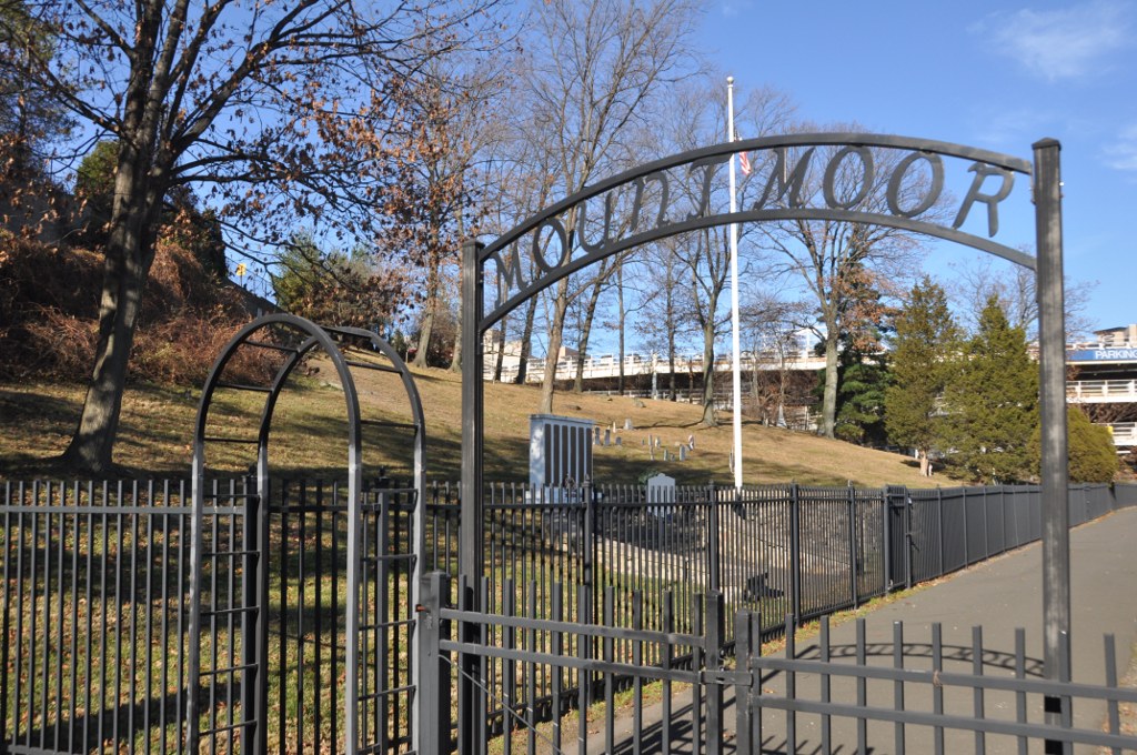
Mount Moor African-American Cemetery
Monument and historic site · National Register of Historic Places · 3.0 mi
Historic cemetery in Rockland County, New York, US

Philipsburg Manor House
Monument and historic site · National Register of Historic Places · 3.4 mi
Historic house in New York, United States

Philipse Manor
Monument and historic site · National Register of Historic Places · 2.8 mi
Railway station in Sleepy Hollow, the United States of America

Ross-Hand Mansion
Monument and historic site · National Register of Historic Places · 2.5 mi
South Nyack, New York, listed on the NRHP in New York

Scarborough Historic District
Monument and historic site · National Register of Historic Places · 2.9 mi
Historic district in Briarcliff Manor, New York

Shadowcliff
Monument and historic site · National Register of Historic Places · 0.9 mi
Historic home located at Upper Nyack, Rockland County, New York


Sleepy Hollow Cemetery
Monument and historic site · National Register of Historic Places · 3.1 mi
Cemetery in Sleepy Hollow, New York

Tarrytown Light
Lighthouse · National Register of Historic Places · 3.2 mi
Lighthouse in New York, United States
6 more on the map.
Parks, trails and playgrounds5

Peabody Preserve
Park · 2.8 mi
Natural preserve in Sleepy Hollow, New York, United States


Restaurants and cafes2

Golden Mushroom
Restaurant · Asian · 1.2 mi
425 North Highland Avenue, Nyack
Mo-Th 11:00-21:30, Fr-Sa 11:00-22:30, Su 12:00-21:30
Little Vietnam
Restaurant · Vietnamese · 1.5 mi
327 North Highland Avenue, Nyack
Mo,We-Su 11:30-15:00,17:00-21:00
History
Upper Nyack was incorporated in 1872. Two hundred years prior, Claus Jansen Purarent of Bergen Township (now Jersey City) received a patent from Governor Phillip Carteret for 640 acres (260 ha) of land north of Tappan. Jansen sold 100 acres (40 ha) to Dowe Harmensen Tallman, and the rest was inherited by his son Cornelius Clausen, who assumed the surname of Kuyper (Cooper). Kuyper was an outstanding public servant in the County of Orange. The first Upper Nyacker also commanded the first company of militia in the county. He died in 1731 and is buried in the Upper Nyack Burial Grounds.
Following the extension of the Northern Railroad of New Jersey into the area in the mid-19th century, rapid growth ensued. Town government no longer being seen as an effective means of dealing with the needs of Nyack proper, village incorporation was discussed. Fearing higher taxes, those in what would have become the northern part of Nyack village formed their own municipal corporation first, named Upper Nyack. Nyack village still incorporated, too, although without this northern portion.
From the History section of Upper Nyack, New York on Wikipedia, under CC BY-SA 4.0.
Churches and places of worship6
First Methodist Episcopal Church of Nyack
Church · National Register of Historic Places · 1.3 mi
Former Wayside Chapel
Church · National Register of Historic Places · 3.3 mi
Old Dutch Church of Sleepy Hollow
Church · National Register of Historic Places · 3.3 mi
St. Paul's United Methodist Church
Church · National Register of Historic Places · 2.4 mi
Shopping1
Schools, colleges and libraries43
Clarkstown South Senior High School
School · 3.8 mi
31 Demarest Mill Rd, West Nyack
Map of Upper Nyack
76 places. The map loads OpenStreetMap tiles when you open it.
Climate by month
Monthly table
| Month | High | Low | Rain | Snow |
|---|---|---|---|---|
| Jan | 40°F | 23°F | 3.9 in | 9.4 in |
| Feb | 43°F | 24°F | 3.3 in | 10.9 in |
| Mar | 51°F | 31°F | 4.4 in | 5.8 in |
| Apr | 63°F | 40°F | 4.3 in | 0.7 in |
| May | 73°F | 50°F | 4.3 in | 0.0 in |
| Jun | 81°F | 59°F | 4.6 in | 0.0 in |
| Jul | 86°F | 64°F | 4.5 in | 0.0 in |
| Aug | 84°F | 63°F | 4.4 in | 0.0 in |
| Sep | 77°F | 56°F | 4.6 in | 0.0 in |
| Oct | 65°F | 45°F | 4.4 in | 0.0 in |
| Nov | 54°F | 36°F | 3.9 in | 0.3 in |
| Dec | 44°F | 29°F | 4.7 in | 5.6 in |
U.S. Climate Normals 1991-2020 for Dobbs Ferry-Ardsley Hcn (9 mi away), NOAA NCEI.
People and cost of living
American Community Survey 5-year estimates, 2020-2024, U.S. Census Bureau. Estimates have margins of error, larger for small towns.
Disaster history
Rockland County has had 20 federal disaster declarations since 2000, most often for hurricanes.
- 2023-07-22: Severe Storms And Flooding (Severe Storm)
- 2021-09-05: Remnants Of Hurricane Ida (Hurricane)
- 2021-09-02: Remnants Of Hurricane Ida (Hurricane)
- 2021-08-22: Hurricane Henri (Hurricane)
- 2020-10-02: Tropical Storm Isaias (Hurricane)
- 2020-03-20: Covid-19 Pandemic (Biological)
OpenFEMA disaster declarations summaries.
Getting there and nearby towns
Westchester County Airport (HPN) is the nearest airport with scheduled flights listed in OpenStreetMap, 11 miles away.
- Sleepy Hollow 3 mi southeast, about 4 min by car
- Ossining 3 mi northeast, about 5 min by car
- Haverstraw 4 mi northwest, about 7 min by car
- Tarrytown 4 mi southeast, about 7 min by car
- New City 5 mi northwest, about 8 min by car
- Nanuet 6 mi west, about 9 min by car
- Sparkill 6 mi south, about 10 min by car
- Pearl River 7 mi southwest, about 10 min by car
- Spring Valley 7 mi west, about 12 min by car
- West Haverstraw 7 mi northwest, about 11 min by car
Drive times are estimates from straight-line distance, not routes.
Local news
Headlines from INDB, the NEMICO news database.
Reviews, tips and questions
Loading what members have shared...
Sources and licences
- NCES EDGE (Public domain): public schools
- NOAA NCEI U.S. Climate Normals 1991-2020 (Public domain): climate by month
- OpenFEMA (Public domain): disaster declarations
- OpenStreetMap contributors (ODbL 1.0): places, airports, map data
- U.S. Census Bureau (Public domain): population, income, housing, education, commute
- Wikidata (CC0 1.0): elevation, founding date, time zone, website, landmarks and historic places
- Wikimedia Commons (see each image): photos
- Wikipedia (CC BY-SA 4.0): overview and history text
Photo credits
- First Methodist Episcopal Church of Nyack 4, David Rivera, CC BY-SA 3.0
- Edward Hopper`s birthplace Nyack, Ritzel, CC BY-SA 3.0
- SleepyHollowNY-entrance, Midnightdreary, Public domain
- Shadowcliff Shadowcliff, also known as the Fellowship of Reconciliation Headquarters, is a historic home located at Upper Nyack, Rockland County, New York, Jimstu8, CC BY-SA 3.0
- Jug Tavern, Ossining, NY, Daniel Case, CC BY-SA 3.0
- Woodlea in Briarcliff Manor (3), Ɱ, CC0
- St. Paul's United Methodist Church, David Rivera, CC BY-SA 3.0
- SouthNyackNY RossHandMansion, User:Magicpiano, CC BY-SA 4.0
- SouthNyackNY CarsonMcCullersHouse, User:Magicpiano, CC BY-SA 4.0
- VAN HOUTEN'S LANDING HISTORIC DISTRICT, ROCKLAND COUNTY NY, JERRYE & ROY KLOTZ, M.D., CC BY-SA 4.0
- GrandViewOnHudsonNY FormerWaysideChapel, User:Magicpiano, CC BY-SA 4.0
- Old Dutch Church taken by James Russiello, The original uploader was James Russiello at English Wikipedia ., CC BY-SA 3.0
- Philipsburg Manor 3, Gryffindor, CC BY-SA 3.0
- Upper Nyack Firehouse, David Rivera, CC BY-SA 3.0
- Brookside-Lochbourn, Izzy406, CC BY-SA 3.0
- Philipse Manor, NY, train station, Daniel Case, CC BY-SA 3.0
- WestNyackNY MountMoorCemetery 01, User:Magicpiano, CC BY-SA 4.0
- Nyack, NY, post office, Daniel Case, CC BY-SA 3.0
- TappanZeePlayhouse, A. O'Brien, Public domain
- 9.6.07PalisadesCenterMallFoodCourtbyLuigiNovi, Nightscream at English Wikipedia, CC BY-SA 2.5
- Philipsburg Manor, Sleepy Hollow, New York, The original uploader was Daderot at English Wikipedia ., CC BY-SA 3.0


Page built October 30, 2026. Spotted a mistake? Tell us or suggest a place.