


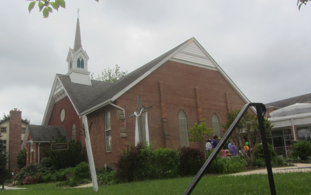


West Laurel, Maryland
West Laurel is a community of 4,428 people in Prince George's County, Maryland.
Why visit West Laurel
Townapedia lists 4 museums and landmarks, 13 parks and trails, 2 places to eat and 1 place to stay in and around town.
Highlights include Avondale Mill, Laurel station, Dinosaur Park and High Ridge Park.
July is the warmest month, with average highs of 89°F; January lows average 26°F.
Weather in West Laurel
Forecast from the National Weather Service. Full forecast
About West Laurel
West Laurel is an unincorporated area and census-designated place (CDP) in Prince George's County, Maryland, United States. Per the 2020 census, the population was 4,428.
From the Wikipedia article West Laurel, Maryland (this version), under CC BY-SA 4.0.
Museums and landmarks4

Avondale Mill
Monument and historic site · National Register of Historic Places · 2.6 mi
United States historic place

Laurel station
Monument and historic site · National Register of Historic Places · 2.9 mi
Train station in Laurel, Maryland, US

Old Laurel High School
Monument and historic site · National Register of Historic Places · 2.1 mi

Parks, trails and playgrounds13


Dinosaur Park
Park · 3.4 mi
Park in Maryland, United States of America

Supplee Lane Recreation Area
Park · 0.7 mi
16904 Supplee Lane, Laurel
Mo-Su 07:00-19:00

1 more on the map.
Restaurants and cafes2

La Curva Tex-Mex Bar & Grill
Restaurant · Grill, Mexican, Peruvian · 1.3 mi
15107 Sweitzer Lane
Su-Th 11:00-23:00; Fr-Sa 11:00-00:00
Tubby's Diner & Liquors
Restaurant · 1.2 mi
Diner front , bar liquor store in back
5701 Sandy Spring Road
Where to stay1

History
As of the 2010 U.S. census some areas previously defined by the U.S. Census Bureau as "West Laurel" were put in a new CDP, Konterra.
From the History section of West Laurel, Maryland on Wikipedia, under CC BY-SA 4.0.
Churches and places of worship10
Trinity Reformed Presbyterian Church
Church · Presbyterian · 1.5 mi
4515 Sandy Spring Road, Burtonsville
Christ Reformed Presbyterian Church
Church · Presbyterian · 1.6 mi
1102 Montgomery Street, Laurel
First Baptist Church of Laurel
Church · Baptist · 1.4 mi
15000 First Baptist Lane, Laurel
Shopping1
Gas and EV charging3
Schools, colleges and libraries46
Map of West Laurel
80 places. The map loads OpenStreetMap tiles when you open it.
Climate by month
Monthly table
| Month | High | Low | Rain |
|---|---|---|---|
| Jan | 43°F | 26°F | 3.5 in |
| Feb | 46°F | 28°F | 2.7 in |
| Mar | 55°F | 35°F | 4.2 in |
| Apr | 67°F | 45°F | 3.8 in |
| May | 76°F | 55°F | 4.4 in |
| Jun | 84°F | 64°F | 4.4 in |
| Jul | 89°F | 69°F | 4.2 in |
| Aug | 87°F | 68°F | 3.8 in |
| Sep | 80°F | 61°F | 4.7 in |
| Oct | 68°F | 50°F | 4.4 in |
| Nov | 57°F | 39°F | 3.5 in |
| Dec | 47°F | 31°F | 3.9 in |
U.S. Climate Normals 1991-2020 for Laurel 3 W Hcn (2 mi away), NOAA NCEI.
People and cost of living
American Community Survey 5-year estimates, 2020-2024, U.S. Census Bureau. Estimates have margins of error, larger for small towns.
Disaster history
Prince George's County has had 13 federal disaster declarations since 2000, most often for hurricanes.
- 2026-01-24: Severe Winter Storm (Winter Storm)
- 2020-03-26: Covid-19 Pandemic (Biological)
- 2020-03-13: Covid-19 (Biological)
- 2016-03-04: Severe Winter Storm And Snowstorm (Snowstorm)
- 2012-11-20: Hurricane Sandy (Hurricane)
- 2012-10-28: Hurricane Sandy (Hurricane)
OpenFEMA disaster declarations summaries.
Getting there and nearby towns
Tipton Airport (FME) is the nearest airport with scheduled flights listed in OpenStreetMap, 7 miles away.
- Scaggsville 2 mi north, about 3 min by car
- Laurel 2 mi southeast, about 4 min by car
- North Laurel 2 mi northeast, about 4 min by car
- Burtonsville 2 mi west, about 4 min by car
- Konterra 2 mi south, about 4 min by car
- Fulton 3 mi north, about 4 min by car
- Fairland 4 mi southwest, about 6 min by car
- South Laurel 4 mi southeast, about 7 min by car
- Savage 4 mi northeast, about 7 min by car
- Maryland City 5 mi east, about 8 min by car
Drive times are estimates from straight-line distance, not routes.
Local news
Headlines from INDB, the NEMICO news database.
Reviews, tips and questions
Loading what members have shared...
Sources and licences
- NCES EDGE (Public domain): public schools
- NOAA NCEI U.S. Climate Normals 1991-2020 (Public domain): climate by month
- OpenFEMA (Public domain): disaster declarations
- OpenStreetMap contributors (ODbL 1.0): places, airports, map data
- U.S. Census Bureau (Public domain): population, income, housing, education, commute
- Wikidata (CC0 1.0): elevation, founding date, time zone, website, landmarks and historic places
- Wikimedia Commons (see each image): photos
- Wikipedia (CC BY-SA 4.0): overview and history text
Photo credits
- Laurel Maryland Railroad Station Dec 08, Pubdog ( talk ), Public domain
- Avondale Mill Site Laurel MD Jan 11, Pubdog, Public domain
- Laurel High School Dec 08, Pubdog ( talk ), Public domain
- First United Methodist Church Laurel Maryland, FlugKerl2, CC BY-SA 4.0
- Dinosaur Park Laurel, Paul, CC BY-SA 2.0
- South Bend Lathe IMG 20150329 192617 (16972160315), Nathanael Burton, CC BY-SA 2.0
- South Bend Lathe IMG 20150329 192625 (16785956439), Nathanael Burton, CC BY-SA 2.0
- South Bend Lathe IMG 20150329 192629 (16764778807), Nathanael Burton, CC BY-SA 2.0
- South Bend Lathe IMG 20150329 192633 (16971221651), Nathanael Burton, CC BY-SA 2.0
- South Bend Lathe IMG 20150319 232229 (16661919627), Nathanael Burton, CC BY-SA 2.0
- South Bend Lathe IMG 20150329 182910 (16971013061), Nathanael Burton, CC BY-SA 2.0
- South Bend Lathe IMG 20150325 090856 (16738692678), Nathanael Burton, CC BY-SA 2.0
- Chuck of a South Bend Lathe, Nathanael Burton, CC BY-SA 2.0
- South Bend Lathe IMG 20150325 091124 (16900452466), Nathanael Burton, CC BY-SA 2.0
- South Bend Lathe IMG 20150329 182900 (16945995396), Nathanael Burton, CC BY-SA 2.0
- South Bend Lathe IMG 20150312 210629 (16797320582), Nathanael Burton, CC BY-SA 2.0
- South Bend Lathe IMG 20150312 095203 (16767877216), Nathanael Burton, CC BY-SA 2.0
- South Bend Lathe IMG 20150329 182955 (16349585174), Nathanael Burton, CC BY-SA 2.0
- South Bend Lathe IMG 20150329 182930 (16351854333), Nathanael Burton, CC BY-SA 2.0
- South Bend Lathe IMG 20150329 183007 (16970622592), Nathanael Burton, CC BY-SA 2.0
- South Bend Lathe IMG 20150329 182941 (16970621522), Nathanael Burton, CC BY-SA 2.0
- South Bend Lathe IMG 20150317 192853 (16662711089), Nathanael Burton, CC BY-SA 2.0
- South Bend Lathe IMG 20150317 193722 (16641594727), Nathanael Burton, CC BY-SA 2.0
- South Bend Lathe IMG 20150312 233824 (16798284442), Nathanael Burton, CC BY-SA 2.0
- South Bend Lathe IMG 20150317 192833 (16662710789), Nathanael Burton, CC BY-SA 2.0
- South Bend Lathe IMG 20150330 133457 (16983246642), Nathanael Burton, CC BY-SA 2.0
- South Bend Lathe IMG 20150319 232259 (16681828110), Nathanael Burton, CC BY-SA 2.0
- South Bend Lathe IMG 20150319 232253 (16246857064), Nathanael Burton, CC BY-SA 2.0
- Gear Box of a South Bend Lathe, Nathanael Burton, CC BY-SA 2.0
- South Bend Lathe IMG 20150319 232304 (16681828980), Nathanael Burton, CC BY-SA 2.0
- South Bend Lathe IMG 20150330 133449 (16984590825), Nathanael Burton, CC BY-SA 2.0
- South Bend Lathe IMG 20150316 214729 (16217306214), Nathanael Burton, CC BY-SA 2.0
- South Bend Lathe IMG 20150316 214723 (16839640745), Nathanael Burton, CC BY-SA 2.0
- South Bend Lathe IMG 20150410 223702 (17104548555), Nathanael Burton, CC BY-SA 2.0
- South Bend Lathe IMG 20150410 223709 (16897163237), Nathanael Burton, CC BY-SA 2.0
- South Bend Lathe IMG 20150322 232951 (16901609115), Nathanael Burton, CC BY-SA 2.0
- South Bend Lathe IMG 20150317 193727 (16847763942), Nathanael Burton, CC BY-SA 2.0
- South Bend Lathe IMG 20150330 133425 (16362227464), Nathanael Burton, CC BY-SA 2.0
- South Bend Lathe IMG 20150328 152924 (16958089285), Nathanael Burton, CC BY-SA 2.0
- South Bend Lathe IMG 20150316 205640 (16631927877), Nathanael Burton, CC BY-SA 2.0


Page built October 30, 2026. Spotted a mistake? Tell us or suggest a place.