


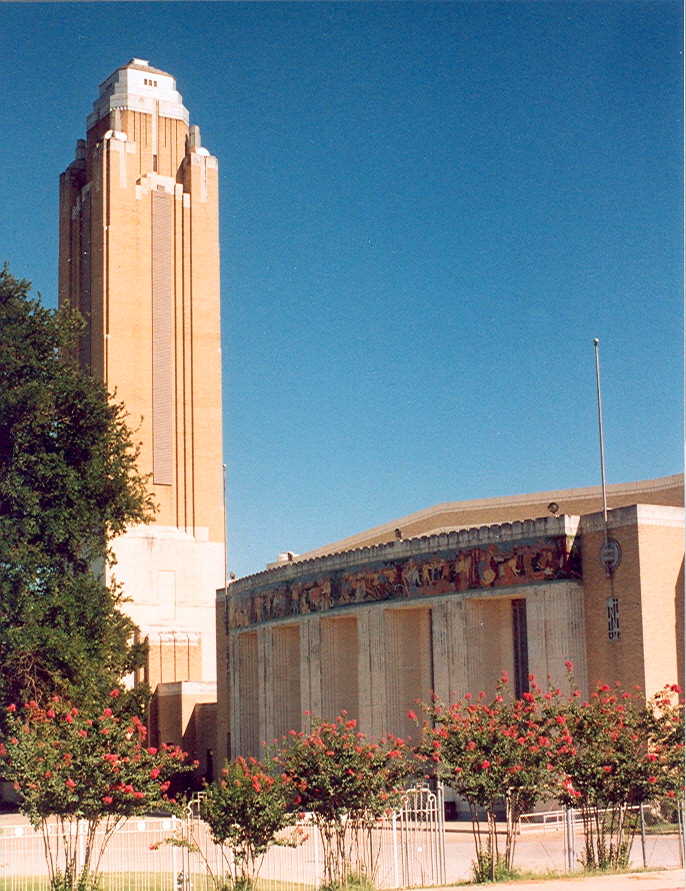


Westworth Village, Texas
Westworth Village is a city of 2,643 people in Tarrant County, Texas.
Why visit Westworth Village
Townapedia lists 14 museums and landmarks, 6 parks and trails, 29 places to eat and 1 attraction in and around town.
Highlights include Marshall R. Sanguinet House, Ridglea Theatre and Leonard Park.
July is the warmest month, with average highs of 97°F; January lows average 37°F.
Weather in Westworth Village
Forecast from the National Weather Service. Full forecast
Things to do1

Museums and landmarks14

Marshall R. Sanguinet House
Monument and historic site · National Register of Historic Places · 2.5 mi
Historic place in Fort Worth, Tarrant County, Texas

Ridglea Theatre
Monument and historic site · National Register of Historic Places · 2.4 mi
Movie theater in Fort Worth, Texas, United States
Westover Manor
Monument and historic site · National Register of Historic Places · 1.8 mi
Historic place in Fort Worth, Tarrant County, Texas
Will Rogers Memorial Center
Monument and historic site · National Register of Historic Places · 3.5 mi
Building in Fort Worth, Tarrant County, Texas

William J. Bryce House
Monument and historic site · National Register of Historic Places · 2.3 mi
Fort Worth, Texas, listed on the NRHP in Texas

Amon Carter Museum of American Art
Museum · 3.3 mi
Art museum in Fort Worth, Texas

Fort Worth Museum of Science and History
Museum · 3.4 mi
Museum in the United States


National Cowgirl Museum and Hall of Fame
Museum · 3.4 mi
Hall of Fame for Cowgirls
Consolidated Vultee Aircraft Corporation Plant No. 4
Monument and historic site · 1.3 mi
2 more on the map.
Parks, trails and playgrounds6


Hawks Creek Golf Club
Golf course
6520 6520 White Settlement Rd, Westworth Village
Restaurants and cafes29




17 more on the map.
Churches and places of worship12
West Side Church of Christ
Church · 0.4 mi
6110 White Settlement Road, Westworth Village
Shopping9
Gas and EV charging2
Schools, colleges and libraries36
Founders Classical Academy - Fort Worth
School · 3.9 mi
501 Academy Blvd, Fort Worth
Healthcare1
Map of Westworth Village
110 places. The map loads OpenStreetMap tiles when you open it.
Climate by month
Monthly table
| Month | High | Low | Rain |
|---|---|---|---|
| Jan | 59°F | 37°F | 1.9 in |
| Feb | 63°F | 41°F | 2.0 in |
| Mar | 70°F | 49°F | 3.2 in |
| Apr | 78°F | 56°F | 2.5 in |
| May | 85°F | 65°F | 3.6 in |
| Jun | 92°F | 73°F | 4.2 in |
| Jul | 97°F | 76°F | 2.0 in |
| Aug | 97°F | 76°F | 1.8 in |
| Sep | 90°F | 70°F | 2.6 in |
| Oct | 79°F | 58°F | 3.9 in |
| Nov | 68°F | 48°F | 2.6 in |
| Dec | 60°F | 40°F | 2.2 in |
U.S. Climate Normals 1991-2020 for Ft Worth Nas (2 mi away), NOAA NCEI.
People and cost of living
American Community Survey 5-year estimates, 2020-2024, U.S. Census Bureau. Estimates have margins of error, larger for small towns.
Disaster history
Tarrant County has had 19 federal disaster declarations since 2000, most often for hurricanes.
- 2021-02-19: Severe Winter Storms (Severe Ice Storm)
- 2021-02-14: Severe Winter Storm (Severe Ice Storm)
- 2020-08-24: Tropical Storms Marco And Laura (Hurricane)
- 2020-03-25: Covid-19 Pandemic (Biological)
- 2020-03-13: Covid-19 (Biological)
- 2017-08-25: Hurricane Harvey (Hurricane)
OpenFEMA disaster declarations summaries.
Getting there and nearby towns
Naval Air Station Joint Reserve Base Fort Worth (Carswell Field) (FWH) is the nearest airport with scheduled flights listed in OpenStreetMap, 1 miles away.
- White Settlement 2 mi west, about 4 min by car
- Fort Worth 5 mi east, about 7 min by car
- Lakeside 5 mi northwest, about 8 min by car
- Benbrook 6 mi south, about 10 min by car
- Saginaw 8 mi northeast, about 13 min by car
- Blue Mound 8 mi northeast, about 13 min by car
- Edgecliff Village 9 mi southeast, about 14 min by car
- Haltom City 10 mi northeast, about 16 min by car
- Azle 11 mi northwest, about 18 min by car
- Forest Hill 11 mi southeast, about 18 min by car
Drive times are estimates from straight-line distance, not routes.
Local news
Headlines from INDB, the NEMICO news database.
Reviews, tips and questions
Loading what members have shared...
Sources and licences
- NCES EDGE (Public domain): public schools
- NOAA NCEI U.S. Climate Normals 1991-2020 (Public domain): climate by month
- OpenFEMA (Public domain): disaster declarations
- OpenStreetMap contributors (ODbL 1.0): places, airports, map data
- U.S. Census Bureau (Public domain): population, income, housing, education, commute
- Wikidata (CC0 1.0): landmarks and historic places
- Wikimedia Commons (see each image): photos
Photo credits
- BryceHouse1 (1 of 1), Renelibrary, CC BY-SA 4.0
- Sanguinet1, Renelibrary, CC BY-SA 3.0
- WillRogersMemorialCenter1, Unknown author, CC BY-SA 2.5
- Westover, Renelibrary, CC BY-SA 3.0
- Amon Carter Museum of American Art, facade, Steven Watson, CC BY-SA 4.0
- Kimbell Art Museum Highsmith, Carol M. Highsmith, Public domain
- MVI 2781 Fort Worth Museum of Science and History, Billy Hathorn, CC BY-SA 3.0
- MVI 2777 National Cowgirl Hall of Fame, Billy Hathorn, CC BY-SA 3.0
- Exterior of All Saints Episcopal Church (ACNA), Fort Worth, Texas, greg westfall, CC BY 2.0

Page built October 30, 2026. Spotted a mistake? Tell us or suggest a place.