


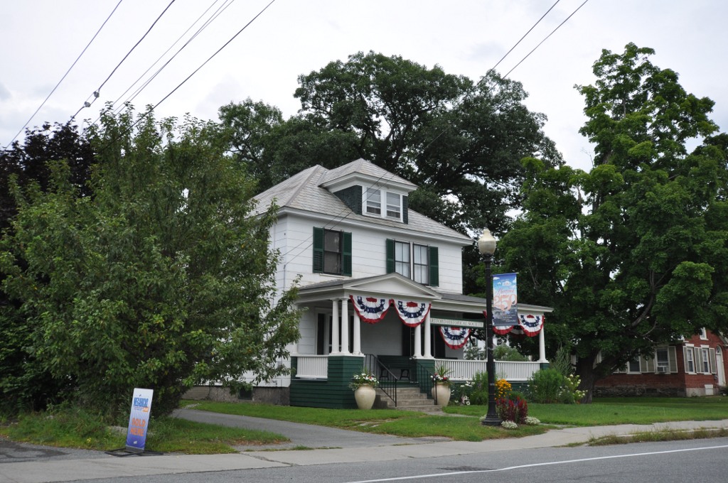


White River Junction, Vermont
White River Junction is a community of 3,364 people in Windsor County, Vermont.
Why visit White River Junction
Townapedia lists 22 museums and landmarks, 12 parks and trails, 50 places to eat, 10 places to stay and 8 attractions in and around town.
Highlights include Northern Stage, Stone Arch Underpass, White River Junction Historic District and Advent Camp Meeting Grounds Historic District.
July is the warmest month, with average highs of 83°F; January lows average 9°F.
Weather in White River Junction
Forecast from the National Weather Service. Full forecast
About White River Junction
White River Junction is an unincorporated village and census-designated place (CDP) in the town of Hartford in Windsor County, Vermont, United States. The population was 2,528 at the 2020 census, up from 2,286 in 2010, making it the largest community within the town of Hartford.
From the Wikipedia article White River Junction, Vermont (this version), under CC BY-SA 4.0.
Things to do8


Stone Arch Underpass
Bridge · National Register of Historic Places · 1.6 mi

Lyman Bridge
Bridge · 0.8 mi
Bridge in and White River Junction, Vermont

Stern's Quality Produce
Farm and orchard · 0.6 mi
83 Pine Street, White River Junction
Mo-Fr 10:00-18:00; Sa 10:00-17:00

Briggs Opera House
Cinema and theater · 0.5 mi
5 South Main Street, White River Junction
Museums and landmarks22

White River Junction Historic District
Monument and historic site · National Register of Historic Places · 0.5 mi
Historic district in Vermont, United States

Advent Camp Meeting Grounds Historic District
Monument and historic site · National Register of Historic Places · 1.2 mi
United States historic place
Christian Street Rural Historic District
Monument and historic site · National Register of Historic Places · 2.9 mi
Historic district in Vermont, United States
Hartford
Monument and historic site · National Register of Historic Places · 1.0 mi
Village in the town of Hartford, Windsor County, Vermont
Jedediah Strong II House
Monument and historic site · National Register of Historic Places · 3.6 mi
Building in Vermont, United States

Ottauquechee River Bridge
Bridge · National Register of Historic Places · 3.5 mi
Bridge in United States of America
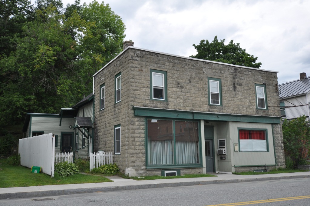
Progressive Market
Monument and historic site · National Register of Historic Places · 0.6 mi
Building in Vermont, United States
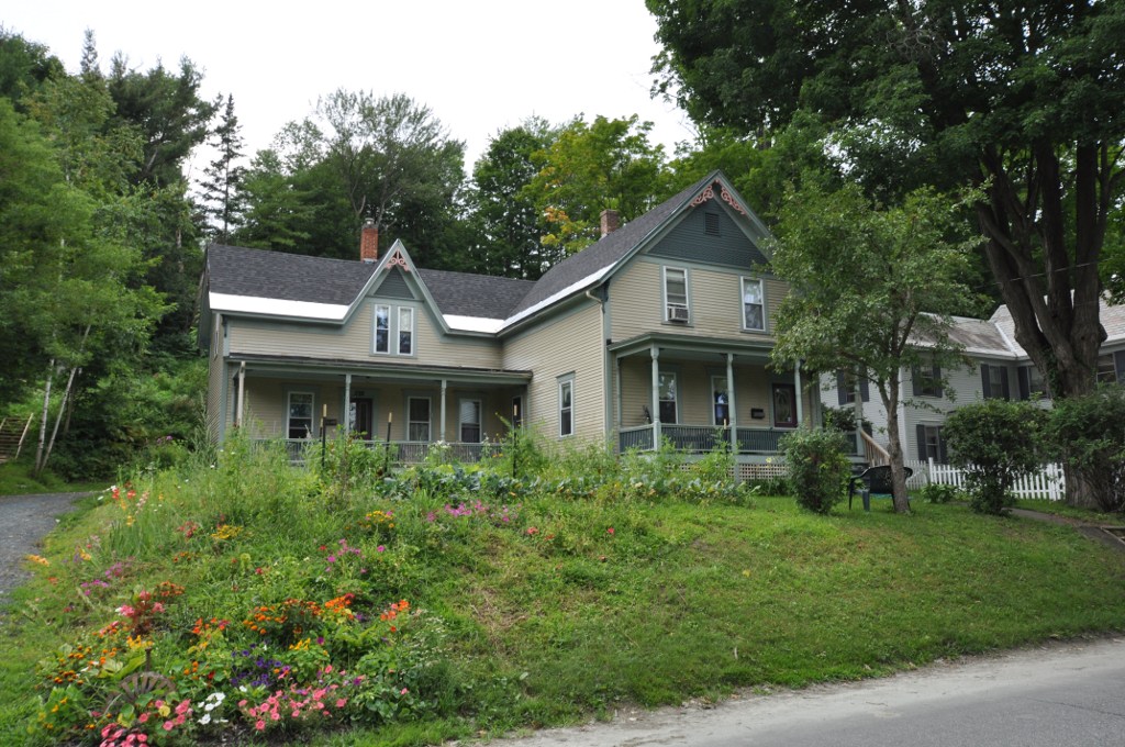
Terraces Historic District
Monument and historic site · National Register of Historic Places
Historic district in Vermont, United States


Wilder
Monument and historic site · National Register of Historic Places · 2.0 mi
Census-designated place in Vermont, USA

10 more on the map.
Parks, trails and playgrounds12



Hurricane Forest Wildlife Refuge
Hiking and trails · 1.4 mi
Wright Reservoir Road
sunrise-21:00

Restaurants and cafes50

110 Grill
Diner · American · 1.4 mi
250 Plainfield Road, West Lebanon
Mo-Sa 11:30-21:00; Su 11:30-20:00

Cantore's Pizza
Restaurant · Pizza · 1.2 mi
1 Glen Road, West Lebanon
Tu-Th 11:00-20:00; Fr 11:00-21:00; Sa 13:00-20:00
China Moon Buffet
Restaurant · Chinese
96 Sykes Mountain Avenue, White River Junction
Mo-Th 11:00-21:30; Fr,Sa 11:00-22:30; Su 11:00-21:00
Men at Wok
Restaurant · Asian · 1.2 mi
1 Glen Road, West Lebanon
Mo-Th,Su 11:00-21:30; Fr,Sa 11:00-22:00
Oriental Wok Express
Restaurant · Chinese · 0.9 mi
97 North Main Street, West Lebanon
Tu-Su 11:30-19:30
Phnom Penh Sandwich Station
Restaurant · Vietnamese · 0.5 mi
7 North Main Street, White River Junction
Mo-Sa 11:00-20:00

38 more on the map.
History
The village has long had a role in transportation, primarily as a railroad junction. From the arrival of the first railroads in the late 1840s until rail diminished in importance in the 1950s and 1960s, White River Junction was the most important railroad community in Vermont. Its original importance was due to its location at the confluence of the White River with the Connecticut River. In 1803 Elias Lyman built a bridge across the Connecticut from the north bank of the White River to West Lebanon, New Hampshire.
The local population remained quite low until the arrival of the railroad in the 1840s. Five different railroad lines were laid through the village site between 1847 and 1863 (the Vermont Central Railway and Connecticut River Railroad in 1847, the Connecticut and Passumpsic Rivers Railroad in 1848, the Northern New Hampshire Railroad in 1849, and the Woodstock Railroad in 1863), creating an eight-track crossing that was served by 50 passenger trains daily. In 1849, the village's first railroad depot was built, and local farmer Samuel Nutt arranged to buy and dismantle a hotel in Enfield, New Hampshire, and move it to his farm on the other side of the railroad tracks from the depot. His hotel, named the Junction House, was the first of three hotels to occupy the site, which now is home to the Coolidge Hotel, built in 1924.
From the History section of White River Junction, Vermont on Wikipedia, under CC BY-SA 4.0.
Where to stay10
Hampton Inn White River Junction
Motel and hotel · 0.7 mi
104 Ballardvale Drive, White River Junction
Holiday Inn Express & Suites White River Junction
Motel and hotel · 0.8 mi
121 Ballardvale Drive, White River Junction
Fairfield Inn & Suites White River Junction
Motel and hotel · 0.6 mi
102 Ballardvale Drive, White River Junction
Churches and places of worship12
West Lebanon Congregational Church
Church · United Church Of Christ · 1.1 mi
18 Maple Street, West Lebanon
White River Junction Methodist Church
Church · Methodist · 0.5 mi
106 Gates Street, White River Junction
Greater Hartford United Church
Church · 1.1 mi
1721 Maple Street, White River Junction
Shambhala Meditation Center of White River
Place of worship · Shambhala · 0.6 mi
Shopping24
Gas and EV charging12
Schools, colleges and libraries26
Hartford Library
Library · National Register of Historic Places · 1.0 mi
1587 Maple Street, White River Junction
Healthcare9
Map of White River Junction
185 places. The map loads OpenStreetMap tiles when you open it.
Climate by month
Monthly table
| Month | High | Low | Rain |
|---|---|---|---|
| Jan | 30°F | 9°F | 2.3 in |
| Feb | 34°F | 11°F | 2.1 in |
| Mar | 43°F | 21°F | 2.7 in |
| Apr | 57°F | 32°F | 3.0 in |
| May | 70°F | 44°F | 3.3 in |
| Jun | 78°F | 52°F | 3.8 in |
| Jul | 83°F | 58°F | 4.0 in |
| Aug | 81°F | 56°F | 3.6 in |
| Sep | 73°F | 49°F | 3.4 in |
| Oct | 60°F | 37°F | 4.0 in |
| Nov | 47°F | 28°F | 3.0 in |
| Dec | 36°F | 18°F | 2.8 in |
U.S. Climate Normals 1991-2020 for Lebanon Muni Ap (2 mi away), NOAA NCEI.
People and cost of living
American Community Survey 5-year estimates, 2020-2024, U.S. Census Bureau. Estimates have margins of error, larger for small towns.
Disaster history
Windsor County has had 19 federal disaster declarations since 2000, most often for severe storms.
- 2024-08-08: Tropical Depression Debby (Tropical Storm)
- 2024-03-02: Severe Storm And Flooding (Severe Storm)
- 2023-07-14: Severe Storms, Flooding, Landslides, And Mudslides (Flood)
- 2023-07-10: Flooding (Flood)
- 2021-08-22: Tropical Storm Henri (Hurricane)
- 2020-04-08: Covid-19 Pandemic (Biological)
OpenFEMA disaster declarations summaries.
Getting there and nearby towns
Lebanon Municipal Airport (LEB) is the nearest airport with scheduled flights listed in OpenStreetMap, 2 miles away.
- Lebanon 4 mi east, about 6 min by car
- Hanover 5 mi northeast, about 8 min by car
- Norwich 5 mi north, about 8 min by car
- Enfield 9 mi east, about 15 min by car
- Claremont 18 mi south, about 29 min by car
- Newport 21 mi south, about 34 min by car
- New London 24 mi southeast, about 38 min by car
- Springfield 26 mi south, about 41 min by car
- Randolph 26 mi northwest, about 41 min by car
- Bradford 26 mi northeast, about 42 min by car
Drive times are estimates from straight-line distance, not routes.
Local news
Headlines from INDB, the NEMICO news database.
Reviews, tips and questions
Loading what members have shared...
Sources and licences
- NCES EDGE (Public domain): public schools
- NOAA NCEI U.S. Climate Normals 1991-2020 (Public domain): climate by month
- OpenFEMA (Public domain): disaster declarations
- OpenStreetMap contributors (ODbL 1.0): places, airports, map data
- U.S. Census Bureau (Public domain): population, income, housing, education, commute
- Wikidata (CC0 1.0): elevation, founding date, time zone, website, landmarks and historic places
- Wikimedia Commons (see each image): photos
- Wikipedia (CC BY-SA 4.0): overview and history text
Photo credits
- White River Junction VT, Mickmaguire at English Wikipedia, CC BY-SA 2.0
- White River Junction Former Post office, Doug Kerr, CC BY-SA 2.0
- Hartland-Vermont-Ottauquechee-River-Bridge, Henry S. Magnuski, CC BY-SA 3.0
- HartfordVT HistoricalSociety, Magicpiano, CC BY-SA 3.0
- HartfordVT JedediahStrongHouse, Magicpiano, CC BY-SA 3.0
- HartfordVT ChristianStreetHD 1, Magicpiano, CC BY-SA 3.0
- WhiteRiverJunctionVT ProgressiveMarket, Magicpiano, CC BY-SA 3.0
- HartfordVT AdventCampMeeting, Magicpiano, CC BY-SA 4.0
- WhiteRiverJunctionVT FairviewTerrace 2, Magicpiano, CC BY-SA 3.0
- Wilder Station, Wilder, Vt (83548), Tichnor Brothers, Publisher, Public domain
- StoneArchLebanonNH, Ken Gallager at English Wikipedia, CC BY 3.0
Page built October 30, 2026. Spotted a mistake? Tell us or suggest a place.