




Why visit Winslow
Townapedia lists 26 museums and landmarks, 30 parks and trails, 47 places to eat, 5 places to stay and 5 attractions in and around town.
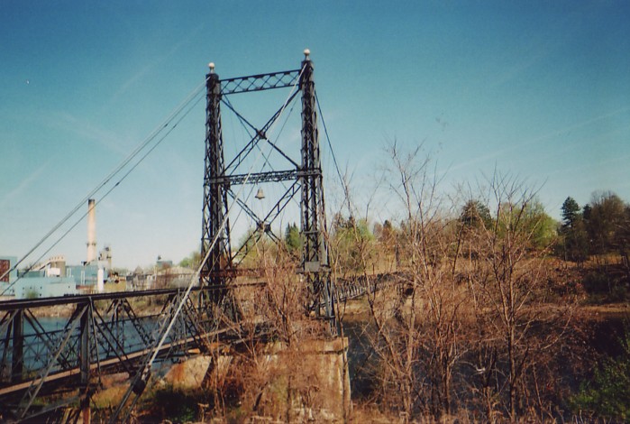
Highlights include Main Film Center, Two Cent Bridge, Fort Halifax and Redington Museum.
July is the warmest month, with average highs of 80°F; January lows average 9°F.
Weather in Winslow
Forecast from the National Weather Service. Full forecast
Things to do5

Two Cent Bridge
Bridge · National Register of Historic Places · 0.9 mi
Suspension bridge in Maine, U.S.
Waterville Opera House
Cinema and theater · 1.0 mi
1 Common Street, Waterville

Museums and landmarks26
Fort Halifax
Monument and historic site · National Register of Historic Places · 1.4 mi
Fort in Maine

Redington Museum
Museum · National Register of Historic Places · 1.4 mi
Historic house in Maine, United States

Alvin O. Lombard House
Monument and historic site · National Register of Historic Places · 1.2 mi
Historic house in Waterville, Maine

Amos Gerald House
Monument and historic site · National Register of Historic Places · 2.2 mi
Historic house in Maine, United States
Benton Grange No. 458
Monument and historic site · National Register of Historic Places · 2.7 mi
Building in Maine, United States of America
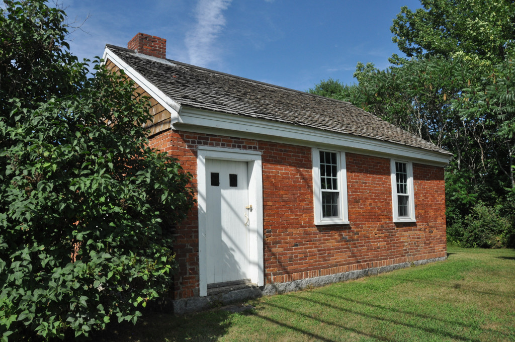
Brick School
Monument and historic site · National Register of Historic Places · 3.3 mi
Historic one-room schoolhouse on Cushman Road in Winslow, Maine


Connor-Bovie House
Monument and historic site · National Register of Historic Places · 2.4 mi
Historic house in Maine, United States
Cotton-Smith House
Monument and historic site · National Register of Historic Places · 2.3 mi
Fairfield, Maine, listed on the NRHP in Somerset County, Maine
Foster-Redington House
Monument and historic site · National Register of Historic Places · 1.2 mi
Historic house at 8 Park Place in Waterville, Maine
Heald House
Monument and historic site · National Register of Historic Places · 1.4 mi
Historic house in Maine, United States
Jonas R. Shurtleff House
Monument and historic site · National Register of Historic Places · 2.5 mi
House in Winslow, Maine
Lawrence Library
Monument and historic site · National Register of Historic Places · 2.4 mi
Public library of Fairfield, Maine, United States
14 more on the map.
Parks, trails and playgrounds30


18 more on the map.
Restaurants and cafes47


Grand Central Cafe
Restaurant · Pizza · 1.1 mi
10 Railroad Square, Waterville
Mo-We 17:00-20:00; Th 11:00-20:00; Fr-Sa 11:00-21:00
Mirakuya Sushi & Steak House
Restaurant · Sushi, Steak House · 2.4 mi
150 Jfk Plaza, Waterville
Mo-Th 11:00-14:30, 16:00-21:30, Fr-Sa 11:00-14:30, 16:00-22:00, Su...
Rita’s House of Pizza
Restaurant · American, Pizza · 1.3 mi
51 Bay Street, Waterville
Mo-We 11:00-20:00; Th-Sa 11:00-21:00; Su 16:00-20:00

Selah Tea Cafe
Cafe · Breakfast, Brunch · 1.1 mi
177 Main Street, Waterville
Mo-Fr 07:00-17:00; Sa-Su 08:00-17:00
Starbucks
Cafe · Coffee Shop · 2.0 mi
2 Waterville Commons Drive, Waterville
Mo-Sa 05:00-20:00; Su 06:00-20:00
The Two Cent Pub
Restaurant · Pasta, Pizza, Sandwich · 0.7 mi
82 Clinton Avenue, Waterville
Mo-Th 08:00-21:00; Fr-Sa 08:00-22:00; Su 10:00-21:00

Juliette's Bakery & Deli
Bakery · 1.2 mi
40 Ticonic Street, Waterville
Mo-Fr 07:00-19:00; Sa 09:00-19:00
Sunrise Bagel
Restaurant · Bagel · 1.3 mi
31 Water Street, Waterville
Mo-Fr 07:00-13:00; Sa,Su 08:00-13:00
35 more on the map.
Where to stay5
Best Western Plus Waterville Grand Hotel
Motel and hotel · 1.9 mi
375 Main Street, Waterville
Churches and places of worship13
First Baptist Church
Church · Nondenominational · National Register of Historic Places · 1.2 mi
1 Park Street, Waterville
Universalist-Unitarian Church
Church · National Register of Historic Places · 1.4 mi
Notre Dame du Perpetuel Secours Catholic Church
Church · Roman Catholic · 1.7 mi
116 Silver Street, Waterville
Saint John the Baptist Catholic Church
Church · Roman Catholic · 1.0 mi
26 Monument Street, Winslow
First Congregational Church
Church · United · 1.5 mi
7 Eustis Parkway, Waterville
St. Joseph's Maronite Catholic Church
Church · Maronite · 1.0 mi
5 Appleton Street, Waterville
Blessed Hope Advent Christian Church
Church · 1.5 mi
10 Pleasant Street, Waterville
Shopping18
Gas and EV charging6
Schools, colleges and libraries19
Waterville Senior High School
School · 1.8 mi
1 Brooklyn Avenue, Waterville
Mount Merici Academy
School · Catholic · 2.4 mi
18 Mount Merci Avenue, Waterville
Healthcare8
Kennebec Behavioral Health - Waterville Clinic
Clinic and pharmacy · 2.0 mi
67 Eustis Parkway, Waterville
MaineGeneral Express Care
Clinic and pharmacy · 1.1 mi
211 Main Street, Waterville
Map of Winslow
177 places. The map loads OpenStreetMap tiles when you open it.
Climate by month
Monthly table
| Month | High | Low | Rain |
|---|---|---|---|
| Jan | 28°F | 9°F | 3.1 in |
| Feb | 32°F | 10°F | 2.6 in |
| Mar | 40°F | 20°F | 3.3 in |
| Apr | 54°F | 32°F | 3.7 in |
| May | 66°F | 43°F | 3.3 in |
| Jun | 75°F | 53°F | 4.0 in |
| Jul | 80°F | 59°F | 3.4 in |
| Aug | 80°F | 57°F | 3.4 in |
| Sep | 72°F | 50°F | 3.8 in |
| Oct | 59°F | 38°F | 4.9 in |
| Nov | 46°F | 29°F | 3.9 in |
| Dec | 34°F | 17°F | 3.9 in |
U.S. Climate Normals 1991-2020 for Waterville Trtmt Plt (3 mi away), NOAA NCEI.
People and cost of living
American Community Survey 5-year estimates, 2020-2024, U.S. Census Bureau. Estimates have margins of error, larger for small towns.
Disaster history
Kennebec County has had 15 federal disaster declarations since 2000, most often for severe storms.
- 2024-01-30: Severe Storm And Flooding (Severe Storm)
- 2023-09-14: Hurricane Lee (Hurricane)
- 2023-07-06: Severe Storm And Flooding (Flood)
- 2020-04-04: Covid-19 Pandemic (Biological)
- 2020-03-13: Covid-19 (Biological)
- 2018-01-02: Severe Storm And Flooding (Severe Storm)
OpenFEMA disaster declarations summaries.
Getting there and nearby towns
Waterville Robert LaFleur Airport (WVL) is the nearest airport with scheduled flights listed in OpenStreetMap, 4 miles away.
- Waterville 3 mi west, about 4 min by car
- Fairfield 3 mi north, about 4 min by car
- Oakland 5 mi west, about 8 min by car
- Norridgewock 14 mi northwest, about 22 min by car
- Augusta 16 mi south, about 26 min by car
- Skowhegan 16 mi north, about 26 min by car
- Pittsfield 19 mi northeast, about 30 min by car
- Hallowell 21 mi southwest, about 34 min by car
- Madison 21 mi northwest, about 34 min by car
- Farmingdale 23 mi southwest, about 36 min by car
Drive times are estimates from straight-line distance, not routes.
Local news
Headlines from INDB, the NEMICO news database.
Reviews, tips and questions
Loading what members have shared...
Sources and licences
- NCES EDGE (Public domain): public schools
- NOAA NCEI U.S. Climate Normals 1991-2020 (Public domain): climate by month
- OpenFEMA (Public domain): disaster declarations
- OpenStreetMap contributors (ODbL 1.0): places, airports, map data
- U.S. Census Bureau (Public domain): population, income, housing, education, commute
- Wikidata (CC0 1.0): landmarks and historic places
- Wikimedia Commons (see each image): photos
Photo credits
- WinslowME FortHalifax Interior, Magicpiano, CC BY-SA 3.0
- Fort Halifax, Winslow, ME, Unknown photographer, Public domain
- TwocentbridgeME, DanielEng at English Wikipedia, CC BY 2.5
- BentonME GrangeHall, Magicpiano, CC BY-SA 4.0
- CONNOR-BOVIE HOUSE, JERRYE & ROY KLOTZ MD, CC BY-SA 3.0
- Waterville, ME City Hall (2014) IMG 2652, Billy Hathorn, CC BY-SA 3.0
- One Post Office Square in Waterville, ME IMG 2630, Billy Hathorn, CC BY-SA 3.0
- AMOS GEROLD HOUSE, JERRYE & ROY KLOTZ MD, CC BY-SA 3.0
- WinslowME BrickSchool2, Magicpiano, CC BY-SA 4.0
- Bridge & Lockwood Mills, Waterville, ME, Unknown author, Public domain
- Kennebec River (249527229), EAWB, CC BY-SA 2.0
- Kennebec River and bridge (249527232), EAWB, CC BY-SA 2.0
- Adult Northern Rough-winged Swallow (Stelgidopteryx serripennis) in Waterville, Maine, Jshamgochian, CC BY-SA 4.0
- Two Cent Bridge in Waterville, Maine - panoramio, Martin Ibert, CC BY-SA 3.0
- Two-cent bridge, Waterville, Maine, Sarah Brewer, CC BY-SA 3.0
- WatervilleME Downtown, Doug Kerr, CC BY-SA 2.0
- WatervilleME MainStreet, Magicpiano, CC BY-SA 4.0
- EdmandsMartin2013-05-04, Garrett Fitzgerald, CC BY-SA 3.0
- Professional Building (Waterville, Maine), Jim Roberts, CC BY-SA 4.0
- Greetings from Waterville (Maine) - Large Letter Postcard (4481430802), Steve Shook from Moscow, Idaho, USA, CC BY 2.0
- Greetings from Waterville, Maine - Large Letter Postcard (8046882845), Steve Shook from Moscow, Idaho, USA, CC BY 2.0
- Post Office, Waterville, ME, Unknown photographer, Public domain
- Waterville, United States (Unsplash), Katie Chase katherinechasephotography, CC0
- WatervilleME LockwoodMills, Magicpiano, CC BY-SA 4.0
- WatervilleME FirstBaptistChurch, Magicpiano, CC BY-SA 4.0
- Eastside of Alvin O. Lombard House, Jim Roberts, CC BY-SA 4.0
- Foster-Redington House, Jim Roberts, CC BY-SA 4.0
- WatervilleME RedingtonHouse, Magicpiano, CC BY-SA 4.0
- Fort Halifax Maine 3, ArkyMaine, CC BY-SA 4.0
- Fort Halifax Maine NHL 5, ArkyMaine, CC BY-SA 4.0
- Heald House (Waterville, Maine), Jim Roberts, CC BY-SA 4.0
- Old Waterville High School, Jim Roberts, CC BY-SA 4.0
- WatervilleME UUChurch, Magicpiano, CC BY-SA 4.0
- Church-Converted-Residence in Fairfield, Maine, Duhc0mmunity, CC0
- FairfieldME AmosGeraldHouse, Magicpiano, CC BY-SA 4.0
- FairfieldME CottonSmithHouse, Magicpiano, CC BY-SA 4.0
- WatervilleME MtMericiHD, Magicpiano, CC BY-SA 4.0
- FairfieldME ConnorBovieHouse, Magicpiano, CC BY-SA 4.0
- FairfieldME LawrenceLibrary, Magicpiano, CC BY-SA 4.0
- FairfieldME GeraldHotel, Magicpiano, CC BY-SA 4.0


Page built October 30, 2026. Spotted a mistake? Tell us or suggest a place.