


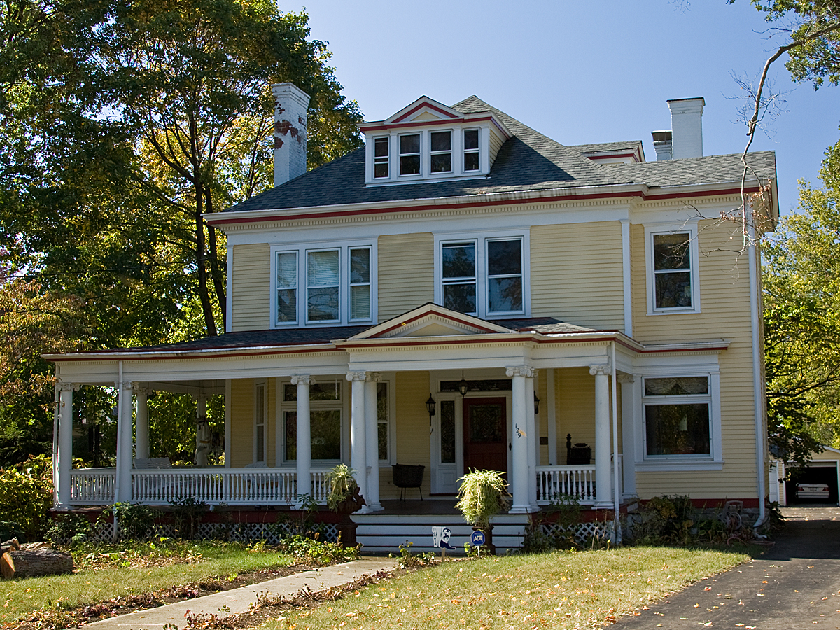


Wyoming, Ohio
Wyoming is a city of 8,723 people in Hamilton County, Ohio, founded in 1861.
Why visit Wyoming
Townapedia lists 32 museums and landmarks, 30 parks and trails, 21 places to eat and 1 attraction in and around town.
Highlights include Walter C. Deye, S.J., Performance Center, Village Historic District, Burchenal Mound and French Park.
July is the warmest month, with average highs of 85°F; January lows average 22°F.
Weather in Wyoming
Forecast from the National Weather Service. Full forecast
About Wyoming
Wyoming is a city in Hamilton County, Ohio, United States. It is a suburb of neighboring Cincinnati. The population was 8,756 at the 2020 census.
From the Wikipedia article Wyoming, Ohio (this version), under CC BY-SA 4.0.
Things to do1

Walter C. Deye, S.J., Performance Center
Cinema and theater · 1.9 mi
600 West North Bend Road, Cincinnati
Museums and landmarks32

Village Historic District
Monument and historic site · National Register of Historic Places · 0.7 mi
Historic district in Ohio, United States

Burchenal Mound
Monument and historic site · National Register of Historic Places · 2.2 mi
Archaeological site in Ohio, United States

Charles Fay House
Monument and historic site · National Register of Historic Places
Historic house in Ohio, United States

Charles H. Moore House
Monument and historic site · National Register of Historic Places · 0.7 mi
Wyoming, Ohio, NRHP-listed

Charles Woodruff House
Monument and historic site · National Register of Historic Places · 0.5 mi
Historic house in Ohio, United States

Clovernook
Monument and historic site · National Register of Historic Places · 3.7 mi
Building in Ohio, United States

Edward R. Stearns House
Monument and historic site · National Register of Historic Places
Historic house in Ohio, United States

Elmer Hess House
Monument and historic site · National Register of Historic Places · 0.6 mi
Historic house in Ohio, United States

Glendale Historic District
Monument and historic site · National Register of Historic Places · 3.0 mi
Historic district in Glendale, Ohio

Glendale Police Station
Monument and historic site · National Register of Historic Places · 3.2 mi
Prison in Ohio, United States of America

Gorman Heritage Farm
Monument and historic site · National Register of Historic Places · 3.2 mi
Working farm museum in Evendale, Ohio, United States


Jacob Bromwell House
Monument and historic site · National Register of Historic Places · 0.5 mi
Historic house in Ohio, United States
20 more on the map.
Parks, trails and playgrounds30

French Park
Park · 3.7 mi
Public park in Amberley, Ohio, United States


18 more on the map.
Restaurants and cafes21

China Wok
Restaurant · Asian, Chinese · 1.5 mi
9178 Winton Road, Cincinnati
Mo 11:00-22:00; Tu off; We,Th 11:00-22:00; Fr,Sa 11:00-22:30; Su...
Romailo Cafe
Restaurant · Asian, Nepali, Indian, Nepalese · 1.5 mi
9172 Winton Road, Cincinnati
Tu-Sa 10:00-14:00; Su 14:00+

Gilligan's Brewery
Bar and pub · 0.8 mi
400 Wyoming Avenue, Wyoming
Fr-Sa 11:00-23:00; Mo-Th 11:00-22:00

Brentwood Brewpub
Bar and pub · 1.5 mi
9176 Winton Road, Cincinnati
Mo-Th 11:00-22:00; Fr-Sa 11:00-23:00; Su 11:00-21:00

9 more on the map.
History
Among the earliest European-American settlers in what is now Wyoming was the Pendery family, who arrived in 1805. Wyoming was named after Wyoming County, Pennsylvania, where some settlers had come from. Robert Reily is considered the "Father of Wyoming" with men and women gathering at his home one week prior to the start of the Civil War in 1861, naming the village Wyoming—a Lenape term meaning "large plains." In 1874, Wyoming officially became a village with 600 residents, and in 1951, the village incorporated as a city of over 5,000 persons, implementing the council–manager form of government.
Good transportation is an integral part of Wyoming's history and the leading reason for its prosperity. The city lies near the old pre-statehood road associated with Anthony Wayne that connected Cincinnati with locations farther north, such as Fort Hamilton and Fallen Timbers. A "New Road" was established in 1806 as a shortcut along a section line in Springfield Township, forming Springfield Pike through central Wyoming, later a toll road established by farmers Burns, Riddle, and Pendery of the Hamilton, Springfield, and Carthage Turnpike Company.
From the History section of Wyoming, Ohio on Wikipedia, under CC BY-SA 4.0.
Churches and places of worship32
Wyoming Presbyterian Church
Church · Presbyterian · National Register of Historic Places · 0.7 mi
Allen Temple AME Church
Church · National Register of Historic Places · 3.2 mi
First Church of Christ, Scientist
Church · Christ Scientist · 0.5 mi
620 Springfield Pike, Cincinnati
Shopping5
Gas and EV charging6
Schools, colleges and libraries59
Academy For Multilingual Immersion Studies
School · 3.1 mi
1908 Seymour Ave, Cincinnati
Cincinnati Achievement Academy
School · 5.4 mi
5555 Little Flower Ave, Cincinnati
Healthcare2
Map of Wyoming
188 places. The map loads OpenStreetMap tiles when you open it.
Climate by month
Monthly table
| Month | High | Low | Rain | Snow |
|---|---|---|---|---|
| Jan | 37°F | 22°F | 3.6 in | 6.0 in |
| Feb | 42°F | 25°F | 3.2 in | 4.3 in |
| Mar | 52°F | 33°F | 4.5 in | 2.4 in |
| Apr | 65°F | 43°F | 4.9 in | 0.2 in |
| May | 74°F | 53°F | 5.2 in | 0.0 in |
| Jun | 82°F | 62°F | 4.8 in | 0.0 in |
| Jul | 85°F | 65°F | 4.3 in | 0.0 in |
| Aug | 85°F | 64°F | 3.5 in | 0.0 in |
| Sep | 78°F | 57°F | 3.3 in | 0.0 in |
| Oct | 66°F | 45°F | 3.5 in | 0.3 in |
| Nov | 52°F | 35°F | 3.4 in | 0.2 in |
| Dec | 42°F | 27°F | 4.0 in | 2.6 in |
U.S. Climate Normals 1991-2020 for Cheviot (9 mi away), NOAA NCEI.
People and cost of living
American Community Survey 5-year estimates, 2020-2024, U.S. Census Bureau. Estimates have margins of error, larger for small towns.
Disaster history
Hamilton County has had 11 federal disaster declarations since 2000, most often for severe storms.
- 2026-10-02: Severe Storms, Straight-Line Winds, Tornadoes, Flooding, And Landslides (Flood)
- 2020-03-31: Covid-19 Pandemic (Biological)
- 2020-03-13: Covid-19 (Biological)
- 2018-04-17: Severe Storms, Landslides, And Mudslides (Flood)
- 2012-06-30: Severe Storms (Severe Storm)
- 2011-07-13: Severe Storms And Flooding (Severe Storm)
OpenFEMA disaster declarations summaries.
Getting there and nearby towns
Lunken Airport (LUK) is the nearest airport with scheduled flights listed in OpenStreetMap, 9 miles away.
- Lockland 1 mi east, about 2 min by car
- Lincoln Heights 2 mi northeast, about 3 min by car
- Finneytown 2 mi southwest, about 3 min by car
- Woodlawn 2 mi north, about 3 min by car
- Pleasant Hills 2 mi west, about 4 min by car
- Reading 3 mi east, about 4 min by car
- Elmwood Place 3 mi south, about 5 min by car
- Glendale 3 mi northeast, about 5 min by car
- Greenhills 3 mi northwest, about 5 min by car
- Evendale 3 mi northeast, about 5 min by car
Drive times are estimates from straight-line distance, not routes.
Local news
Headlines from INDB, the NEMICO news database.
Reviews, tips and questions
Loading what members have shared...
Sources and licences
- NCES EDGE (Public domain): public schools
- NOAA NCEI U.S. Climate Normals 1991-2020 (Public domain): climate by month
- OpenFEMA (Public domain): disaster declarations
- OpenStreetMap contributors (ODbL 1.0): places, airports, map data
- U.S. Census Bureau (Public domain): population, income, housing, education, commute
- Wikidata (CC0 1.0): elevation, founding date, time zone, website, landmarks and historic places
- Wikimedia Commons (see each image): photos
- Wikipedia (CC BY-SA 4.0): overview and history text
Photo credits
- Wyoming Ohio 4020, Kabir Bakie, CC BY-SA 2.5
- Ornate houses on Wyoming Avenue, Nyttend, Public domain
- WyomingPresbyterianChurchLR, Photo by Greg Hume ( Greg5030 ), CC BY 3.0
- WCRetszchHouseLR, Photo by Greg Hume ( Greg5030 ), CC BY 3.0
- JohnPollockHouse, Photo by Greg Hume ( Greg5030 ), CC BY-SA 3.0
- Mathew Mound from Oak Road, Nyttend, Public domain
- Brown-Gorman Farm barn, Nyttend, Public domain
- JohnTangemanHouseLR, Photo by Greg Hume ( Greg5030 ), CC BY 3.0
- MtHealthySchool03, Photo by Greg Hume ( Greg5030 ), CC BY-SA 3.0
- JosiahKirbyHouse, Photo by Greg Hume ( Greg5030 ), CC BY 3.0
- Burchenal Mound from the south, Nyttend, Public domain
- Glendale OH shops, User:Bedford, Public domain
- James Baxter House, Nyttend, Public domain
- Smith-JessupHouse, Chase Eckert, CC BY-SA 3.0
- Twin Oaks, Robert Reily House, Nyttend, Public domain
- JacobBromwellHouseLR, Photo by Greg Hume ( Greg5030 ), CC BY 3.0
- CharlesHMooreHouse, Photo by Greg Hume ( Greg5030 ), CC BY 3.0
- James Whallon House, Nyttend, Public domain
- LouisSawyerHouseLR, Photo by Greg Hume ( Greg5030 ), CC BY 3.0
- LuethstromHurinHouseLR, Photo by Greg Hume ( Greg5030 ), CC BY 3.0
- JosephWBaldwinHouseLR, Photo by Greg Hume ( Greg5030 ), CC BY 3.0
- Bandstand and World War One Memorial in Veterans Park, Margaretw1020, CC BY-SA 4.0
- CharlesFayHouseLR, Photo by Greg Hume ( Greg5030 ), CC BY 3.0
- RiddleFriendHouseLR, Photo by Greg Hume ( Greg5030 ), CC BY 3.0
- ProfessorWilliamPabodieHouse, Photo by Greg Hume ( Greg5030 ), CC BY 3.0
- GlendalePolice, Photo by Greg Hume ( Greg5030 ), CC BY-SA 3.0
- WilliamStearnsHouseLR, Photo by Greg Hume ( Greg5030 ), CC BY 3.0
- CharlesWoodruffHouse, Photo by Greg Hume ( Greg5030 ), CC BY-SA 3.0
- ElmerHessHouseLR, Photo by Greg Hume ( Greg5030 ), CC BY 3.0
- Cary cottage 3380, The original uploader was Rdikeman at English Wikipedia ., Public domain
- EdwardStearnsHouseLR, Photo by Greg Hume ( Greg5030 ), CC BY 3.0
- Winton and Farragut in Greenhills, Nyttend, Public domain


Page built October 30, 2026. Spotted a mistake? Tell us or suggest a place.