


Bardonia, New York
Bardonia is a community of 3,717 people in Rockland County, New York.
Why visit Bardonia
Townapedia lists 18 museums and landmarks, 1 park or trail, 22 places to eat and 1 attraction in and around town.
Highlights include AMC Palisades 21, Brookside and Carson McCullers House.
July is the warmest month, with average highs of 86°F; January lows average 23°F, and about 33 inches of snow fall in a normal year.
Weather in Bardonia
Forecast from the National Weather Service. Full forecast
About Bardonia
Bardonia is a hamlet and census-designated place in the town of Clarkstown, Rockland County, New York, United States. It is located northeast of Nanuet, northwest of West Nyack, south of New City, and west of Valley Cottage. As of the 2020 census, Bardonia had a population of 4,249.
From the Wikipedia article Bardonia, New York (this version), under CC BY-SA 4.0.
Things to do1

Museums and landmarks18

Brookside
Monument and historic site · National Register of Historic Places · 3.2 mi
Historic home located at Upper Nyack, Rockland County, New York

Carson McCullers House
Monument and historic site · National Register of Historic Places · 3.7 mi
Historic home museum of writer Carson McCullers, in Nyack, New York, USA

Edward Hopper Birthplace and Boyhood Home
Monument and historic site · National Register of Historic Places · 3.5 mi
Historic house museum in Nyack, New York

H. R. Stevens House
Monument and historic site · National Register of Historic Places · 2.6 mi
Historic house in New York, United States
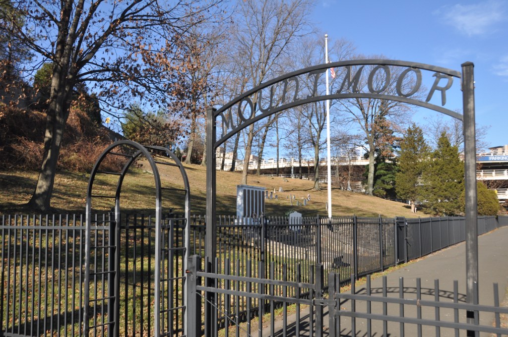
Mount Moor African-American Cemetery
Monument and historic site · National Register of Historic Places · 1.6 mi
Historic cemetery in Rockland County, New York, US

North Main Street School
Monument and historic site · National Register of Historic Places · 3.4 mi
School building in New York, United States of America

Palisades Interstate Parkway
Monument and historic site · National Register of Historic Places · 2.6 mi
Highway in New Jersey and New York
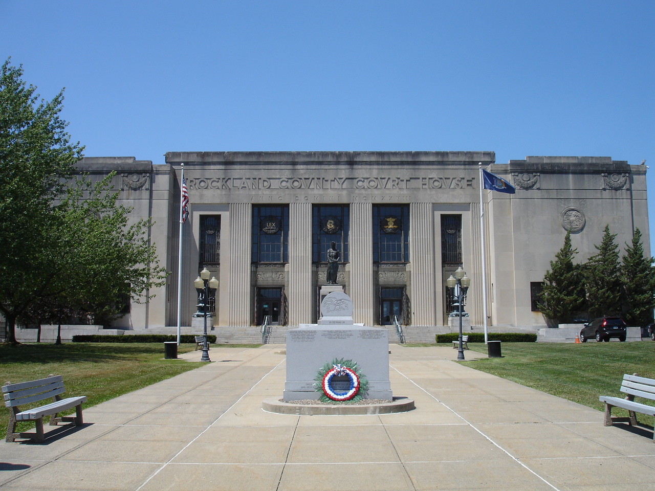
Rockland County Courthouse and Dutch Gardens
Monument and historic site · National Register of Historic Places · 2.3 mi
Historic district in New York, United States of America
Ross-Hand Mansion
Monument and historic site · National Register of Historic Places · 3.5 mi
South Nyack, New York, listed on the NRHP in New York

Shadowcliff
Monument and historic site · National Register of Historic Places · 3.2 mi
Historic home located at Upper Nyack, Rockland County, New York
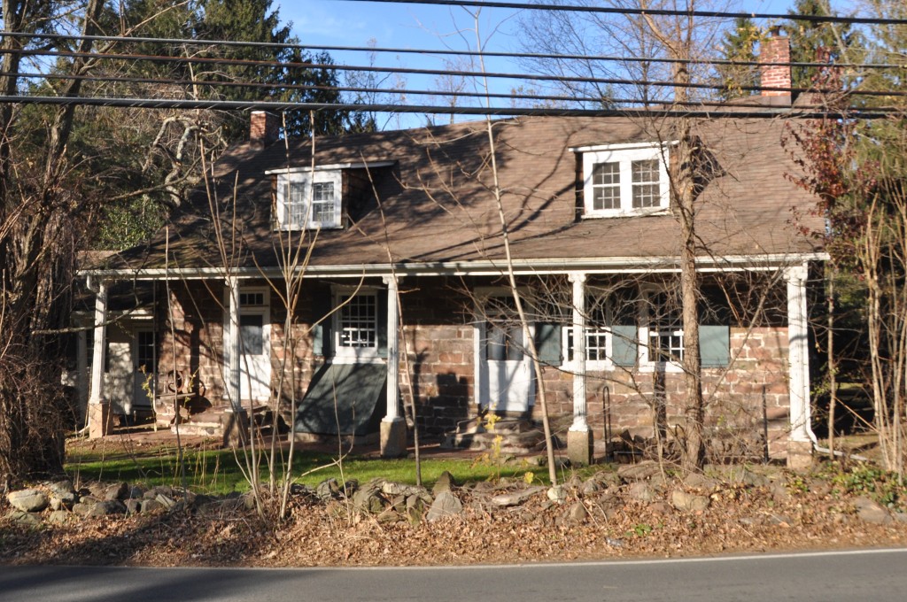
Terneur-Hutton House
Monument and historic site · National Register of Historic Places · 2.2 mi
Historic house in New York, United States


United States Post Office
Monument and historic site · National Register of Historic Places · 3.6 mi
Government building in Nyack, New York
6 more on the map.
Parks, trails and playgrounds1

Restaurants and cafes22

Pizzarena West Nyack
Restaurant · Pizza · 1.5 mi
Very popular pizza/ Italian restaurant in the town of west nyack. Often caters local school and sport team events and meetings.
82 West Nyack Road, West Nyack
Mo-Sa 11:00-21:00; Su 12:00-21:00


Bagel Boys New City
Restaurant · Breakfast · 0.8 mi
Popular morning destination for breakfast and coffee. Customers usually consist of local school students and teachers in the mornings....
48 Germonds Road, New City

Little Tokyo Sushi
Restaurant · Japanese · 1.7 mi
3563 Palisades Center Drive, West Nyack

Dunkin'
Fast food · Donut, Coffee Shop · 1.0 mi
301 Route 304, Nanuet
Mo-Sa 05:00-22:00; Su 06:00-21:00
Dunkin'
Fast food · Donut, Coffee Shop · 1.7 mi
1000 Palisades Center Drive, West Nyack
Mo-Th 08:00-20:00; Fr-Sa 08:00-21:30; Su 08:00-19:00
10 more on the map.
Churches and places of worship9
First Methodist Episcopal Church of Nyack
Church · National Register of Historic Places · 3.3 mi
St. Paul's Episcopal Church
Church · National Register of Historic Places · 3.5 mi
St. Paul's United Methodist Church
Church · National Register of Historic Places · 3.5 mi
Nanuet Hebrew Center
Place of worship · 1.6 mi
411 South Little Tor Road, New City
Shopping8
Schools, colleges and libraries47
Healthcare4
Map of Bardonia
110 places. The map loads OpenStreetMap tiles when you open it.
Climate by month
Monthly table
| Month | High | Low | Rain | Snow |
|---|---|---|---|---|
| Jan | 40°F | 23°F | 3.9 in | 9.4 in |
| Feb | 43°F | 24°F | 3.3 in | 10.9 in |
| Mar | 51°F | 31°F | 4.4 in | 5.8 in |
| Apr | 63°F | 40°F | 4.3 in | 0.7 in |
| May | 73°F | 50°F | 4.3 in | 0.0 in |
| Jun | 81°F | 59°F | 4.6 in | 0.0 in |
| Jul | 86°F | 64°F | 4.5 in | 0.0 in |
| Aug | 84°F | 63°F | 4.4 in | 0.0 in |
| Sep | 77°F | 56°F | 4.6 in | 0.0 in |
| Oct | 65°F | 45°F | 4.4 in | 0.0 in |
| Nov | 54°F | 36°F | 3.9 in | 0.3 in |
| Dec | 44°F | 29°F | 4.7 in | 5.6 in |
U.S. Climate Normals 1991-2020 for Dobbs Ferry-Ardsley Hcn (11 mi away), NOAA NCEI.
People and cost of living
American Community Survey 5-year estimates, 2020-2024, U.S. Census Bureau. Estimates have margins of error, larger for small towns.
Disaster history
Rockland County has had 20 federal disaster declarations since 2000, most often for hurricanes.
- 2023-07-22: Severe Storms And Flooding (Severe Storm)
- 2021-09-05: Remnants Of Hurricane Ida (Hurricane)
- 2021-09-02: Remnants Of Hurricane Ida (Hurricane)
- 2021-08-22: Hurricane Henri (Hurricane)
- 2020-10-02: Tropical Storm Isaias (Hurricane)
- 2020-03-20: Covid-19 Pandemic (Biological)
OpenFEMA disaster declarations summaries.
Getting there and nearby towns
Westchester County Airport (HPN) is the nearest airport with scheduled flights listed in OpenStreetMap, 14 miles away.
- Nanuet 2 mi southwest, about 4 min by car
- New City 3 mi north, about 4 min by car
- Spring Valley 4 mi west, about 6 min by car
- Pearl River 4 mi south, about 6 min by car
- Upper Nyack 4 mi east, about 6 min by car
- Chestnut Ridge 4 mi southwest, about 7 min by car
- Haverstraw 5 mi northeast, about 8 min by car
- Monsey 5 mi west, about 8 min by car
- Montvale 5 mi southwest, about 9 min by car
- Sleepy Hollow 6 mi east, about 9 min by car
Drive times are estimates from straight-line distance, not routes.
Local news
Headlines from INDB, the NEMICO news database.
Reviews, tips and questions
Loading what members have shared...
Sources and licences
- NCES EDGE (Public domain): public schools
- NOAA NCEI U.S. Climate Normals 1991-2020 (Public domain): climate by month
- OpenFEMA (Public domain): disaster declarations
- OpenStreetMap contributors (ODbL 1.0): places, airports, map data
- U.S. Census Bureau (Public domain): population, income, housing, education, commute
- Wikidata (CC0 1.0): elevation, founding date, time zone, website, landmarks and historic places
- Wikimedia Commons (see each image): photos
- Wikipedia (CC BY-SA 4.0): overview and history text
Photo credits
- First Methodist Episcopal Church of Nyack 4, David Rivera, CC BY-SA 3.0
- Edward Hopper`s birthplace Nyack, Ritzel, CC BY-SA 3.0
- ST. PAUL'S EPISCOPAL CHURCH, Spring Valley, New York, JERRYE AND ROY KLOTZ, M.D., CC BY-SA 4.0
- Shadowcliff Shadowcliff, also known as the Fellowship of Reconciliation Headquarters, is a historic home located at Upper Nyack, Rockland County, New York, Jimstu8, CC BY-SA 3.0
- St. Paul's United Methodist Church, David Rivera, CC BY-SA 3.0
- SouthNyackNY RossHandMansion, User:Magicpiano, CC BY-SA 4.0
- North Main Street School, Spring Valley, NY, Daniel Case, CC BY-SA 3.0
- SouthNyackNY CarsonMcCullersHouse, User:Magicpiano, CC BY-SA 4.0
- WestNyackNY TerneurHuttonHouse, User:Magicpiano, CC BY-SA 4.0
- VAN HOUTEN'S LANDING HISTORIC DISTRICT, ROCKLAND COUNTY NY, JERRYE & ROY KLOTZ, M.D., CC BY-SA 4.0
- HR Stevens House, New City, NY, Daniel Case, CC BY-SA 3.0
- Upper Nyack Firehouse, David Rivera, CC BY-SA 3.0
- Brookside-Lochbourn, Izzy406, CC BY-SA 3.0
- New York - Palisades Interstate Parkway - 20180904201335, Kapitangrant, CC BY-SA 4.0
- WestNyackNY MountMoorCemetery 01, User:Magicpiano, CC BY-SA 4.0
- Nyack, NY, post office, Daniel Case, CC BY-SA 3.0
- Spring Valley, NY, post office, Daniel Case, CC BY-SA 3.0
- RocklandCountyCourthouse, KForce, CC BY-SA 3.0
- TappanZeePlayhouse, A. O'Brien, Public domain
- 9.6.07PalisadesCenterMallFoodCourtbyLuigiNovi, Nightscream at English Wikipedia, CC BY-SA 2.5
- Church at Novo-Diveevo, Violette79 from Brooklyn, NY, USA, CC BY-SA 2.0
- ClarkstownNY VanderbiltBudkeTraphagenHouse2, Magicpiano, CC BY-SA 4.0
- ClarkstownNY TallmanBudkeHouse, Magicpiano, CC BY-SA 4.0
- ClarkstownNY VanderbiltBudkeTraphagenHouse, Magicpiano, CC BY-SA 4.0
- Audi A4 Cabriolet 3.0 quattro (2003) (53645289780), Charles from Port Chester, New York, CC BY 2.0
- Audi A4 Cabriolet 3.0 quattro (2003) (53644831751), Charles from Port Chester, New York, CC BY 2.0
- ISS043-E-243777 - View of Earth, Earth Science and Remote Sensing Unit , Lyndon B. Johnson Space Center, Public domain
- ISS043-E-243778 - View of Earth, Earth Science and Remote Sensing Unit , Lyndon B. Johnson Space Center, Public domain
- The Home Depot - Palisades Park Mall West Nyack, NY June 2016 (28729525894), Mike Kalasnik from Jersey City, USA, CC BY-SA 2.0
- 1990 Nissan RB20DET engine in HNR32 Skyline GTS-4, Mr.choppers, CC BY-SA 3.0
- 2RZ-E engine in 1994 Hiace Wagon Super Custom, Mr.choppers, CC BY-SA 3.0
- 1992 Plymouth Laser RS Turbo AWD in Red, front right, Mr.choppers, CC BY-SA 3.0
- CSX Tracks Valley Cottage, Jondude11, CC BY-SA 4.0
- Palisades Center 2, JJBers, CC BY 2.0
- Barnes & Noble (Palisades Center) (52027183310), JJBers from Windham, Connecticut, USA, CC BY 2.0
- Palisades Center Mall Ferris Wheel, June 2016, TMBLover, CC BY-SA 4.0
- Palisades Center Mall Ferris Wheel, June 2016 (cropped), TMBLover, CC BY-SA 4.0
- Current Venetian Carousel at Palisades Mall, TMBLover, CC BY-SA 4.0
- Blauvelt-Cropsey Farm, New City, NY, Daniel Case, CC BY-SA 3.0


Page built October 30, 2026. Spotted a mistake? Tell us or suggest a place.