


Why visit Bath
Townapedia lists 22 museums and landmarks, 19 parks and trails, 22 places to eat, 3 places to stay and 6 attractions in and around town.
Highlights include Doubling Point Light, Doubling Point Range Lights, Bath Historic District and Captain Merritt House.
July is the warmest month, with average highs of 79°F; February lows average 10°F, and about 72 inches of snow fall in a normal year.
Weather in Bath
Forecast from the National Weather Service. Full forecast
About Bath
Bath is a city in and county seat of Sagadahoc County, Maine, United States. Bath had a 2024 population of 8,870. Bath is growing at a rate of 0.29% annually, and its population has increased by 1.21% since the most recent census, which recorded a population of 8,764 in 2020. The city is popular with tourists, many drawn by its 19th-century architecture.
From the Wikipedia article Bath, Maine (this version), under CC BY-SA 4.0.
Things to do6

Doubling Point Light
Lighthouse · National Register of Historic Places · 4.0 mi
Lighthouse in Maine, United States

Doubling Point Range Lights
Lighthouse · National Register of Historic Places · 4.3 mi
Lighthouse in Maine, United States




Chocolate Church Arts Center
Cinema and theater · 2.0 mi
804 Washington Street, Bath
Museums and landmarks22

Bath Historic District
Monument and historic site · National Register of Historic Places · 1.8 mi
Historic district in Bath, Maine
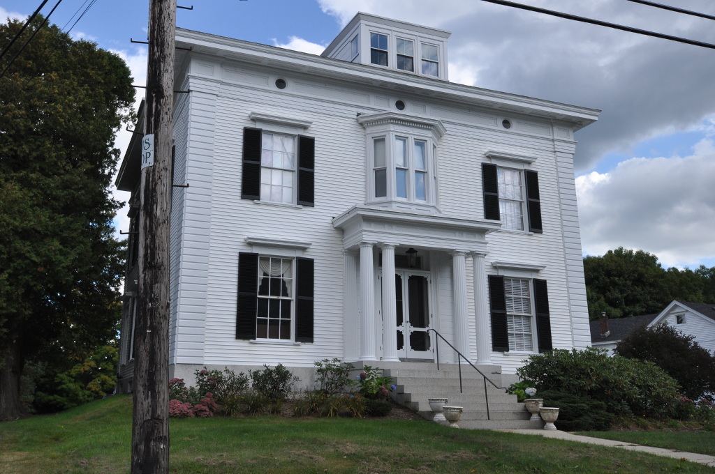
Captain Merritt House
Monument and historic site · National Register of Historic Places · 2.2 mi
Bath, Maine, NRHP-listed in Sagahadoc County, Maine
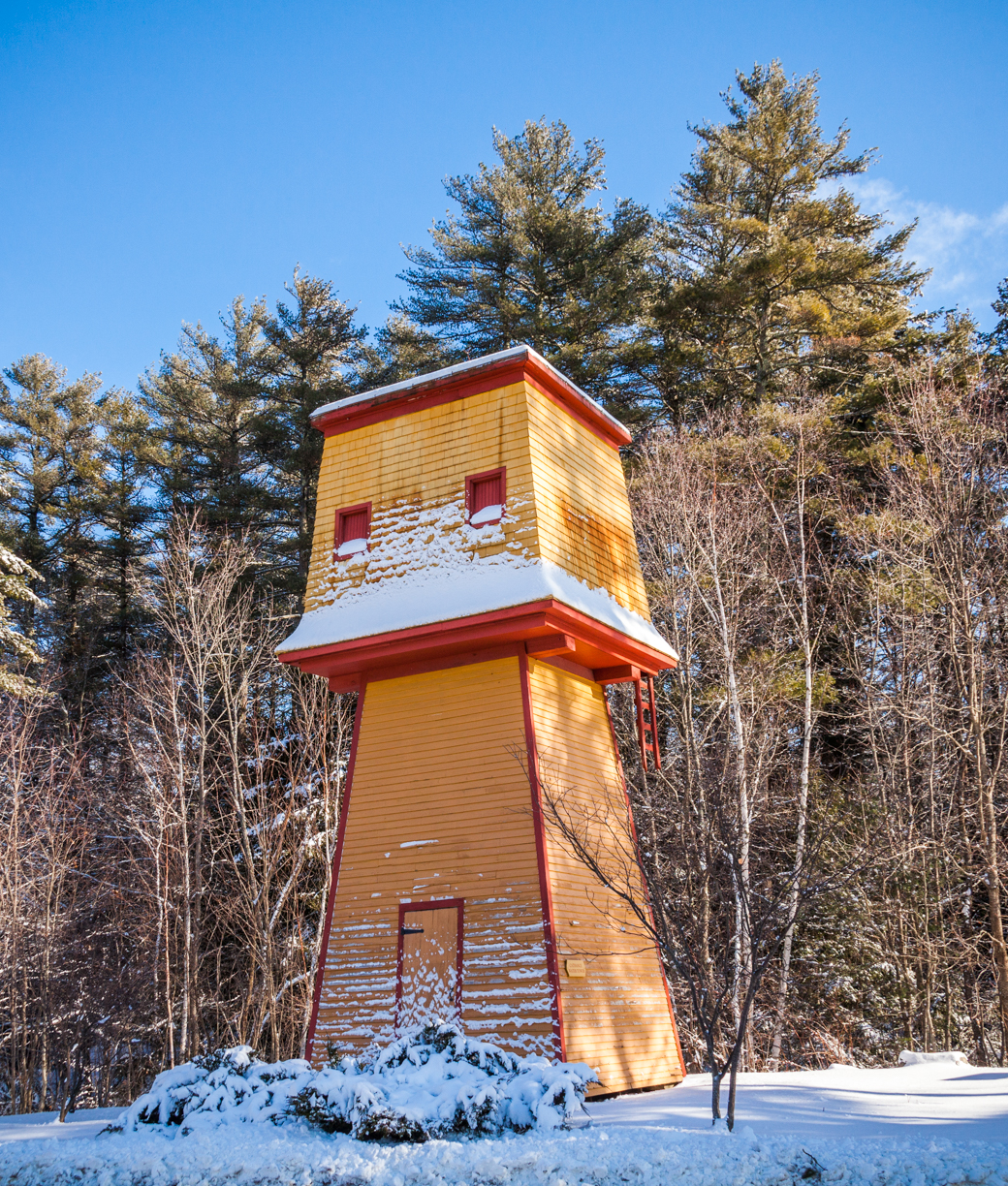
Cathance Water Tower
Monument and historic site · National Register of Historic Places · 4.4 mi
Water tower in Topsham, United States of America

Days Ferry Historic District
Monument and historic site · National Register of Historic Places · 2.2 mi
Historic district in Maine, United States

Fiddler's Reach Fog Signal
Monument and historic site · National Register of Historic Places · 4.2 mi
Fog signal station on Kennebec River in Arrowsic, Maine, United States

Gov. William King House
Monument and historic site · National Register of Historic Places · 1.2 mi
Bath, Maine, listed on the NRHP in Sagadahoc County, Maine
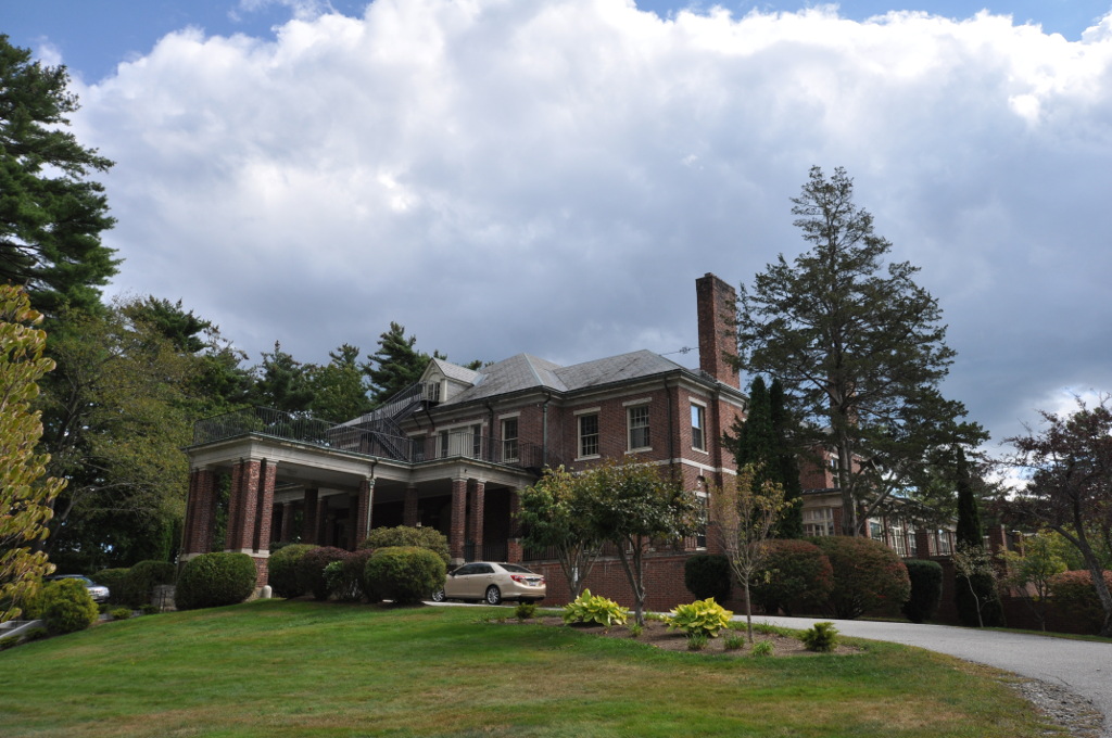
Hyde Mansion
Monument and historic site · National Register of Historic Places · 2.2 mi
Historic house at 616 High Street in Bath, Maine, United States
John E.L. Huse Memorial School
Monument and historic site · National Register of Historic Places · 1.7 mi
Building in Maine, United States

Lt. Richard Hathorn House
Monument and historic site · National Register of Historic Places · 3.9 mi
House in Woolwich, Maine

Mill Cove School
Monument and historic site · National Register of Historic Places · 3.6 mi
Historic school building on Berrys Mill Road in West Bath, Maine
Percy & Small Shipyard
Monument and historic site · National Register of Historic Places · 3.0 mi
Shipyard in Bath, Maine, United States


Randall-Hildreth House
Monument and historic site · National Register of Historic Places · 2.7 mi
House in Topsham, Maine
10 more on the map.
Parks, trails and playgrounds19

Captain William A. Fitzgerald U.S.N. Recreation and Conservation Area
Park · 2.1 mi
Lindbergh Crossing, Brunswick
dawn-dusk



7 more on the map.
Restaurants and cafes22

Solo Pane & Pasticceria
Cafe · Bakery, Coffee Shop, Pizza, Italian · 2.1 mi
Bakery, gourmet lunches - take out
29 Centre Street, Bath
Mo-Sa 07:00-17:00

Cafe Creme
Cafe · Coffee Shop · 2.1 mi
56 Front Street, Bath
Mo-We 07:30-16:30; Th-Sa 07:30-17:30; Su 08:30-15:30
Southgate Family Restaurant
Restaurant · American, Breakfast, Burger, Sandwich · 2.1 mi
25 Centre Street, Bath
We-Su 07:00-13:00

Beale Street Barbecue
Restaurant · Barbecue · 2.1 mi
215 Water Street, Bath
11:00-21:00
Midcoast Pizza and More
Restaurant · Pizza · 2.2 mi
737 Washington Street, Bath
11:00-21:00
Southgate Family Restaurant
Restaurant · Breakfast · 2.5 mi
510 Washington Street, Bath
10 more on the map.
History
Abenaki Indians called the area Sagadahoc, meaning "mouth of big river". It was a reference to the Kennebec River, which Samuel de Champlain explored in 1605. Popham Colony was established in 1607 downstream, together with Fort St George. The settlement failed due to harsh weather and lack of leadership, but the colonists built the New World's first oceangoing vessel constructed by English shipwrights, the Virginia of Sagadahoc. It provided passage back to England. Most of Bath, Maine, was settled by travelers from Bath, England.
The next settlement at Sagadahoc was around 1660, when the land was taken from an Indian sagamore known as Robinhood. Incorporated as part of Georgetown in 1753, Bath was set off and incorporated as a town on February 17, 1781. It was named by the postmaster, Dummer Sewall, after Bath in Somerset, England. In 1844, a portion of the town was set off to create West Bath. On June 14, 1847, Bath was incorporated as a city, and in 1854, designated county seat. Land was annexed from West Bath in 1855.
From the History section of Bath, Maine on Wikipedia, under CC BY-SA 4.0.
Where to stay3
Churches and places of worship13
Winter Street Church
Church · National Register of Historic Places · 1.8 mi
880 Washington Street, Bath
Bath Foursquare Gospel Church
Church · Foursquare · 1.6 mi
405 Centre Street, Bath
Days Ferry Congregational Church
Church · United Church Of Christ · 2.4 mi
50 Old Stage Road, Woolwich
Shopping8
Gas and EV charging6
Schools, colleges and libraries15
Healthcare2
Map of Bath
116 places. The map loads OpenStreetMap tiles when you open it.
Climate by month
Monthly table
| Month | High | Low | Rain | Snow |
|---|---|---|---|---|
| Jan | 31°F | 10°F | 3.7 in | 20.0 in |
| Feb | 34°F | 10°F | 3.6 in | 18.8 in |
| Mar | 41°F | 20°F | 4.2 in | 13.4 in |
| Apr | 52°F | 31°F | 4.3 in | 3.0 in |
| May | 63°F | 41°F | 3.6 in | 0.0 in |
| Jun | 72°F | 51°F | 4.4 in | 0.0 in |
| Jul | 79°F | 57°F | 3.1 in | 0.0 in |
| Aug | 78°F | 56°F | 3.3 in | 0.0 in |
| Sep | 70°F | 48°F | 3.9 in | 0.0 in |
| Oct | 59°F | 38°F | 5.2 in | 0.1 in |
| Nov | 47°F | 28°F | 4.5 in | 2.5 in |
| Dec | 36°F | 18°F | 4.6 in | 14.0 in |
U.S. Climate Normals 1991-2020 for Bath (0 mi away), NOAA NCEI.
People and cost of living
American Community Survey 5-year estimates, 2020-2024, U.S. Census Bureau. Estimates have margins of error, larger for small towns.
Disaster history
Sagadahoc County has had 15 federal disaster declarations since 2000, most often for severe storms.
- 2024-03-20: Severe Storms And Flooding (Severe Storm)
- 2023-09-14: Hurricane Lee (Hurricane)
- 2023-07-06: Severe Storm And Flooding (Flood)
- 2020-04-04: Covid-19 Pandemic (Biological)
- 2020-03-13: Covid-19 (Biological)
- 2018-01-02: Severe Storm And Flooding (Severe Storm)
OpenFEMA disaster declarations summaries.
Getting there and nearby towns
Brunswick Executive Airport (NHZ) is the nearest airport with scheduled flights listed in OpenStreetMap, 6 miles away.
- Brunswick 6 mi southwest, about 9 min by car
- Lewiston 19 mi northwest, about 31 min by car
- Auburn 23 mi northwest, about 36 min by car
- Portland 27 mi southwest, about 43 min by car
- Augusta 28 mi north, about 46 min by car
- Westbrook 30 mi southwest, about 48 min by car
- South Portland 30 mi southwest, about 49 min by car
- Saco 40 mi southwest, about 1 h by car
- Waterville 43 mi north, about 1 h 15 min by car
- Biddeford 44 mi southwest, about 1 h 15 min by car
Drive times are estimates from straight-line distance, not routes.
Local news
Headlines from INDB, the NEMICO news database.
Reviews, tips and questions
Loading what members have shared...
Sources and licences
- NCES EDGE (Public domain): public schools
- NOAA NCEI U.S. Climate Normals 1991-2020 (Public domain): climate by month
- OpenFEMA (Public domain): disaster declarations
- OpenStreetMap contributors (ODbL 1.0): places, airports, map data
- U.S. Census Bureau (Public domain): population, income, housing, education, commute
- Wikidata (CC0 1.0): elevation, founding date, time zone, website, landmarks and historic places
- Wikimedia Commons (see each image): photos
- Wikipedia (CC BY-SA 4.0): overview and history text
Photo credits
- Bath City Hall, Maine, USA 4th of July Photo, WestportWiki, CC BY-SA 3.0
- BathME GovWilliamKingHouse, Magicpiano, CC BY-SA 4.0
- American beech (Fagus grandifolia) leaves at the Thorne Head Preserve Trail, Bath, Maine, US (PPL1-Corrected) julesvernex2, Jules Verne Times Two, CC BY-SA 4.0
- American toad (Anaxyrus americanus), Thorne Head Preserve Trail, Bath, Maine, US (PPL3-Altered) julesvernex2, Jules Verne Times Two, CC BY-SA 4.0
- Pier at the end of the Thorne Head Preserve Trail, Bath, Maine, US (PPL1-Corrected) julesvernex2, Jules Verne Times Two, CC BY-SA 4.0
- Bracken (Pteridium aquilinum) at the Thorne Head Preserve Trail, Bath, Maine, US (PPL1-Corrected) julesvernex2, Jules Verne Times Two, CC BY-SA 4.0
- Thorne Head Preserve Trail, Bath, Maine, US (PPL1-Corrected) julesvernex2, Jules Verne Times Two, CC BY-SA 4.0
- Gabriel on tent made of tree branches, Thorne Head Preserve Trail, Bath, Maine, US (PPL1-Corrected) julesvernex2, Jules Verne Times Two, CC BY-SA 4.0
- Fallen tree the Thorne Head Preserve Trail, Bath, Maine, US (PPL1-Corrected) julesvernex2, Jules Verne Times Two, CC BY-SA 4.0
- Red maple (Acer rubrum) leaves at the Thorne Head Preserve Trail, Bath, Maine, US (PPL1-Corrected) julesvernex2, Jules Verne Times Two, CC BY-SA 4.0
- Witch hazel (Hamamelis virginiana) leaves at the Thorne Head Preserve Trail, Bath, Maine, US (PPL1-Corrected) julesvernex2, Jules Verne Times Two, CC BY-SA 4.0
- Gabriel carrying a large stick the Thorne Head Preserve Trail, Bath, Maine, US (PPL1-Corrected) julesvernex2, Jules Verne Times Two, CC BY-SA 4.0
- Jules and Gabriel at a pier at the end of the Thorne Head Preserve Trail, Bath, Maine, US (PPL1-Corrected) julesvernex2, Jules Verne Times Two, CC BY-SA 4.0
- Starburst through red maple (Acer rubrum) trees at the Thorne Head Preserve Trail, Bath, Maine, US (PPL1-Corrected) julesvernex2, Jules Verne Times Two, CC BY-SA 4.0
- Tent made of tree branches at the Thorne Head Preserve Trail, Bath, Maine, US (PPL1-Corrected) julesvernex2, Jules Verne Times Two, CC BY-SA 4.0
- Jules and Gabriel at the Thorne Head Preserve Trail, Bath, Maine, US (PPL1-Corrected) julesvernex2, Jules Verne Times Two, CC BY-SA 4.0
- Gabriel carrying a large stick the Thorne Head Preserve Trail, Bath, Maine, US (PPL1-Corrected) julesvernex2-2, Jules Verne Times Two, CC BY-SA 4.0
- BathME HuseMemorialSchool, Magicpiano, CC BY-SA 4.0
- Bath, Maine aerial view, Quintin Soloviev, CC BY 4.0
- Bath, Maine aerial view (cropped), Quintin Soloviev, CC BY 4.0
- MotelWestBath (9413361244), Paul VanDerWerf from Brunswick, Maine, USA, CC BY 2.0
- Street clock, Bath, Maine, Seasider53, CC BY-SA 4.0
- Fiddlers Reach Maine Sound Signal, Jameslwoodward, CC BY-SA 3.0
- Doubling Point Light Maine, Jameslwoodward, CC BY-SA 3.0
- Bath downtown 09.07.2012 14-31-46, Dirk Ingo Franke, CC BY 3.0
- BathME TrufantHD 1, Magicpiano, CC BY-SA 3.0
- Woolwich Town House, Iverjm, CC BY-SA 3.0
- WoolwichME LtRichardHathornHouse, Magicpiano, CC BY-SA 4.0
- WoolwichME DaysFerryHD 1, Magicpiano, CC BY-SA 4.0
- BathME HydeMansion, Magicpiano, CC BY-SA 3.0
- CathanceWaterTower, Paul VanDerWerf, CC BY 2.0
- TopshamME RandallHildrethHouse, Magicpiano, CC BY-SA 4.0
- BathME WDCrookerHouse, Magicpiano, CC BY-SA 3.0
- BathME WilliamTDonnellHouse, Magicpiano, CC BY-SA 3.0
- Littlefield School in Mill Cove District, Vanessa White, CC BY-SA 4.0
- BathME CaptainMerrittHouse, Magicpiano, CC BY-SA 3.0
- U. S. Custom House, Bath, Maine 1991, Tommyboymee, CC BY-SA 4.0
- Carlton Bridge, Bath, Maine (67555), Tichnor Brothers, Publisher, Public domain
- Sagadahoc Bridge, Bath, Maine, USA 2012, WestportWiki, CC BY-SA 3.0
- Friday Fence (32810963005), Paul VanDerWerf from Brunswick, Maine, USA, CC BY 2.0


Page built October 30, 2026. Spotted a mistake? Tell us or suggest a place.