


Boothbay Harbor, Maine
Boothbay Harbor is a community of 1,047 people in Lincoln County, Maine.
Why visit Boothbay Harbor
Townapedia lists 27 museums and landmarks, 23 parks and trails, 47 places to eat, 29 places to stay and 8 attractions in and around town.
Highlights include Burnt Island Light, Opera House at Boothbay Harbor, Boothbay Harbor Memorial Library and Auld-McCobb House.
July is the warmest month, with average highs of 76°F; January lows average 14°F.
Weather in Boothbay Harbor
Forecast from the National Weather Service. Full forecast
About Boothbay Harbor
Boothbay Harbor is a census-designated place (CDP) comprising the densely populated center of the town of Boothbay Harbor in Lincoln County, Maine, United States. The population was 1,086 at the 2010 census, down from 1,237 at the 2000 census.
From the Wikipedia article Boothbay Harbor (CDP), Maine (this version), under CC BY-SA 4.0.
Things to do8

Burnt Island Light
Lighthouse · National Register of Historic Places · 2.3 mi
Lighthouse in Maine, United States

Opera House at Boothbay Harbor
Cinema and theater
86 Townsend Avenue, Boothbay Harbor

Brown's Farm Stand
Farm and orchard · 0.5 mi
208 Townsend Avenue, Boothbay Harbor
Carousel Music Theater
Cinema and theater · 0.4 mi
196 Townsend Avenue, Boothbay Harbor

Maine State Aquarium
Zoo and aquarium · 1.2 mi
194 McKown Point Road, Boothbay Harbor

Museums and landmarks27

Boothbay Harbor Memorial Library
Monument and historic site · National Register of Historic Places · 0.4 mi
Library in Boothbay Harbor, Maine, United States
4 Oak Street, Boothbay Harbor
Auld-McCobb House
Monument and historic site · National Register of Historic Places
Double house in Boothbay Harbor, Maine
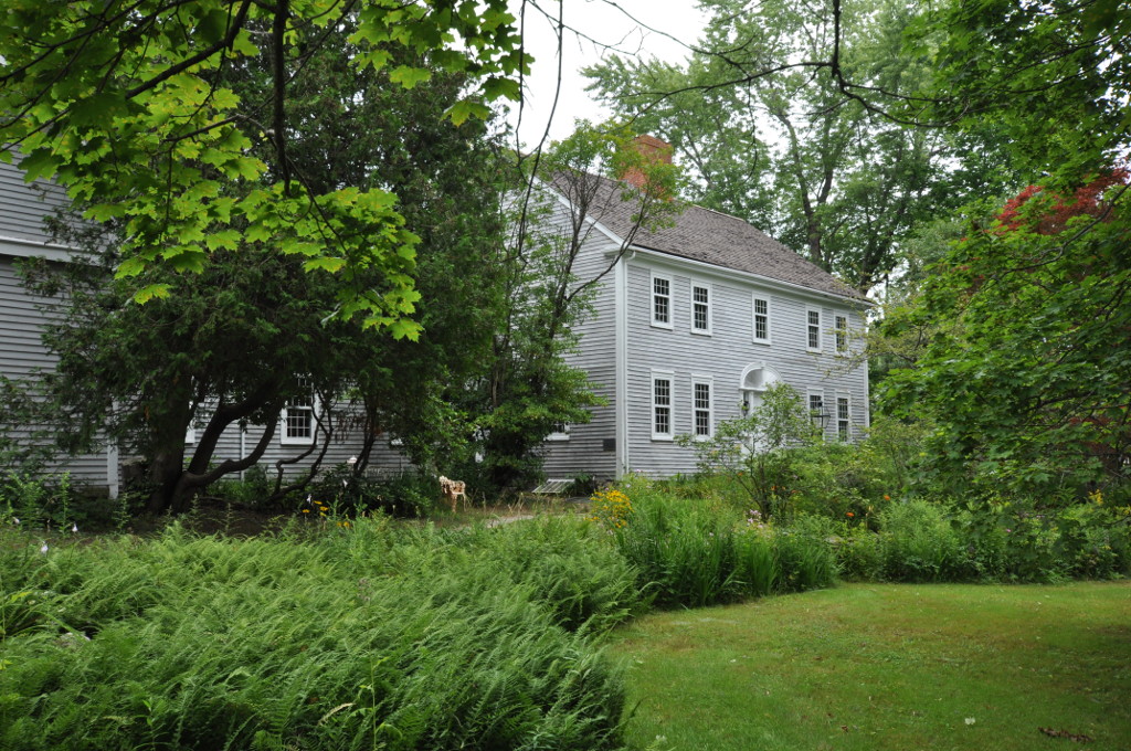
Knight-Corey House
Monument and historic site · National Register of Historic Places · 1.6 mi
Historic house on Corey Lane in Boothbay, Maine
Old Gray House
Monument and historic site · National Register of Historic Places · 3.1 mi
Historic house at 60 Tavenner Road, on Sawyers Island in Boothbay, Maine
Pythian Opera House
Cinema and theater · National Register of Historic Places
Meeting hall and theatre in Boothbay Harbor, Maine, United States


Sprucewold Lodge
Monument and historic site · National Register of Historic Places · 1.0 mi
Historic summer tourist accommodation in Boothbay Harbor, Maine

Ed Brown’s Wharfside Gallery
Museum · 0.4 mi
21 Commercial Street, Boothbay Harbor
Balmy Days Cruises
Monument and historic site · 0.5 mi
42 Commercial Street, Boothbay Harbor
Boothbay Harbor Schooners
Monument and historic site · 0.4 mi
20 Commercial Street, Boothbay Harbor
Boothbay Region Art Foundation Gallery
Museum · 0.4 mi
1 Townsend Avenue, Boothbay Harbor
15 more on the map.
Parks, trails and playgrounds23



11 more on the map.
Restaurants and cafes47

Boothbay House of Pizza
Restaurant · Pizza · 0.4 mi
185 Townsend Avenue, Boothbay Harbor
Boothbay Lobster Wharf
Restaurant · Seafood · 0.7 mi
97 Atlantic Avenue, Boothbay Harbor

Brisetto's Second Cup
Cafe · Coffee Shop · 0.4 mi
41 Commercial Street, Boothbay Harbor
Cabbage Island Clambakes
Restaurant · Seafood · 1.3 mi
1 Cabbage Island, Boothbay

Kaler's Restaurant
Restaurant · Seafood · 0.5 mi
48 Commercial Street, Boothbay Harbor
McSeagull's Restaurant
Restaurant · Seafood · 0.4 mi
14 Wharf Street, Boothbay Harbor
35 more on the map.
Where to stay29
Boothbay Harbor Oceanside Resort
Motel and hotel · 0.4 mi
37 Atlantic Avenue, Boothbay Harbor
Captain Sawyer's Bed and Breakfast
Motel and hotel · 0.5 mi
55 Commercial Street, Boothbay Harbor
Dancing Pines Cottage
Motel and hotel · 1.3 mi
175 Lakeside Drive, Boothbay Harbor
Fisherman's Wharf Inn
Motel and hotel · 0.4 mi
22 Commercial Street, Boothbay Harbor
Churches and places of worship4
Our Lady Queen of Peace Catholic Church
Church · Roman Catholic · 0.6 mi
82 Atlantic Avenue, Boothbay Harbor
Congregational Church of Boothbay Harbor
Church · United Church Of Christ
125 Townsend Avenue, Boothbay Harbor
First United Methodist Church of Boothbay Harbor
Church · Methodist
81 Townsend Avenue, Boothbay Harbor
Saint Columba's Episcopal Church
Church · Episcopal · 0.6 mi
32 Emery Lane, Boothbay Harbor
Shopping20
Friends of the Library Used Book Store
Shop · 0.4 mi
15 McKown Street, Boothbay Harbor
Hammond Lumber Company
Hardware store · 0.8 mi
276 Townsend Avenue, Boothbay Harbor
Sherman's Maine Coast Book Shop
Shop · 0.4 mi
5 Commercial Street, Boothbay Harbor
Gas and EV charging2
Schools, colleges and libraries5
South Bristol Elementary School
School · 3.3 mi
2024 State Route 129, South Bristol
Healthcare2
Lincoln Hospital Saint Andrews Campus
Clinic and pharmacy · 0.9 mi
6 Saint Andrews Lane, Boothbay Harbor
Boothbay Harbor Primary Care Center
Clinic and pharmacy · 0.9 mi
18 Saint Andrews Lane, Boothbay Harbor
Map of Boothbay Harbor
167 places. The map loads OpenStreetMap tiles when you open it.
Climate by month
Monthly table
| Month | High | Low | Rain |
|---|---|---|---|
| Jan | 31°F | 14°F | 4.4 in |
| Feb | 33°F | 16°F | 3.9 in |
| Mar | 40°F | 24°F | 4.9 in |
| Apr | 51°F | 34°F | 4.3 in |
| May | 62°F | 44°F | 3.6 in |
| Jun | 70°F | 53°F | 4.4 in |
| Jul | 76°F | 59°F | 3.7 in |
| Aug | 76°F | 59°F | 3.2 in |
| Sep | 69°F | 51°F | 4.3 in |
| Oct | 58°F | 42°F | 5.2 in |
| Nov | 47°F | 32°F | 4.3 in |
| Dec | 37°F | 22°F | 5.4 in |
U.S. Climate Normals 1991-2020 for Westport Island (5 mi away), NOAA NCEI.
People and cost of living
American Community Survey 5-year estimates, 2020-2024, U.S. Census Bureau. Estimates have margins of error, larger for small towns.
Disaster history
Lincoln County has had 18 federal disaster declarations since 2000, most often for severe storms.
- 2024-03-20: Severe Storms And Flooding (Severe Storm)
- 2023-09-14: Hurricane Lee (Hurricane)
- 2023-07-06: Severe Storm And Flooding (Flood)
- 2020-04-04: Covid-19 Pandemic (Biological)
- 2020-03-13: Covid-19 (Biological)
- 2018-01-02: Severe Storm And Flooding (Severe Storm)
OpenFEMA disaster declarations summaries.
Getting there and nearby towns
Wiscasset Municipal Airport (ISS) is the nearest airport with scheduled flights listed in OpenStreetMap, 9 miles away.
- Bath 12 mi northwest, about 20 min by car
- Brunswick 16 mi west, about 26 min by car
- Portland 32 mi southwest, about 51 min by car
- Lewiston 32 mi northwest, about 51 min by car
- Augusta 34 mi north, about 54 min by car
- Auburn 35 mi northwest, about 56 min by car
- South Portland 37 mi southwest, about 59 min by car
- Westbrook 38 mi west, about 1 h by car
- Saco 46 mi southwest, about 1 h 15 min by car
- Biddeford 48 mi southwest, about 1 h 15 min by car
Drive times are estimates from straight-line distance, not routes.
Local news
Headlines from INDB, the NEMICO news database.
Reviews, tips and questions
Loading what members have shared...
Sources and licences
- NCES EDGE (Public domain): public schools
- NOAA NCEI U.S. Climate Normals 1991-2020 (Public domain): climate by month
- OpenFEMA (Public domain): disaster declarations
- OpenStreetMap contributors (ODbL 1.0): places, airports, map data
- U.S. Census Bureau (Public domain): population, income, housing, education, commute
- Wikidata (CC0 1.0): elevation, founding date, time zone, website, landmarks and historic places
- Wikimedia Commons (see each image): photos
- Wikipedia (CC BY-SA 4.0): overview and history text
Photo credits
- Boothbay Harbor Memorial Library 2003, Kenneth C. Zirkel, CC BY-SA 3.0
- Dock in Boothbay Harbor (7998308146), Paul VanDerWerf from Brunswick, Maine, USA, CC BY 2.0
- Boothbay Harbor WV banner, Paul VanDerWerf from Brunswick, Maine, USA, CC BY 2.0
- Boothbay Harbor Sunrise (29380813841), Paul VanDerWerf from Brunswick, Maine, USA, CC BY 2.0
- Our Lady Queen of Peace Catholic Church (Boothbay Harbor, Maine) - view from the harbor 3, Nheyob, CC BY-SA 4.0
- Sea Hound - Boothbay Harbor, Eric Kilby, CC BY-SA 4.0
- Burnt Island Light 2018, ShagVT, CC BY-SA 3.0
- BoothbayME KnightCoreyHouse, User:Magicpiano, CC BY-SA 4.0
- BoothbayHarborME SprucewoldLodge2, User:Magicpiano, CC BY-SA 4.0
- BoothbayHarborME PythianOperaHouse 1, Magicpiano, CC BY-SA 3.0
- BoothbayHarborME PythianOperaHouse 2, Magicpiano, CC BY-SA 3.0
- Boothbay Library, B Lee Mannino, CC BY-SA 3.0
- Schooner American Eagle (43161354761), Paul VanDerWerf from Brunswick, Maine, USA, CC BY 2.0
- Dinghy - Flickr - Me in ME, Paul VanDerWerf from Brunswick, Maine, USA, CC BY 2.0
- The Footbridge (41833852722), Paul VanDerWerf from Brunswick, Maine, USA, CC BY 2.0
- BoothbayHarborME AuldMcCobbHouse, Magicpiano, CC BY-SA 3.0
- Daffy Taffy Factory (41423198980), Paul VanDerWerf from Brunswick, Maine, USA, CC BY 2.0
- Hannaford (55479169421), Todd Van Hoosear, CC BY-SA 4.0
- Windjammer Days - Flickr - Me in ME, Paul VanDerWerf from Brunswick, Maine, USA, CC BY 2.0


Page built October 30, 2026. Spotted a mistake? Tell us or suggest a place.