



Braintree Town, Massachusetts
Braintree Town is a city of 38,899 people in Norfolk County, Massachusetts, founded in 1634.
Why visit Braintree Town
Townapedia lists 112 museums and landmarks, 114 parks and trails, 173 places to eat, 8 places to stay and 23 attractions in and around town.
Highlights include AMC Braintree 10, Curtain Call Theater, Tomb and Chickatawbut Observation Tower.
July is the warmest month, with average highs of 83°F; January lows average 22°F, and about 51 inches of snow fall in a normal year.
Weather in Braintree Town
Forecast from the National Weather Service. Full forecast
About Braintree Town
Braintree (US: ), officially the Town of Braintree, is a city in Norfolk County, Massachusetts, United States. It is officially known as a town, but Braintree is a city with a mayor–council form of government, and it is considered a city under Massachusetts law. The population was 39,143 at the 2020 census. It is part of the Greater Boston area, with access to the MBTA Red Line, and is a member of the Metropolitan Area Planning Council's South Shore Coalition.
From the Wikipedia article Braintree, Massachusetts (this version), under CC BY-SA 4.0.
Things to do23


11 more on the map.
Museums and landmarks112

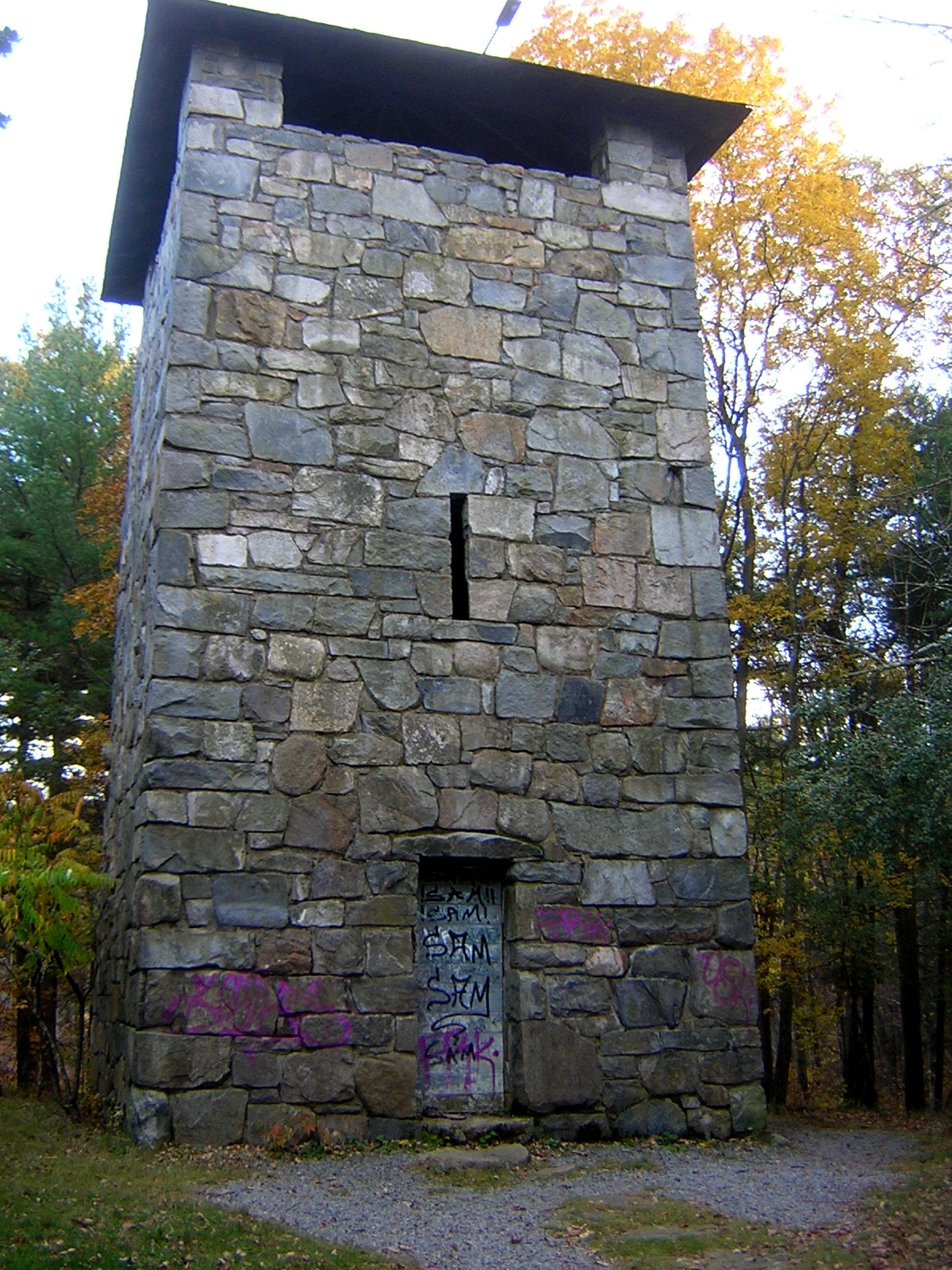
Chickatawbut Observation Tower
Monument and historic site · National Register of Historic Places · 3.3 mi
Observation tower in Quincy, United States of America

Christ Church Burial Ground
Monument and historic site · National Register of Historic Places · 2.6 mi
Cemetery in Quincy, Massachusetts
54-60 School Street

John Quincy Adams Birthplace
Monument and historic site · National Register of Historic Places · 2.3 mi
Building in Massachusetts, United States
135 Franklin Street

Quincy City Hall
Monument and historic site · National Register of Historic Places · 3.1 mi
Rathaus in Massachusetts, United States of America
1351 Hancock Street, Quincy

Thayer Public Library
Monument and historic site · National Register of Historic Places
Library
798 Washington Street, Braintree
A. C. Smith & Co. Gas Station
Monument and historic site · National Register of Historic Places · 4.2 mi
Filling station in Quincy, Massachusetts
Adams Academy
Monument and historic site · National Register of Historic Places · 3.3 mi
Historic school building in Massachusetts
Adams National Historical Park
Monument and historic site · National Register of Historic Places · 3.5 mi
Park commemerating the Adams political family
Arthur Alden House
Monument and historic site · National Register of Historic Places · 3.3 mi
United States historic place
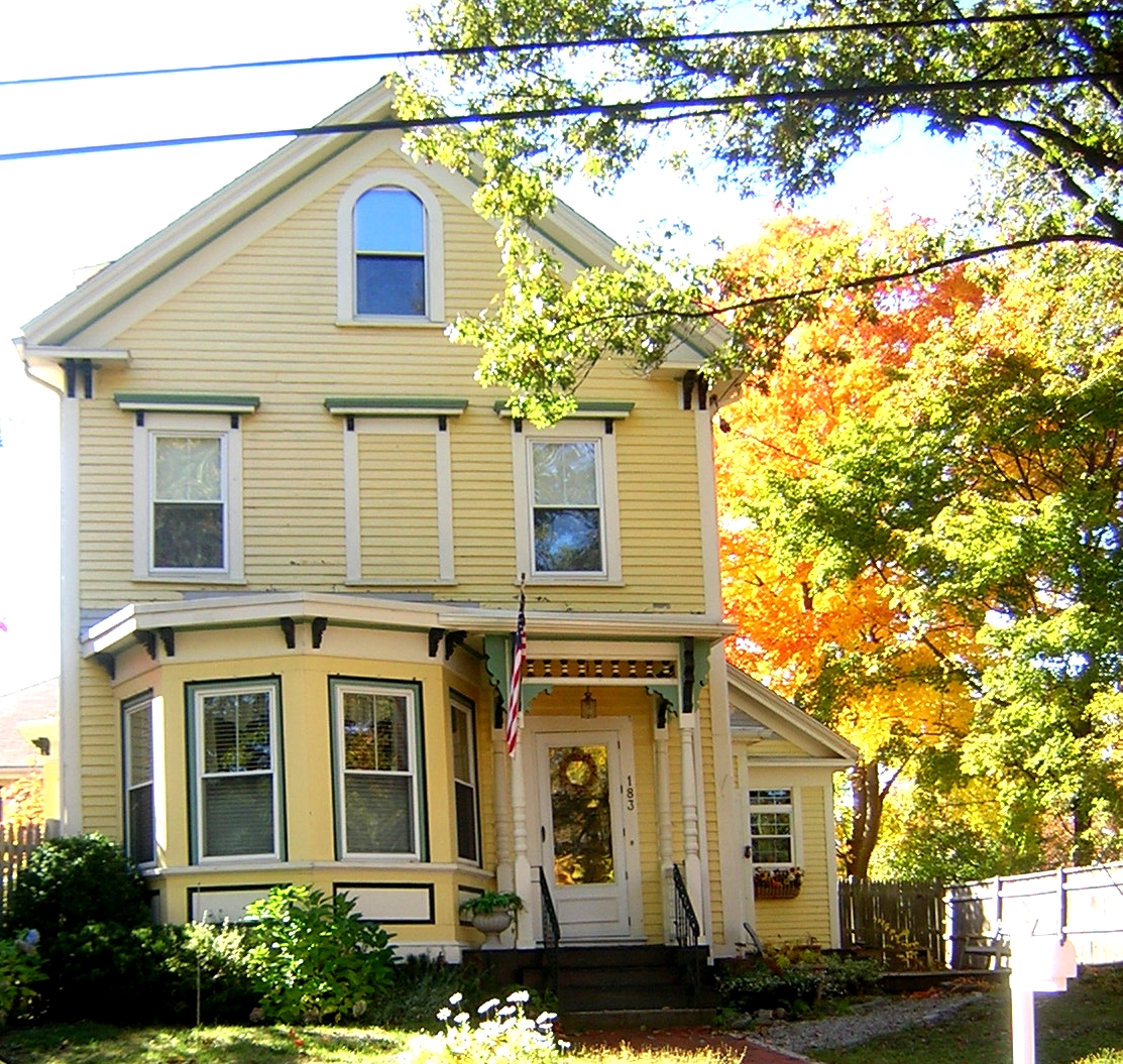
Barnes House
Monument and historic site · National Register of Historic Places · 4.0 mi
Historic house in Massachusetts, United States


Blue Hills Reservation Parkways
Monument and historic site · National Register of Historic Places · 3.8 mi
Historic district in Massachusetts, United States
100 more on the map.
Parks, trails and playgrounds114




102 more on the map.
Restaurants and cafes173

Gunther Tooties
Cafe · Coffee Shop, Sandwich · 3.2 mi
Casual spot for a variety of NYC-style bagels, plus baked goods, sandwiches & espresso drinks.
1253 Hancock Street, Quincy
Mo-Fr 06:00-19:00; Sa 06:00-18:00; Su 07:00-18:00

Angelina's Pizza
Restaurant · Pizza · 3.0 mi
1437 Hancock Street, Quincy
Mo-We 10:00-24:00; Th,Sa 10:00-25:00; Fr 10:00-25:30; Su 11:00-22:15
El Sarape
Restaurant · Mexican · 2.0 mi
5 Commercial Street
Mo-Tu 15:00-22:00; We-Th 11:30-22:00; Fr 11:30-23:00; Sa...
Jake n JOES Sports Grille
Restaurant · Bar And Grill · 0.5 mi
551 John Mahar Highway
Su-We 11:30-24:00; Th-Sa 11:30-01:00
LaScala Restaurant
Restaurant · Italian · 3.1 mi
1070 North Main Street, Randolph
Mo-Fr 11:30-16:00,16:30-23:00; Sa 11:30-23:00; Su 13:00-22:00
MOTW Coffee & Pastries
Cafe · Arab · 3.2 mi
279 Willard Street
Mo-Th 06:30-21:00; Fr 06:30-00:00; Sa 08:00-00:00; Su 08:00-20:00
Old Railroad Cafe
Restaurant · Pizza, Sandwich · 3.2 mi
273 Willard Street
Su-Th 10:00-22:00; Fr-Sa 10:00-23:00
Papa Gino's
Restaurant · Pizza · 2.8 mi
100 Granite Street, Quincy
Mo-Th 10:30-21:00; Fr-Sa 10:30-22:00; Su 11:00-21:00
Royal Hotpot Korean BBQ & Bar
Restaurant · Barbecue, Korean · 2.6 mi
227 Parkingway, Quincy
Mo-Th, Su 12:00-22:00; Fr, Sa 12:00-00:00
161 more on the map.
History
Braintree was colonized in 1635 and incorporated in 1640. The town is named after the Essex town of Braintree. Its original area split to form the municipalities of Quincy (incorporated in 1792) and Randolph (incorporated in 1793) in the late eighteenth century, after which Randolph split to form the municipality of Holbrook (incorporated in 1872) eight decades later. Braintree was part of Suffolk County until the formation of Norfolk County in 1793.
In 1888, the villages of Braintree and South Braintree were separate communities within the town of Braintree.
In 1920, Braintree was the site of the murders that led to the trial of Sacco and Vanzetti. During that same decade, the town's population grew by more than 50%.
In the period after World War II, several Irish American and Italian American families living in lower income portions of Boston moved to Braintree.
From the History section of Braintree, Massachusetts on Wikipedia, under CC BY-SA 4.0.
Where to stay8
Churches and places of worship45
Bethany Congregational Church
Church · National Register of Historic Places · 3.2 mi
Christ Church
Church · National Register of Historic Places · 2.7 mi
Faith Lutheran Church
Church · National Register of Historic Places · 2.7 mi
First Baptist Church of Wollaston
Church · National Register of Historic Places · 3.9 mi
Holbrook Kingdom Hall of Jehovah's Witnesses
Place of worship · Jehovahs Witness · 3.0 mi
314 North Franklin Street, Holbrook
Shopping39
Gas and EV charging35
Schools, colleges and libraries89
Healthcare20
Map of Braintree Town
250 places. The map loads OpenStreetMap tiles when you open it.
Climate by month
Monthly table
| Month | High | Low | Rain | Snow |
|---|---|---|---|---|
| Jan | 38°F | 22°F | 4.5 in | 14.8 in |
| Feb | 40°F | 23°F | 4.0 in | 14.5 in |
| Mar | 47°F | 29°F | 5.4 in | 10.3 in |
| Apr | 58°F | 38°F | 4.6 in | 1.7 in |
| May | 68°F | 48°F | 3.8 in | 0.0 in |
| Jun | 77°F | 57°F | 4.0 in | 0.0 in |
| Jul | 83°F | 63°F | 3.6 in | 0.0 in |
| Aug | 82°F | 62°F | 3.8 in | 0.0 in |
| Sep | 74°F | 55°F | 3.9 in | 0.0 in |
| Oct | 63°F | 44°F | 5.2 in | 0.1 in |
| Nov | 52°F | 35°F | 4.4 in | 0.7 in |
| Dec | 43°F | 27°F | 5.1 in | 8.8 in |
U.S. Climate Normals 1991-2020 for Hingham (5 mi away), NOAA NCEI.
People and cost of living
American Community Survey 5-year estimates, 2020-2024, U.S. Census Bureau. Estimates have margins of error, larger for small towns.
Disaster history
Norfolk County has had 25 federal disaster declarations since 2000, most often for snowstorms.
- 2023-09-15: Hurricane Lee (Hurricane)
- 2022-04-18: Severe Winter Storm And Snowstorm (Snowstorm)
- 2020-03-27: Covid-19 Pandemic (Biological)
- 2020-03-13: Covid-19 (Biological)
- 2018-07-19: Severe Winter Storm And Snowstorm (Snowstorm)
- 2018-06-25: Severe Winter Storm And Flooding (Severe Storm)
OpenFEMA disaster declarations summaries.
Getting there and nearby towns
Norwood Memorial Airport (OWD) is the nearest airport with scheduled flights listed in OpenStreetMap, 9 miles away.
- Quincy 4 mi north, about 6 min by car
- Abington 7 mi south, about 11 min by car
- Boston 9 mi north, about 14 min by car
- Brockton 9 mi south, about 14 min by car
- Cambridge 13 mi northwest, about 21 min by car
- Belmont 16 mi northwest, about 26 min by car
- Bridgewater Town 16 mi south, about 26 min by car
- Arlington 17 mi northwest, about 27 min by car
- Lynn 19 mi north, about 30 min by car
- Attleboro 24 mi southwest, about 39 min by car
Drive times are estimates from straight-line distance, not routes.
Local news
Headlines from INDB, the NEMICO news database.
Reviews, tips and questions
Loading what members have shared...
Sources and licences
- NCES EDGE (Public domain): public schools
- NOAA NCEI U.S. Climate Normals 1991-2020 (Public domain): climate by month
- OpenFEMA (Public domain): disaster declarations
- OpenStreetMap contributors (ODbL 1.0): places, airports, map data
- U.S. Census Bureau (Public domain): population, income, housing, education, commute
- Wikidata (CC0 1.0): elevation, founding date, time zone, website, landmarks and historic places
- Wikimedia Commons (see each image): photos
- Wikipedia (CC BY-SA 4.0): overview and history text
Photo credits
- Braintree Town Hall, MA, John Phelan, CC BY 3.0
- Chickatawbut Observation Tower Quincy MA 02, Jameslwoodward, CC BY-SA 3.0
- Across the street from the JQA Birthplace, National Park Service, Public domain
- Quincy MA Town Hall 1844, Sswonk ( talk ), Public domain
- Christ Church Burial Ground Quincy MA, Sswonk, CC BY-SA 3.0
- Braintree Old Library, Marcbela (Marc N. Belanger), Public domain
- Chickatawbut Road Quincy MA, Jameslwoodward, CC BY-SA 3.0
- Jonathan Belcher House Randolph MA, Jameslwoodward, CC BY-SA 3.0
- David L Jewell House Quincy MA, Jameslwoodward, CC BY-SA 3.0
- House at 94 Grandview Avenue Quincy MA 01, Jameslwoodward, CC BY-SA 3.0
- House at 15 Gilmore Street Quincy MA 01, Jameslwoodward, CC BY-SA 3.0
- MiltonMA BlueHillsPoliceHQ, Magicpiano, CC BY-SA 3.0
- Edward Miller House, Sswonk, CC BY-SA 3.0
- WeymouthMA SeaStreet, User:Magicpiano, CC BY-SA 4.0
- Christ Church Quincy MA, Sswonk, CC BY-SA 3.0
- Thomas Curtis House, Sswonk, CC BY-SA 3.0
- Frank Burgess House Quincy MA, Jameslwoodward, CC BY-SA 3.0
- Seth Spear Homestead Quincy MA 01, Jameslwoodward, CC BY-SA 3.0
- Noah Curtis House, Sswonk, CC BY-SA 3.0
- Barnes House Quincy MA, Jameslwoodward, CC BY-SA 3.0
- Quincy Water Company Pumping Station Site, Jameslwoodward, CC BY-SA 3.0
- C. F. Pettengill House, Sswonk, CC BY-SA 3.0
- Bethany Congregational Church Quincy MA 01, Jameslwoodward, CC BY-SA 4.0
- WeymouthMA FirstChurch, User:Magicpiano, CC BY-SA 4.0
- Frank W. Crane House Quincy MA, Jameslwoodward, CC BY-SA 3.0
- S. H. Barnicoat Monuments Site Quincy MA, Jameslwoodward, CC BY-SA 3.0
- Red Line trains in Caddigan Yard, August 2018, Pi.1415926535, CC BY-SA 3.0
- Red Line train at Braintree station (2), August 2018, Pi.1415926535, CC BY-SA 3.0
- MBTA 01862 at Braintree station, December 2015, Pi.1415926535, CC BY-SA 3.0
- MBTA route 236 bus at Braintree station, October 2018, Beantowndude316 from USA, CC BY 2.0
- Braintree station busway from garage roof, December 2015, Pi.1415926535, CC BY-SA 3.0
- Thayer Public Library, Elizabeth B. Thomsen, CC BY-SA 4.0
- Braintree station entrance from busway, December 2015, Pi.1415926535, CC BY-SA 3.0
- MBTA route 236 bus in Braintree busway, December 2015, Pi.1415926535, CC BY-SA 3.0
- Closed footbridge at Braintree station, August 2018, Pi.1415926535, CC BY-SA 3.0
- Elevator on Red Line platform at Braintree station, December 2015, Pi.1415926535, CC BY-SA 3.0
- Red line entrance at Braintree station, August 2018, Pi.1415926535, CC BY-SA 3.0
- Red Line train at Braintree station (1), August 2018, Pi.1415926535, CC BY-SA 3.0
- Red Line trains at Braintree station (1), August 2018, Pi.1415926535, CC BY-SA 3.0
- Red Line trains at Braintree station (2), August 2018, Pi.1415926535, CC BY-SA 3.0


Page built October 30, 2026. Spotted a mistake? Tell us or suggest a place.