


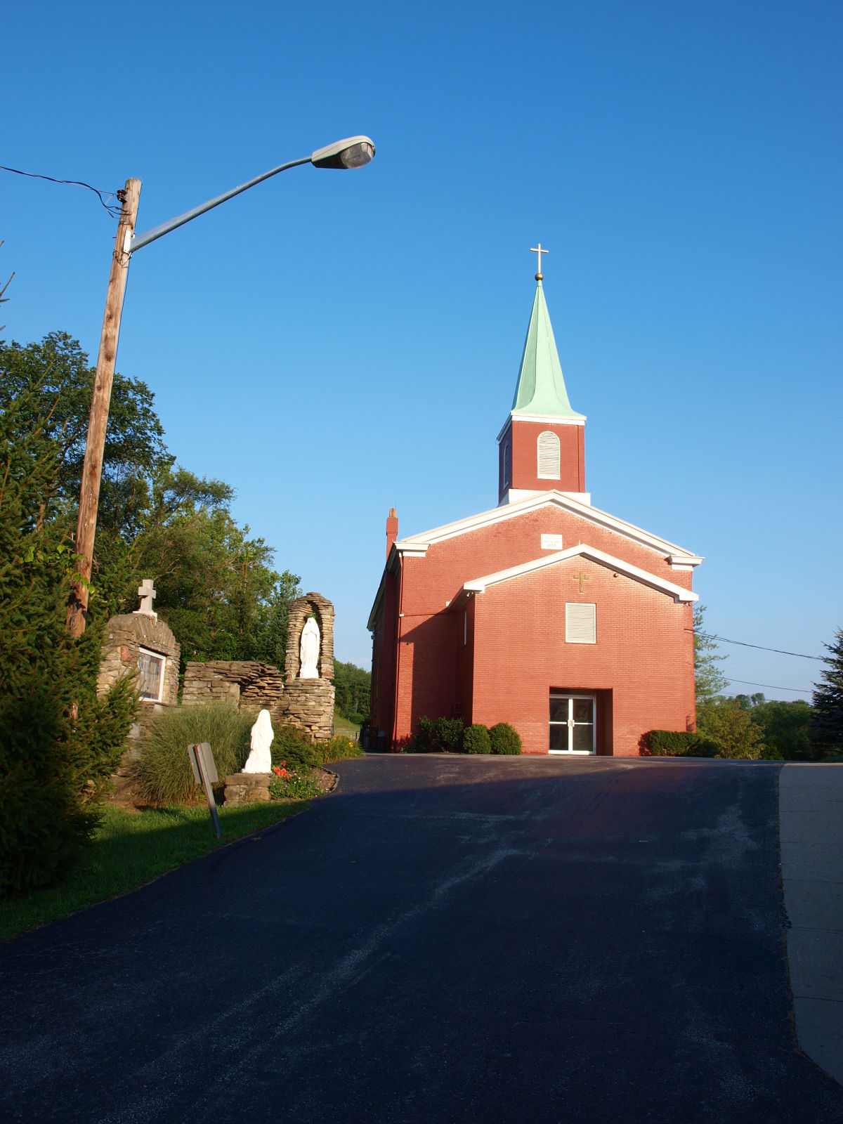

Why visit Coldstream
Townapedia lists 10 museums and landmarks, 12 parks and trails and 2 attractions in and around town.
Highlights include Saint Gregory Seminary, Blau's Four Mile House, Camp Springs House and Withrow Nature Preserve.
July is the warmest month, with average highs of 87°F; January lows average 24°F.
Weather in Coldstream
Forecast from the National Weather Service. Full forecast
About Coldstream
Coldstream is a census-designated place (CDP) in southern Anderson Township, Hamilton County, Ohio, United States. The population was 1,322 at the 2020 census.
From the Wikipedia article Coldstream, Ohio (this version), under CC BY-SA 4.0.
Things to do2

Saint Gregory Seminary
School · 3.1 mi
Former Catholic seminary in Ohio, US

Museums and landmarks10

Blau's Four Mile House
Monument and historic site · National Register of Historic Places · 3.5 mi
Historic house in Kentucky, United States

Camp Springs House
Monument and historic site · National Register of Historic Places · 3.0 mi
Historic property in Kentucky

Gaskins-Malany House
Monument and historic site · National Register of Historic Places · 2.7 mi
Historic house in Ohio, United States

Kort Grocery
Monument and historic site · National Register of Historic Places · 3.3 mi
Historic property in Camp Springs, Kentucky, U.S

Peter Barth Farm
Monument and historic site · National Register of Historic Places · 3.5 mi
Historic farm in Alexandria, Kentucky, USA

St. John's Lutheran Cemetery
Monument and historic site · National Register of Historic Places · 3.1 mi
Cemetery in Alexandria, Kentucky
St. Joseph Catholic Church and Cemetery
Monument and historic site · National Register of Historic Places · 3.7 mi
Historic church and cemetery in Campbell County, Kentucky, US

Walter House
Monument and historic site · National Register of Historic Places · 3.4 mi
Historic building in Melbourne, Kentucky, USA
Anderson Township Heritage Center
Monument and historic site · 1.5 mi
890 Eight Mile Road, Cincinnati
Nine Mile School
Monument and historic site · 1.9 mi
3468 Nine Mile Tobasco Road, Cincinnati
Parks, trails and playgrounds12




Churches and places of worship4

Salem Methodist Church Complex
Church · National Register of Historic Places · 3.4 mi
Church building in Ohio, United States of America


United Brethren in Christ
Church · National Register of Historic Places · 1.9 mi
Church building in Ohio, United States of America

Schools, colleges and libraries21
Crossroads Elementary School
School · 4.9 mi
475 Crossroads Boulevard, Cold Spring
Donald E. Cline Elementary School
School · 5.2 mi
5586 E Alexandria Dr, Cold Spring
Locust Corner Elementary School
School · 3.6 mi
3431 Locust Corner Rd, Cincinnati
Healthcare1
Map of Coldstream
50 places. The map loads OpenStreetMap tiles when you open it.
Climate by month
Monthly table
| Month | High | Low | Rain |
|---|---|---|---|
| Jan | 41°F | 24°F | 2.9 in |
| Feb | 45°F | 26°F | 2.8 in |
| Mar | 55°F | 33°F | 3.9 in |
| Apr | 67°F | 42°F | 4.4 in |
| May | 75°F | 53°F | 4.7 in |
| Jun | 83°F | 61°F | 4.6 in |
| Jul | 87°F | 65°F | 4.4 in |
| Aug | 86°F | 64°F | 3.4 in |
| Sep | 80°F | 56°F | 3.1 in |
| Oct | 68°F | 44°F | 3.0 in |
| Nov | 55°F | 34°F | 2.9 in |
| Dec | 45°F | 28°F | 3.3 in |
U.S. Climate Normals 1991-2020 for Cincinnati Lunken Ap (6 mi away), NOAA NCEI.
People and cost of living
American Community Survey 5-year estimates, 2020-2024, U.S. Census Bureau. Estimates have margins of error, larger for small towns.
Disaster history
Hamilton County has had 11 federal disaster declarations since 2000, most often for severe storms.
- 2026-10-02: Severe Storms, Straight-Line Winds, Tornadoes, Flooding, And Landslides (Flood)
- 2020-03-31: Covid-19 Pandemic (Biological)
- 2020-03-13: Covid-19 (Biological)
- 2018-04-17: Severe Storms, Landslides, And Mudslides (Flood)
- 2012-06-30: Severe Storms (Severe Storm)
- 2011-07-13: Severe Storms And Flooding (Severe Storm)
OpenFEMA disaster declarations summaries.
Getting there and nearby towns
Lunken Airport (LUK) is the nearest airport with scheduled flights listed in OpenStreetMap, 6 miles away.
- Forestville 2 mi north, about 3 min by car
- Alexandria 6 mi southwest, about 9 min by car
- Amelia 7 mi east, about 11 min by car
- Fort Thomas 7 mi northwest, about 11 min by car
- Newport 8 mi west, about 13 min by car
- Batavia 9 mi east, about 15 min by car
- Covington 10 mi west, about 16 min by car
- Norwood 10 mi northwest, about 16 min by car
- Cincinnati 11 mi northwest, about 18 min by car
- Independence 13 mi southwest, about 20 min by car
Drive times are estimates from straight-line distance, not routes.
Local news
Headlines from INDB, the NEMICO news database.
Reviews, tips and questions
Loading what members have shared...
Sources and licences
- NCES EDGE (Public domain): public schools
- NOAA NCEI U.S. Climate Normals 1991-2020 (Public domain): climate by month
- OpenFEMA (Public domain): disaster declarations
- OpenStreetMap contributors (ODbL 1.0): places, airports, map data
- U.S. Census Bureau (Public domain): population, income, housing, education, commute
- Wikidata (CC0 1.0): elevation, founding date, time zone, website, landmarks and historic places
- Wikimedia Commons (see each image): photos
- Wikipedia (CC BY-SA 4.0): overview and history text
Photo credits
- St. John Lutheran Cemetery, Bill Eichelberger, CC BY-SA 4.0
- Blau's Four Mile House (Reitman House), Camp Springs, Kentucky, FloNight (Sydney Poore) and Russell Poore, CC BY-SA 3.0
- Walter House, Bill Eichelberger, CC BY-SA 4.0
- Salem Community Church in Anderson Township, Nyttend, Public domain
- St Joe's Camp Springs, Bill Eichelberger, CC BY-SA 4.0
- Five Mile Chapel in Anderson Township, Nyttend, Public domain
- Kort Grocery, Camp Springs, Kentucky, FloNight (Sydney Poore) and Russell Poore, CC BY-SA 3.0
- GaskinMalanyHouse, Aesopposea, CC BY-SA 3.0
- Camp Springs House, Campbell County, Kentucky, FloNight (Sydney Poore) and Russell Poore, CC BY-SA 4.0
- Crepidotus cinnabarinus 12922838, squirrely, CC BY-SA 4.0
- Postia ptychogaster 12923105, Crystal Davidson, CC BY-SA 4.0
- Crepidotus cinnabarinus 12922836, squirrely, CC BY-SA 4.0
- Scutellinia scutellata 15026000, squirrely, CC BY-SA 4.0
- Crepidotus cinnabarinus 12922840, squirrely, CC BY-SA 4.0
- Postia ptychogaster 12923101, Crystal Davidson, CC BY-SA 4.0
- Mollisia melaleuca 59289919, squirrely, CC BY-SA 4.0
- Mollisia melaleuca 59289922, squirrely, CC BY-SA 4.0
- Mollisia melaleuca 59289909, squirrely, CC BY-SA 4.0
- Mollisia melaleuca 59289906, squirrely, CC BY-SA 4.0
- Mollisia melaleuca 59289910, squirrely, CC BY-SA 4.0
- Mollisia melaleuca 59289914, Crystal Davidson, CC BY-SA 4.0
- Mollisia melaleuca 59289918, squirrely, CC BY-SA 4.0
- Mollisia melaleuca 59289912, squirrely, CC BY-SA 4.0
- Mollisia melaleuca 59289916, squirrely, CC BY-SA 4.0
- Tiemeyer House, Bill Eichelberger, CC BY-SA 4.0


Page built October 30, 2026. Spotted a mistake? Tell us or suggest a place.