


Why visit Congers
Townapedia lists 14 museums and landmarks, 6 parks and trails and 2 places to eat in and around town.
Highlights include Blauvelt House, Brookside, Hook Mountain State Park and Rockland Lake State Park.
July is the warmest month, with average highs of 83°F; January lows average 17°F, and about 40 inches of snow fall in a normal year.
Weather in Congers
Forecast from the National Weather Service. Full forecast
About Congers
Congers (English pronunciation: /ˈkɒŋgəɹz/ ) is a suburban hamlet and census-designated place in the town of Clarkstown, Rockland County, New York, United States. It is located north of Valley Cottage, east of New City, across Lake DeForest, south of Haverstraw, and west of the Hudson River. It lies 19 miles (31 km) north of New York City's Bronx boundary. As of the 2020 census, the population was 8,532.
From the Wikipedia article Congers, New York (this version), under CC BY-SA 4.0.
Museums and landmarks14

Blauvelt House
Monument and historic site · National Register of Historic Places · 2.6 mi
Historic house in New York, United States

Brookside
Monument and historic site · National Register of Historic Places · 3.4 mi
Historic home located at Upper Nyack, Rockland County, New York

Fowler Library Building
Monument and historic site · National Register of Historic Places · 3.3 mi
Historic building in New York, Haverstraw, United States

H. R. Stevens House
Monument and historic site · National Register of Historic Places · 1.4 mi
Historic house in New York, United States
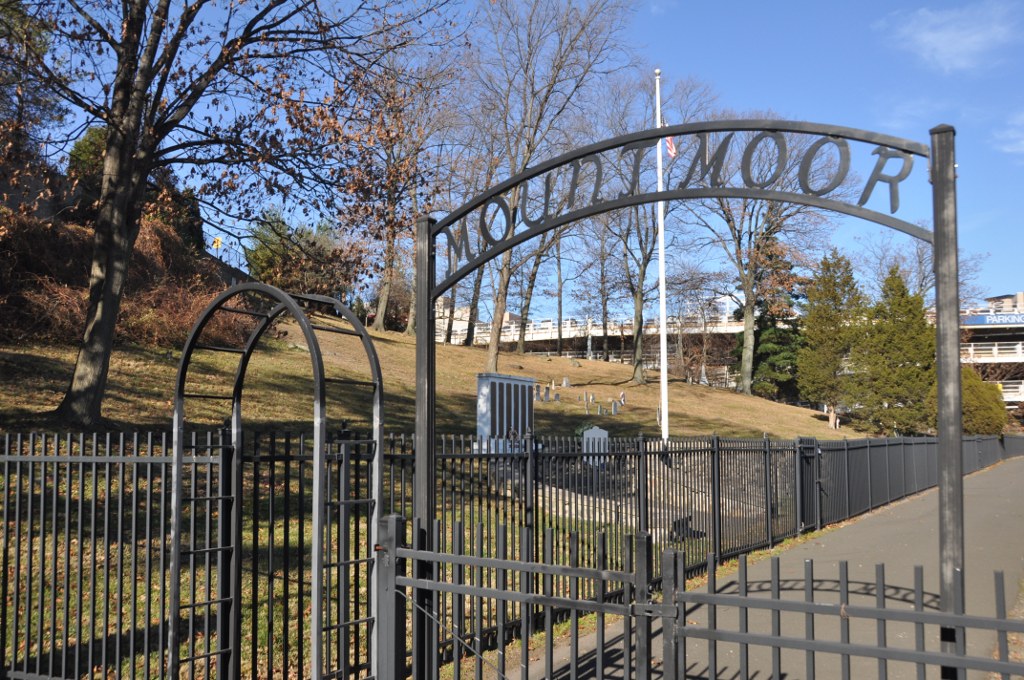
Mount Moor African-American Cemetery
Monument and historic site · National Register of Historic Places · 3.7 mi
Historic cemetery in Rockland County, New York, US

Peter DePew House
Monument and historic site · National Register of Historic Places · 2.2 mi
Historic house in New York, United States
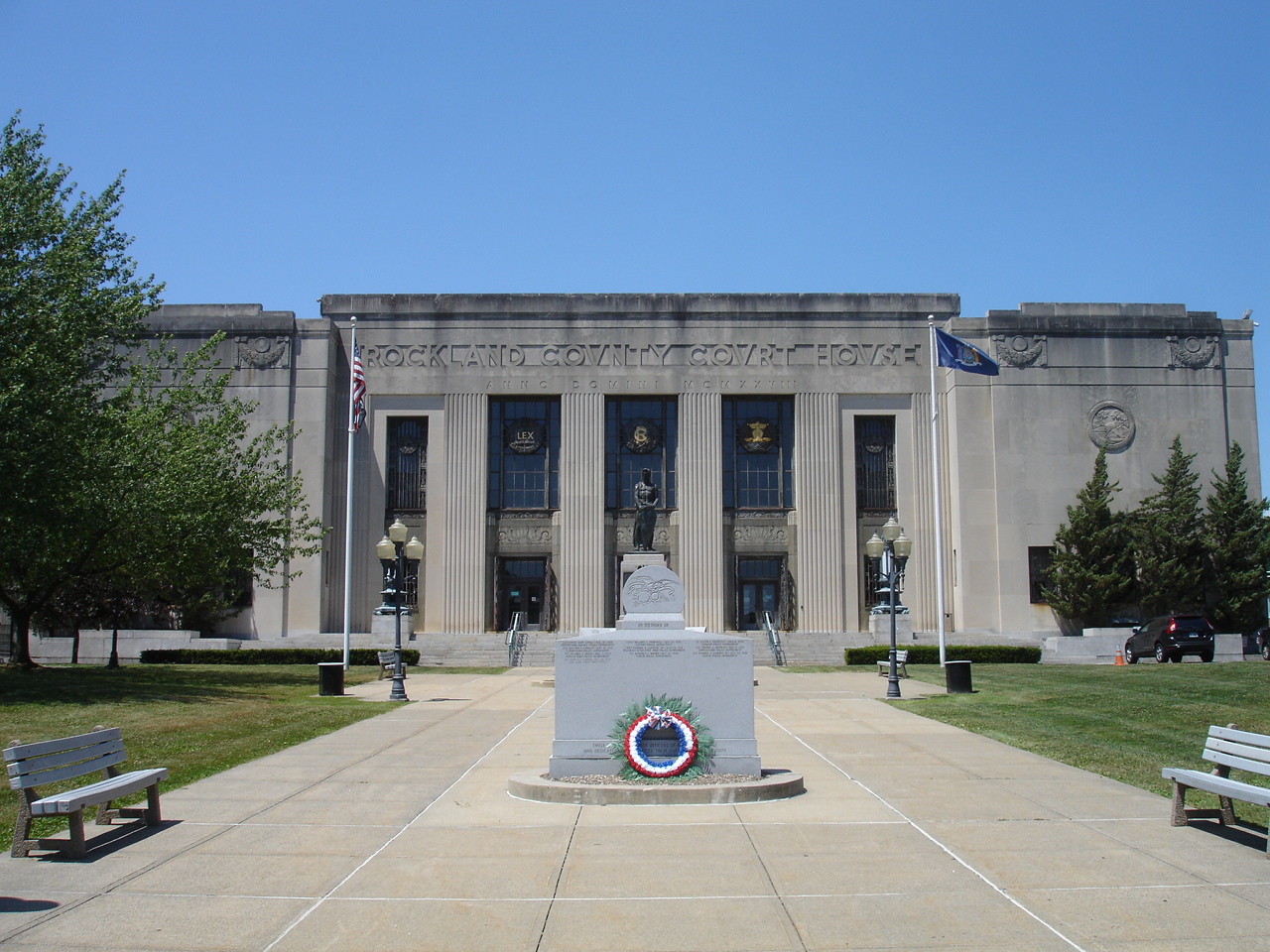
Rockland County Courthouse and Dutch Gardens
Monument and historic site · National Register of Historic Places · 2.3 mi
Historic district in New York, United States of America

Shadowcliff
Monument and historic site · National Register of Historic Places · 3.1 mi
Historic home located at Upper Nyack, Rockland County, New York

The Homestead
Monument and historic site · National Register of Historic Places · 3.2 mi
Listed on the NRHP in Haverstraw, New York

United States Post Office
Monument and historic site · National Register of Historic Places · 3.3 mi
Government building in Haverstraw, New York

Upper Nyack Firehouse
Monument and historic site · National Register of Historic Places · 3.6 mi
Fire station in Upper Nyack, United States of America

Van Houten's Landing Historic District
Monument and historic site · National Register of Historic Places · 3.7 mi
United States historic district in New York State
2 more on the map.
Parks, trails and playgrounds6




Restaurants and cafes2

China Garden
Restaurant · Chinese · 0.7 mi
15 State Highway 303 South, Clarkstown
Su-Mo, We-Th 11:00-21:30; Fr-Sa 11:00-22:00

Churches and places of worship5


First Methodist Episcopal Church of Nyack
Church · National Register of Historic Places · 3.5 mi
Church building in Upper Nyack, United States of America


History
Congers was settled in the late 17th century by Dutch, German and English settlers. It was known as Cedar Grove Corner and then Waldberg, which in German means "forest mountain". It is named after New York State Senator Abraham Bogart Conger (1814 - 1887).
In the 19th century the Congers railroad station, three churches, a school, the firehouse and the Central and Globe hotels were built. The first floor of the then Globe hotel on the southeastern corner of Congers Road is presently the Last Chance Saloon. The Clarktown Dutch Reformed Church still stands at the corner of Congers Road and Kings Highway.
Kings Highway was the first major road in the county and for many years the only road from New York to Albany.
Nine structures in Congers have recognized historical markers dating back to the 18th century, including the DeBaum House on Kings Highway, the Smith House on Gilchrest Road and the Snedeker House, where the George Washington is believed to have spent a night in his role as commander-in-chief of Colonial forces during the American Revolution.
The Swartout estate, which was occupied by George Swartout, was part of a large tract of land confiscated by the government about 1777. It was purchased by General Jacobus Swartwout, who was a top ally of Washington, and member of a family who traced their residence in Rockland County to 1660.
From the History section of Congers, New York on Wikipedia, under CC BY-SA 4.0.
Shopping2
Gas and EV charging2
Schools, colleges and libraries45
Clarkstown South Senior High School
School · 3.6 mi
31 Demarest Mill Rd, West Nyack
Healthcare1
Map of Congers
77 places. The map loads OpenStreetMap tiles when you open it.
Climate by month
Monthly table
| Month | High | Low | Rain | Snow |
|---|---|---|---|---|
| Jan | 36°F | 17°F | 3.7 in | 8.8 in |
| Feb | 39°F | 18°F | 3.1 in | 12.6 in |
| Mar | 47°F | 25°F | 4.1 in | 8.2 in |
| Apr | 60°F | 36°F | 3.9 in | 1.8 in |
| May | 70°F | 46°F | 3.9 in | 0.0 in |
| Jun | 78°F | 55°F | 5.0 in | 0.0 in |
| Jul | 83°F | 61°F | 4.3 in | 0.0 in |
| Aug | 81°F | 59°F | 4.3 in | 0.0 in |
| Sep | 74°F | 52°F | 4.8 in | 0.0 in |
| Oct | 62°F | 41°F | 4.6 in | 0.0 in |
| Nov | 51°F | 32°F | 4.2 in | 0.5 in |
| Dec | 41°F | 23°F | 4.4 in | 7.6 in |
U.S. Climate Normals 1991-2020 for Yorktown Hts 1W Hcn (11 mi away), NOAA NCEI.
People and cost of living
American Community Survey 5-year estimates, 2020-2024, U.S. Census Bureau. Estimates have margins of error, larger for small towns.
Disaster history
Rockland County has had 20 federal disaster declarations since 2000, most often for hurricanes.
- 2023-07-22: Severe Storms And Flooding (Severe Storm)
- 2021-09-05: Remnants Of Hurricane Ida (Hurricane)
- 2021-09-02: Remnants Of Hurricane Ida (Hurricane)
- 2021-08-22: Hurricane Henri (Hurricane)
- 2020-10-02: Tropical Storm Isaias (Hurricane)
- 2020-03-20: Covid-19 Pandemic (Biological)
OpenFEMA disaster declarations summaries.
Getting there and nearby towns
Westchester County Airport (HPN) is the nearest airport with scheduled flights listed in OpenStreetMap, 14 miles away.
- Haverstraw 2 mi north, about 3 min by car
- New City 2 mi west, about 4 min by car
- Upper Nyack 3 mi southeast, about 4 min by car
- Bardonia 3 mi southwest, about 5 min by car
- Ossining 4 mi east, about 6 min by car
- West Haverstraw 4 mi northwest, about 7 min by car
- Nanuet 5 mi southwest, about 8 min by car
- Briarcliff Manor 5 mi east, about 8 min by car
- Sleepy Hollow 5 mi southeast, about 9 min by car
- Spring Valley 6 mi southwest, about 9 min by car
Drive times are estimates from straight-line distance, not routes.
Local news
Headlines from INDB, the NEMICO news database.
Reviews, tips and questions
Loading what members have shared...
Sources and licences
- NCES EDGE (Public domain): public schools
- NOAA NCEI U.S. Climate Normals 1991-2020 (Public domain): climate by month
- OpenFEMA (Public domain): disaster declarations
- OpenStreetMap contributors (ODbL 1.0): places, airports, map data
- U.S. Census Bureau (Public domain): population, income, housing, education, commute
- Wikidata (CC0 1.0): elevation, founding date, time zone, website, landmarks and historic places
- Wikimedia Commons (see each image): photos
- Wikipedia (CC BY-SA 4.0): overview and history text
Photo credits
- Congers NY Downtown, Alexisrael, CC BY-SA 3.0
- First Methodist Episcopal Church of Nyack 4, David Rivera, CC BY-SA 3.0
- Shadowcliff Shadowcliff, also known as the Fellowship of Reconciliation Headquarters, is a historic home located at Upper Nyack, Rockland County, New York, Jimstu8, CC BY-SA 3.0
- VAN HOUTEN'S LANDING HISTORIC DISTRICT, ROCKLAND COUNTY NY, JERRYE & ROY KLOTZ, M.D., CC BY-SA 4.0
- HR Stevens House, New City, NY, Daniel Case, CC BY-SA 3.0
- The Homestead, Haverstraw, NY, Daniel Case, CC BY-SA 3.0
- Upper Nyack Firehouse, David Rivera, CC BY-SA 3.0
- Brookside-Lochbourn, Izzy406, CC BY-SA 3.0
- Haverstraw, NY, post office, Daniel Case, CC BY-SA 3.0
- Jacob Blauvelt House, Alexisrael, CC BY-SA 3.0
- PETER DEPEW HOUSE, NEW CITY, ROCKLAND COUNTY NY, JERRYE & ROY KLOTZ, M.D., CC BY-SA 4.0
- WestNyackNY MountMoorCemetery 01, User:Magicpiano, CC BY-SA 4.0
- Haverstraw King's Daughters Public Library, Daniel Case, CC BY-SA 3.0
- RocklandCountyCourthouse, KForce, CC BY-SA 3.0
- 9.6.07PalisadesCenterMallFoodCourtbyLuigiNovi, Nightscream at English Wikipedia, CC BY-SA 2.5
- FISHING IN THE HUDSON RIVER FROM CROTON POINT PARK, Wil Blanche, Public domain
- Gilchrest Road grade crossing, Clarkstown, NY, Daniel Case, CC BY-SA 3.0
- DeForest Lake with a view north toward Haverstraw Beach, New City, New York, USA October, 2006 - panoramio, Gary Miotla, CC BY 3.0
- NY 303 nb approaching end at US 9W, May 2025, Mr. Matté (if there is an issue with this image, contact me using this image's Commons talk page , my Commons user talk page , or my English Wikipedia user talk page ; I'll know about it a lot faster), CC BY-SA 4.0
- NY 303 nb approaching US 9W, April 2025, Mr. Matté (if there is an issue with this image, contact me using this image's Commons talk page , my Commons user talk page , or my English Wikipedia user talk page ; I'll know about it a lot faster), CC BY-SA 4.0
- NY 304 nb past CR 23, April 2025, Mr. Matté (if there is an issue with this image, contact me using this image's Commons talk page , my Commons user talk page , or my English Wikipedia user talk page ; I'll know about it a lot faster), CC BY-SA 4.0
- NY 304 nb approaching CR 23, April 2025, Mr. Matté (if there is an issue with this image, contact me using this image's Commons talk page , my Commons user talk page , or my English Wikipedia user talk page ; I'll know about it a lot faster), CC BY-SA 4.0


Page built October 30, 2026. Spotted a mistake? Tell us or suggest a place.