


Coral Hills, Maryland
Coral Hills is a community of 9,756 people in Prince George's County, Maryland.
Why visit Coral Hills
Townapedia lists 21 museums and landmarks, 23 parks and trails, 22 places to eat and 6 attractions in and around town.
Highlights include Amtrak Railroad Anacostia Bridge, Anacostia Railroad Bridge, Concord and Congressional Cemetery.
July is the warmest month, with average highs of 90°F; January lows average 28°F.
Weather in Coral Hills
Forecast from the National Weather Service. Full forecast
About Coral Hills
Coral Hills is an unincorporated area and census-designated place (CDP) in Prince George's County, Maryland, United States. As of the 2020 census, the population was 9,997.
From the Wikipedia article Coral Hills, Maryland (this version), under CC BY-SA 4.0.
Things to do6

Amtrak Railroad Anacostia Bridge
Bridge · 3.3 mi
Bridge in United States of America

Anacostia Railroad Bridge
Bridge · 2.8 mi
Bridge in United States of America


New York Avenue Bridge
Bridge · 3.4 mi
Bridge crossing over the Anacostia River in Washington, D.C.

Pennsylvania Avenue Bridge
Bridge · 3.1 mi
Bridge in United States of America

Whitney Young Memorial Bridge
Bridge · 2.7 mi
Bridge in Washington, D.C.
Museums and landmarks21
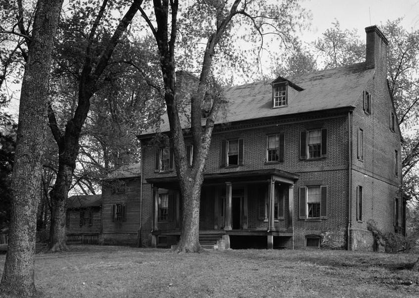
Concord
Monument and historic site · National Register of Historic Places · 2.9 mi
Historic house in District Heights, Maryland, United States

Congressional Cemetery
Monument and historic site · National Register of Historic Places · 3.1 mi
Cemetery in Washington, DC

Engine Company 27
Monument and historic site · National Register of Historic Places · 2.3 mi
Fire station in Washington, D.C.

Fairmount Heights Historic District
Monument and historic site · National Register of Historic Places · 2.0 mi
Historic district in Maryland, USA

Gallinger Municipal Hospital Psychopathic Ward
Monument and historic site · National Register of Historic Places · 3.1 mi
Psychiatric hospital in Washington, D.C., United States of America

John Philip Sousa Junior High School
Monument and historic site · National Register of Historic Places · 1.9 mi
Historic school building in Washington, D.C., United States
Langston Golf Course
Monument and historic site · National Register of Historic Places · 3.3 mi
Historic golf course in Washington, D.C., United States

Langston Terrace Dwellings
Monument and historic site · National Register of Historic Places · 3.4 mi
Listed on the National Register of Historic Places in Washington, D.C

Mayfair Mansions Apartments
Monument and historic site · National Register of Historic Places · 2.6 mi
Washington, D.C

Nannie Helen Burroughs School
Monument and historic site · National Register of Historic Places · 1.7 mi
Historic school formerly named Trades Hall of National Training School for Women and Girls

Strand Theater
Monument and historic site · National Register of Historic Places · 1.8 mi
Former movie theater in Washington D.C.

Suitland Parkway
Monument and historic site · National Register of Historic Places · 3.1 mi
Parkway in the Washington D.C. area
9 more on the map.
Parks, trails and playgrounds23
Kenilworth Park and Aquatic Gardens
Park · National Register of Historic Places · 2.9 mi
Park in Washington, D.C., United States



11 more on the map.
Restaurants and cafes22

Mi Pueblo By Big Papa
Restaurant
Mexican Restaurant in Capitol Heights, MD
4947 Marlboro Pike, Capitol Heights

Shrimp Boat
Restaurant · Seafood · 1.5 mi
4510 East Capitol Street Northeast, Washington

Burger King
Fast food · Burger · 1.4 mi
5730 Silver Hill Road, Forestville
Mo-Sa 06:00-22:00; Su 07:00-22:00
Chick-fil-A
Fast food · Chicken · 1.4 mi
5502 Silver Hill Road, District Heights
Mo-Sa 06:00-22:00; Su off
Domino's
Fast food · Pizza · 1.5 mi
6254 Central Avenue, Capitol Heights
Mo-Th 10:00-24:00; Fr-Sa 10:00-01:00; Su 10:00-24:00
Dunkin'
Fast food · Donut, Coffee Shop · 1.4 mi
5409 Silver Hill Road, District Heights
Mo-Fr 05:00-20:00; Sa-Su 06:00-20:00
Panda Express
Fast food · Chinese · 1.4 mi
5410 Silver Hill Road, District Heights
Mo-Th 09:30-22:00; Fr 09:30-22:30; Sa 10:00-22:30; Su 10:00-21:30
Popeyes
Fast food · Chicken · 0.6 mi
5320 Marlboro Pike, District Heights
Mo-Th 10:00-23:00; Fr-Sa 10:00-24:00; Su 10:00-23:00
10 more on the map.
Churches and places of worship58
First Baptist Church of Deanwood
Church · National Register of Historic Places · 2.3 mi
St. Matthew's Church
Church · National Register of Historic Places · 2.1 mi
Dupont Park Seventh Day Adventist Church
Church · Seventh Day Adventist · 1.4 mi
3985 Massachusetts Avenue Southeast
Saint Lucille African Methodist Episcopal Zion Church
Church · African Methodist Episcopal Zion · 1.1 mi
5100 Astor Place Southeast
Shopping5
Gas and EV charging8
Schools, colleges and libraries80
Dupont Park Adventist School
School · Seventh Day Adventist · 1.5 mi
3942 Alabama Avenue Southeast, Washington
DC Scholars
School · 1.2 mi
5601 5601 E Capitol Street SE, Washington, DC 20019, Washington
Cesar Chavez Public Charter Schools For Public Policy
School · 2.5 mi
3701 Hayes Street Ne, Washington
Elsie Whitlow Stokes Community Freedom Pcs - Brookland
School · 5.7 mi
3700 Oakview Terrace Ne, Washington
Elsie Whitlow Stokes Community Freedom Pcs - East End
School · 1.2 mi
5600 East Capitol Street Ne, Washington
Friendship Pcs - Armstrong Elementary
School · 5.6 mi
111 O Street Nw, Washington
Friendship Pcs - Blow Pierce Elementary
School · 3.5 mi
725 19Th Street Ne, Washington
Friendship Pcs - Blow Pierce Middle
School · 3.5 mi
725 19Th Street Ne, Washington
Healthcare1
Map of Coral Hills
224 places. The map loads OpenStreetMap tiles when you open it.
Climate by month
Monthly table
| Month | High | Low | Rain | Snow |
|---|---|---|---|---|
| Jan | 45°F | 28°F | 3.0 in | 4.7 in |
| Feb | 48°F | 30°F | 2.8 in | 2.3 in |
| Mar | 56°F | 36°F | 4.0 in | 1.4 in |
| Apr | 68°F | 46°F | 3.4 in | 0.0 in |
| May | 77°F | 57°F | 4.3 in | 0.0 in |
| Jun | 85°F | 66°F | 4.6 in | 0.0 in |
| Jul | 90°F | 71°F | 4.6 in | 0.0 in |
| Aug | 88°F | 69°F | 3.7 in | 0.0 in |
| Sep | 82°F | 62°F | 4.1 in | 0.0 in |
| Oct | 70°F | 49°F | 4.2 in | 0.0 in |
| Nov | 58°F | 39°F | 3.2 in | 0.0 in |
| Dec | 49°F | 32°F | 3.7 in | 1.3 in |
U.S. Climate Normals 1991-2020 for Natl Arboretum Dc (4 mi away), NOAA NCEI.
People and cost of living
American Community Survey 5-year estimates, 2020-2024, U.S. Census Bureau. Estimates have margins of error, larger for small towns.
Disaster history
Prince George's County has had 13 federal disaster declarations since 2000, most often for hurricanes.
- 2026-01-24: Severe Winter Storm (Winter Storm)
- 2020-03-26: Covid-19 Pandemic (Biological)
- 2020-03-13: Covid-19 (Biological)
- 2016-03-04: Severe Winter Storm And Snowstorm (Snowstorm)
- 2012-11-20: Hurricane Sandy (Hurricane)
- 2012-10-28: Hurricane Sandy (Hurricane)
OpenFEMA disaster declarations summaries.
Getting there and nearby towns
Joint Base Andrews (ADW) is the nearest airport with scheduled flights listed in OpenStreetMap, 5 miles away.
- Walker Mill 2 mi east, about 2 min by car
- Suitland 2 mi south, about 3 min by car
- Seat Pleasant 2 mi northeast, about 3 min by car
- District Heights 2 mi southeast, about 3 min by car
- Fairmount Heights 2 mi north, about 3 min by car
- Capitol Heights 2 mi east, about 4 min by car
- Peppermill Village 2 mi northeast, about 4 min by car
- Silver Hill 2 mi southwest, about 4 min by car
- Cedar Heights 2 mi north, about 4 min by car
- Forestville 3 mi southeast, about 5 min by car
Drive times are estimates from straight-line distance, not routes.
Local news
Headlines from INDB, the NEMICO news database.
Reviews, tips and questions
Loading what members have shared...
Sources and licences
- NCES EDGE (Public domain): public schools
- NOAA NCEI U.S. Climate Normals 1991-2020 (Public domain): climate by month
- OpenFEMA (Public domain): disaster declarations
- OpenStreetMap contributors (ODbL 1.0): places, airports, map data
- U.S. Census Bureau (Public domain): population, income, housing, education, commute
- Wikidata (CC0 1.0): elevation, founding date, time zone, website, landmarks and historic places
- Wikimedia Commons (see each image): photos
- Wikipedia (CC BY-SA 4.0): overview and history text
Photo credits
- Kenilworthgarden1, Jennifer Boyer from Maryland, USA, CC BY 2.0
- Deanwood Old Church, Smallbones, CC0
- Strand Teater DC, Smallbones, CC0
- QR CC cenotaphs Tip and Hale, Smallbones, CC0
- Langston Golf Course, NPS Photo, Public domain
- Mayfair Mansons DC, Farragutful, CC BY-SA 3.0
- Engine Company 27 DC, Smallbones, CC0
- Woodlawn Cemetery DC, Smallbones, CC0
- John-phillip-sousa-high-school, Dmadeo, CC BY-SA 3.0
- St Matthews Church Sept 09, Pubdog ( talk ), Public domain
- Trades Hall of National Training School for Women and Girls, Farragutful, CC BY-SA 4.0
- Concord 1936, Historic American Buildings Survey / Historic American Engineering Record, Public domain
- Langston Terrace DC 1, Smallbones, CC0
- Grace United Methodist Church - Fairmount Heights, Maryland, Farragutful, CC BY-SA 4.0
- Suitland Parkway - Washington, D.C. (4129841060), Doug Kerr from Albany, NY, United States, CC BY-SA 2.0
- Engine Co 19 DC 1, Smallbones, CC0
- Amtrak Anacostia River Bridge 1977, Jack Boucher, Public domain
- Benning Bridge 2015, Antony-22, CC BY-SA 4.0
- Looking NE at Anacostia Railroad Bridge 02 - Washington DC, Tim Evanson, CC BY-SA 2.0
- Whitney Young Bridge 2015, Antony-22, CC BY-SA 4.0
- Fort Dupont Park December 2017, Eric T. Gunther, CC BY 3.0
- New York Avenue Bridge 2016, Antony-22, CC BY-SA 3.0
- Pennsylvania Avenue Bridge 01 - Washington DC - 1890, U.S. Commission of Fine Arts, Public domain


Page built October 30, 2026. Spotted a mistake? Tell us or suggest a place.