

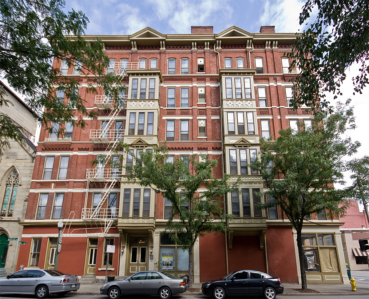


Dayton, Kentucky
Dayton is a city of 5,743 people in Campbell County, Kentucky, founded in 1867.
Why visit Dayton
Townapedia lists 87 museums and landmarks, 34 parks and trails, 69 places to eat, 1 place to stay and 2 attractions in and around town.
Highlights include Marianne Theater, Abraham J. Friedlander House, Alkemeyer Commercial Buildings and Larz Anderson Park.
July is the warmest month, with average highs of 87°F; January lows average 24°F.
Weather in Dayton
Forecast from the National Weather Service. Full forecast
About Dayton
The City of Dayton, Kentucky, is a home rule-class city along a bend of the Ohio River in Campbell County, Kentucky, United States. The population was 5,666 at the 2020 census. It is less than 3 miles (5 km) from downtown Cincinnati, Ohio.
From the Wikipedia article Dayton, Kentucky (this version), under CC BY-SA 4.0.
Things to do2


Museums and landmarks87

Abraham J. Friedlander House
Monument and historic site · National Register of Historic Places · 2.8 mi
House in Cincinnati, Ohio
Alkemeyer Commercial Buildings
Monument and historic site · National Register of Historic Places · 2.8 mi
Building in Ohio, United States
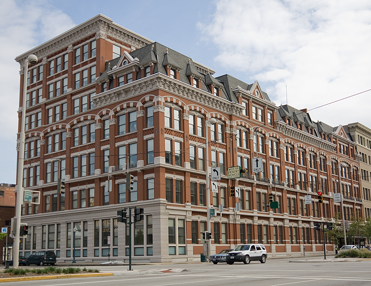
Alms and Doepke Dry Goods Company
Monument and historic site · National Register of Historic Places · 2.6 mi
United States historic place

Apostolic Bethlehem Temple Church
Monument and historic site · National Register of Historic Places · 3.0 mi
Church building in Ohio, United States of America

Bartlett Building
Monument and historic site · National Register of Historic Places · 2.7 mi
Building in Cincinnati, Ohio
Bellevue
Monument and historic site · National Register of Historic Places · 1.9 mi
House in Newport, Kentucky

Bernard Ratterman House
Monument and historic site · National Register of Historic Places · 2.5 mi
Historic house in Cincinnati, Ohio, U.S.


Betts-Longworth Historic District
Monument and historic site · National Register of Historic Places · 3.2 mi
Historic district in Cincinnati, Ohio, United States
Brittany Apartments
Monument and historic site · National Register of Historic Places · 2.9 mi
Historic apartment building in Cincinnati, Ohio
Carew Tower
Monument and historic site · National Register of Historic Places · 2.8 mi
Skyscraper in Cincinnati, Ohio, United States
Cathedral Basilica of St. Peter in Chains
Monument and historic site · National Register of Historic Places · 3.1 mi
Cathedral of the Roman Catholic Archdiocese of Cincinnati in downtown Cincinnati, Ohio, United States, with the title of minor basilica
Cathedral Basilica of the Assumption
Monument and historic site · National Register of Historic Places · 3.4 mi
Roman Catholic cathedral in the United States
75 more on the map.
Parks, trails and playgrounds34

Fountain Square, Cincinnati
Park · 2.8 mi
City square in Ohio, United States
Piatt Park
Park · 2.9 mi
Park in Ohio, United States of America, United States of America
22 more on the map.
Restaurants and cafes69

Bellevue Bistro
Restaurant · Sandwich · 1.2 mi
313 Fairfield Avenue, Bellevue
Mo-Tu 09:00-14:00; We closed; Th-Su 08:00-14:00

BonBonerie Café & Tearoom
Cafe · American, Pastry · 1.4 mi
2030 Madison Road, Cincinnati
Mo-Sa 07:30-17:30
Fessler's Legendary Pizza and Hoagies
Restaurant · Pizza, Italian, Hoagies · 1.1 mi
343 Fairfield Avenue, Bellevue
Su-Mo off; Tu-Th 11:00-21:00; Fr-Sa 11:00-22:00
Galactic Fried Chicken
Restaurant · Chicken · 0.5 mi
624 6th Avenue, Dayton
Th-Sa 11:30-21:00; Su,We 11:30-20:00
Knuckle's Deli
Restaurant · Sandwich, Italian Beef · 1.1 mi
3227 Riverside Drive, Cincinnati
Tu-Su 11:00-21:00
MRBL
Restaurant · Steak House, Sushi · 1.5 mi
119 Fairfield Avenue, Bellevue
We-Th 16:30-21:00; Fr 16:30-21:30; Sa 16:00-21:30; Su 16:00-20:30
O’Bryon’s Bar & Grill
Restaurant · American, Pub · 1.4 mi
1998 Madison Road, Cincinnati
Su-Th 11:00-24:00; Fr-Sa 11:00-02:00

Pearl’s
Bar and pub · Beer, Bar · 1.3 mi
3520 Eastern Avenue, Cincinnati
Mo-Th 16:00-02:00, Fr 15:00-02:00, Sa 12:00-02:00, Su 12:00-24:00

Rusk Kitchen + Bar
Diner · American · 1.4 mi
2724 Woodburn Avenue
Mo-Th 11:00-00:30; Sa 09:30-01:00; Fr 11:00-01:00; Su 09:30-00:30
Taglio
Restaurant · Pizza · 1.3 mi
3533 Columbia Parkway, Cincinnati
Su-Th 11:00-21:00; Fr,Sa 11:00-23:00
57 more on the map.
History
Dayton had a ferry crossing, established in this area by the early 19th century, at the foot of what is now Dayton Pike.
Two separate cities, Jamestown and Brooklyn, separately incorporated in 1848 and 1849 respectively, were merged and reincorporated in 1867 under the name Dayton in honor of the Ohio town.
Jamestown was incorporated March 1, 1848. According to the state charter, the founding fathers were James Berry, James McArthur and Henry Walker. Berry was a nephew of James Taylor, Jr., founder of Newport, Kentucky.
Dayton has a large sandbar just offshore. It had a popular beach for many years known as the "Manhattan Bathing Beach", until the US Army Corps of Engineers raised the level of the Ohio River. In 1779, the beach was involved in the Battle of Dayton, KY; the fight involved Simon Girty, Alexander McKee, Col, John Campbell, Col. David Rogers and Capt. Robert Benham. Laws were passed prohibiting nude swimming in the Ohio River during daylight hours and prohibiting dogs from running loose. Violators of the nude swimming law faced a penalty of $1 for the first offense and as much as $5 for subsequent offenses. People also had the right to shoot dogs that were running loose in the city, and bill the owners for carcass removal. In 1919, the private Doyle Country Club was built and is now listed on the National Register of Historic Places.
From the History section of Dayton, Kentucky on Wikipedia, under CC BY-SA 4.0.
Where to stay1
Churches and places of worship21
Saint Stephens Roman Catholic Church
Church · Catholic · 1.5 mi
3804 Eastern Avenue, Cincinnati
Columbia Baptist Church
Church · Baptist · 1.4 mi
3718 Eastern Avenue, Cincinnati
Lee Chapel African Methodist Episcopal Church
Church · African Methodist Episcopal · 1.5 mi
2009 Pogue Avenue, Cincinnati
Shopping16
Gas and EV charging7
Schools, colleges and libraries56
Healthcare1
Map of Dayton
250 places. The map loads OpenStreetMap tiles when you open it.
Climate by month
Monthly table
| Month | High | Low | Rain |
|---|---|---|---|
| Jan | 41°F | 24°F | 2.9 in |
| Feb | 45°F | 26°F | 2.8 in |
| Mar | 55°F | 33°F | 3.9 in |
| Apr | 67°F | 42°F | 4.4 in |
| May | 75°F | 53°F | 4.7 in |
| Jun | 83°F | 61°F | 4.6 in |
| Jul | 87°F | 65°F | 4.4 in |
| Aug | 86°F | 64°F | 3.4 in |
| Sep | 80°F | 56°F | 3.1 in |
| Oct | 68°F | 44°F | 3.0 in |
| Nov | 55°F | 34°F | 2.9 in |
| Dec | 45°F | 28°F | 3.3 in |
U.S. Climate Normals 1991-2020 for Cincinnati Lunken Ap (2 mi away), NOAA NCEI.
People and cost of living
American Community Survey 5-year estimates, 2020-2024, U.S. Census Bureau. Estimates have margins of error, larger for small towns.
Disaster history
Campbell County has had 14 federal disaster declarations since 2000, most often for severe storms.
- 2026-01-24: Severe Winter Storm (Winter Storm)
- 2025-04-24: Severe Storms, Straight-Line Winds, Tornadoes, Flooding, Landslides, And Mudslides (Severe Storm)
- 2025-04-03: Severe Storms, Straight-Line Winds, Tornadoes, And Flooding (Severe Storm)
- 2025-02-16: Severe Storms, Straight-Line Winds, Flooding, And Landslides (Severe Storm)
- 2020-03-28: Covid-19 Pandemic (Biological)
- 2020-03-13: Covid-19 (Biological)
OpenFEMA disaster declarations summaries.
Getting there and nearby towns
Lunken Airport (LUK) is the nearest airport with scheduled flights listed in OpenStreetMap, 2 miles away.
- Bellevue 1 mi southwest, about 2 min by car
- Fort Thomas 2 mi south, about 3 min by car
- Newport 2 mi southwest, about 4 min by car
- Cincinnati 3 mi northwest, about 5 min by car
- Norwood 3 mi north, about 5 min by car
- Fairfax 4 mi northeast, about 7 min by car
- St. Bernard 4 mi north, about 7 min by car
- Turpin Hills 5 mi east, about 8 min by car
- Mariemont 5 mi northeast, about 8 min by car
- Golf Manor 5 mi north, about 9 min by car
Drive times are estimates from straight-line distance, not routes.
Local news
Headlines from INDB, the NEMICO news database.
Reviews, tips and questions
Loading what members have shared...
Sources and licences
- NCES EDGE (Public domain): public schools
- NOAA NCEI U.S. Climate Normals 1991-2020 (Public domain): climate by month
- OpenFEMA (Public domain): disaster declarations
- OpenStreetMap contributors (ODbL 1.0): places, airports, map data
- U.S. Census Bureau (Public domain): population, income, housing, education, commute
- Wikidata (CC0 1.0): elevation, founding date, time zone, website, landmarks and historic places
- Wikimedia Commons (see each image): photos
- Wikipedia (CC BY-SA 4.0): overview and history text
Photo credits
- Dayton-Kentucky-September-2008, Wholtone, Public domain
- BrittanyApartments, Photo by Greg Hume ( Greg5030 ), CC BY 3.0
- PhoenixClub, Photo by Greg Hume ( Greg5030 ), CC BY 3.0
- MutterGottesHistoricDistrict, Photo by Greg Hume ( Greg5030 ), CC BY 3.0
- CovenantPresbyterian, Photo by Greg Hume ( Greg5030 ), CC BY 3.0
- Race Street Historic District building, Nyttend, Public domain
- ApostolicBeth, Unknown author, CC BY 3.0
- SCMayerHouse, Photo by Greg Hume ( Greg5030 ), CC BY 3.0
- WadsworthElectric, Photo by Greg Hume ( Greg5030 ), CC BY 3.0
- AlmsDoepkeBuilding, Unknown author, CC BY 3.0
- LaSalette Academy in Covington, Nyttend, Public domain
- StPaulDistrict, Photo by Greg Hume ( Greg5030 ), CC BY 3.0
- CincinnatiBell, Photo by Greg Hume ( Greg5030 ), CC BY 3.0
- HolyCrossMonastery, Photo by Greg Hume ( Greg5030 ), CC BY 3.0
- FireMuseum, Photo by Greg Hume ( Greg5030 ), CC BY 3.0
- Remnant of the Laurel Homes, Nyttend, Public domain
- Terrace Plaza Hotel, Cincinnati, Ohio (78788), Pub. by Bell Block News & Novelty Co., Cincinnati, Ohio. "Tichnor Quality Views," Reg. U. S. Pat. Off. Made Only by Tichnor Bros., Inc., Boston, Mass., Public domain
- ImmaculateConceptionChurch, Photo by Greg Hume ( Greg5030 ), CC BY 3.0
- TaftMuseum, Greg Hume ( User:Greg5030 ), CC BY-SA 2.5
- Main and Third Street Cluster, Nyttend, Public domain
- JohnChurchCompanyBuilding, Photo by Greg Hume ( Greg5030 ), CC BY 3.0
- Daniel Beard Home, C. Bedford Crenshaw, aka Bedford at en.wikipedia, Attribution
- AthleticClub2e, Greg Hume, CC BY-SA 3.0
- GoodallBuilding, Photo by Greg Hume ( Greg5030 ), CC BY 3.0
- MotherOfGod, Photo by Greg Hume ( Greg5030 ), CC BY 3.0
- Findlay Market Cincinnati, Lanskeith17, Public domain
- TrinityCovington, Photo by Greg Hume ( Greg5030 ), CC BY 3.0
- HooperBuilding, Photo by Greg Hume ( Greg5030 ), CC BY 3.0
- Union Trust Building in Cincinnati, Nyttend, Public domain
- Fourth and Walnut Centre, Cincinnati, OH (47221101471), Warren LeMay from Cincinnati, OH, United States, CC0
- KrumburgBuilding, Unknown author, CC BY 3.0
- CincinnatiCityHall, Greg Hume ( talk ), CC BY-SA 3.0
- Renovated Cincinnati Music Hall 2, Larsonj3, CC BY-SA 4.0
- Chestnut Street in Betts-Longworth, Nyttend, Public domain
- BernardRattermanHouse, Photo by Greg Hume ( Greg5030 ), CC BY 3.0
- Sacred-Heart-Church-Bellevue-KY, Wholtone, Public domain
- Bellevue High School, Center and Washington, Nyttend, Public domain


Page built October 30, 2026. Spotted a mistake? Tell us or suggest a place.