


Why visit Achern
Townapedia lists 75 museums and landmarks, 37 parks and trails, 205 places to eat, 29 places to stay and 50 attractions in and around town.
Highlights include Hofladen Aspichhof, Hofladen Lemminger, Schnapsbrunnen and Toni-Merz-Museum.
Weather in Achern
Forecast from MET Norway (CC BY 4.0). Full forecast
About Achern
Achern (German pronunciation: [ˈaxɐn] ; Low Alemannic: Achre) is a city in Western Baden-Württemberg, Germany. It is located approximately 18 km southwest of Baden-Baden and 19 km northeast of Offenburg. Achern is the fourth largest town in the district of Ortenau (Ortenaukreis), after Offenburg, Lahr / Black Forest and Kehl.
From the Wikipedia article Achern (this version), under CC BY-SA 4.0.
Things to do50

Hofladen Aspichhof
Farm and orchard · 5.4 km
3 Aspichweg, Ottersweier
We,Fr 14:00-18:00; Sa 09:30-12:30
Hofladen Lemminger
Farm and orchard · 3.8 km
21 Renchtalstraße, Achern
Apr-Oct: Mo-Fr 08:00-19:00, Sa 08:00-18:00; Nov-Mar: Mo-Sa 08:00-18:00
Hofladen Querfeldein
Farm and orchard · 4.3 km
4 Haft, Ottersweier
Tu, Fr 09:00-18:00; Sa 09:00-16:00; Su 10:00-12:00
Huber Hof
Farm and orchard · 4.4 km
45 Gewerbestraße, Achern
Apr: Fr 09:00-18:00; May-Jul: Mo-Su 09:00-18:00; Aug: Mo-Th...
Laufbachhof Pfeifer's Hofladen
Farm and orchard · 4.2 km
20 Haft, Ottersweier
Tu,Th,Sa 09:00-13:00; Fr 09:00-18:00
Rettig's Hofladen
Farm and orchard · 4.0 km
10 Önsbacher Straße, Achern
Mo-Th 17:00-19:00; We off; Fr 08:00-19:00; Sa 09:00-14:00
Webers Hofglück
Farm and orchard · 3.4 km
Hofladen, Hofcafé, Murmelbahn, Streichelzoo, Hofcamping
Mo-Sa 08:00-19:00; Su 09:00-19:00

Sasbachwalden
Monument and historic site · 4.0 km
Municipality in Germany
Kern's Hofladen
Farm and orchard · 4.6 km
35 Önsbacher Straße, Achern
Mo-Sa 08:00-19:00; Su,PH 08:00-11:30,17:30-19:00
Seifermann's Bauernhof
Farm and orchard · 4.8 km
15 Bachstraße, Ottersweier
Tu 08:00-19:00; Th 15:00-19:00; Fr 07:30-19:00; Sa 07:30-14:00
38 more on the map.
Museums and landmarks75




Stadtgeschichtliches Institut Schloss Waldsteg
Museum · 6.2 km
6 Otto-Stemmler-Straße, Bühl
Alte Trotte
Museum · 5.2 km
Älteste Weintrotte Deutschlands aus dem 16. Jahrhundert
May 1-Oct 31: Su,PH 14:00-18:00

63 more on the map.
Parks, trails and playgrounds37



25 more on the map.
Restaurants and cafes205
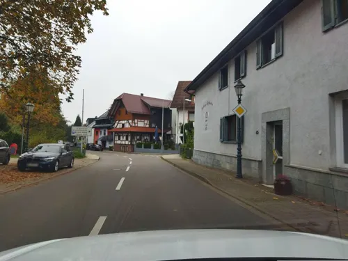
Landgasthaus Zur Linde
Restaurant · Regional · 6.1 km
32 Schwarzwaldstraße, Bühl
Tu-Sa 11:30-14:00, 17:30-22:30; Su 11:30-14:00
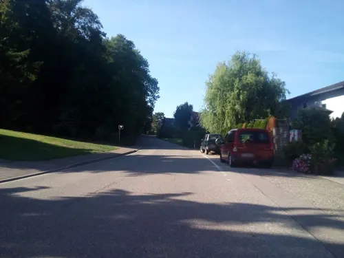
Brauerei-Gasthof Löwen
Restaurant · Regional · 2.1 km
23 Sasbachwaldener Straße, Sasbach
Mo-Sa 17:00-23:00; We off; Th off; Su 11:30-14:00,17:00-23:00
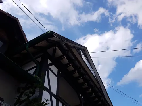
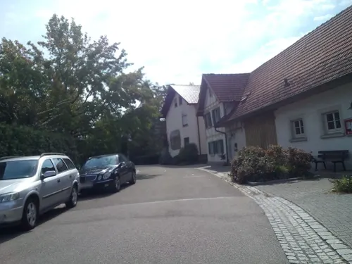
Gasthaus zum Wagen
Restaurant · Regional, Mediterranean · 3.1 km
10 Kirchwegstraße, Achern
We-Sa 17:00-23:00; Su,PH 11:00-15:00, 17:00-23:00; Mo,Tu off
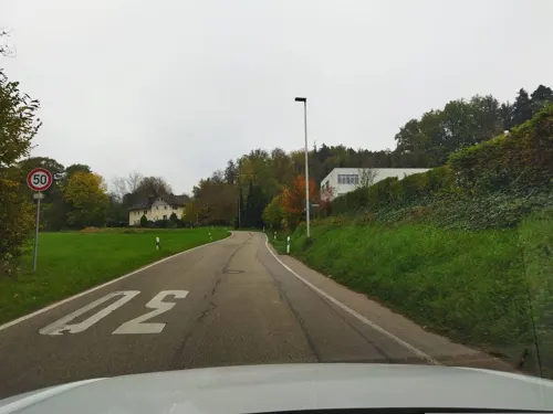
Gasthaus zur Grässelmühle
Restaurant · German · 2.2 km
64 Sasbachwaldener Straße, Sasbach
Sa-We 11:00+

Restaurant Sonne Eintracht
Restaurant · Mediterranean
112 Hauptstraße, Achern
Tu-Sa 11:30-14:30, 18:00-22:00

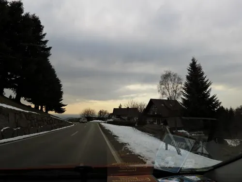
Hotel Restaurant Spinnerhof
Restaurant · 5.3 km
Apr 1-Sep 30: Mo-Su,PH 11:30-22:00; Oct 1-Mar 31: Tu-Th...
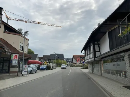
Kininger's Hirsch
Restaurant · German · 1.5 km
26 Oberacherner Straße, Achern
We-Su 11:00-15:00, 17:00-21:00
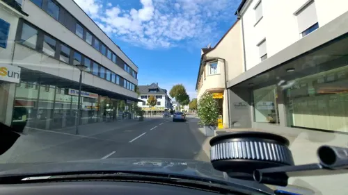
RatsKeller
Restaurant · Regional
2 Ratskellerstraße, Achern
Mo,Tu,Th,Fr 11:30-14:00,17:30-21:00; We 11:30-14:00; Su...



Ald Saschwalle
Restaurant · Regional · 3.7 km
3 Talstraße, Sasbachwalden
Mo,Tu,Fr,Sa,Su 15:00-22:00; We,Th off
193 more on the map.
History
Achern was first mentioned in 1095 as Acchara and developed later into Oberachern and Niederachern. Eventually, Niederachern was referred to only as Achern. During the High Middle Ages the town became part of the German Reich, courtesy of the Staufenberger and Zähringer families, and was included in the Landsvogtei of Ortenau. In 1334, together with Ortenau Achern became part of Baden, in 1351 it went to Strasbourg, in 1405 to the Electorate of the Palatinate, and in 1504 to Fürstenberg-Fürstenberg. In 1551 the town became part of Further Austria and part of the Reichlandsvogtei Ortenau. In 1495 and then again in 1637 Achern burned to the ground and was uninhabited for several years thereafter.
In 1805 Achern again became part of what was then the Grand Duchy of Baden and was made a district court seat. In 1808 it was awarded town status. In 1924 the district of Achern was dissolved and became part of the district of Bühl which was awarded District status in 1939.
After World War II, Bühl District was part of the State of Baden and from 1952 part of the Regierungsbezirk of South Baden. Pursuant to the district reform Bühl District was dissolved, effective January 1, 1973. Its southern part — and with it the city of Achern — was made part of the newly created Ortenaukreis.
From the History section of Achern on Wikipedia, under CC BY-SA 4.0.
Where to stay29
Churches and places of worship51
Pfarrkirche St. Nikolaus
Church · Catholic · 5.6 km
4 Am Kirchplatz, Kappelrodeck
St. Johannes
Church · Roman Catholic · 4.8 km
38 Hauptstraße, Ottersweier
Shopping53
Gas and EV charging23
bft Tank- und Waschcenter Leppert
Gas station · 4.6 km
Bronnmattstraße, Kappelrodeck
Schools, colleges and libraries28
Healthcare15
Alte Apotheke Kappelrodeck
Clinic and pharmacy · 5.1 km
19 Hauptstraße, Kappelrodeck
Map of Achern
250 places. The map loads OpenStreetMap tiles when you open it.
Getting there and nearby towns
Airport Karlsruhe/Baden-Baden (FKB) is the nearest airport with scheduled flights listed in OpenStreetMap, 16 km away.
- Bühl 8 km northeast, about 8 min by car
- Oberkirch 11 km south, about 11 min by car
- Sinzheim 16 km northeast, about 16 min by car
- Baden-Baden 19 km northeast, about 19 min by car
- Offenburg 20 km southwest, about 20 min by car
- Kehl 20 km west, about 20 min by car
- Gernsbach 25 km northeast, about 25 min by car
- Gengenbach 26 km south, about 26 min by car
- Rastatt 27 km north, about 27 min by car
- Gaggenau 27 km northeast, about 27 min by car
Drive times are estimates from straight-line distance, not routes.
Local news
Headlines from INDB.
Reviews, tips and questions
Loading what members have shared...
Sources and licences
- GeoNames (CC BY 4.0): population, coordinates, regions and time zone
- Mapillary (see each image): photos
- OpenStreetMap contributors (ODbL 1.0): places, airports, map data
- Wikidata (CC0 1.0): elevation, founding date, time zone, website, landmarks and historic places
- Wikimedia Commons (see each image): photos
- Wikipedia (CC BY-SA 4.0): overview and history text
Photo credits
- Grossweier-St Martin-02-von SW-gje, Gerd Eichmann, CC BY-SA 4.0
- Achern-Kirche Unserer Lieben Frau-112-sued-2025-gje, Gerd Eichmann, CC BY 4.0
- Achern-Nepomuk-Statue-06-2025-gje, Gerd Eichmann, CC BY 4.0
- Achern-Nepomuk-Statue-04-2025-gje, Gerd Eichmann, CC BY 4.0
- Achern-Nepomuk-Statue-08-2025-gje, Gerd Eichmann, CC BY 4.0
- Achern-Kirche Unserer Lieben Frau-296-Turmkapelle-2025-gje, Gerd Eichmann, CC BY 4.0
- Achern-Kirche Unserer Lieben Frau-298-Turmkapelle-2025-gje, Gerd Eichmann, CC BY 4.0
- Achern-Kirche Unserer Lieben Frau-270-Gemaelde-Seliger Bernhard-2025-gje, Gerd Eichmann, CC BY 4.0
- Achern-Kirche Unserer Lieben Frau-266-Gemaelde-Maria Koenigin-2025-gje, Gerd Eichmann, CC BY 4.0
- Achern-Kirche Unserer Lieben Frau-260-Kruzifix-2025-gje, Gerd Eichmann, CC BY 4.0
- Achern-Kirche Unserer Lieben Frau-300-Turmkapelle-2025-gje, Gerd Eichmann, CC BY 4.0
- Achern-Kirche Unserer Lieben Frau-294-Turmkapelle-2025-gje, Gerd Eichmann, CC BY 4.0
- Achern-Kirche Unserer Lieben Frau-264-Gemaelde-Heilige Familie-2025-gje, Gerd Eichmann, CC BY 4.0
- Achern-Kirche Unserer Lieben Frau-292-Turmkapelle-2025-gje, Gerd Eichmann, CC BY 4.0
- Achern-Kirche Unserer Lieben Frau-248-Johannes der Taeufer-2025-gje, Gerd Eichmann, CC BY 4.0
- Achern-Kirche Unserer Lieben Frau-154-Missionskreuz-2025-gje, Gerd Eichmann, CC BY 4.0
- Achern-Kirche Unserer Lieben Frau-290-Turmkapelle-2025-gje, Gerd Eichmann, CC BY 4.0
- Achern-Kirche Unserer Lieben Frau-268-Gemaelde-Enthauptung Johannes des Taeufers-2025-gje, Gerd Eichmann, CC BY 4.0
- Achern-Kirche Unserer Lieben Frau-152-Madonna-2025-gje, Gerd Eichmann, CC BY 4.0
- Achern-Nepomuk-Statue-02-2025-gje, Gerd Eichmann, CC BY 4.0
- Achern-Kirche Unserer Lieben Frau-156-Missionskreuz-2025-gje, Gerd Eichmann, CC BY 4.0
- Achern-Kirche Unserer Lieben Frau-158-Missionskreuz-2025-gje, Gerd Eichmann, CC BY 4.0
- Achern-Kirche Unserer Lieben Frau-110-sued-2025-gje, Gerd Eichmann, CC BY 4.0
- Achern-Kirche Unserer Lieben Frau-116-suedost-2025-gje, Gerd Eichmann, CC BY 4.0
- Achern-Kirche Unserer Lieben Frau-120-ost-2025-gje, Gerd Eichmann, CC BY 4.0
- Achern-Kirche Unserer Lieben Frau-124-ost-2025-gje, Gerd Eichmann, CC BY 4.0
- Achern-Kirche Unserer Lieben Frau-122-ost-2025-gje, Gerd Eichmann, CC BY 4.0
- Achern-Kirche Unserer Lieben Frau-102-suedwest-2025-gje, Gerd Eichmann, CC BY 4.0
- Achern-Kirche Unserer Lieben Frau-118-suedost-2025-gje, Gerd Eichmann, CC BY 4.0
- Achern-Kirche Unserer Lieben Frau-114-suedost-2025-gje, Gerd Eichmann, CC BY 4.0
- Achern-Kirche Unserer Lieben Frau-108-suedwest-2025-gje, Gerd Eichmann, CC BY 4.0
- Achern-Kirche Unserer Lieben Frau-250-Johannes der Taeufer-2025-gje, Gerd Eichmann, CC BY 4.0
- Achern-Kirche Unserer Lieben Frau-230-linker Seitenaltar-2025-gje, Gerd Eichmann, CC BY 4.0
- Achern-Kirche Unserer Lieben Frau-202-Vorhalle-Taufstein-2025-gje, Gerd Eichmann, CC BY 4.0
- Achern-Kirche Unserer Lieben Frau-272-Gemaelde-Mariae Himmelfahrt-2025-gje, Gerd Eichmann, CC BY 4.0
- Achern-Kirche Unserer Lieben Frau-238-seitlich-2025-gje, Gerd Eichmann, CC BY 4.0
- Achern-Kirche Unserer Lieben Frau-226-rechter Seitenaltar-2025-gje, Gerd Eichmann, CC BY 4.0
- Achern-Kirche Unserer Lieben Frau-232-linker Seitenaltar-2025-gje, Gerd Eichmann, CC BY 4.0
- Achern-Kirche Unserer Lieben Frau-224-Seitenaltaere-2025-gje, Gerd Eichmann, CC BY 4.0
- Achern-Kirche Unserer Lieben Frau-234-linker Seitenaltar-Reliquienschrein-2025-gje, Gerd Eichmann, CC BY 4.0
- Sasbachwalden July 2000, Jacquesverlaeken, CC BY-SA 4.0
- Burg hohenrod, Original uploader was Huschelpuschel at de.wikipedia, Public domain
- Neu-Windeck 01, Rainer Kunze. The original uploader was MacElch at German Wikipedia ., CC BY-SA 3.0
- Gymnasium Achern jm60190, joergens.mi, CC BY-SA 3.0
- Heimschule Lender (Sasbach) jm60216, joergens.mi, CC BY-SA 3.0
- Kappelrodeck-St Nikolaus-140-suedwest-Pfarrhaus-2025-gje, Gerd Eichmann, CC BY 4.0
- Schloss Aubach - Lauf, H. Zell, CC BY-SA 3.0
- Lauf-St Leonhard-02-gje, Gerd Eichmann, CC BY-SA 4.0
- Ottersweier-St Johannes-04-gje, Gerd Eichmann, CC BY-SA 4.0
- Ottersweier-Maria Linden-06-Fronleichnam-Altar-Blumenteppich-gje, Gerd Eichmann, CC BY-SA 4.0
- Unzhurst-St Cyriacus-02-gje, Gerd Eichmann, CC BY-SA 4.0
- Sasbach-St Brigitta-02-gje, Gerd Eichmann, CC BY-SA 4.0
- Acherns Nikolauskapelle, S. Finner at German Wikipedia ( Original text: Siddhartha Finner (Autor von www.badischewanderungen.de) ), CC BY-SA 3.0
- Wagshurst-St Johannes der Taeufer-118-suedwest-2025-gje, Gerd Eichmann, CC BY 4.0
- Achern-Christuskirche-02-nordost-2025-gje, Gerd Eichmann, CC BY 4.0
- Renchen-Ulm-St Mauritius-106-suedwest-2025-gje, Gerd Eichmann, CC BY 4.0
- Sasbachwalden- Gasthaus zum Engel, Fachwerkbau - LABW - Staatsarchiv Freiburg W 134 Nr. 113784, Willy Pragher, CC BY 4.0
- Achern-Hotel Sonne-Eintracht-04-2022-gje, Gerd Eichmann, CC BY 4.0
- Sasbachwalden Ald Saschwalle 2026-04, Karthoo, CC BY 4.0
- Street-level photo, changchun1, CC BY-SA 4.0
- Street-level photo, karthoo, CC BY-SA 4.0
- Street-level photo, changchun1, CC BY-SA 4.0
- Street-level photo, karthoo, CC BY-SA 4.0
- Street-level photo, it_s_so_funny, CC BY-SA 4.0
- Street-level photo, bitnapper, CC BY-SA 4.0
- Street-level photo, MirDochEga1, CC BY-SA 4.0
- Street-level photo, tasmaniadevil, CC BY-SA 4.0
- Street-level photo, karthoo, CC BY-SA 4.0
- Street-level photo, karthoo, CC BY-SA 4.0
- Street-level photo, karthoo, CC BY-SA 4.0
- Street-level photo, MirDochEga1, CC BY-SA 4.0
- Street-level photo, karthoo, CC BY-SA 4.0
- Street-level photo, karthoo, CC BY-SA 4.0
- Street-level photo, karthoo, CC BY-SA 4.0
- Street-level photo, karthoo, CC BY-SA 4.0
- Street-level photo, karthoo, CC BY-SA 4.0
- Street-level photo, karthoo, CC BY-SA 4.0
- Street-level photo, changchun1, CC BY-SA 4.0
- Street-level photo, changchun1, CC BY-SA 4.0
- Street-level photo, karthoo, CC BY-SA 4.0
- Street-level photo, karthoo, CC BY-SA 4.0
- Street-level photo, karthoo, CC BY-SA 4.0
- Street-level photo, karthoo, CC BY-SA 4.0
- Street-level photo, fell3, CC BY-SA 4.0
- Street-level photo, karthoo, CC BY-SA 4.0
- Street-level photo, karthoo, CC BY-SA 4.0
- Street-level photo, karthoo, CC BY-SA 4.0
- Street-level photo, karthoo, CC BY-SA 4.0


Page built November 8, 2026. Spotted a mistake? Tell us or suggest a place.