


Bad Bramstedt, Germany
Bad Bramstedt is a town of 13,177 people in Schleswig-Holstein, Germany.
Why visit Bad Bramstedt
Townapedia lists 19 museums and landmarks, 10 parks and trails, 49 places to eat, 8 places to stay and 4 attractions in and around town.
Highlights include Bad Bramstedter Moorbahn, Heilmoor Hamanns Sumpf and Katenmoor, Schindermoor, Dewsbeekermoor und Schapbrookermoor.
Weather in Bad Bramstedt
Forecast from MET Norway (CC BY 4.0). Full forecast
About Bad Bramstedt
Bad Bramstedt (German: [baːt ˈbʁaːmʃtɛt] ) is a municipality in the district of Segeberg, in Schleswig-Holstein, Germany. It is situated approximately 40 km north of Hamburg. It is famous for its statue of Roland and its rheumatism clinic.
From the Wikipedia article Bad Bramstedt (this version), under CC BY-SA 4.0.
Things to do4



Museums and landmarks19




Dänischer Meilenstein
Monument and historic site · 2.8 km
Dänischer Ganzmeilenstein, Kieler Straße am Abzweig der Straße Osterfeld in Fuhlendorf.

Schloss Bad Bramstedt
Monument and historic site
Früheres Torhaus der Gutsanlage; heute Kulturzentrum

Informationstafel Erschießungsort Todesmarsch 1945
Monument and historic site · 2.0 km
7 more on the map.
Parks, trails and playgrounds10


Katenmoor, Schindermoor, Dewsbeekermoor und Schapbrookermoor
Hiking and trails · 4.0 km


Roland Oase
Sports field and stadium
Mo-Th 06:00-07:30,10:00-20:00; Fr-Su,PH 10:00-18:00


Restaurants and cafes49
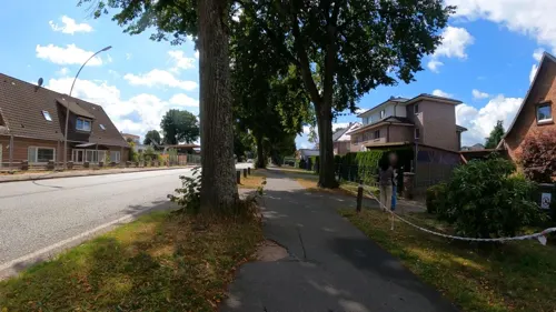


Bäckerei Andresen
Bakery · 1.2 km
53 Hamburger Straße, Bad Bramstedt
Mo-Fr 05:30-20:00; Sa 06:00-20:00; Su,PH 07:00-11:00
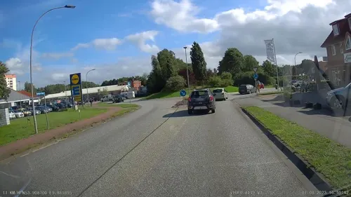
Eiscafe Liburna
Ice cream · 1.1 km
68 Hamburger Straße, Bad Bramstedt
Apr-Oct: Tu-Su 09:00-21:00; Nov-May: Tu-Su 09:00-18:00
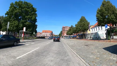
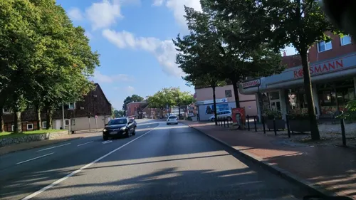
Eiscafé Liburna Centro
Ice cream
15 Kirchenbleeck, Bad Bramstedt
Apr-Oct: Tu-Su 09:00-21:00; Nov-May: Tu-Su 09:00-18:00

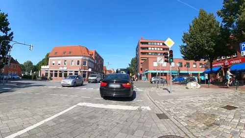


37 more on the map.
Where to stay8
Churches and places of worship4
Shopping15
Gas and EV charging4
Schools, colleges and libraries12
Healthcare9
Facharztzentrum Bad Bramstedt
Clinic and pharmacy
5 König-Christian-Straße, Bad Bramstedt
Map of Bad Bramstedt
134 places. The map loads OpenStreetMap tiles when you open it.
Getting there and nearby towns
Flugplatz Neumünster (EUM) is the nearest airport with scheduled flights listed in OpenStreetMap, 18 km away.
- Kaltenkirchen 11 km southeast, about 11 min by car
- Neumünster 19 km north, about 19 min by car
- Quickborn 21 km south, about 21 min by car
- Elmshorn 24 km southwest, about 24 min by car
- Itzehoe 24 km west, about 24 min by car
- Norderstedt 25 km south, about 25 min by car
- Tornesch 27 km southwest, about 27 min by car
- Bad Segeberg 28 km east, about 28 min by car
- Pinneberg 29 km south, about 29 min by car
- Uetersen 29 km southwest, about 29 min by car
Drive times are estimates from straight-line distance, not routes.
Local news
Headlines from INDB.
Reviews, tips and questions
Loading what members have shared...
Sources and licences
- GeoNames (CC BY 4.0): population, coordinates, regions and time zone
- Mapillary (see each image): photos
- OpenStreetMap contributors (ODbL 1.0): places, airports, map data
- Wikidata (CC0 1.0): elevation, founding date, time zone, website
- Wikimedia Commons (see each image): photos
- Wikipedia (CC BY-SA 4.0): overview and history text
Photo credits
- Roland Bad Bramstedt, Original uploader was Joachim Müllerchen at de.wikipedia, CC BY 2.5
- Roland Figurt Kirche Maria Magdalena Bad Bramstedt, Clemensfranz, CC BY-SA 4.0
- Roland gesamt Kirche Maria Magdalena Bad Bramstedt, Clemensfranz, CC BY-SA 4.0
- Bad Bramstedt, am Roland NIK 2306, Nightflyer, CC BY 3.0
- Bad Bramstedt, am Roland NIK 2306 (Berliner Meilenstein), Nightflyer, CC BY 3.0
- Bad Bramstedt NIK 2303, Nightflyer, CC BY 3.0
- Bad Bramstedt, Germany - panoramio (18), hh oldman, CC BY 3.0
- Bad Bramstedt, Roland NIK 2296, Nightflyer, CC BY 3.0
- Bad Bramstedt, Schachtdeckel NIK 2340, Nightflyer, CC BY 3.0
- Gedenkstein zum 25. Jahrestag der Erhebung Schleswig-Holsteins (Bad Bramstedt).ajb, Ajepbah, CC BY-SA 3.0
- Bad Bramstedt, NIK 2297, Nightflyer, CC BY 3.0
- Bad Bramstedt, Rolanddenkmal NIK 2290, Nightflyer, CC BY 3.0
- Bad Bramstedt, Roland NIK 2295, Nightflyer, CC BY 3.0
- Bad Bramstedt, Roland NIK 2292, Nightflyer, CC BY 3.0
- Bad Bramstedt, Roland NIK 2291, Nightflyer, CC BY 3.0
- Bad Bramstedt, Roland NIK 2289, Nightflyer, CC BY 3.0
- Rathaus Bad Bramstedt.1.ajb, Ajepbah, CC BY-SA 3.0
- Rathaus Bad Bramstedt.2.ajb, Ajepbah, CC BY-SA 3.0
- Bad bramstedt, Mühle NIK 2324, Nightflyer, CC BY 3.0
- Bad Bramstedt, Turbine NIK 2326, Nightflyer, CC BY 3.0
- Bad Bramstedt, Sohlgleite an der Osterau NIK 2327, Nightflyer, CC BY 3.0
- Beeckerbrücke (Bad Bramstedt).1.ajb, Ajepbah, CC BY-SA 3.0
- Bad Bramstedt, Kriegerdenkmal 1870-71 NIK 2344, Nightflyer, CC BY 3.0
- Bad Bramstedt, an der Mühlenbrücke NIK 2338, Nightflyer, CC BY 3.0
- Bad Bramstedt, Sohlgleite an der Osterau NIK 2329, Nightflyer, CC BY 3.0
- Bad Bramstedt, Denkmal Wibeke Kruse NIK 2314, Nightflyer, CC BY 3.0
- Bad Bramstedt, Schloss NIK 2352, Nightflyer, CC BY 3.0
- Bad Bramstedt, Germany - panoramio (15), hh oldman, CC BY 3.0
- Bad Bramstedt, NIK 2322, Nightflyer, CC BY 3.0
- Bad Bramstedt, Germany - panoramio (16), hh oldman, CC BY 3.0
- Bad Bramstedt, NIK 2308, Nightflyer, CC BY 3.0
- Bad Bramstedt, an der Osterau NIK 2330, Nightflyer, CC BY 3.0
- Bad Bramstedt, Brücke über die Osterau NIK 2333, Nightflyer, CC BY 3.0
- Psychosomatische Klinik Bad Bramstedt, Psychosomatische Klinik Bad Bramstedt, CC BY-SA 3.0
- Aussen Kirche Maria Magdalena Bad Bramstedt, Clemensfranz, CC BY-SA 4.0
- Die Bad Bramstedter Moorbahn überquerte auf einer Drehbrücke ein Anschlussgleis der AKN-Bahn, Unknown photographer Unknown photographer ; re-published by Jürgen Kallinich, May 1999, Public domain
- Wassermühle Weddelbrook 1, Tmhpr, CC BY-SA 4.0
- Fuhlendorf Daenischer Ganzmeilenstein, Radler59 ( talk ), CC BY-SA 4.0
- Bramstedt Schloss, PodracerHH, CC BY-SA 3.0
- Schleswig-Holstein, Bad Bramstedt, Katenmoor NIK 5985, -- Nightflyer ( talk ) 19:13, 8 May 2017 (UTC), CC BY 4.0
- Street-level photo, veloroute_hamburg, CC BY-SA 4.0
- Street-level photo, veloroute_hamburg, CC BY-SA 4.0
- Street-level photo, hotteliene, CC BY-SA 4.0
- Street-level photo, veloroute_hamburg, CC BY-SA 4.0
- Street-level photo, alexander2010, CC BY-SA 4.0
- Street-level photo, alexander2010, CC BY-SA 4.0
- Street-level photo, veloroute_hamburg, CC BY-SA 4.0
- Street-level photo, veloroute_hamburg, CC BY-SA 4.0
- Street-level photo, hotteliene, CC BY-SA 4.0
- Street-level photo, hotteliene, CC BY-SA 4.0
- Street-level photo, veloroute_hamburg, CC BY-SA 4.0
- Street-level photo, alexander2010, CC BY-SA 4.0
- Street-level photo, hotteliene, CC BY-SA 4.0
- Street-level photo, veloroute_hamburg, CC BY-SA 4.0
- Street-level photo, veloroute_hamburg, CC BY-SA 4.0
- Street-level photo, hotteliene, CC BY-SA 4.0
- Street-level photo, veloroute_hamburg, CC BY-SA 4.0
- Street-level photo, alexander2010, CC BY-SA 4.0


Page built November 8, 2026. Spotted a mistake? Tell us or suggest a place.